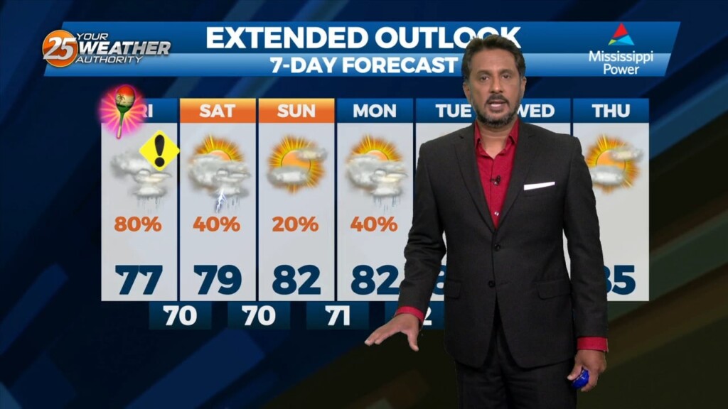
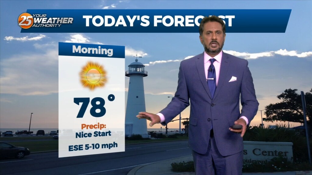
5/5 - The Chief's "Marginal Severe Threat" Cinco De Mayo Morning Forecast
A very persistent pattern of weak upper level high pressure with passing disturbances will continue through the Lower Mississippi Valley. This pattern will be…
A very persistent pattern of weak upper level high pressure with passing disturbances will continue through the Lower Mississippi Valley. This pattern will be…
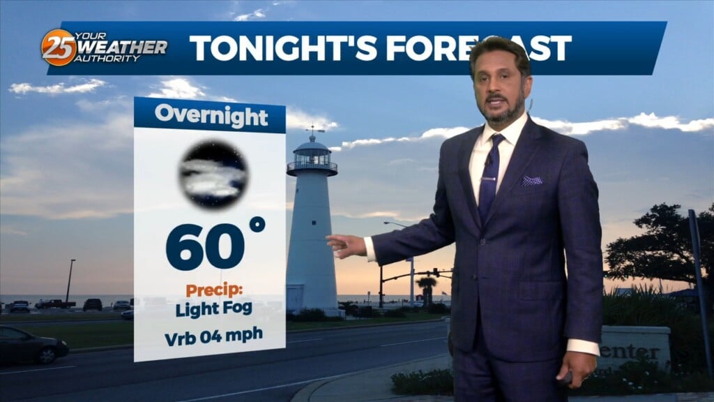
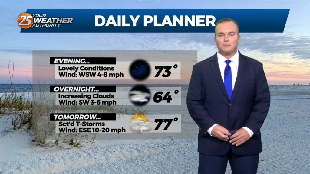
Humidity and cloud coverage will be on the increase beginning tonight. Expect a muggy start with light fog possible from a low cloud deck for your Friday morning.…
Our area is about to see the weather pattern change. The combination of high pressure shifting to its east and a warm front moving through…
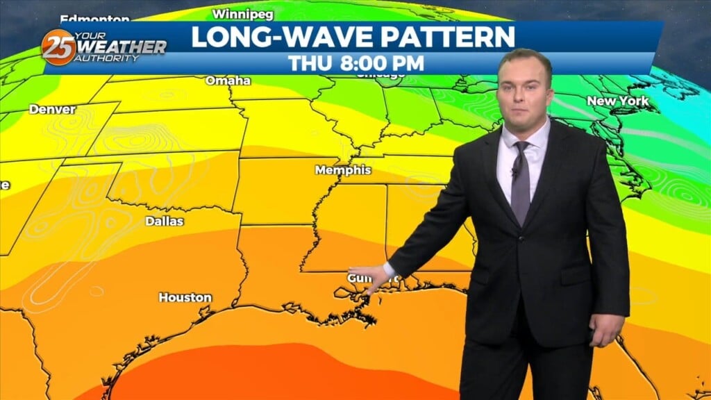
An upper level high pressure will build in across the middle of the country from the Gulf Coast all the way to the Northern Plains.…
A broad longwave disturbance is currently encompassing the eastern 1/3 of the country and will continue east today and tomorrow. Upper level high pressure…
Temperatures will be cool again overnight with mainly clear skies for the area. Dry air remains in place as high pressure has remained in control of the…
A strong upper level low pressure system is currently located over the Ohio Valley and moving into New England is holding some influence interacting with…
Not much has changed with the overall pattern though the region. A strong upper level low pressure system is currently located over the Ohio Valley and…
Quiet conditions continue for the first portion of this week across the area. Dominant ridge of high pressure is shaping the forecast for South Mississippi at the moment.…
There really isn’t a whole lot of material for discussion in the package as we’re in a period of benign weather. Upper level northwest flow on…
Cool temperatures will be present out the door tomorrow. Expect sunny skies through much of the first half of the day until clouds move in…
Gorgeous conditions aided by clear skies and dry air will linger for much of the week. High pressure is in control for much of the eastern two-thirds of the…
The center of a broad upper level disturbance is currently near the Great Lakes with weakness encompassing almost 2/3`s of the country…
Cool conditions will be present out the door tomorrow morning. High pressure and northwesterly flow building into the region will allow for dry conditions for much of the…
Clouds will increase overnight and temperatures will remain mild for the start of your Saturday. A frontal system will be getting closer to our area beginning early…
Today shaped up to be a perfect spring day for South Mississippi. Warm temperatures will turn mild for this evening and overnight. Cloud coverage will increase as…
Yesterday’s frontal system will continue sliding east out of the area. Zonal flow will dominate the upper level pattern, with a northerly surface winds becoming SE…
Skies will clear out tonight following the passage of the cold front over our area. Drier air will work in which will provide for a very comfortable feel to…
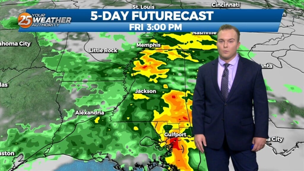
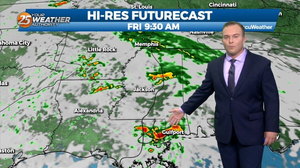
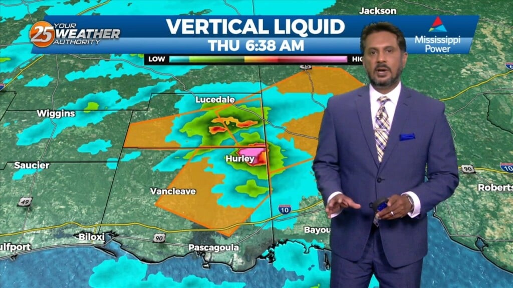
It was quite active during the first portion of today! Some spots received over 3 inches of rain and some thunderstorms produced large hail. Skies are clearing out…
As an area of low pressure continues to drag a cold front through the region, isolated t-storms will continue this afternoon but begin to diminish late afternoon.…
A weakening upper low currently moving through the Central Plains will continue east across the lower/mid-Mississippi Valley this afternoon and evening. With increasing low level moisture, cooling…
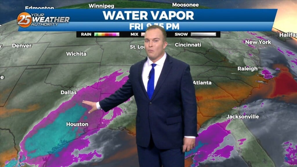
Cloud coverage will increase tonight ahead of a complex of thunderstorms that will move in. Expect rain to move in around daybreak tomorrow and persist through much…
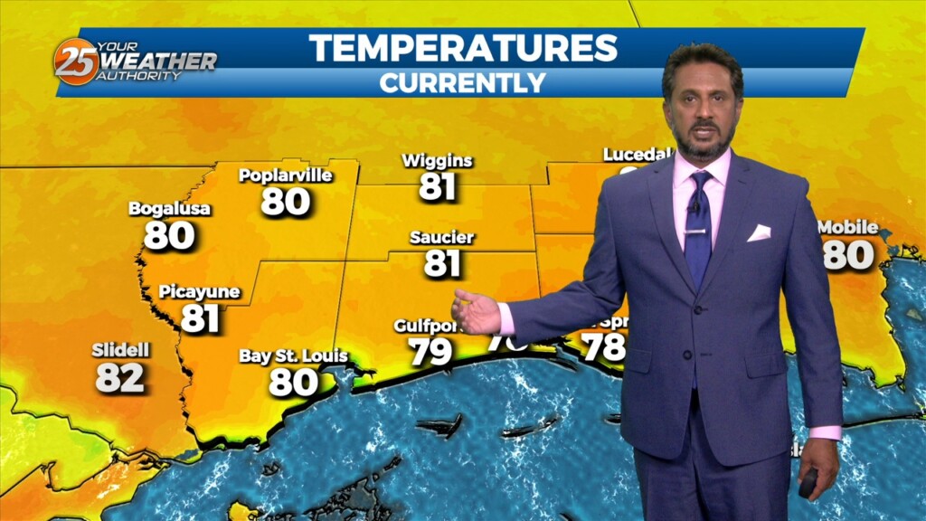
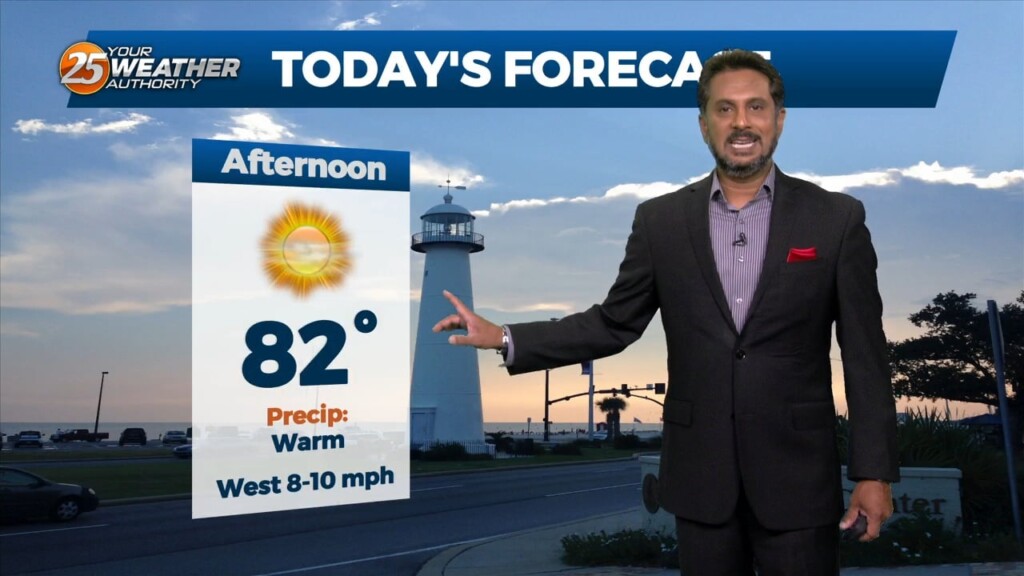
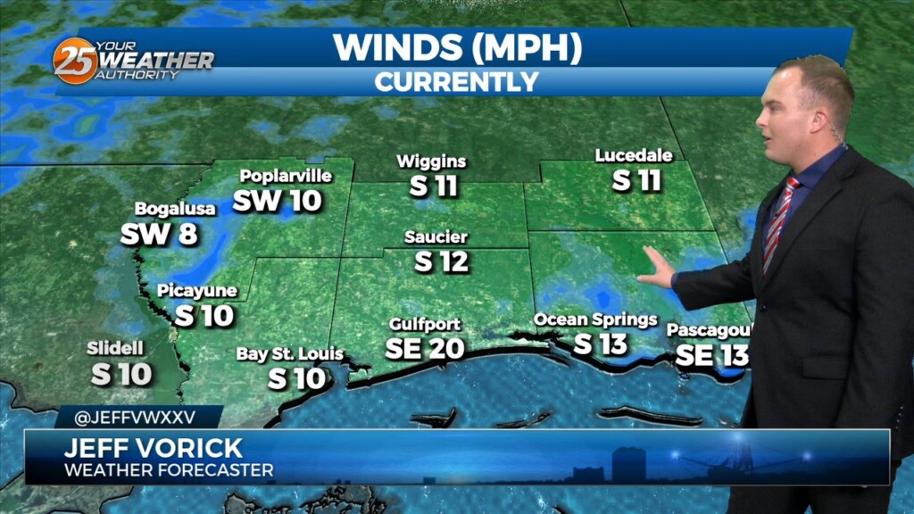
Today has been a lovely, breezy, and warm day across the coast. Clouds have been few and far between while winds are southerly. The southerly flow has…
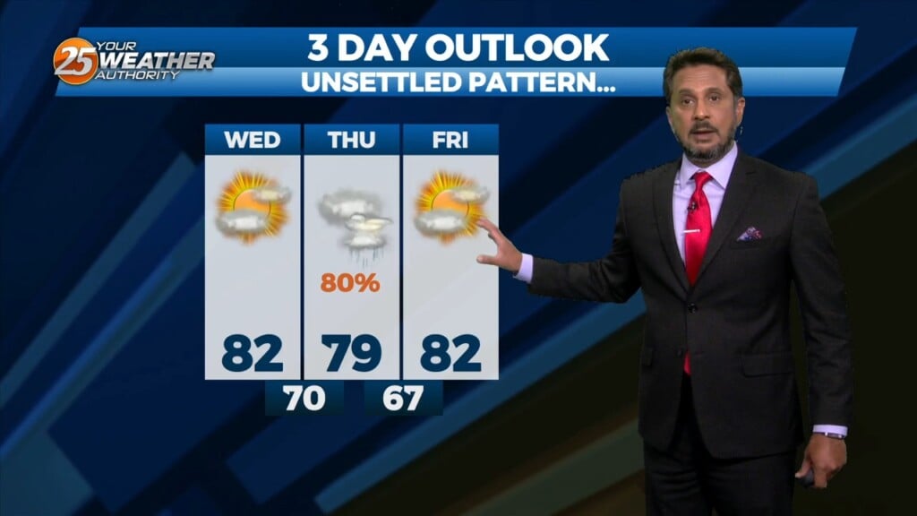
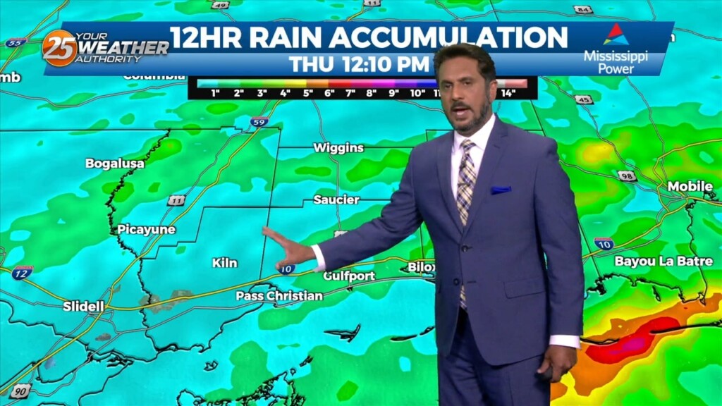
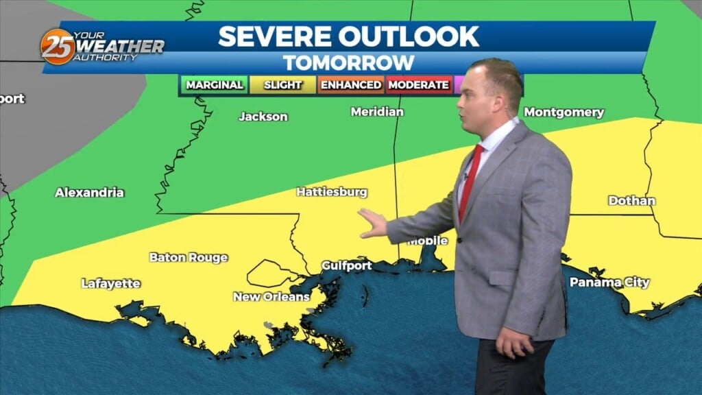
This afternoon will bring pleasant conditions as sky condition will vary between partly/mostly cloudy skies. Much of the focus is on Thursday as severe weather seems…