5/2 – Jeff Vorick’s “Quiet” Tuesday Evening Forecast
Quiet conditions continue for the first portion of this week across the area. Dominant ridge of high pressure is shaping the forecast for South Mississippi at the moment. Dry air remains in place in the low-levels which provides for the comfortable conditions. Upper-level non rain producing clouds will be in the picture tonight. Some clearing can be expected overnight with sunny skies returning for your Wednesday afternoon.
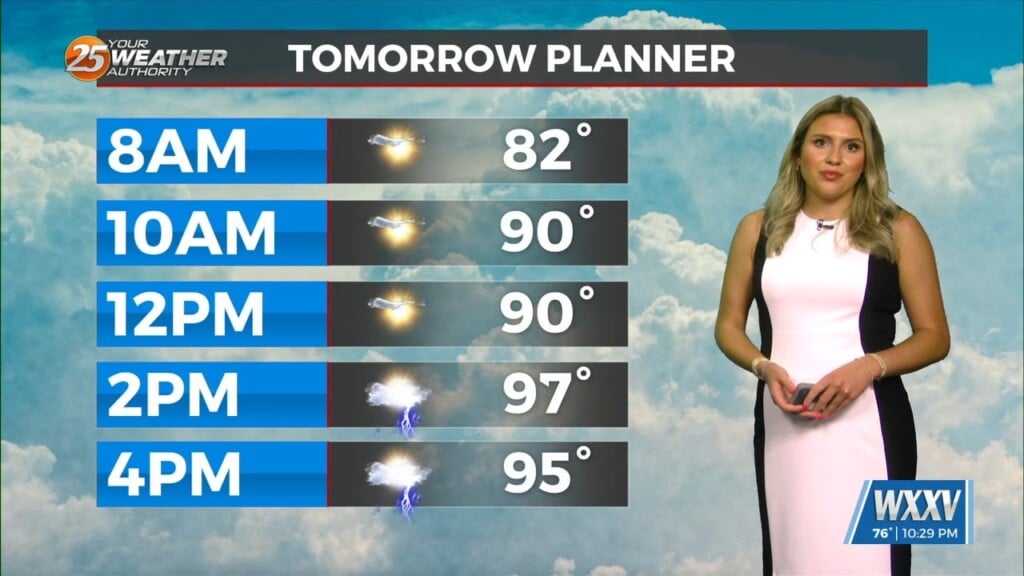
Cool temperatures to start the day followed by warm afternoon high temperatures will be present tomorrow and Thursday. By Thursday, high pressure will slowly shift to our east bringing warm, moist southerly flow into the area. Also, a warm front will lift through the region which will add more moisture into the equation. The pattern will gradually change as the week closes out.
A frontal system and return flow will help aid making the pattern more unsettled for the region. Batches of energy to our west will move to their east. Potential rounds of scattered thunderstorms are on the table Friday through the weekend. The best coverage of rainfall looks to be Saturday. However, widespread rain or severe weather does not look to be on the table. More details will come as we get closer to the weekend.