11/28 - Rob Knight's "Clearing Skies" Monday Morning Forecast
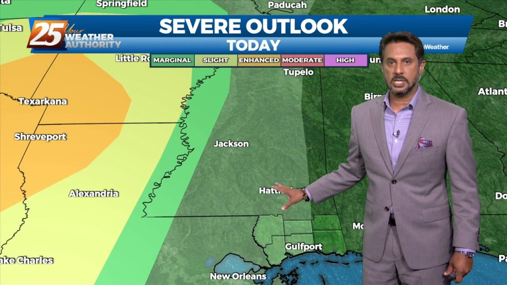
A pleasant day ahead with high-pressure to the NW shaping the short-term forecast. The primary headline to monitor beyond today is severe weather and excessive rainfall potential…
A pleasant day ahead with high-pressure to the NW shaping the short-term forecast. The primary headline to monitor beyond today is severe weather and excessive rainfall potential…
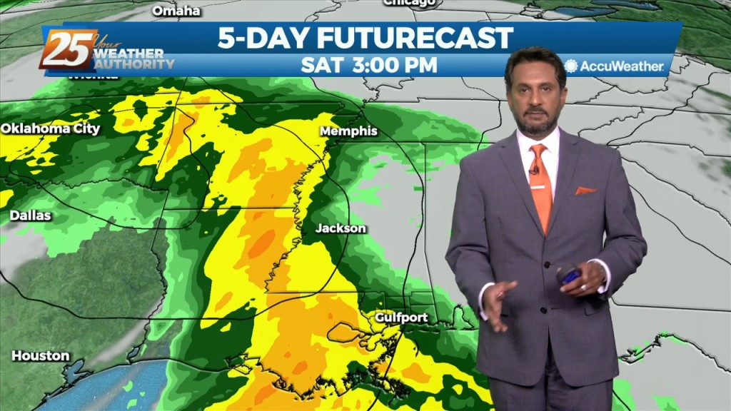
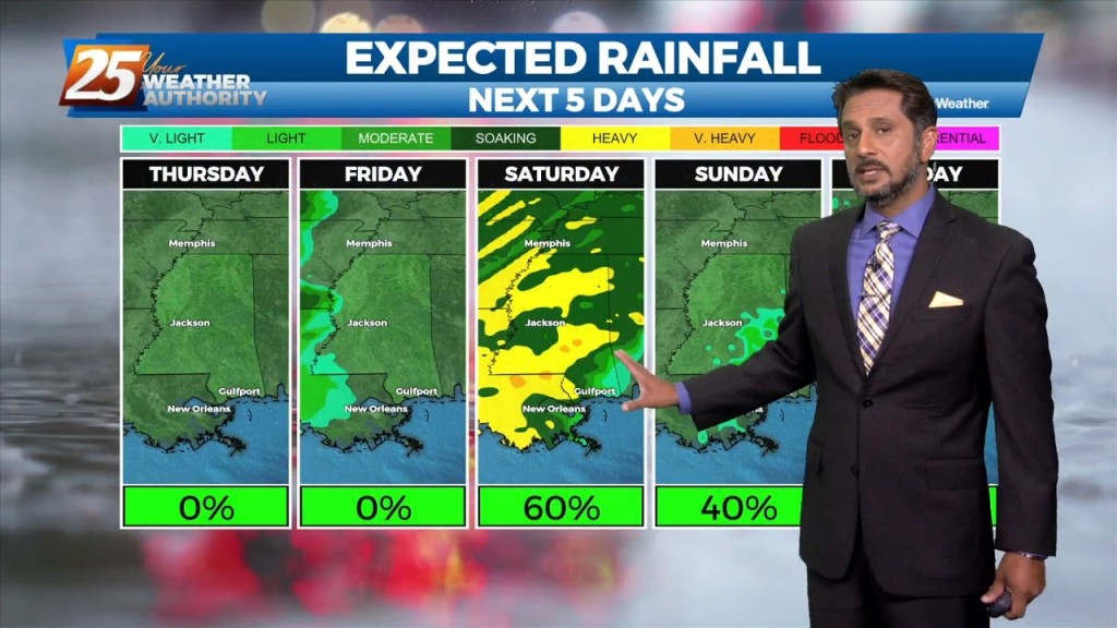
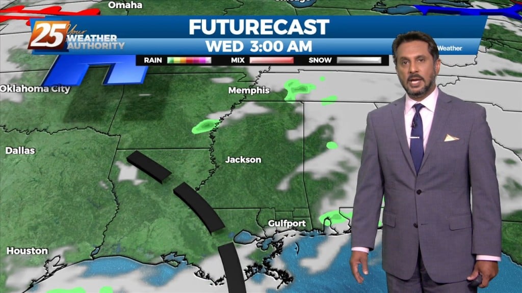
The main issue continues to be the heavy rain threat across the area as showers and thunderstorms continue to move from west to east across the…
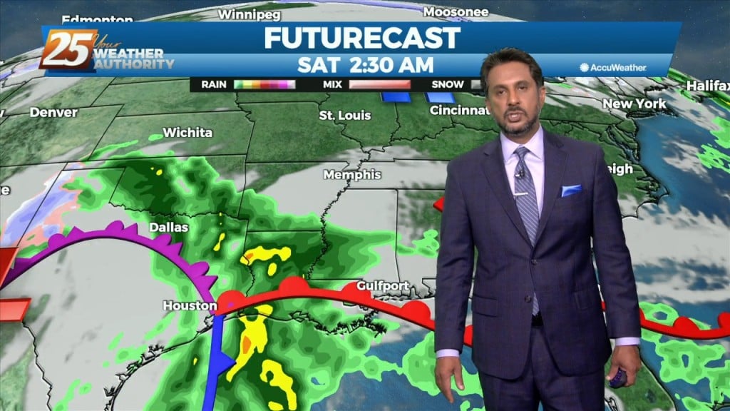
This morning and likely into the early afternoon will remain dry and quiet before our next weather maker brings widespread rain showers and isolated…
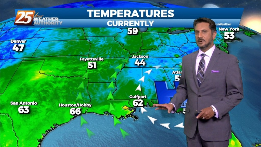
After a couple days of light precipitation in some areas with mostly cloudy skies, clouds will break up today revealing partly cloudy to eventually mostly sunny skies. These…
Another weak disturbance will move through the area today bringing chances for some light precipitation, mainly in the afternoon. Models are still showing quite a bit…
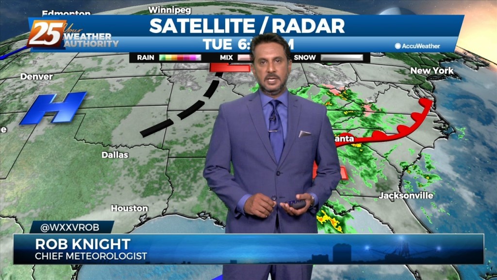
A weak disturbance currently over northern Texas will track east today and tonight, passing through the lower Mississippi Valley. Showers have developed well ahead of that system…
After a cold start to the day, expect mostly sunny or filtered sunshine across the region through the morning and into the afternoon hours.…
In the short term, a dry re-enforcing cold front with parent upper level disturbance will swing through the region later today. Ahead of this feature,…
A deepening low pressure system which moved through the area overnight is now racing east along the northern Gulf Coast early this morning. The speed of…
The main weather maker for the week is the system that will impact the local area over the next 24 hours. Dry air will modify quickly…
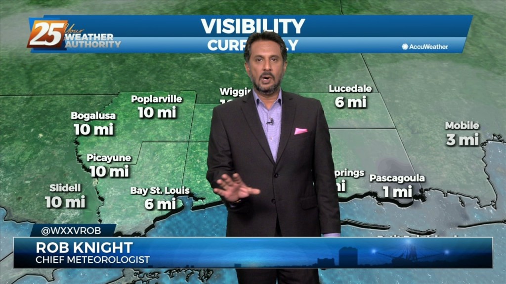
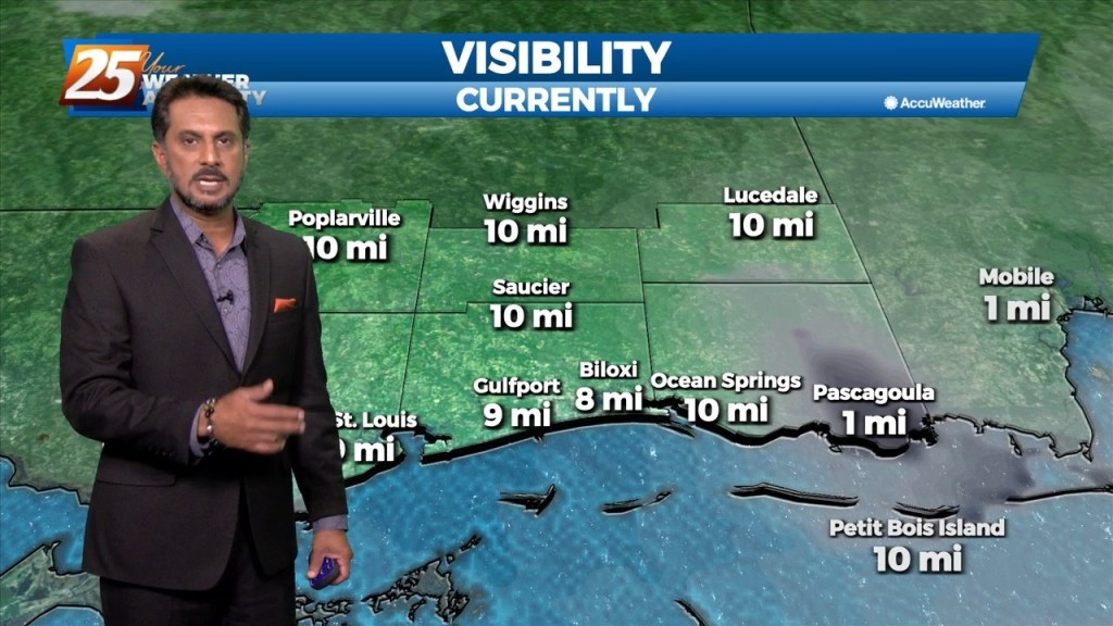
The primary story this Friday morning is visibility concerns. Widespread fog, some dense has developed generally along and north of the I10/12 corridor east of…
Another day of relatively quiet weather is expected as high pressure continues to sit over the northern gulf coast. Temperatures will remain about the same as…
The only real impact overnight with an area of weakness moving NE, was a deck of mid clouds over the region which should clear out slowly…
Currently there is an upper level disturbance over East Texas, with surface high pressure centered near Meridian MS. Upper jet max transporting a lot of moisture at upper…
Weakness in the upper levels extends from Missouri to Baja California. At the surface, low pressure associated with the weakness was centered over Illinois with a frontal…

The next in a series of upper disturbances extended from the Canadian Prairie Provinces to near Salt Lake City to Baja California. This is beginning to turn…
A cold front east of the area continue to move east as high pressure to the NW will shape the short term forecast. Most of the…
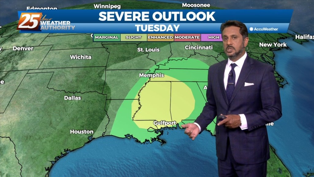
The main weather impacts for the local area come in Tuesday as an upper level disturbance digs south through the 4 Corners region will begin heading…
Temperatures will warm into the mid-80s across the viewing area ahead of a cold front. Winds will be out of the south, shifting to southwest around…
The mild weather pattern continues across the area today and for the remainder of the workweek. The area of high pressure has moved to the…
High pressure continues to dominate our weather pattern across the area. A weak disturbance will move across the area this morning into this afternoon. With…
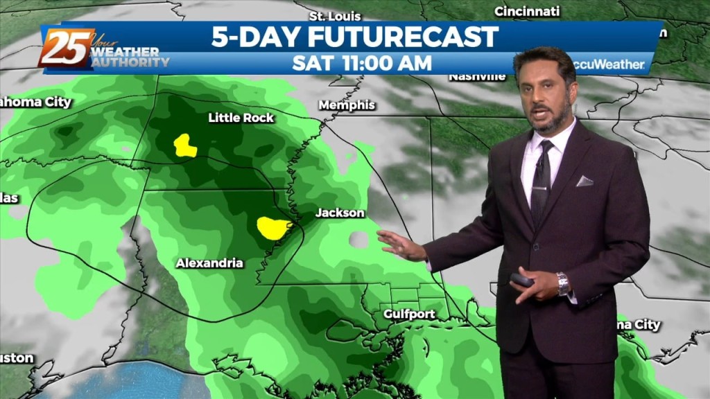
We could not ask for more pleasant weather heading into the 1st weekend of October. It has been breezy and dry with the minimum relative humidity dropping from…
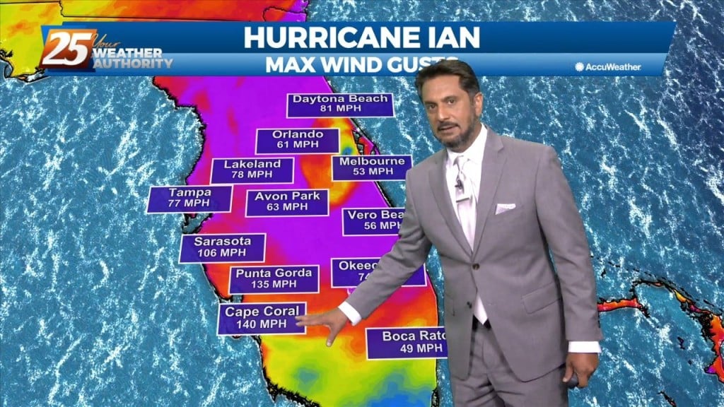
As Ian continue to affect the region with a combined flow from the NNE, the drier air will shape the forecast through the weekend. Low relative…
Fall is in the air! No rainfall is expected for the next few days. We are still experiencing some impacts across the area from pressure…