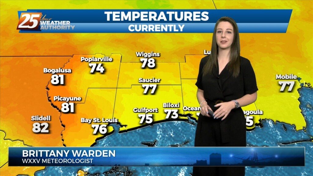
3/8 - Brittany's "Midway Through The Workweek" Wednesday Evening Forecast
The primary forecast concerns through Thursday night will be the prospect of locally dense fog forming each night, the threat of isolated to widely scattered convection…
The primary forecast concerns through Thursday night will be the prospect of locally dense fog forming each night, the threat of isolated to widely scattered convection…
Cloud coverage will be more dominant today as compared to the previous couple of days. Some peeks of sunshine can be expected this afternoon. Also, 30-40% coverage…

A weak backdoor frontal has dropped south in to the area and will be a focal point for a few afternoon showers/t-storms. To the south of…
No significant changes in the overall synoptic pattern that has been influencing the region for the past several day is anticipated through Thursday night. A weak backdoor frontal boundary…
No significant changes in the overall synoptic pattern that has been influencing the region for the past several day is anticipated through Thursday night. A weak backdoor frontal boundary…
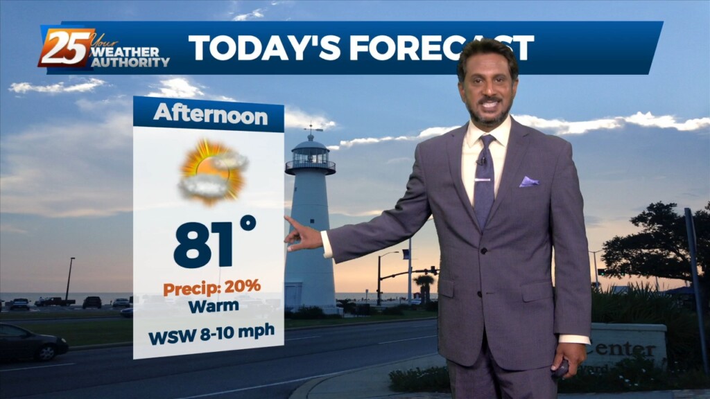
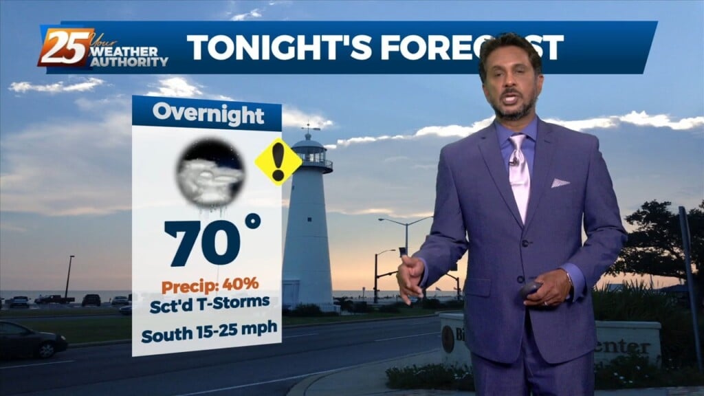
Low-end rain chances will be in the picture this afternoon. Skies will clear out towards this evening but before that, temperatures will near record highs…
A very warm start to the day with another warm day expected across the region and no sign of a change at least in the…
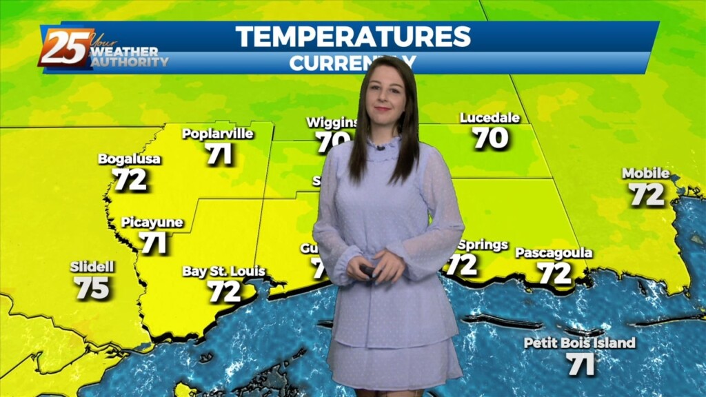
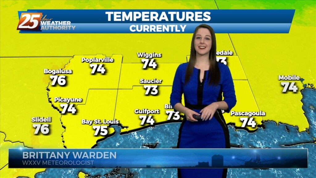
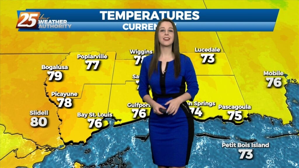
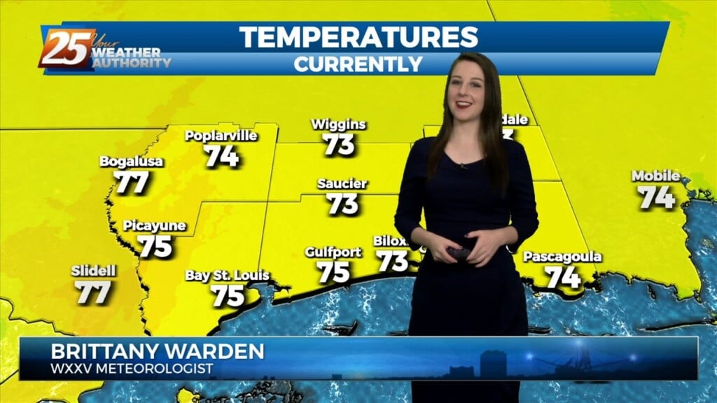
Another warm day across the region and no sign of a change at least in the short term. Fog was an issue this morning and could be again tonight.…
Another warm day across the region and no sign of a change at least in the short term. Fog was an issue this morning and could be…
A stationary front near our area is providing just enough lift for 30% coverage of isolated showers this afternoon. Warm and humid conditions are returning to our area…
A warm front moving north this morning over south shore locations could bring enough vertical depth to get some showers out of it today…otherwise just…
After a slight, brief cool-down over the weekend, the pattern will return to a much warmer one. Moisture will increase overnight thanks to a stationary…
The center of the high will pass to our north on Saturday but the ridge axis will move overhead. The high will continue to progress eastward through the…
Current surface analysis shows the cold front has moved east of the forecast area and was near Mobile Bay as evident by the veered westerly winds behind it vs…
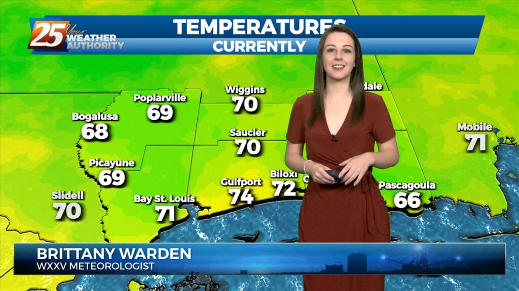
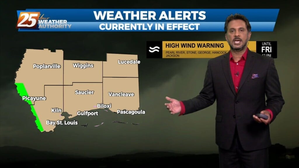
TOP TIER WEEKEND AHEAD... Behind the front this afternoon, winds will be gusty and we return back to more normal temperatures. These gusty winds and…
Currently there is a narrow line of showers across western Louisiana. Expect that to continue to move off to the east through the late morning hours.…
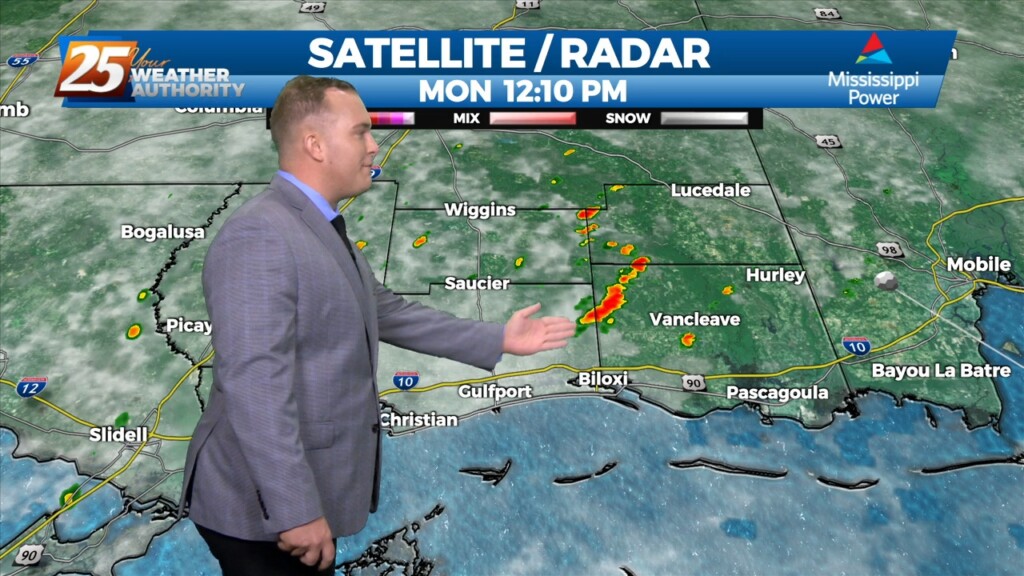
Some weak convection has developed over the MS Sound and near the Pearl River this afternoon. This is likely in response to steel low level lapse rates/enhanced…
Some weak convection has developed over the MS Sound and near the Pearl River this afternoon. This is likely in response to steel low level lapse rates/enhanced…
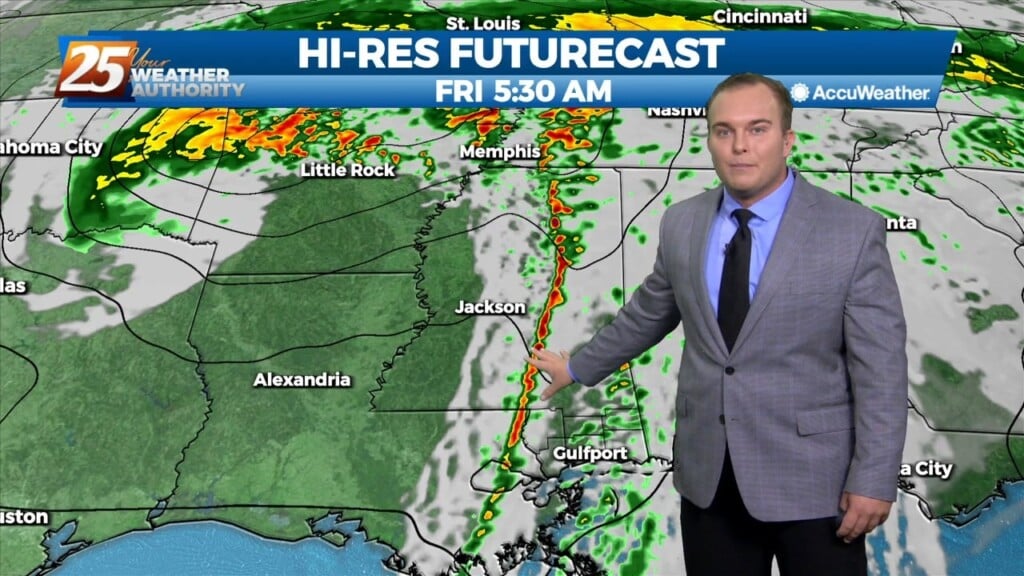
Warm and breezy conditions ahead this afternoon with a storm system developing to the west. A strong upper level disturbance begins to move from…
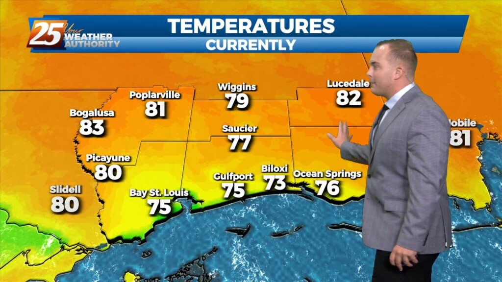
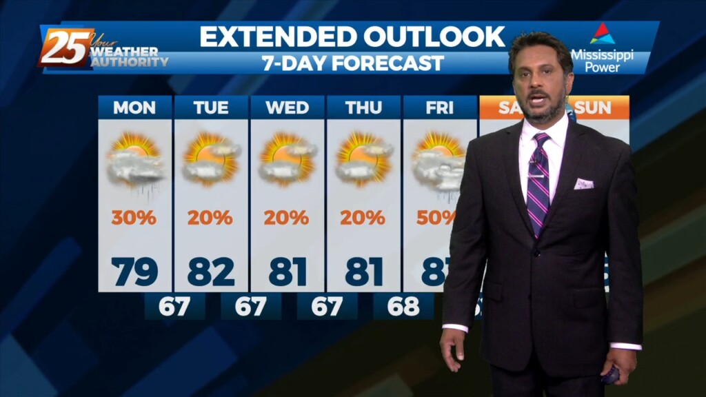
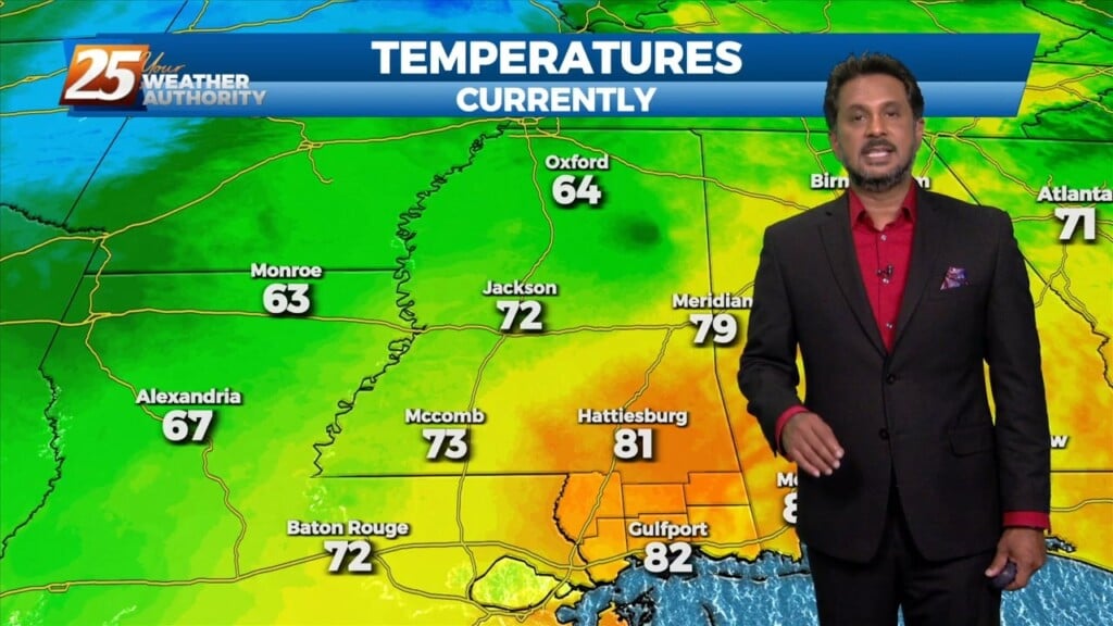
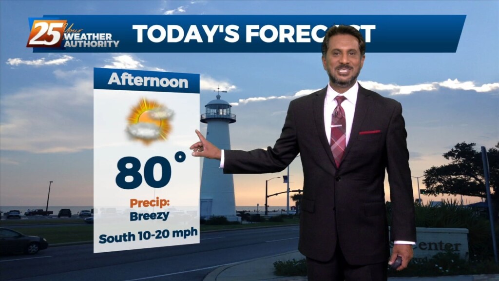
Another warm day expected across the region with most of the area warming into the upper 70s to low 80s along with breezy conditions. All eyes…
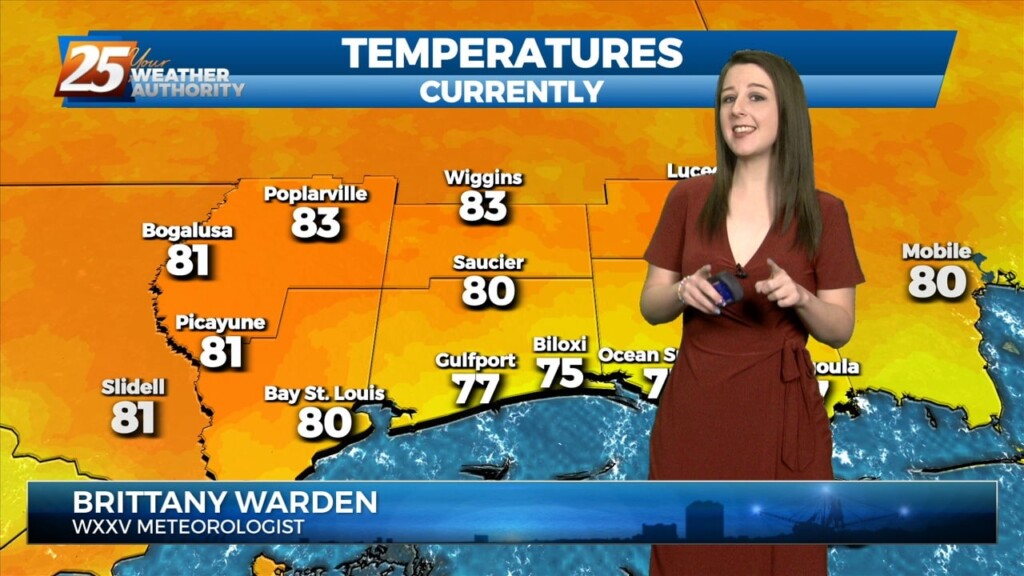
Another warm day across the region with most of the area warming into the lower and middle 80s...which is still well above average for this time of…
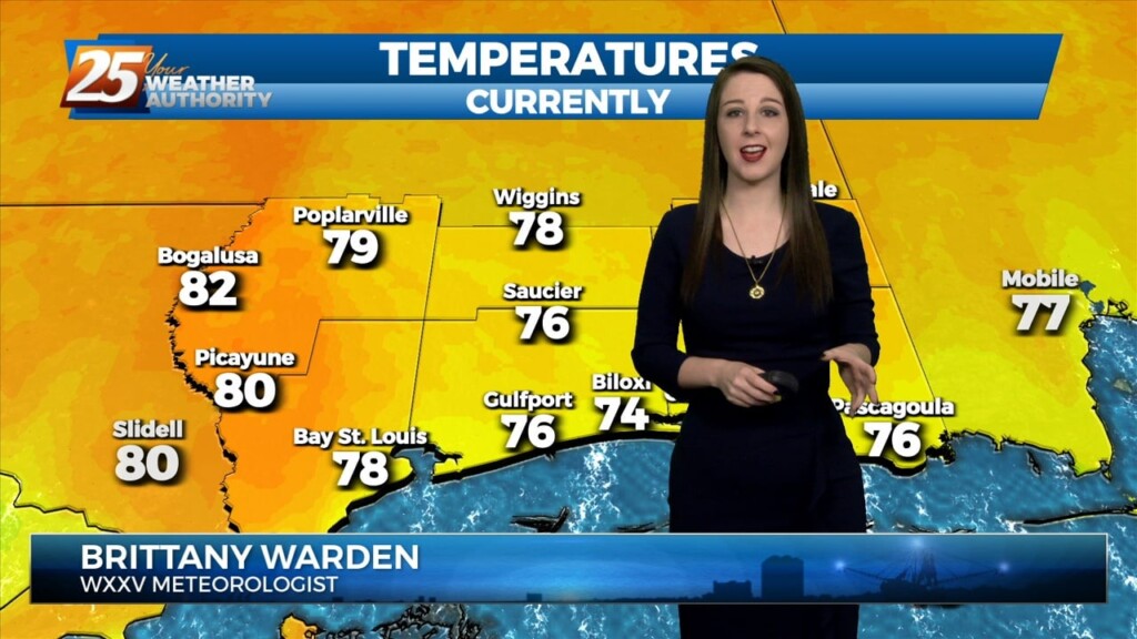
Another warm day across the region with most of the area warming into the lower and middle 80s...which is still well above average for this time…
Clouds will thin into this afternoon and very warm conditions are expected again. Breezy conditions this afternoon will subside this evening as daytime heating is lost. Clouds…
Continued unseasonably warm conditions will persist for the next few days as the surface high over the Bahamas causes southerly surface flow into…