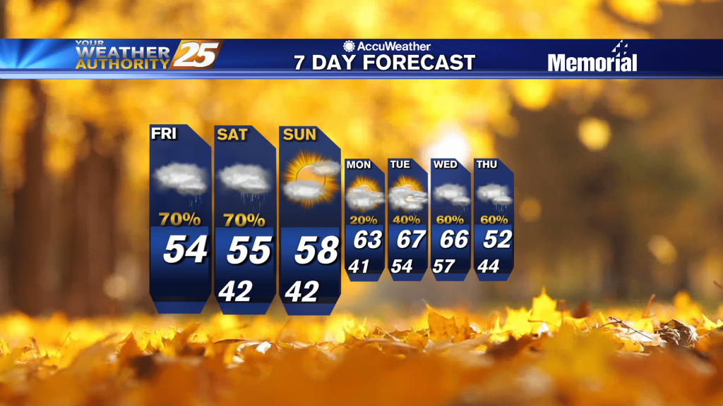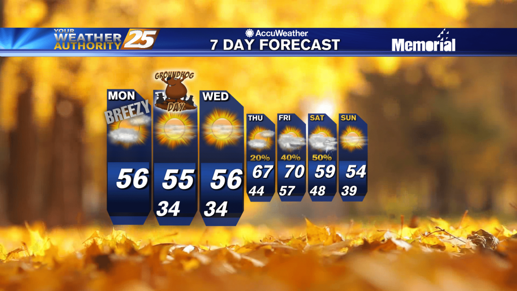
02/08 – Brantly's "Showers Expected Overnight" Monday Afternoon Forecast
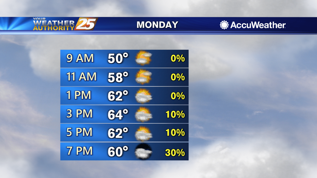
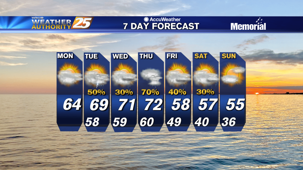
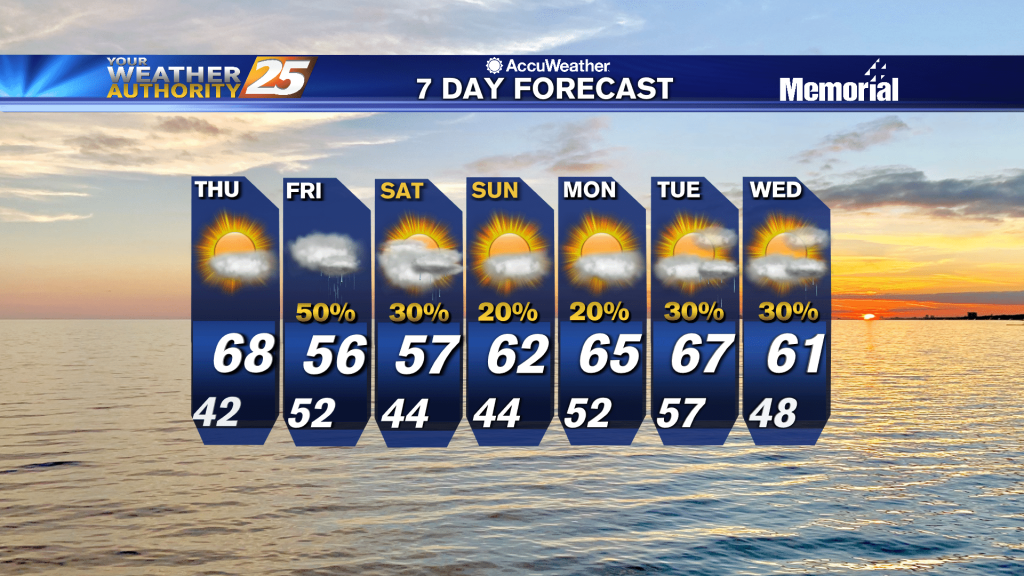
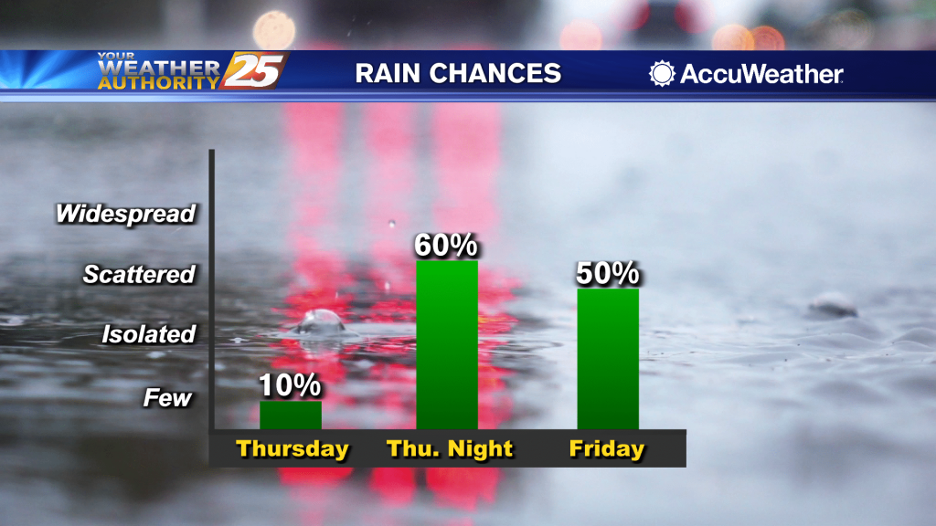
Highs today will likely climb into the mid to upper 60s and conditions will gradually become more humid. Partly cloudy skies are expected through the middle of the day, and then cloud cover starts to build once again moisture pushes…