02/17 Ryan's "Wet, Stormy" Wednesday Night Forecast
Showers and storms are streaming through for the rest of the night, bringing another round of colder, drier air for the end of the week.
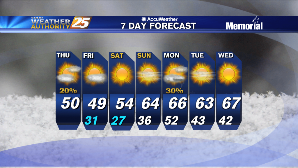
Showers and storms are streaming through for the rest of the night, bringing another round of colder, drier air for the end of the week.

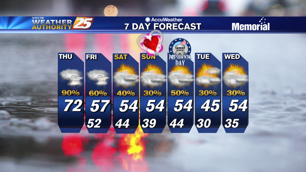
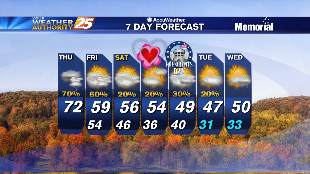
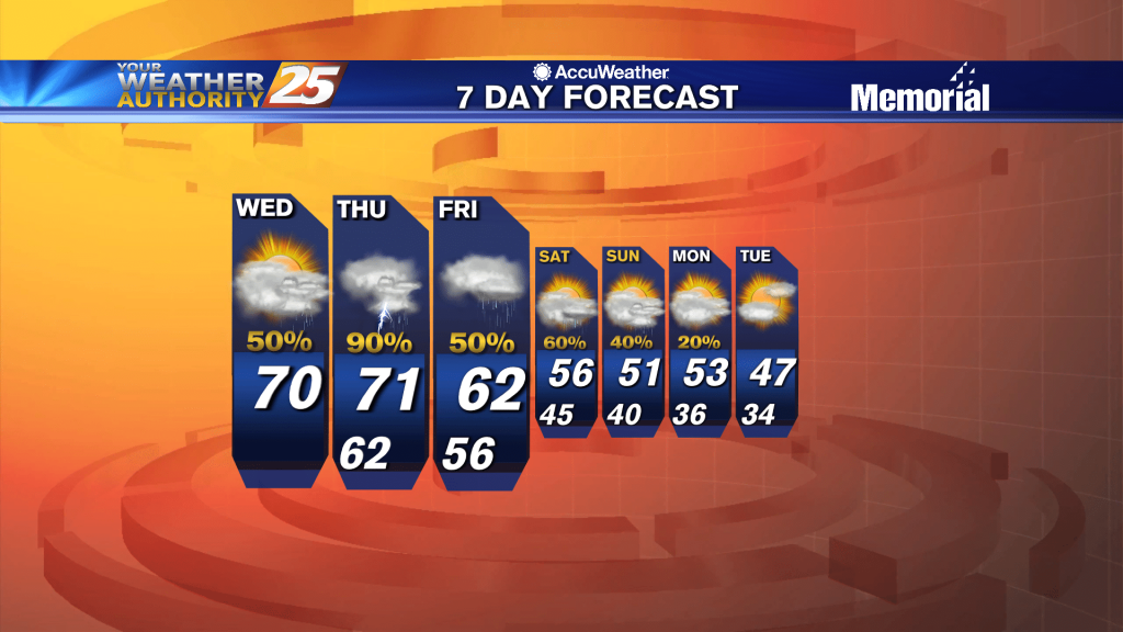
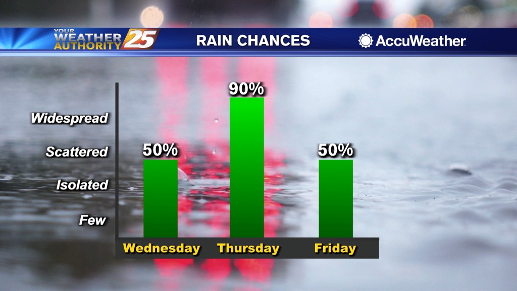
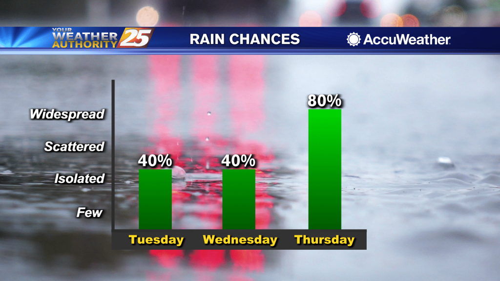
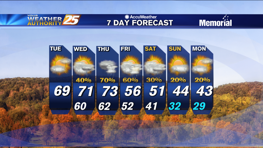
Showers and thunderstorms are expected Wednesday, mainly in the evening and overnight timeframe. All of the ingredients are there including enough lift and moisture in place, fairly widespread rainfall (1 to 2 inches on average) is expected to develop across…
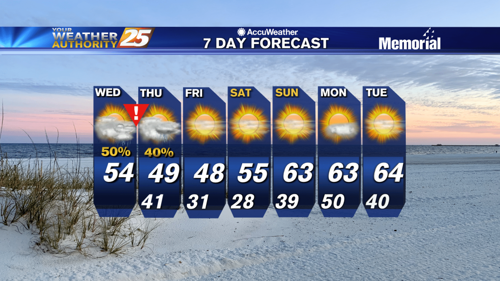
Showers and thunderstorms are expected Wednesday, mainly in the evening and overnight timeframe. All of the ingredients are there including enough lift and moisture in place, fairly widespread rainfall (1 to 2 inches on average) is expected to develop across…
Going to be another exceptionally cold night by South MS standards, but it is warming.
A cold afternoon ahead as temperature will struggle to make it into the upper 30s...
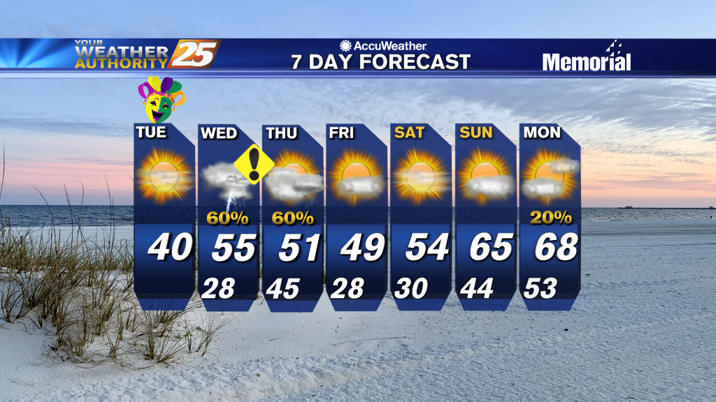
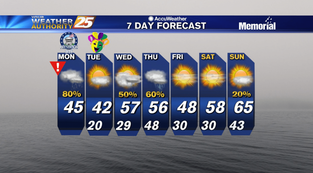
It may be the coldest Mardi Gras on record, with temperatures running about 25 degrees below normal. The system that moved through yesterday is exiting stage right into New England, while the next system is already moving through the Great…
Brutally cold weather is on the way, and any warming will be short-lived as more freezing temperatures move in again later on this week.
Sleet and rain moving across the area will come to an end by mid-afternoon, then it gets REALLY DANGEROUS...
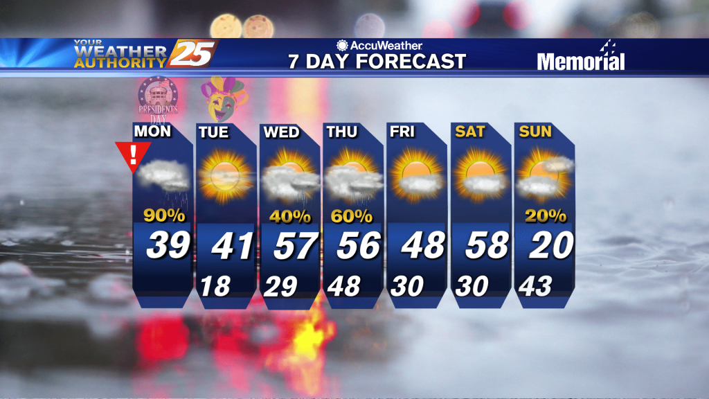
With rain on Monday, high temperatures north of I-10 will struggle to climb out of the 30s with highs a little warmer along the coast. Once the low passes, temperatures will quickly begin to drop off heading into Monday evening.…
Temperatures tonight will remain cold with cold air moving in quickly at the surface and a shallow arctic air mass in place. Lows will be in the low 30s. With rain on Monday, high temperatures north of I-10 will struggle…
Cooling into the night, but we're still a few days away from possible winter weather.
A cold north wind will continue to gust into the 20 mph range through early Saturday morning...

Another wet start to the day with rainfall moving in from the SW with pockets of fog...
Not much change initially, but much cooler weather is expected in the days ahead before Arctic air moves in to begin next week.
Wet conditions will continue this afternoon with the THREAT for heavy rainfall...

Another day... another high chance for rain. Conditions remain warm and muggy along the Gulf Coast as fog, showers, and thunderstorms continue. Rain chances stay elevated today at around 90 percent, mainly in the afternoon between 12 noon and around…
End of this week will be quite wet, but much cooler, drier air lies ahead as well....
The area has already seen heavy rainfall this morning, with more to come this afternoon...
High pressure draped across Florida and portions of the Gulf of Mexico, with clockwise flow, is sending moisture from the northern Gulf into our region. This setup has been and will continue to produce muggy and warm conditions locally. Low-level…
Another foggy night ahead with calm, humid conditions...and rain returns before long.
Only change from last night is even warmer and more humid air continues to flow in ahead of a series of fronts.
Rain has temporarily departed the area as temps climb into the 70s this afternoon...
Showers and thunderstorms moved across the coast overnight. That rain has now come to an end, but we are still looking at that moisture lingering behind. It will be warm and humid today. Temperatures will top out at around 70°…
Going to be considerably warmer and more humid than the weekend was, and get ready for a big change by the start of next week!