08/25 Ryan's "Tropical Activity" Wednesday Night Forecast
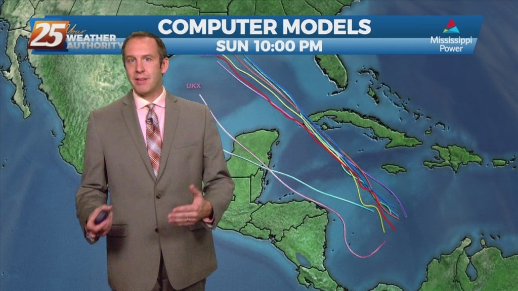
Starting off with the Mississippi Power tropical update today since a developing system has a chance to impact the Gulf Coast. Statistically it's on the lower end in…
Starting off with the Mississippi Power tropical update today since a developing system has a chance to impact the Gulf Coast. Statistically it's on the lower end in…
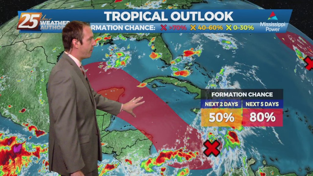
Starting off with the Mississippi Power tropical update today since a developing system has a chance to impact the Gulf Coast. Statistically it's on the lower end in…
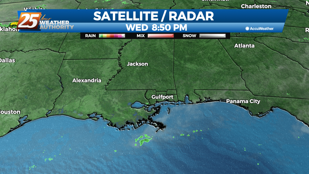
The showers and thunderstorms that develop in the heat of the day are starting to die off, but we'll see more in the way of coastal activity overnight.…
The showers and thunderstorms that develop in the heat of the day generally lead to some nice cool spots, but they've been sparse recently. That will change…
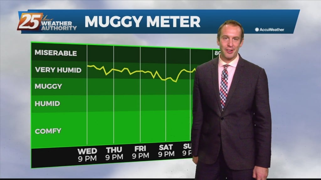
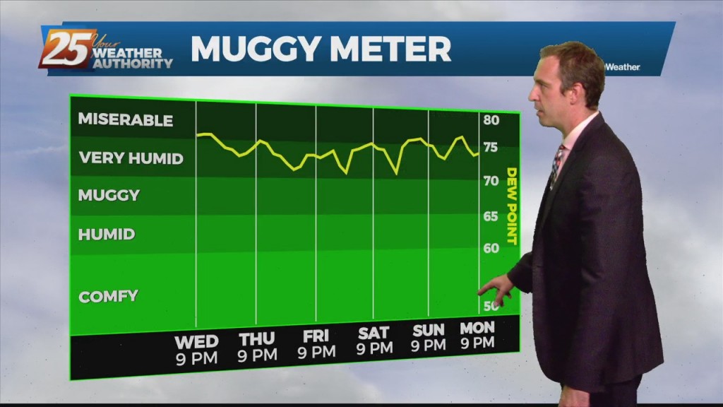
They say the only sure things in life are death and taxes, but I'd also push for adding our consistently humid summer weather. Once again today the temperature…
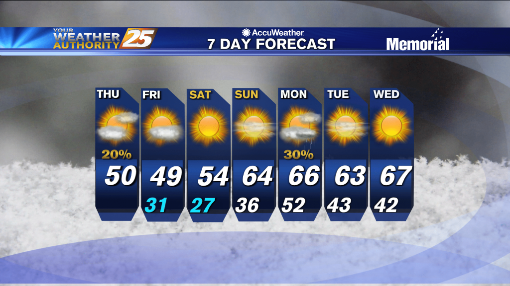
They say the only sure things in life are death and taxes, but I'd also push for adding our consistent South Mississippi summer humidity. Once again today the temperature…
If the forecast had a theme today it would be "no surprises" as we head into another calm, humid evening. That means more overnight lows in the mid 70s, a few clouds,…
It may not seem like it at first glance, but tonight will be a bit drier than the last few evenings we've seen. Still expecting an isolated shower or two, but considering the…
We still saw a few afternoon thunderstorms, but drier mid-level air kept them from lingering for long. That's a trend I expect to continue for the next few afternoons, limiting evening activity and cloud cover. That means you can expect…
The last few nights have been cloudy, warm, and humid, but now clearing skies will get rid of one of those descriptors. That means it'll still be hot and humid...and for a while.…
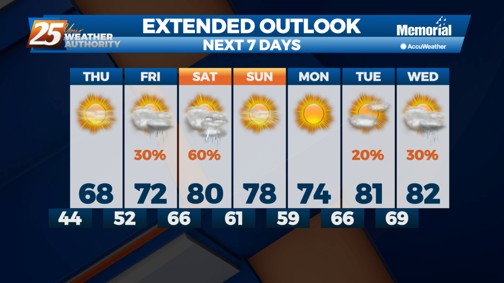
More similar weather lies ahead for the rest of the week before any active weather moves in.
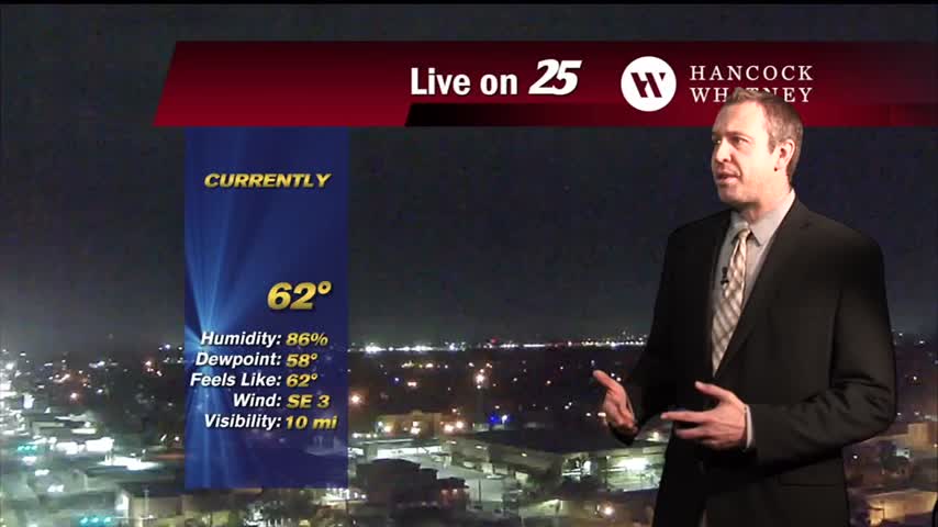
Warmer and even more humid than it was last night, making it feel rather tropical here in South MS....
It has been quite humid for the last few days, but slightly cooler and drier air is moving in just in time for the weekend.

Another warm, humid night ahead as moisture continues to pile up ahead of an end-of-week front.
One of the coolest nights we've seen in a while is moving in later, but we'll begin warming from there until our next front moves in Saturday morning.
Finding ourselves in the midst of a familiar pattern as a lingering boundary with frequent impulses bringing rain each day. The sun will return soon though....
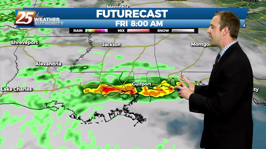
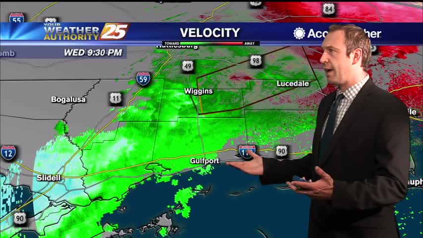
It has been several days since our last round of active weather, but that changes now as showers and storms move in quickly overnight.

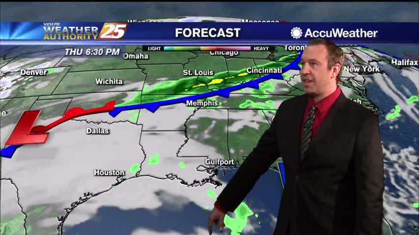
A front has finally moved in and and will push through, bringing cooler and drier air...an event we haven't seen much of over the last few weeks.
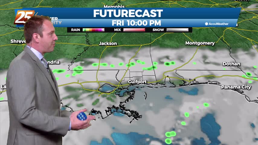
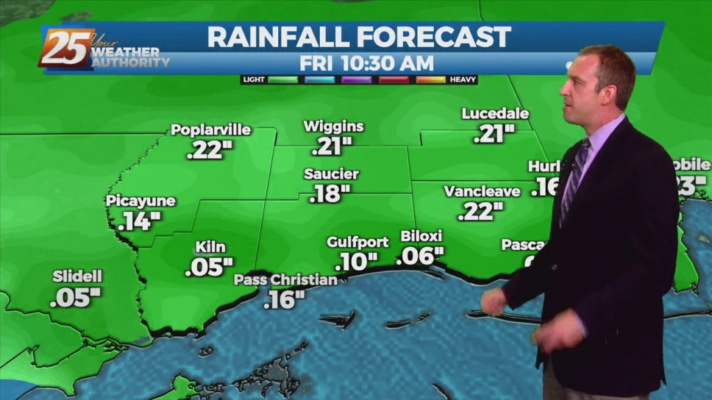
After even more rain today, flooding issues are becoming more and more obvious with another stormy day ahead....
The line of storms expected tonight has sped up some, and will be quickly leaving the area through the early morning hours.
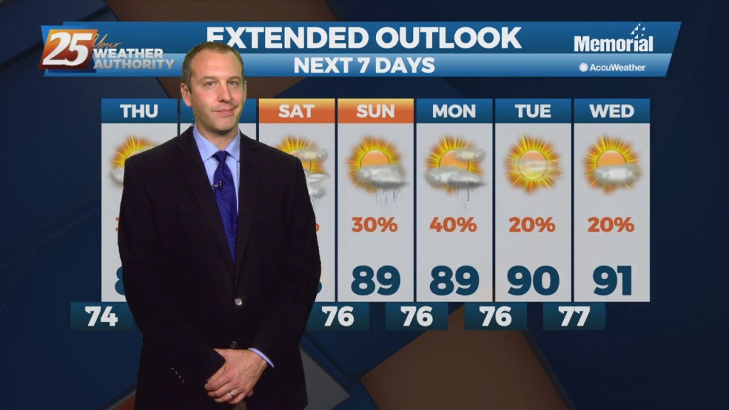
Not seeing significant changes right now, but each day will be slightly warmer and more humid than the last until next week....

Finally dry after a string of fronts paraded through South MS over the past several days, but now we're looking at a sunny rest of the week....
Getting warmer and more cloudy through the night, as days of grey, wet days are on the way.
Showers and storms are streaming through for the rest of the night, bringing another round of colder, drier air for the end of the week.