1/9 - The Chief's "Quiet Weather Pattern" Monday Morning Forecast
In a nut shell - Generally quiet weather conditions expected through the short term with near normal temperatures through tonight and above normal temperatures Tuesday and…
In a nut shell - Generally quiet weather conditions expected through the short term with near normal temperatures through tonight and above normal temperatures Tuesday and…
It will be a bit cooler today, but overall a very beautiful day ahead across the lower Mississippi River Valley/North Central Gulf Coast. Aloft,…
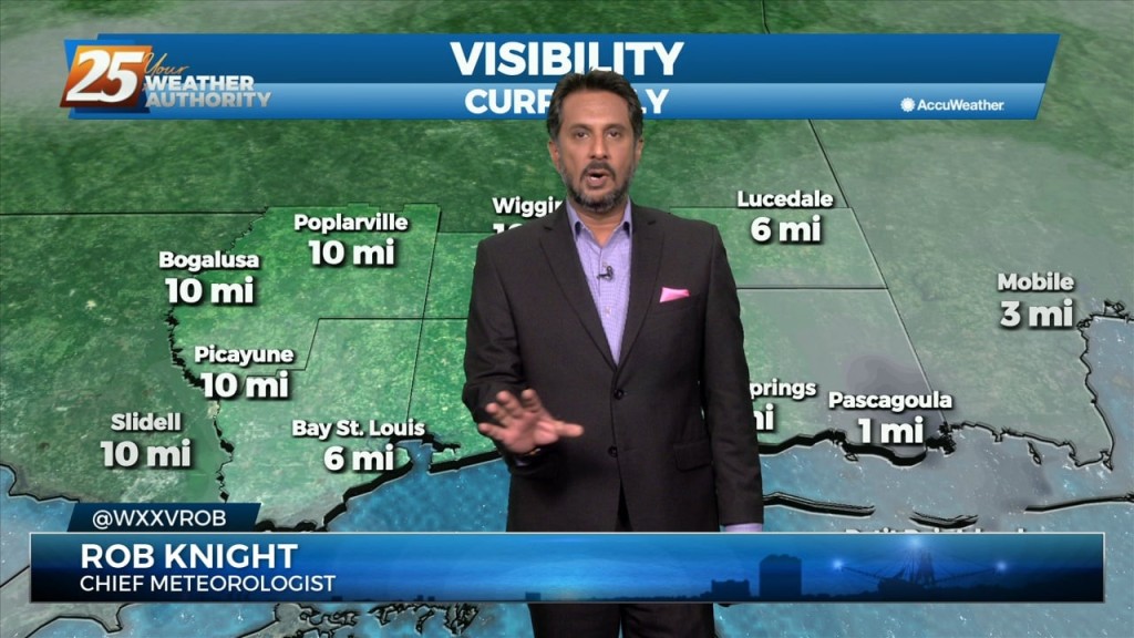
A cold front is currently east of the area moving east with a few lingering showers. Behind the front, very subtle Cold Air Advection will…
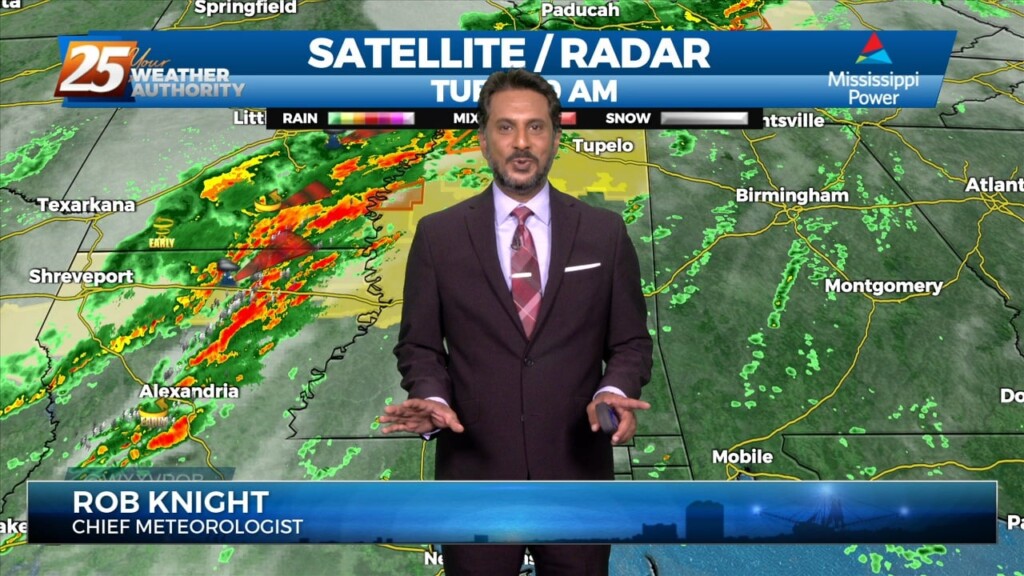
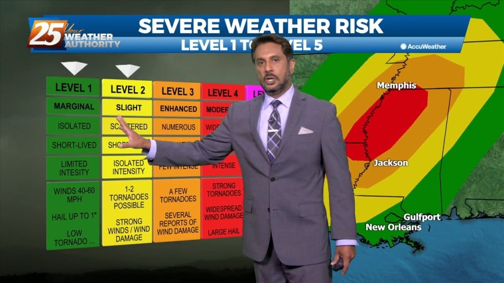
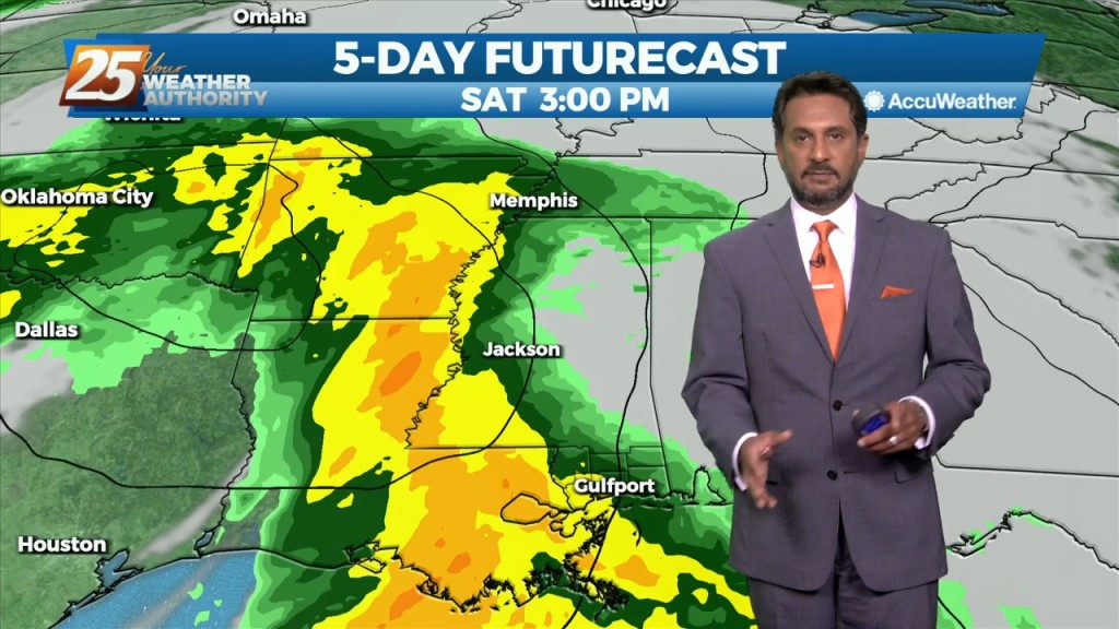
The focus today is the storm system due into our region. Expect the overall forward progression of the front to slow, with the main threat of discrete super-cell…
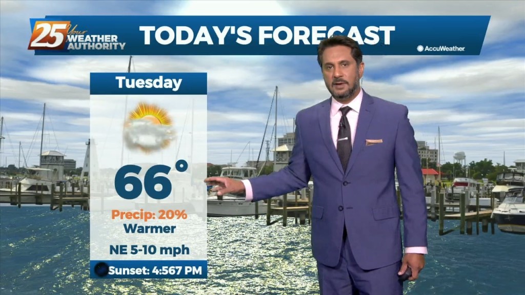
Today will be a very nice December day with partly cloudy skies and afternoon high temperatures in the low to mid 70s. After today we will be…
A weak disturbance will be passing over the area within the next few hours, but not causing much noise as it comes through. It will delay…
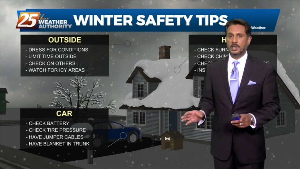
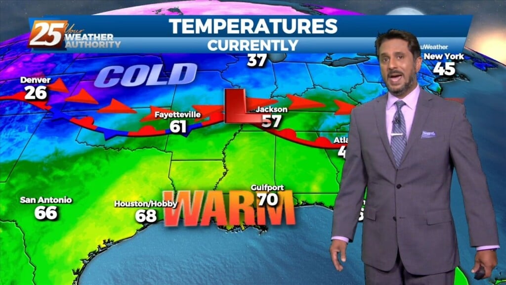
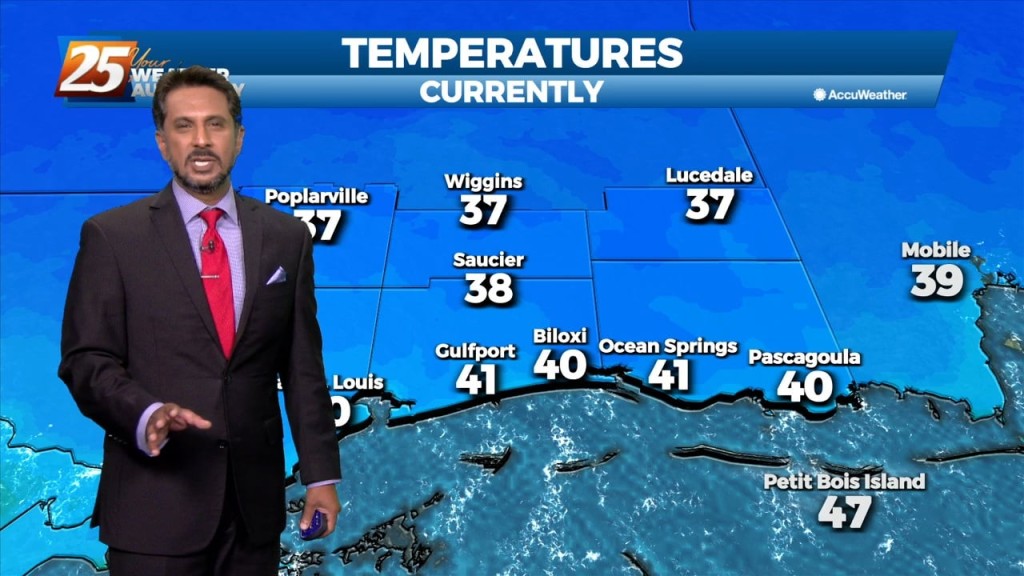
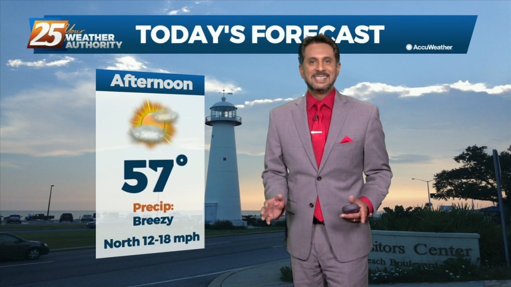
The coldest air of the season is approaching, with a very uncomfortable few days ahead. Current expectation is that cold front will reach the extreme…
This warm , humid air mass will continue as a high pressure spreads east over the Mid Atlantic. The southerly/southeasterly winds really begin to ramp as…
The warm front yesterday retreated quickly and even by this morning was already north of the area and we are now in a warm air regime. This could set the…
Temperatures will quickly rebound to normal for this time of year on Friday as the upper level trough ejects east and ridge centered over the Gulf of…
A pleasant day ahead with high-pressure to the NW shaping the short-term forecast. The primary headline to monitor beyond today is severe weather and excessive rainfall potential…
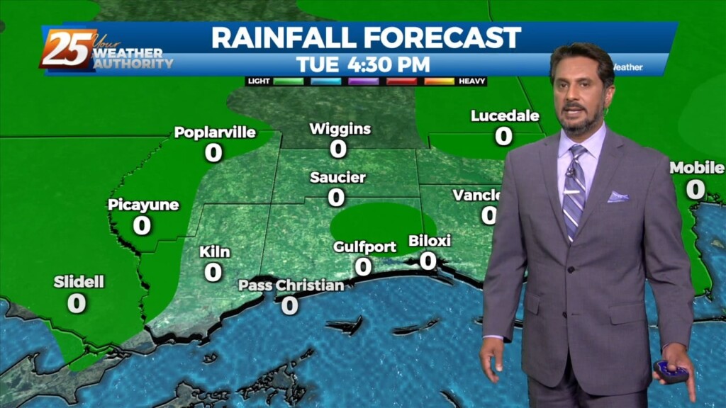
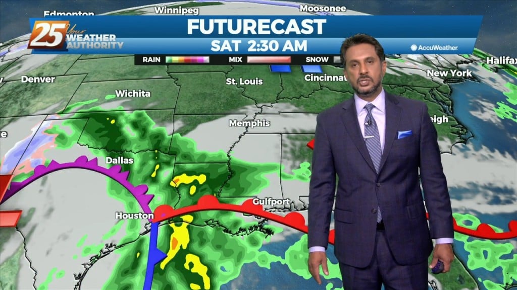
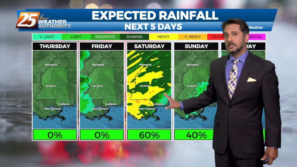
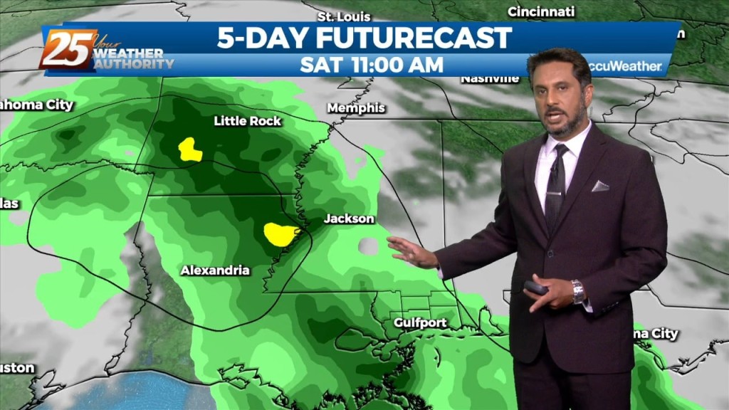
The main issue continues to be the heavy rain threat across the area as showers and thunderstorms continue to move from west to east across the…
This morning and likely into the early afternoon will remain dry and quiet before our next weather maker brings widespread rain showers and isolated…
After a couple days of light precipitation in some areas with mostly cloudy skies, clouds will break up today revealing partly cloudy to eventually mostly sunny skies. These…
Another weak disturbance will move through the area today bringing chances for some light precipitation, mainly in the afternoon. Models are still showing quite a bit…
In the short term, a dry re-enforcing cold front with parent upper level disturbance will swing through the region later today. Ahead of this feature,…
The main weather maker for the week is the system that will impact the local area over the next 24 hours. Dry air will modify quickly…
Another day of relatively quiet weather is expected as high pressure continues to sit over the northern gulf coast. Temperatures will remain about the same as…
Weakness in the upper levels extends from Missouri to Baja California. At the surface, low pressure associated with the weakness was centered over Illinois with a frontal…

The next in a series of upper disturbances extended from the Canadian Prairie Provinces to near Salt Lake City to Baja California. This is beginning to turn…
A cold front east of the area continue to move east as high pressure to the NW will shape the short term forecast. Most of the…
High pressure continues to dominate our weather pattern across the area. A weak disturbance will move across the area this morning into this afternoon. With…
We could not ask for more pleasant weather heading into the 1st weekend of October. It has been breezy and dry with the minimum relative humidity dropping from…
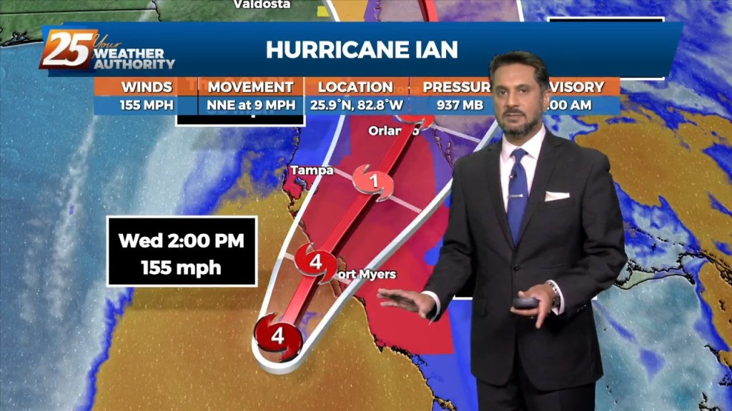
Drier and cooler temperatures are here, and Fall-like feeling is in the air! No rainfall is expected for the next few days. And while the Hurricane Ian is…