3/13 - Jeff's "Cool & Windy" Monday Afternoon Forecast
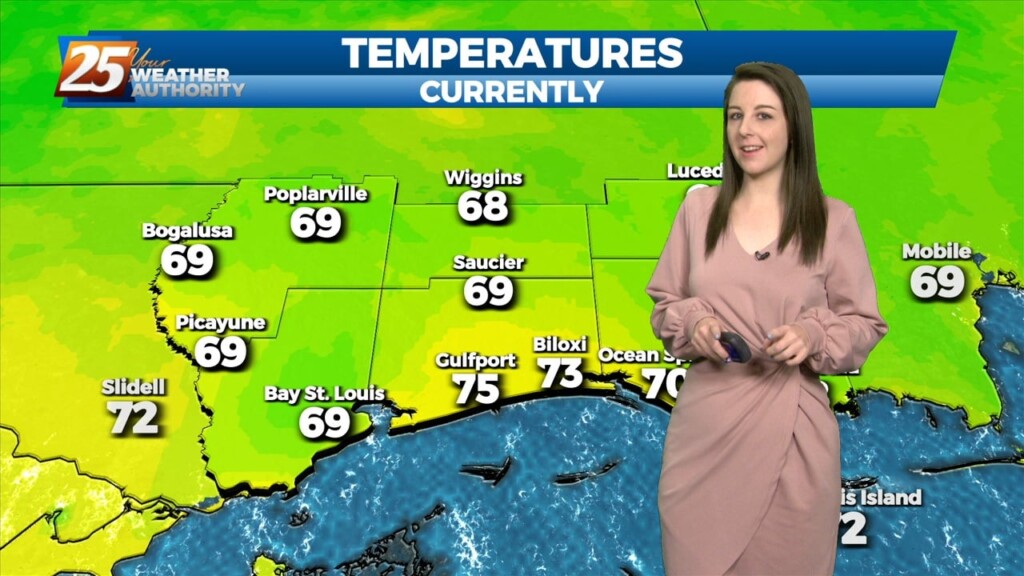
The cold front pushed through last night and brought a much cooler airmass with it. Temperatures will max out just below seasonal averages this afternoon under clearing…
The cold front pushed through last night and brought a much cooler airmass with it. Temperatures will max out just below seasonal averages this afternoon under clearing…
As last night’s cold front continues downstream, cold air advection will continue to be the story, along with decreasing clouds later in the afternoon from…
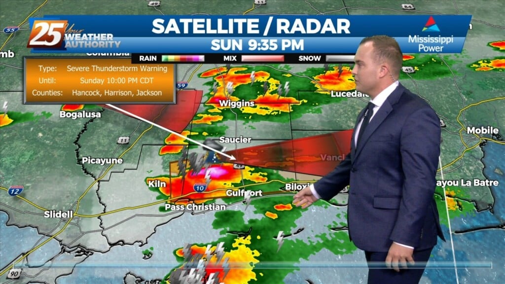
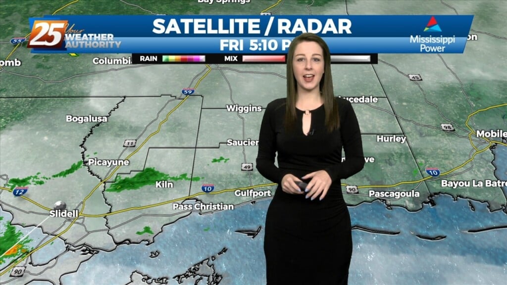
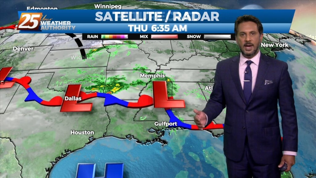
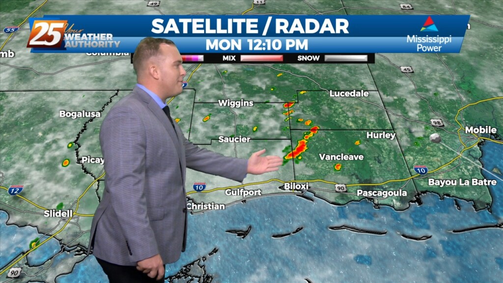
Showers and a few thunderstorms are making their way through South Mississippi as a cold front transits the region. High wind gusts and small hail can…
We've officially had a cold front make it's way through our area and can expect colder and drier conditions behind the front for a brief period of time. Main…
We've officially had a cold front make it's way through our area and can expect colder and drier conditions behind the front for a brief period of time.…

A few shower in the area will begin to dissipate this afternoon as a drier air mass moves in behind a cold front moving SE. High…
A cold front just north of the area will slowly slip though south Mississippi later this afternoon/evening. High pressure to the SE will suppress the energy…
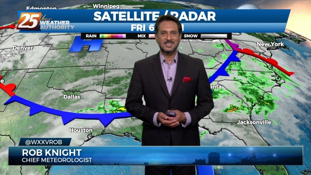
The upper level ridge axis that has been dominating the region over the past several days will weaken tomorrow as a progressive upper level trough passes through.…
The upper level ridge axis that has been dominating the region over the past several days will weaken tomorrow as a progressive upper level trough passes through. The…
Widely scattered afternoon/evening showers and a few t-storms will affect the area this afternoon, dissipating this evening. The prospect of locally dense fog forming…
Isolated t-storms will continue this morning with partial sunshine moving in this afternoon. Concerns overnight will be the prospect of locally dense fog forming. The near record…
The primary forecast concerns through Thursday night will be the prospect of locally dense fog forming each night, the threat of isolated to widely scattered convection forming…
The primary forecast concerns through Thursday night will be the prospect of locally dense fog forming each night, the threat of isolated to widely scattered convection…
Cloud coverage will be more dominant today as compared to the previous couple of days. Some peeks of sunshine can be expected this afternoon. Also, 30-40% coverage…

A weak backdoor frontal has dropped south in to the area and will be a focal point for a few afternoon showers/t-storms. To the south of…
No significant changes in the overall synoptic pattern that has been influencing the region for the past several day is anticipated through Thursday night. A weak backdoor frontal boundary…
No significant changes in the overall synoptic pattern that has been influencing the region for the past several day is anticipated through Thursday night. A weak backdoor frontal boundary…
Low-end rain chances will be in the picture this afternoon. Skies will clear out towards this evening but before that, temperatures will near record highs…
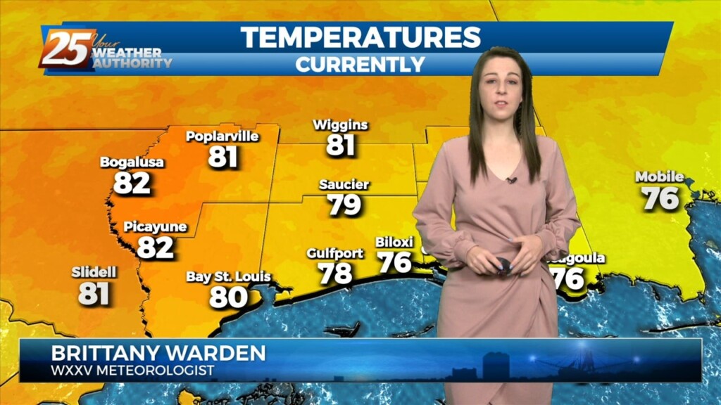
A very warm start to the day with another warm day expected across the region and no sign of a change at least in the…
Another warm day across the region and no sign of a change at least in the short term. Fog was an issue this morning and could be again tonight.…
Another warm day across the region and no sign of a change at least in the short term. Fog was an issue this morning and could be…
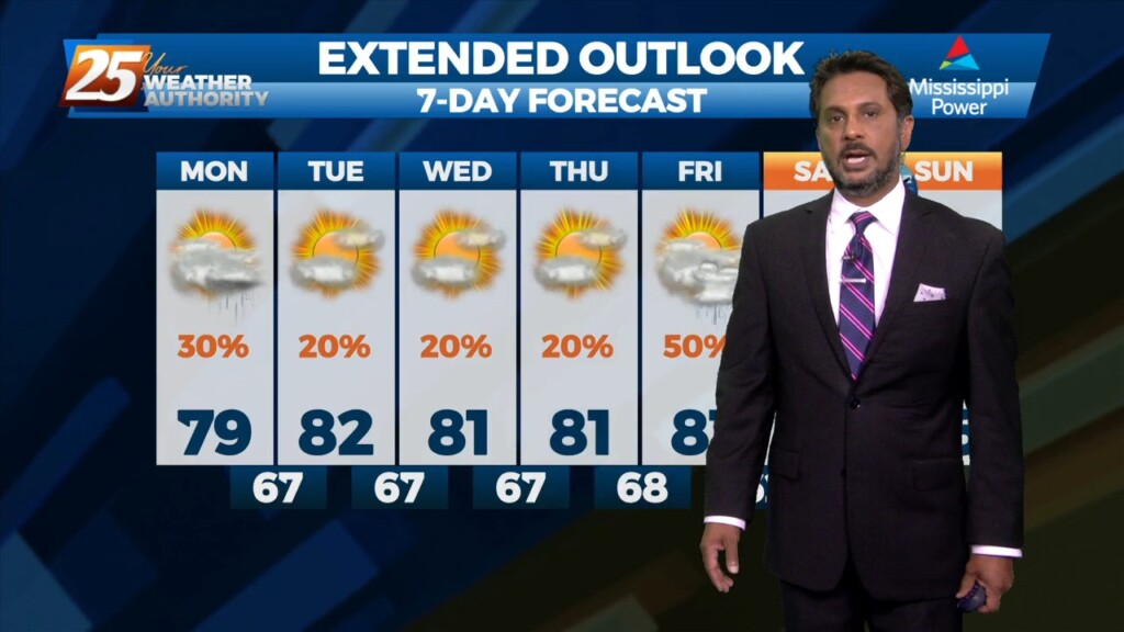
A stationary front near our area is providing just enough lift for 30% coverage of isolated showers this afternoon. Warm and humid conditions are returning to our area…
A warm front moving north this morning over south shore locations could bring enough vertical depth to get some showers out of it today…otherwise just…
After a slight, brief cool-down over the weekend, the pattern will return to a much warmer one. Moisture will increase overnight thanks to a stationary…