3/1 - Rob Knight's "Approaching Cold Front" Morning Forecast
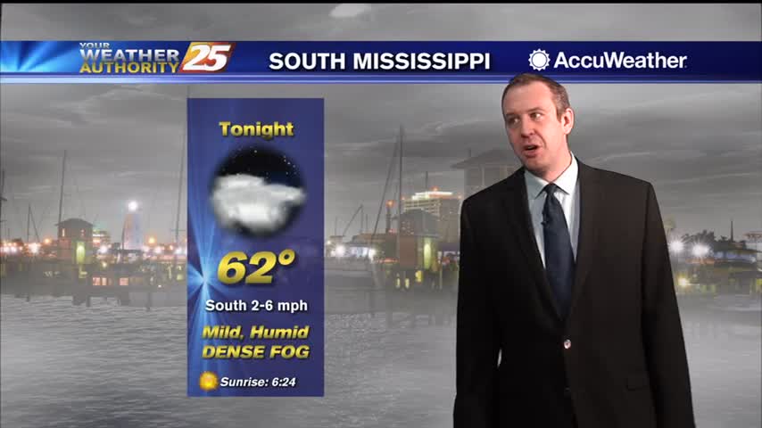
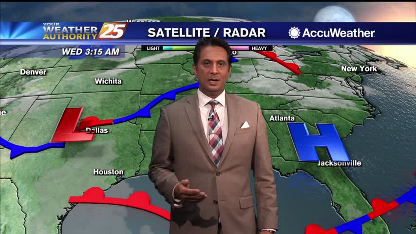
DENSE FOG is once again affecting south Mississippi with an approaching cold front to the NW...
DENSE FOG is once again affecting south Mississippi with an approaching cold front to the NW...
Not much has changed since the end of last week as warm, humid conditions remain, but change is moving in later this week....
We'll see several warm, foggy nights in a row before anything changes noticeably, taking us well into next week....
Sunshine beginning to poke through the clouds, with warm temperatures this afternoon...
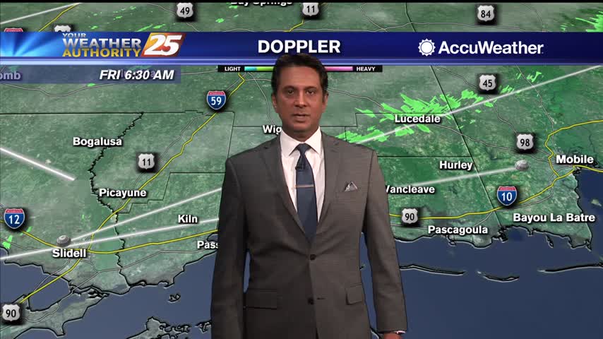
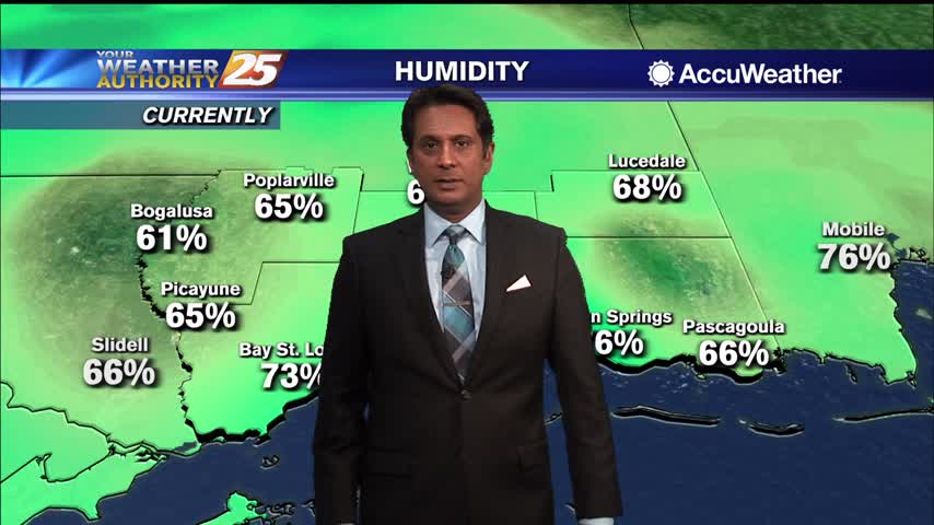
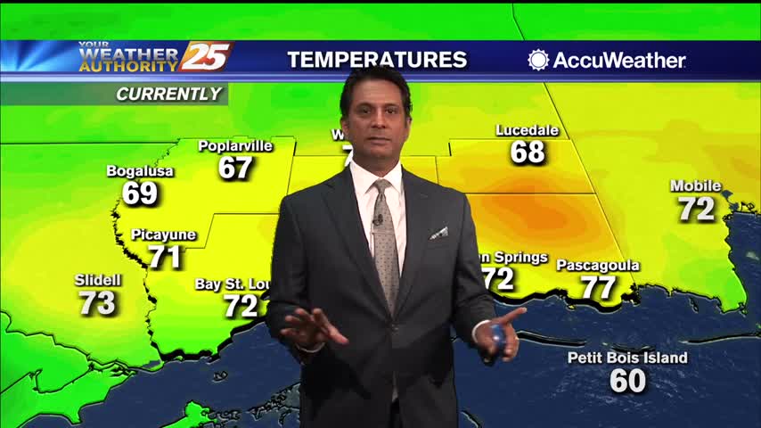
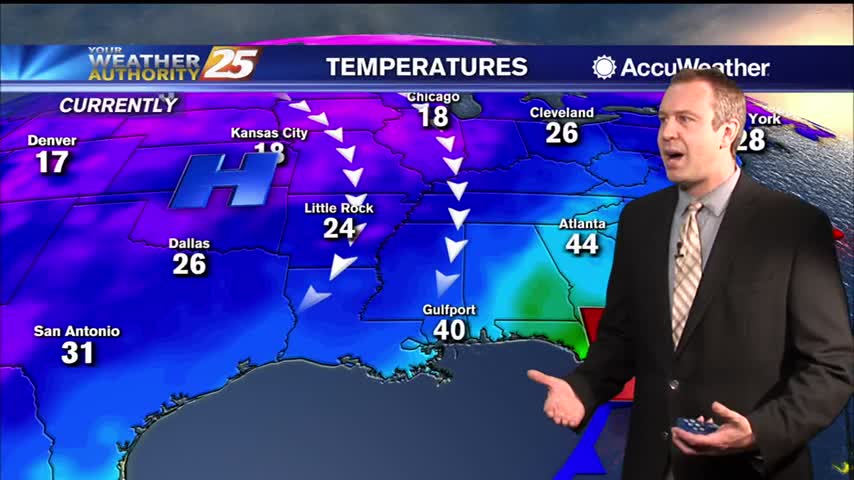
Another very HUMID start to the day with widespread fog affecting south Mississippi...
Warmer, more humid air is setting up shop and won't leave South MS any time soon, and we'll see several days with low rain chances.
Sunshine mixed with clouds as DENSE FOG continues over the sound and outer coastal waters...

Widespread DENSE FOG is in the area with an advisory until mid-morning...
Getting warmer and more cloudy through the night, as days of grey, wet days are on the way.

Another very nice "spring-like" afternoon ahead with sunshine and warm temperatures...
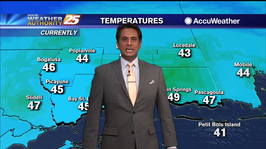
Another cold start to the day but warmer than we have seen over the past week...

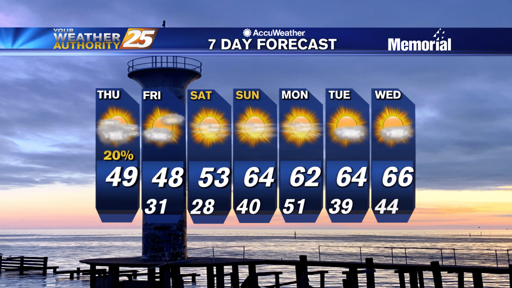
Cooling trend is over, and we're starting our warming trend that will take us through the rest of the week.

A beautiful sunny afternoon ahead as warmer air from the GOM will move back into the area...
A cold start this morning with much warmer temperatures through the weekend...
Last weekend was quite warm, but we're going to see a decent short-term cool-down as we head through the next few days.
Clearing skies will continue with sunshine and mild temperatures this afternoon...
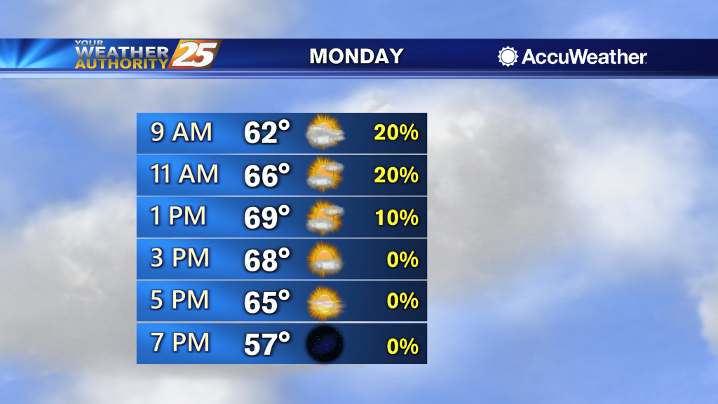
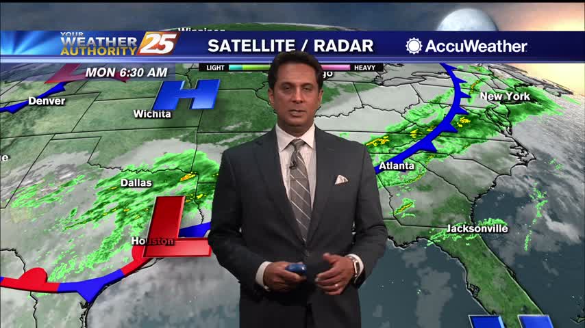
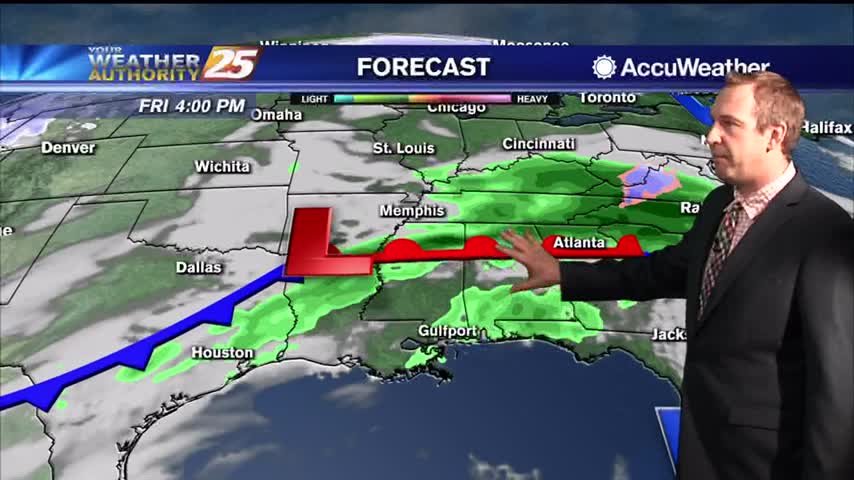
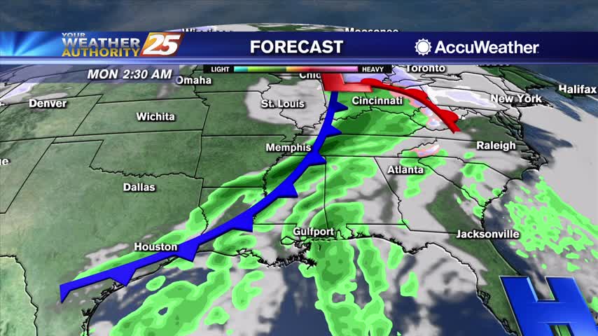
Scattered showers will be possible Monday, especially during the morning hours, that could produce light to moderate rainfall for the region. Some patchy fog will also be possible in between showers for the inland areas. During the day and evening…
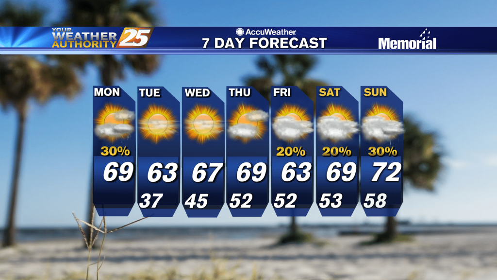
Scattered showers will be possible Monday, especially during the morning hours, that could produce light to moderate rainfall for the region. Some patchy fog will also be possible in between showers for the inland areas. During the day and evening…
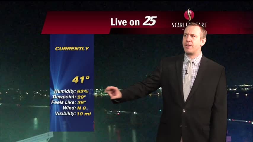
Last night was cold, but tonight will be even colder as the skies clear and winds calm....
Clouds have cleared the area with an abundance of sunshine ahead this afternoon...
A very cold start as a blanket of clouds continue to linger overhead...
Temperatures warmed for the last couple of days and nights, but now we start going the other direction, but this trend won't last long either....

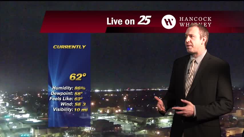
Rain is out of the area but the cloud coverage and gusting winds will continue through early Friday morning...
Showers and a few thunderstorms pushed across the area last night, but now we are looking at rain-free conditions with heavy cloud cover sticking around. It is likely going to take another 24-36 hours for that system to move east…