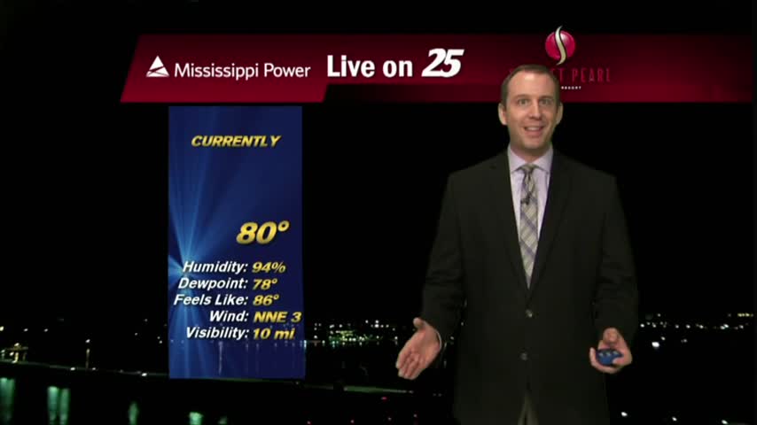
08/14 Ryan's "Summer Night" Monday Forecast
After another day of predictable afternoon showers and storms, we'll see more of the same as we head into tomorrow. Click the forecast link for more details.
After another day of predictable afternoon showers and storms, we'll see more of the same as we head into tomorrow. Click the forecast link for more details.
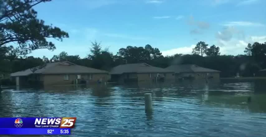
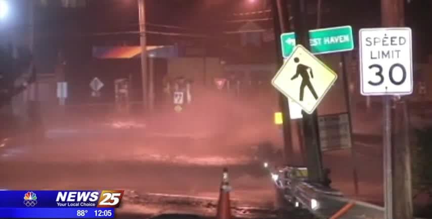
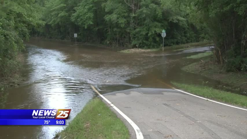
Heavy rain means problems for people living at the O’Neal Road apartments in Gulfport. Long-time residents say floods have been an issue in the neighborhood for decades. It was more than just a little bit of water in the middle…
One year ago this week, the Gulf Coast came together despite disaster, as heavy flooding devastated Baton Rouge and the surrounding areas, putting Southern Louisiana in a state of emergency. With 146,000 homes affected by the flood water, the City…
Just like the last few nights, earlier showers and storms have dissipated but we can expect them to return through the weekend. More details inside.

The amount of wrecks due to the weather has the Gulfport police urging motorists to drive with caution as more rain is expected. An 18-wheeler is involved in an accident with multiple vehicles near the Lorraine Cowan Road exit on…
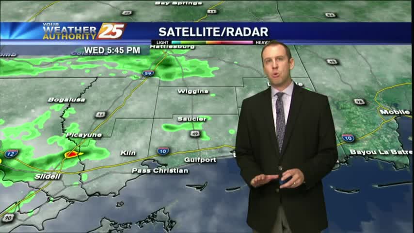
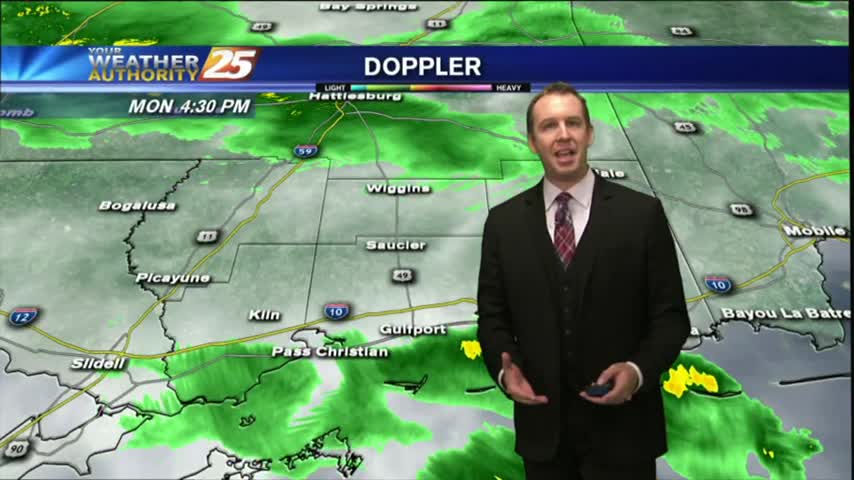
While last night was the exception, we're again seeing our earlier showers & t-storms dissipating and and even some slight sky clearing. Rain returns quickly though, so watch the full forecast for details.
Forecasters are now predicting a higher likelihood of an above normal hurricane season and could be the most active since 2010. Forecasters now say there is a 60 percent chance of an above normal season compared to the May prediction…
Didn't see much rain this morning/afternoon, but early evening thunderstorms helped light up the night sky. This will dissipate quickly, and more rain expected soon, but you'll have to watch the forecast for more.
Some dry air moved in this afternoon as expected, keeping the showers a bit more few and far between than the day before. Watch the full forecast for more details.
Our earlier showers have all but cleared, though more rain is expected every afternoon through the rest of the week. Watch the full forecast for more.
Overcast and rainy as expected, but most of the rain stayed North of the three coastal counties. Expect much more in the coming days, but you'll have to watch the full forecast for details.
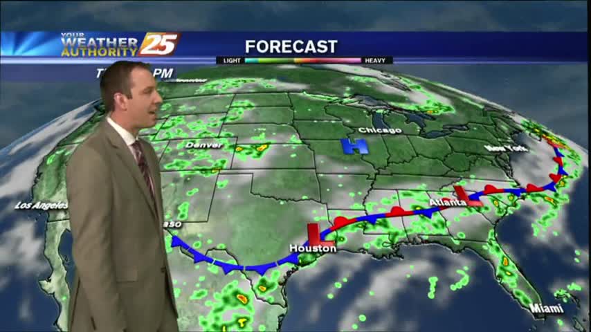
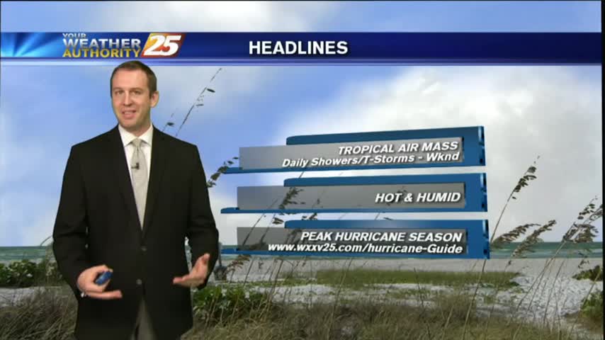
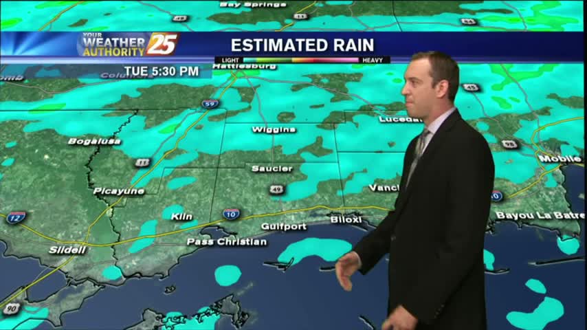
A frontal boundary is moving into the Southeast, but is not expected to pass through South MS. It will however, linger in the area causing several rainy days. Forecast details inside.
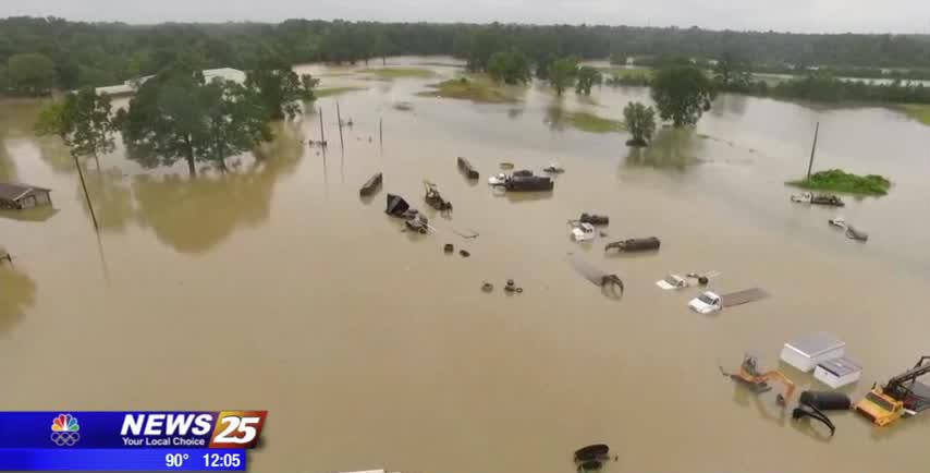
The Harrison County area is still dealing with the aftermath of yesterday’s heavy rainfall. At last check, the Biloxi River was over flood stage, cresting right around 15 feet. The good news is the water is now descending. The Biloxi…
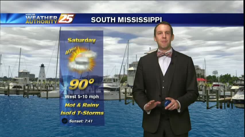
Didn't see the rain totals I expected for today, but rain will move in and linger through the weekend. Check out the full forecast for details.

The clouds have thickened as expected throughout the day, but we haven't seen many showers yet. That will change overnight, and continue through the weekend. Details inside.
Clouds increased as expected today, and showers will begin over the next few hours. Be sure to watch the full forecast for all of this weekend's rainy details.
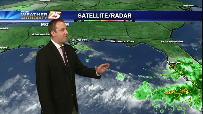
Drier and slightly cooler conditions moved into South MS, just as a developing Tropical Storm moved East! Great conditions last a little longer, but change soon. Read full forecast for details.

A sunny and DRY start with a cold front overhead...
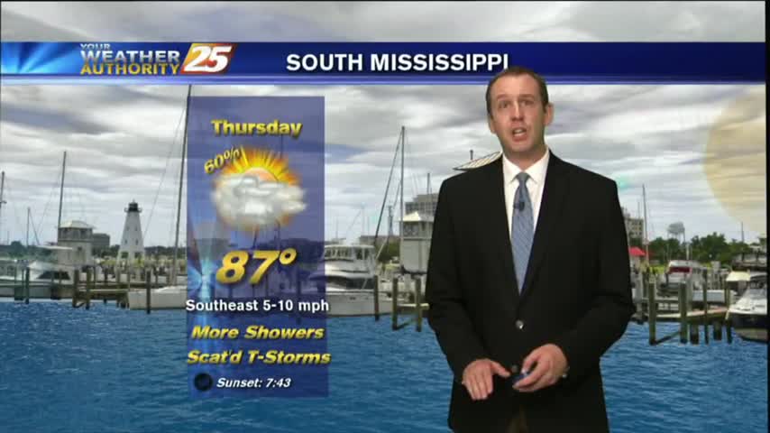
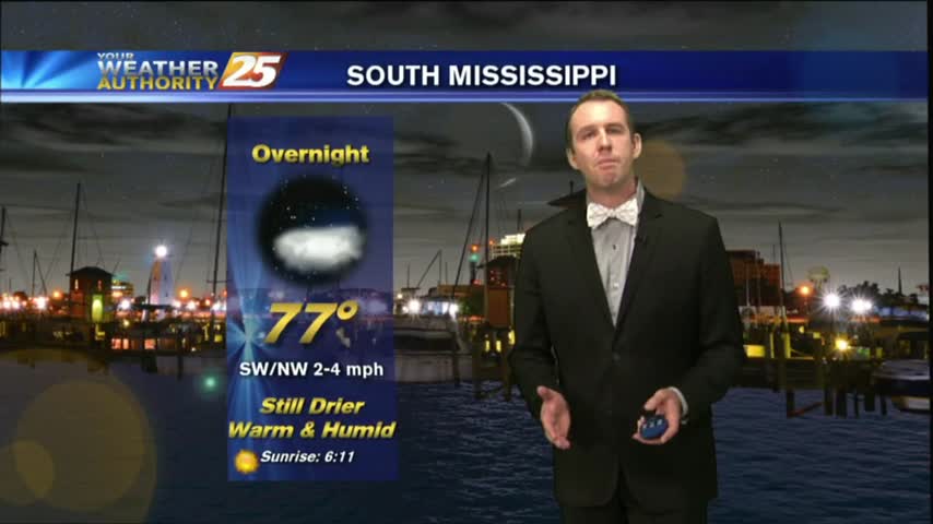
While Thursday may have been the hottest, today was the most sunny! That's already starting to end though as cloud cover increases through the night. Full forecast inside.
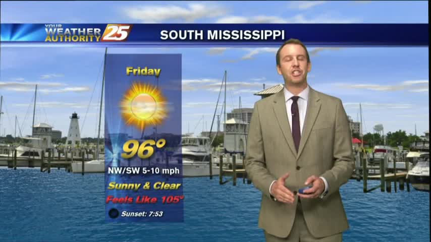
Mostly clear skies will help us cool into the mid-to-upper 70s, but we'll see very hot conditions tomorrow. Watch the full forecast for details.
Much drier today with only a few showers popping up in the West, but the high heat indices we expected definitely showed up. Another dry and hot day ahead before rain arrives, so watch the full forecast for details.
We saw a few showers pop up this afternoon, and I'm expecting a few more tomorrow, but otherwise it will be very hot and humid. Watch the full forecast for details.
Our earlier showers & thunderstorms have cleared out, but I'm expecting more overnight and tomorrow afternoon. Watch the full forecast for more.
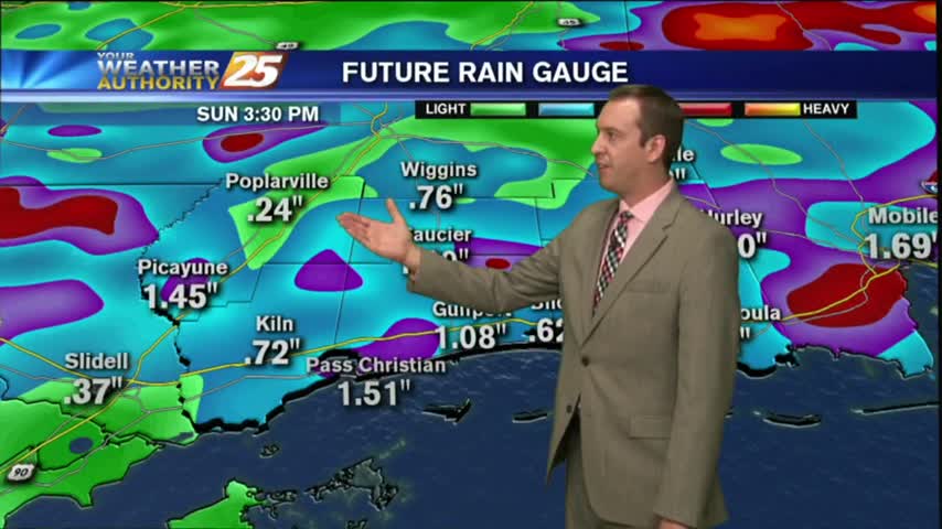
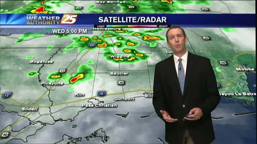
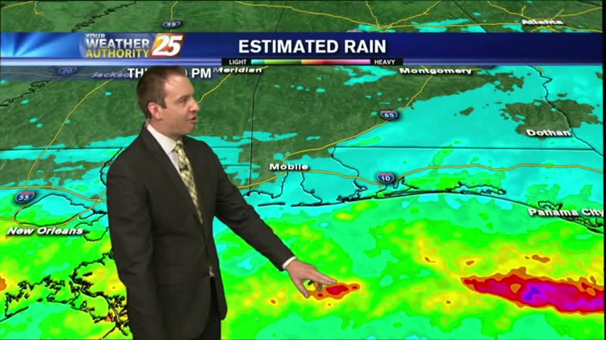
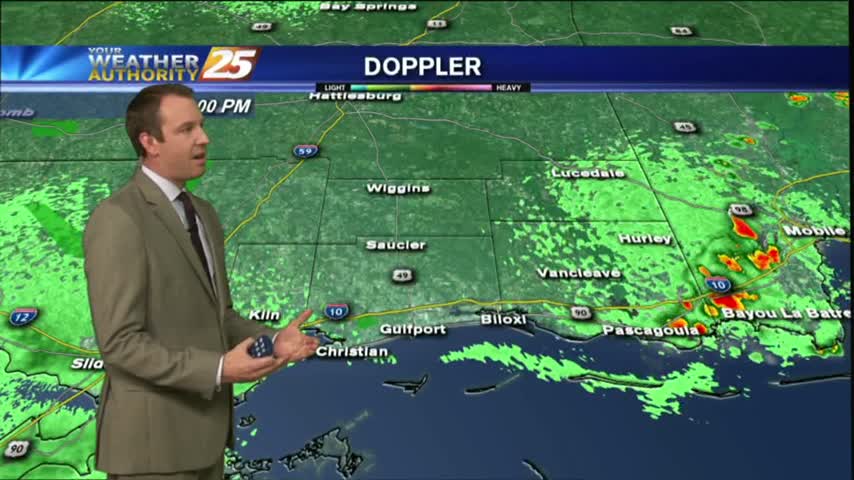
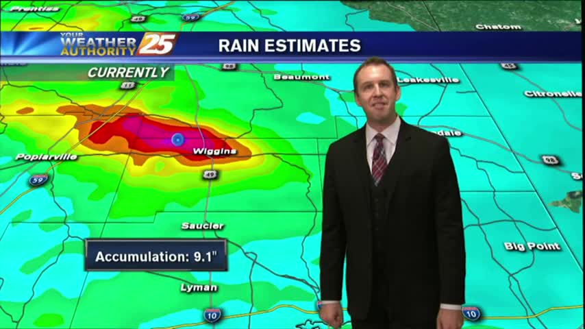
Rain was expected to begin the week, but we saw some ridiculously high rainfall totals from this afternoon's thunderstorms. Drier air moves in soon, watch the forecast for details.