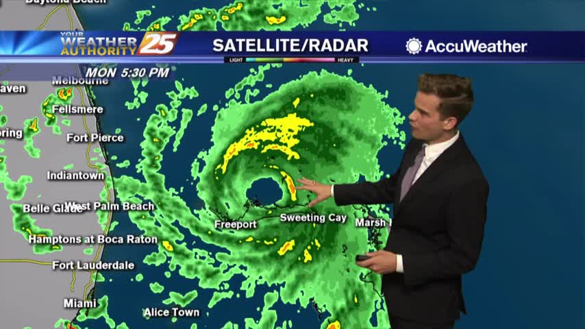
9/2 - Payton's Monday Evening Forecast
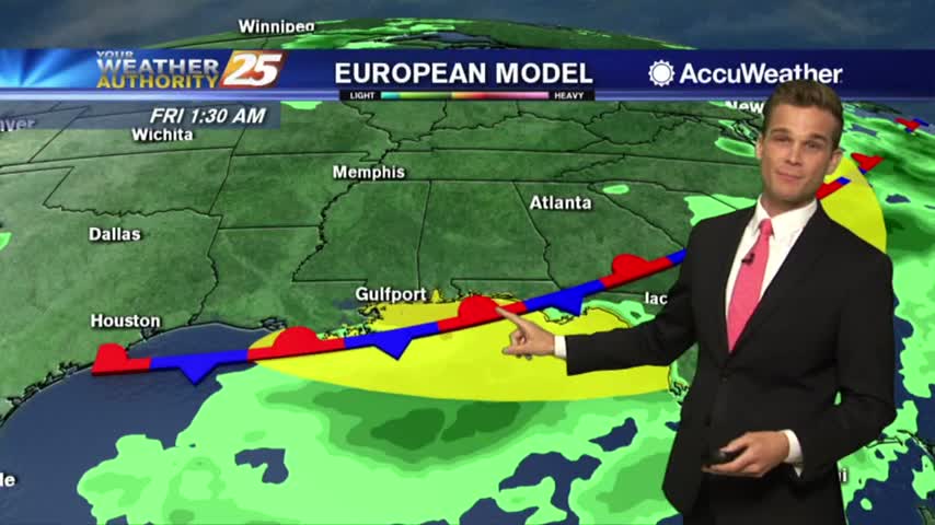
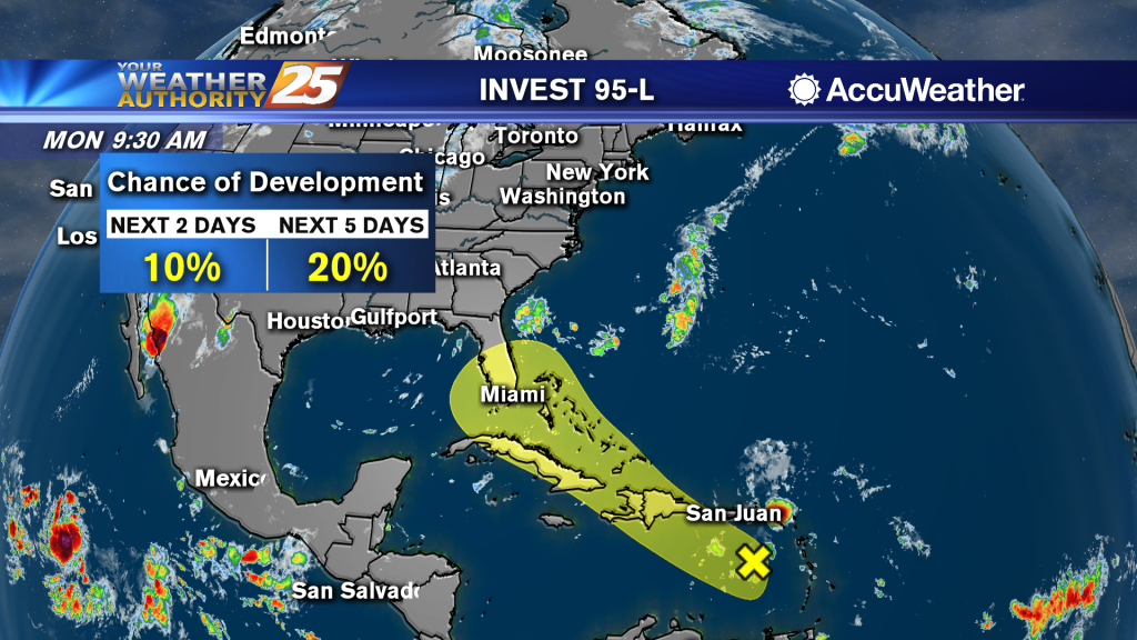
A hot and dry week...and the tropics have come alive.
A hot and dry week...and the tropics have come alive.
A few t-storms possible on Labor Day, but hotter and drier midweek.

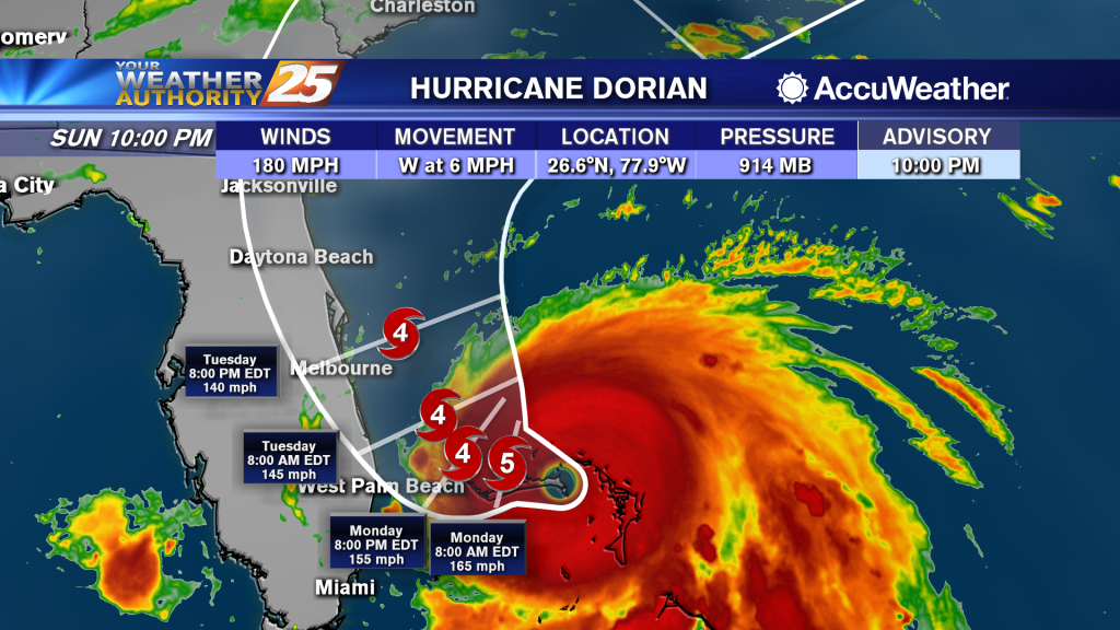
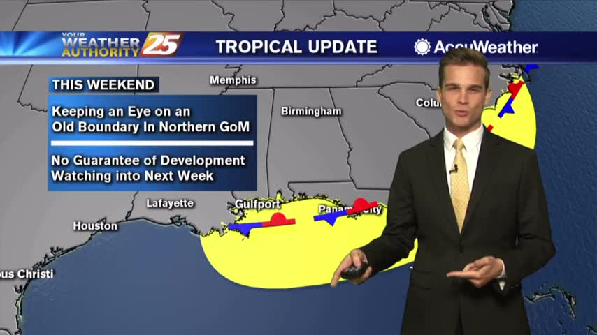
Drier Thursday and Friday and the latest on Tropical Storm Dorian
Few more days of rain before dry air moves in
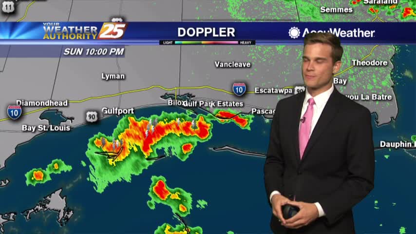
Flash flooding possible this afternoon
Heavy rain expected tonight and Monday

Rain chances still look likely as we head into the weekend as tropical moisture heads our way
We're watching the potential for heavy rain all the way into the weekend
More rain today and the latest on the potential for heavy rain this weekend.

Heavy rain possible this afternoon...tropical moisture this weekend?
We'll start the workweek stormy and we're watching this weekend for more rain.
Rain chances on the rise this weekend and the latest on the tropics
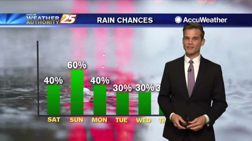
Better rain chances as we head into the weekend
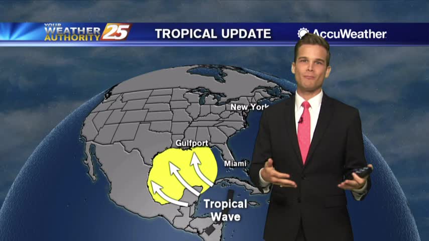
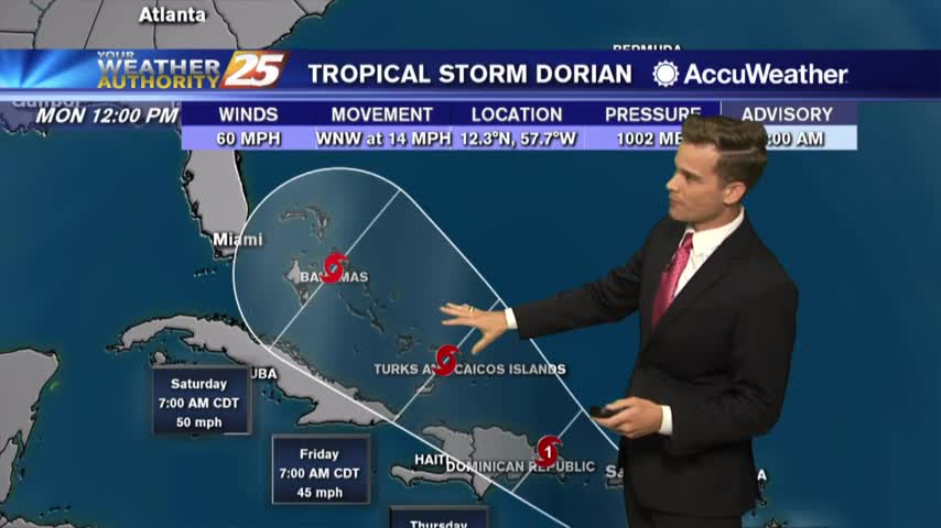
A little drier over the next few days...and let's talk tropics.
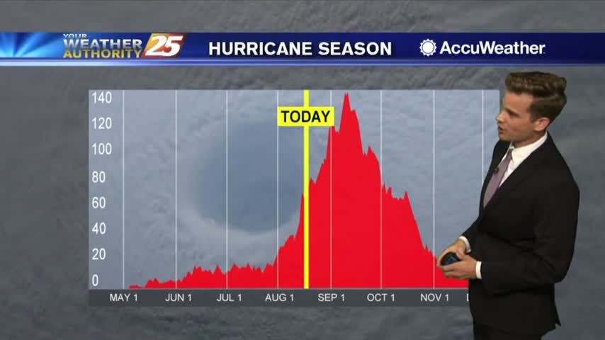
The latest on the summertime heat and tropics.
Heat Advisory for Monday and what we're keeping an eye on in the tropics
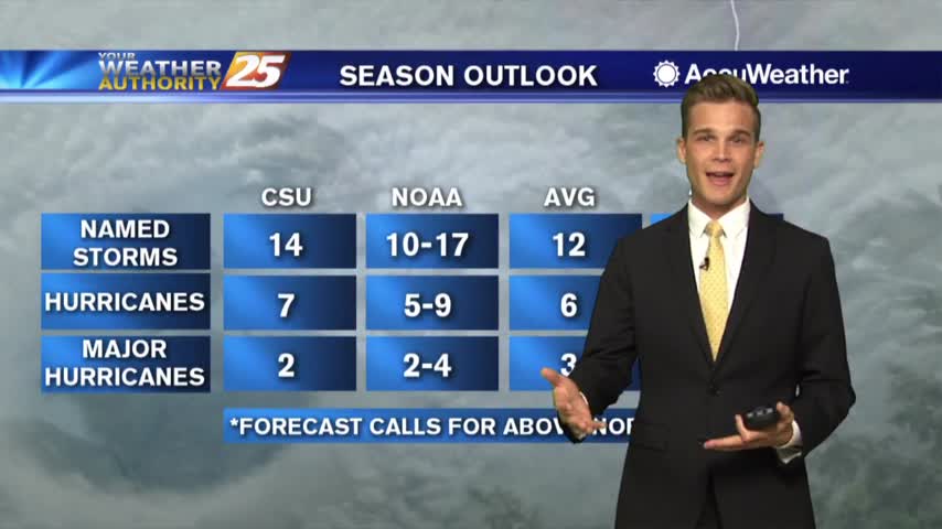
Be careful in the heat...also an update on NOAA's latest hurricane season outlook.
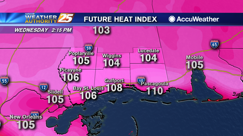
Heat index values over 105 possible this afternoon and into the weekend
Another hot and humid one with a few t-storms this afternoon.
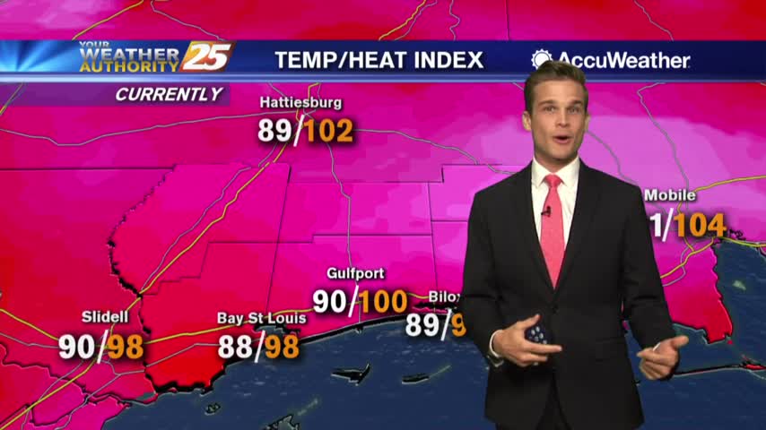
Heat index values over 105 in a few locations this afternoon. If you're lucky a shower could cool you off.
We'll see more showers and t-storms this afternoon, but drier days are ahead.
T-Storms in the area tonight and more for your Monday.
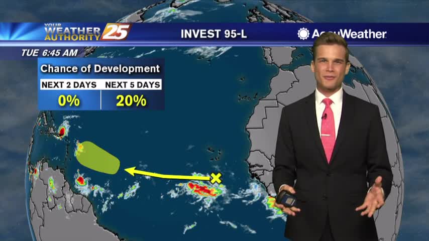
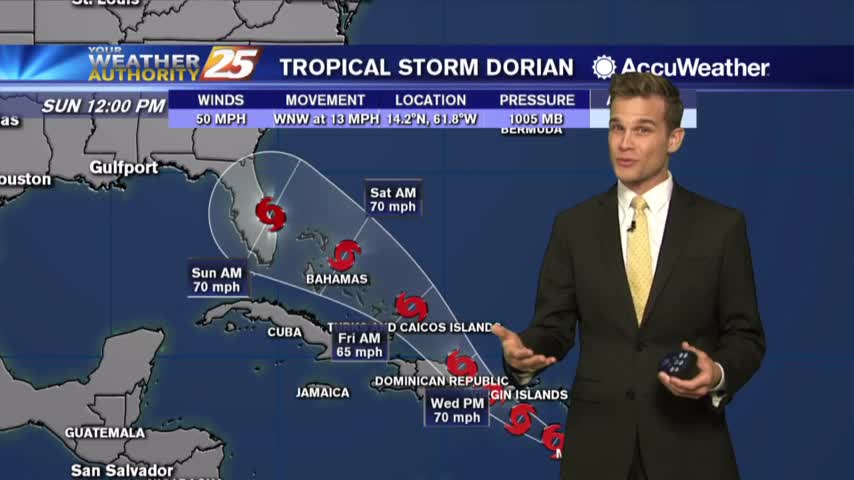
Rain possible this afternoon, and the latest on the tropics.
Popup t-storms possible this week...and the latest on the tropics.