8/21 - Payton's Wednesday Afternoon Forecast
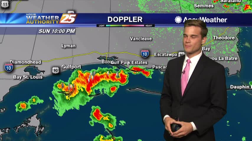
We're watching the potential for heavy rain all the way into the weekend
We're watching the potential for heavy rain all the way into the weekend
More rain today and the latest on the potential for heavy rain this weekend.

Heavy rain possible this afternoon...tropical moisture this weekend?
We'll start the workweek stormy and we're watching this weekend for more rain.
Rain chances on the rise this weekend and the latest on the tropics
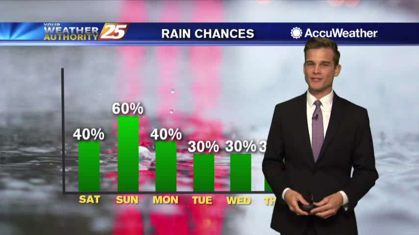
Better rain chances as we head into the weekend
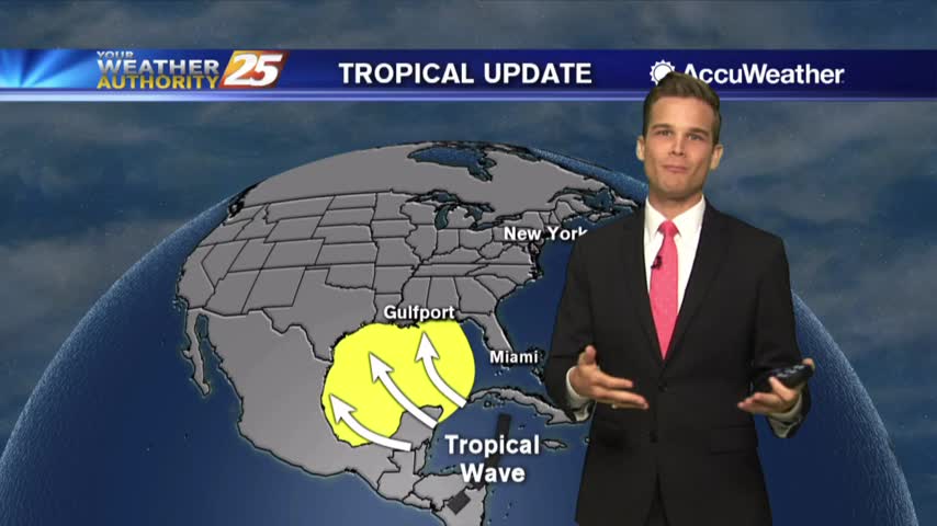
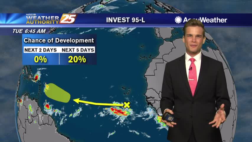
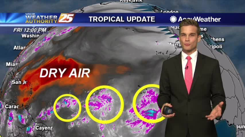
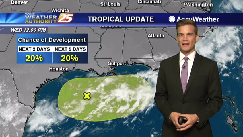
A little drier over the next few days...and let's talk tropics.
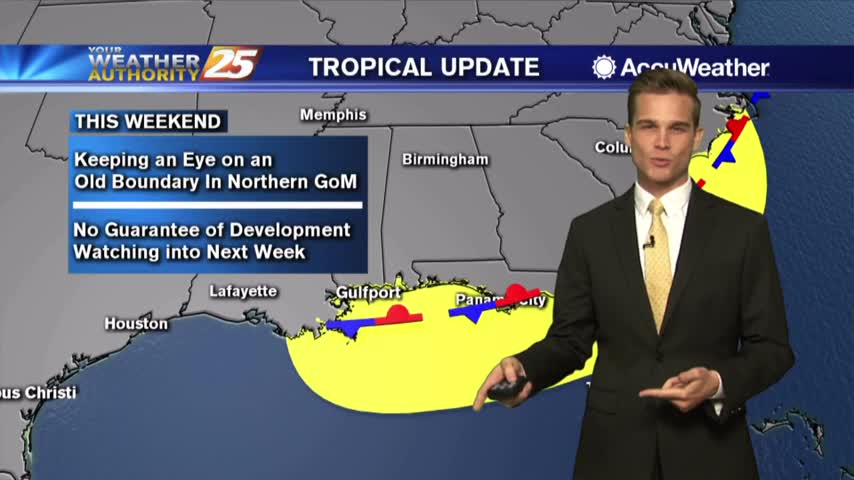
The latest on the summertime heat and tropics.
Heat Advisory for Monday and what we're keeping an eye on in the tropics
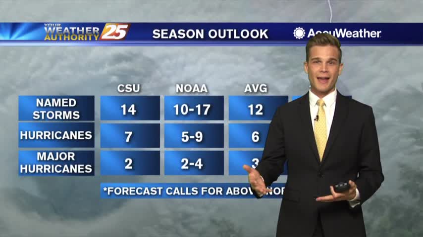
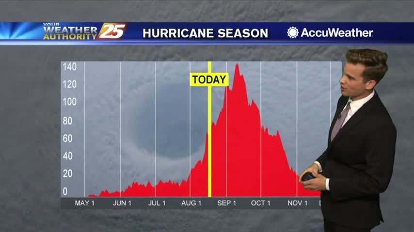
Be careful in the heat...also an update on NOAA's latest hurricane season outlook.
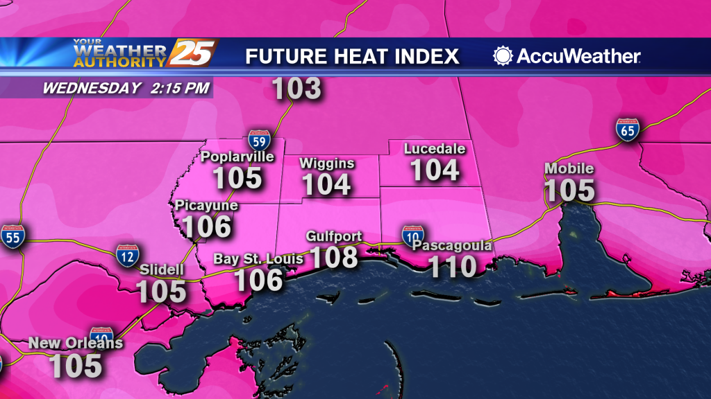
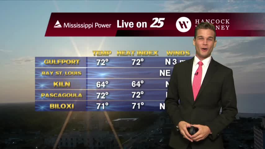
Heat index values over 105 possible this afternoon and into the weekend
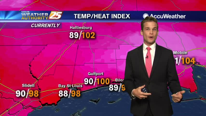
Another hot and humid one with a few t-storms this afternoon.
Heat index values over 105 in a few locations this afternoon. If you're lucky a shower could cool you off.
We'll see more showers and t-storms this afternoon, but drier days are ahead.
T-Storms in the area tonight and more for your Monday.
Rain possible this afternoon, and the latest on the tropics.
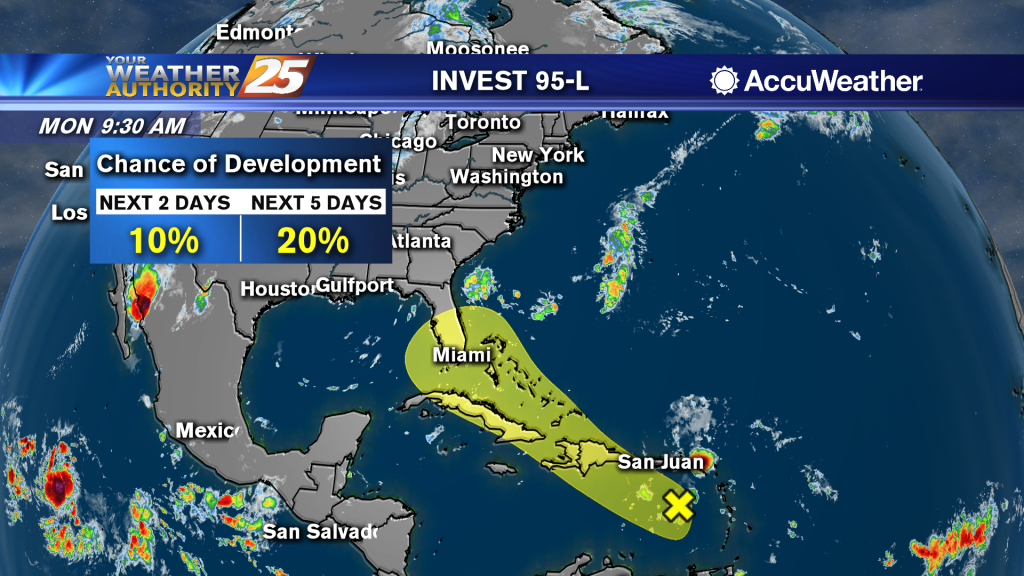
Popup t-storms possible this week...and the latest on the tropics.
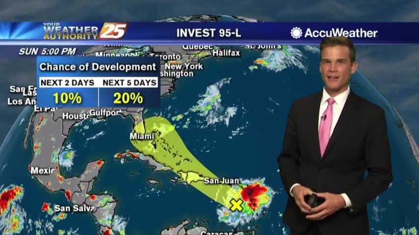
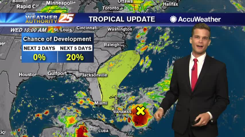
Just in time for August the tropics are heating up...here's the latest.
Heat and humidity are about to return and the latest on the tropics.
One final day of decent weather before we get back to heat and humidity.
One final day of beautiful weather before things return to normal.
A perfect day! Won't last for long though and we're keeping an eye on the tropics.
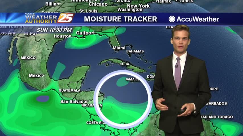
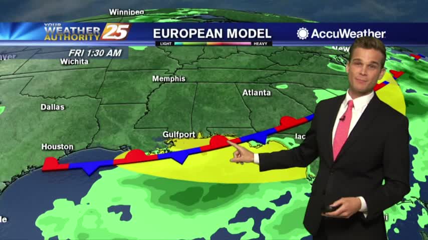
Cold front brings rain then drier air...could also stir up the tropics later this week. More details here.
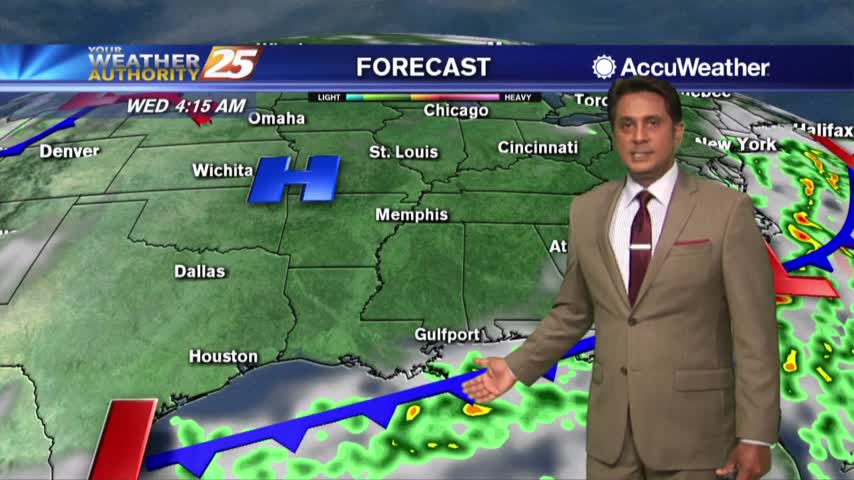
Heavy rain Tuesday afternoon...drier and sunny by Wednesday.