08/20 Ryan's "Excessive Heat" Friday Evening Forecast
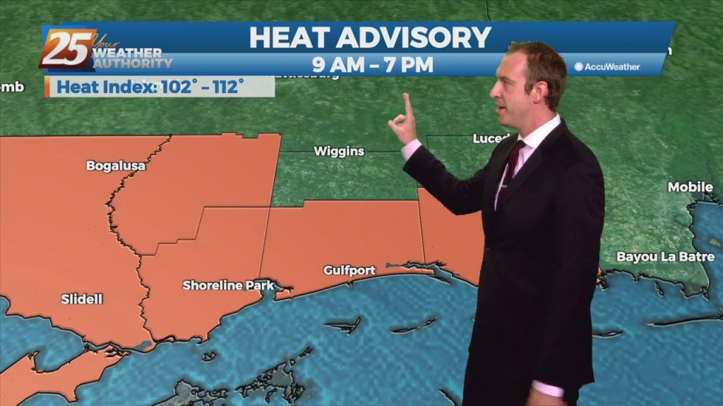
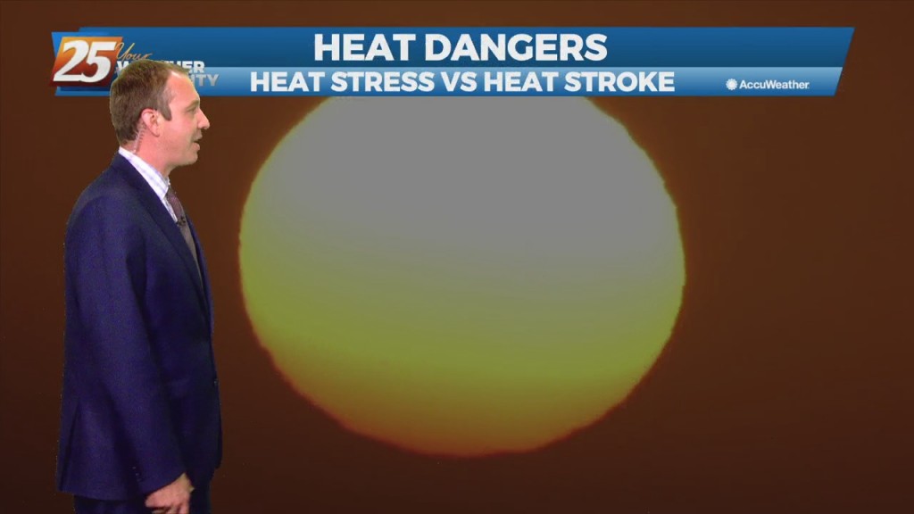
Yesterday we were under a heat advisory, but today that was upgraded further to an excessive heat warning. That means heat indices across South MS will lie between…
Yesterday we were under a heat advisory, but today that was upgraded further to an excessive heat warning. That means heat indices across South MS will lie between…
Dangerous heat has moved in and today's heat advisory won’t be the last we’ll see over the next week. We’re in for an interesting change though. Right now…
An heat advisory was issued today and is still active until 7 PM, and it won't be the last we'll see over the next week. We're in for…
The showers and thunderstorms that develop in the heat of the day are starting to die off, but we'll see more in the way of coastal activity overnight.…
The showers and thunderstorms that develop in the heat of the day generally lead to some nice cool spots, but they've been sparse recently. That will change…
More hot and humid weather is on the way with only spotty afternoon activity. That means fewer cool spots in the heat of the day, and even then…
More hot and humid weather is on the way with only spotty afternoon activity. That means fewer cool spots in the heat of the day, and even then…

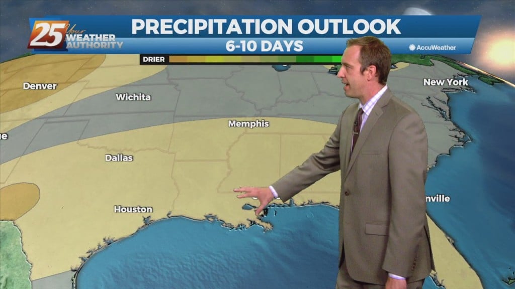
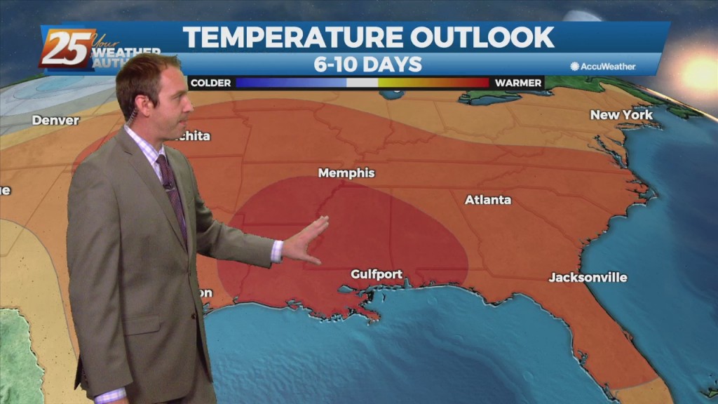
Sorry everyone, no video tonight. Capture software wasn't working. After a close call with Tropical Storm Fred it seems a hotter, drier trend is developing in South MS. The humidity at least will be a short-lived bump, but we're looking…
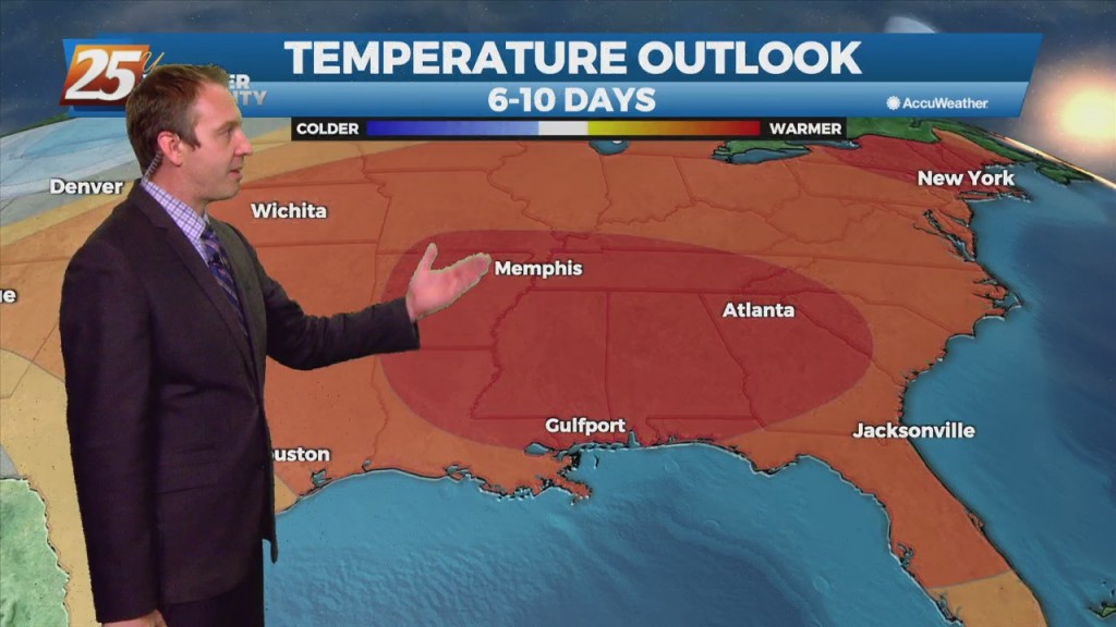
After a close call with Tropical Storm Fred it seems it's just getting hotter and more humid in South MS. The humidity at least will be a short-lived…
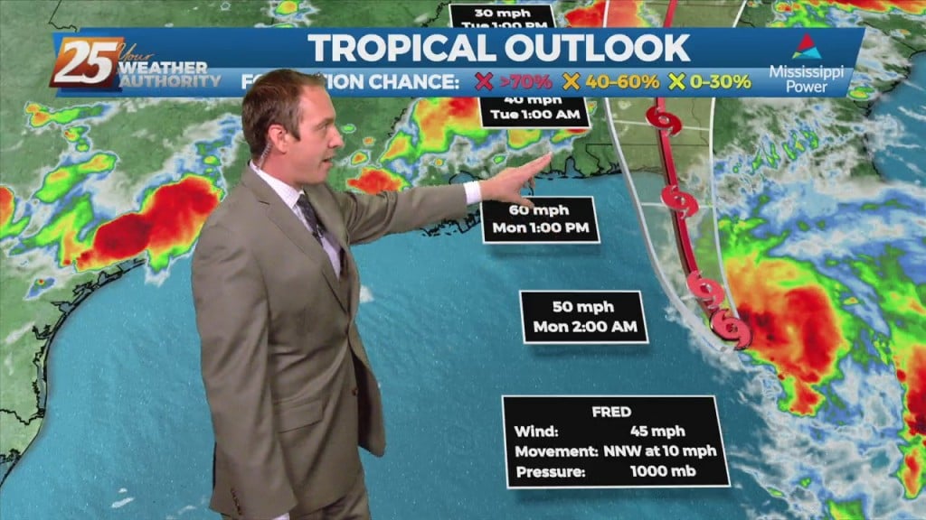
The last 48 hours have been a bit all over the place with regards to TS Fred, but the latest update has me feeling better. This particular…
There weren't any weather surprises today as our active weather was once again driven by the sea breeze. That's when showers and thunderstorms develop due to the heating differences…
There weren't any weather surprises today as our active weather was once again driven by the sea breeze. That's when showers and thunderstorms develop due to the heating…
Today was slightly wetter in terms of rain amount and coverage, but we'll be drier again by tomorrow. Friday will also be one of the sunniest…
Today was slightly wetter in terms of rain amount and coverage, but we'll be drier again by tomorrow. Friday will also be one of the sunniest days of…
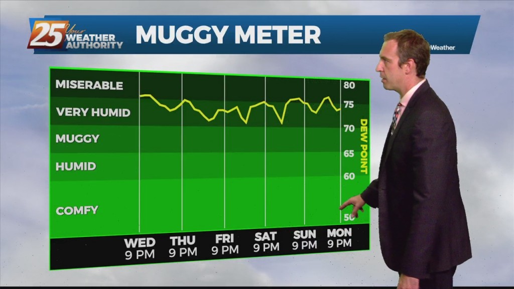
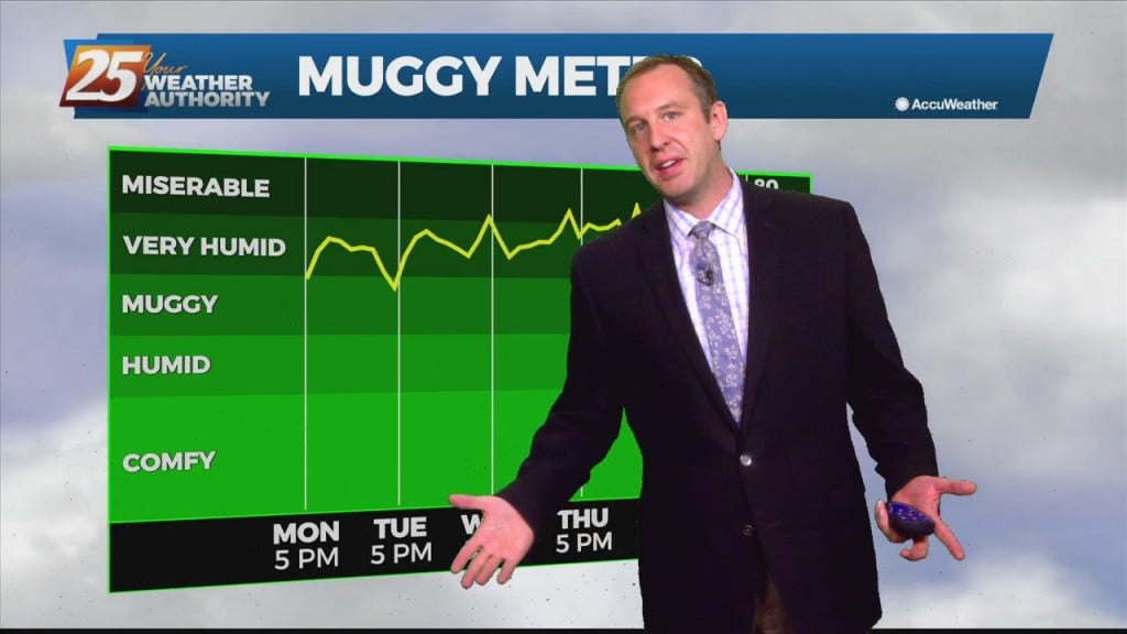
They say the only sure things in life are death and taxes, but I'd also push for adding our consistently humid summer weather. Once again today the temperature…
They say the only sure things in life are death and taxes, but I'd also push for adding our consistent South Mississippi summer humidity. Once again today the temperature…
Good to be back after a few weeks off, and it's no surprise it's still hot and humid though it will be drier. That isn't going to change…
Good to be back after a few weeks off, and it's no surprise it's still hot and humid. That isn't going to change anytime soon since…
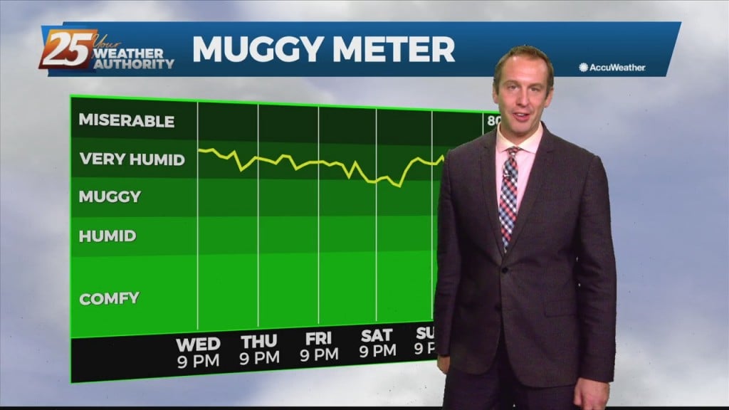
After a scorcher of a weekend, the heat and humidity isn't going anywhere except at night when things calm down. The humidity has remained steady for the…
After a scorcher of a weekend, the heat and humidity isn't going anywhere. The humidity has remained steady for the last several weeks, and will even…
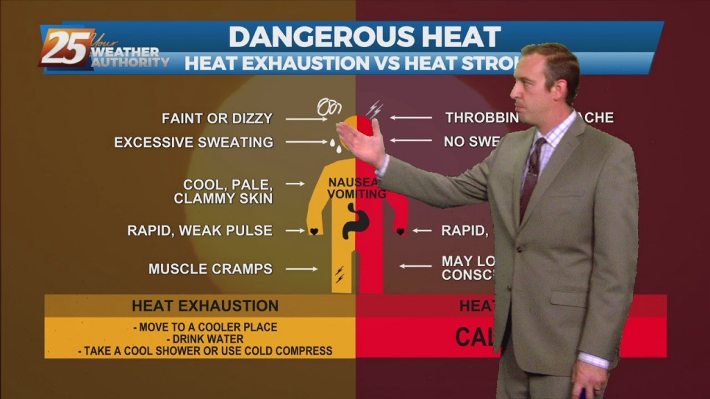
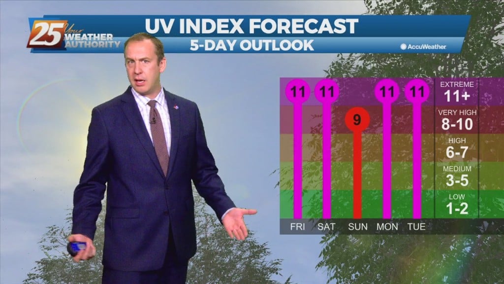
Hot temperatures and high humidity will peak this weekend, leading to some dangerously hot weather. We saw some of that weather today as a few areas climbed…
Drier today as we didn't see much rain, but that led to some sweltering conditions with heat indices near 105! That sadly is "the rub" when it comes…
Didn't see much rain today, but that led to some sweltering conditions with heat indices near 105! That sadly is "the rub" when it comes to our weather.…
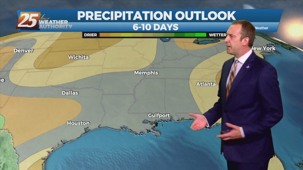
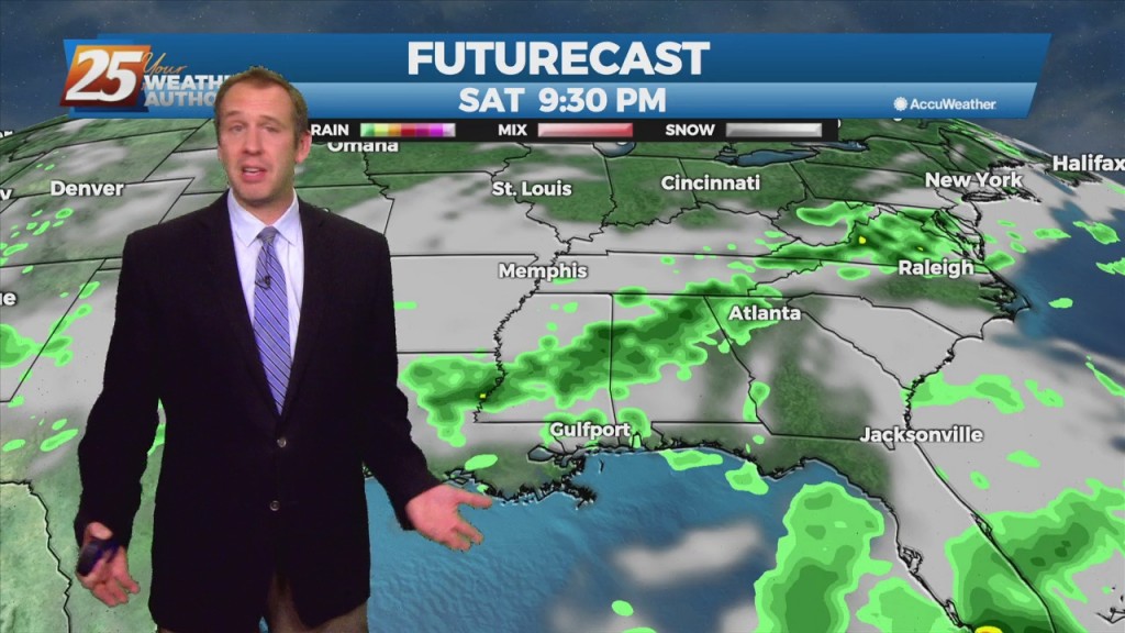
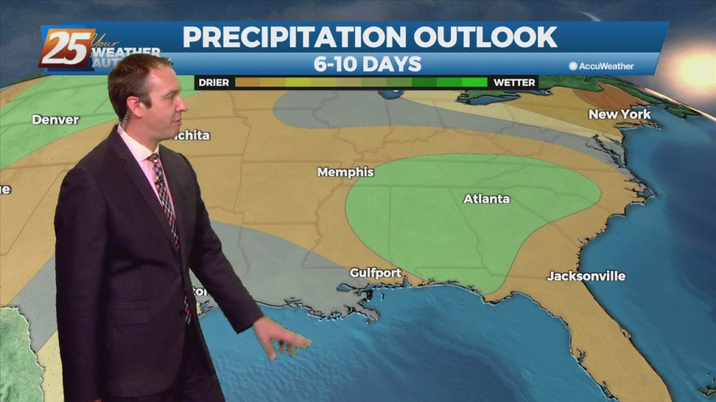
Much wetter in parts of South MS today as more widespread activity developed this afternoon. Today's t-storms lasted longer, and brought higher short-term totals that topped 4"…