9/23 - Rob's 1st Weekend of Autumn Forecast
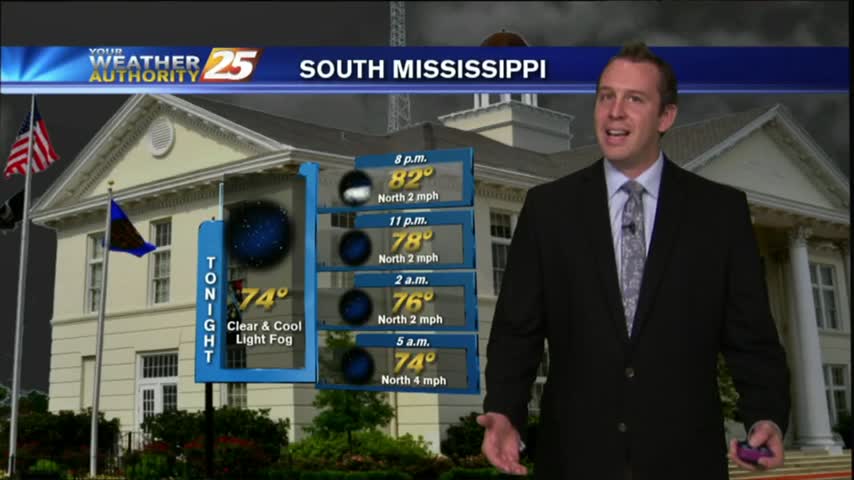
As low-level humidity continue to increase, it's a warm & humid start with areas of PATCHY FOG...
As low-level humidity continue to increase, it's a warm & humid start with areas of PATCHY FOG...
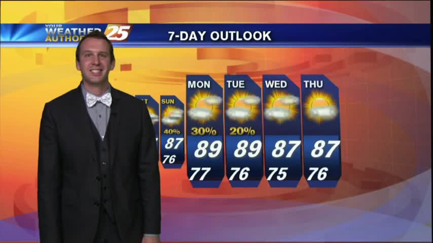
Not a bad first night of Fall, but cooler temperatures certainly would fit the part a bit more. Find out when they'll get here inside.
It was the first "official" day of Fall, but we won't see a drastic change in local conditions just yet. Cooler temps ahead though, details inside.
Welcome ... to Fall 2016!
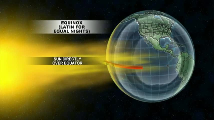
Tonight is the official last night of Summer, find out what the Fall Equinox is all about and the plan for the weekend inside.
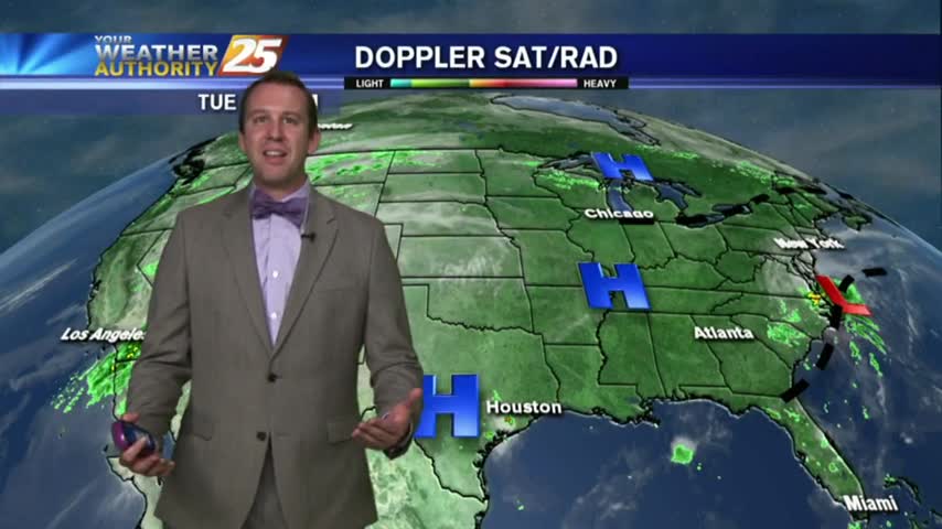
As dry air continues to be dominant across the southeastern U.S., our weather has been excellent today.
As dry air continues to move into the Gulf coast, temps have fallen into the upper 60s under clear skies...
Another quiet and beautiful day! Will we keep it going? Details inside.
Rain? What rain?
After a clear, cool, and drier morning, the sun returns in the afternoon and the great weather continues. Forecast details inside.
After a grey and rainy weekend, we started off the week in style with a beautiful day today. How long will it last? Good news: quite a while. Better news: You'll have to watch the forecast for more!
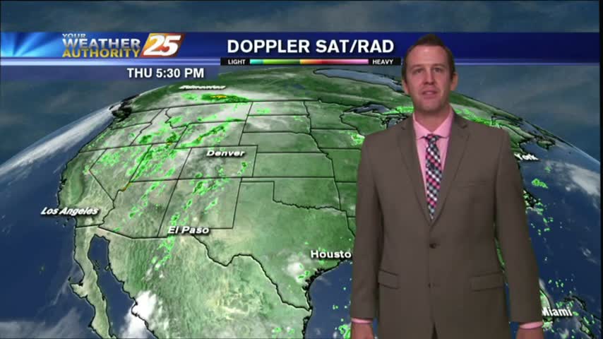
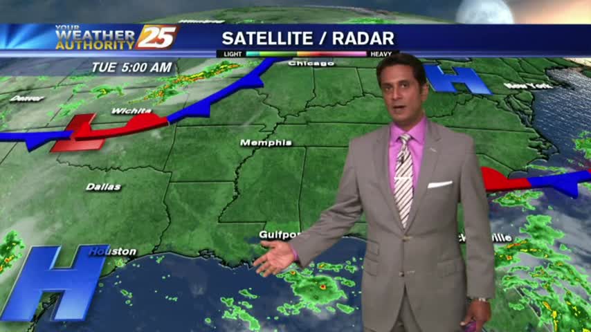
As we in southern Mississippi welcome a new workweek, we can also greet drier conditions today.
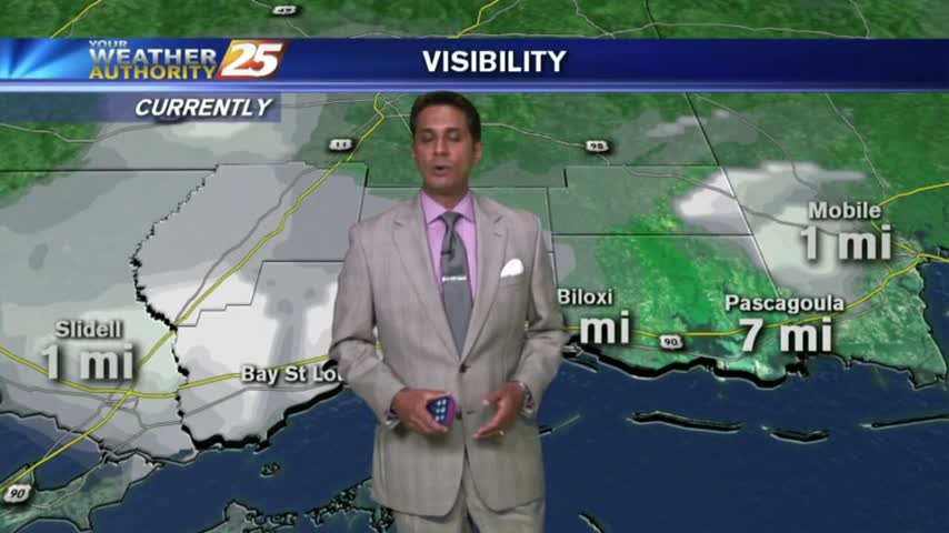
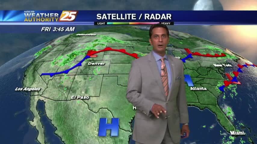
PLEASE BE CAREFUL - Areas of patchy DENSE FOG has developed for your morning commute...

It looks like warmer and dryer weather is in store for the Coast this week.

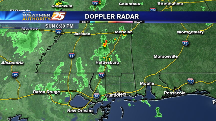
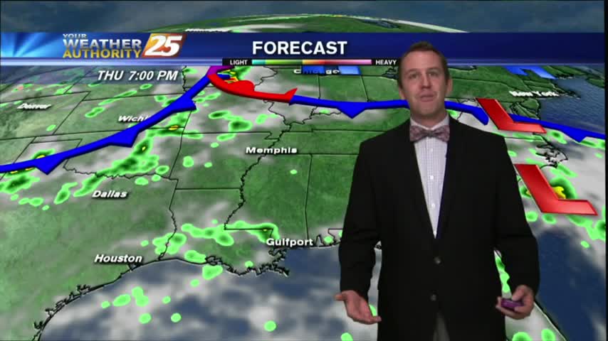
Tonight's storms are beginning to dissipate, but will return throughout the weekend. Details inside.
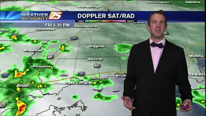
After a rainy start, the afternoon turned stormy, but can we expect this all weekend? Find out inside.
Another mostly clear and dry afternoon, but rain is right around the corner. Details inside.
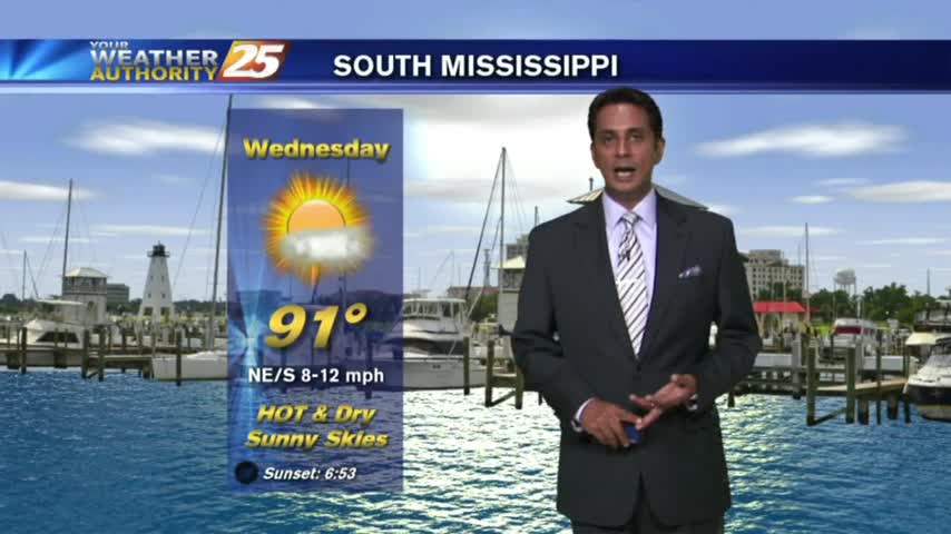
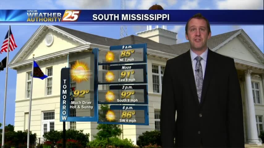
We'll have a warmer-than-normal day today with high temps everywhere in the low- to mid-90s.
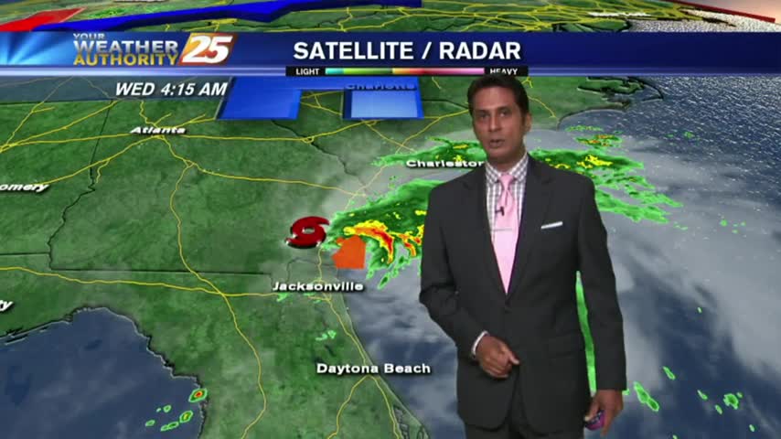
Julia formed late last night, but what's in store for the rest of the day? Find out inside.
Rain and storms hold off until the weekend (BOO!) and THREE tropical systems to tell you about!
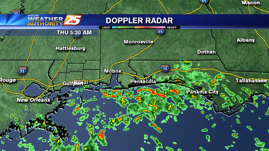
Early morning showers and t-storms continue over the northern Gulf and sound...moving to the NW.
A new tropical storm was named right as we started the broadcast, details can be found inside.
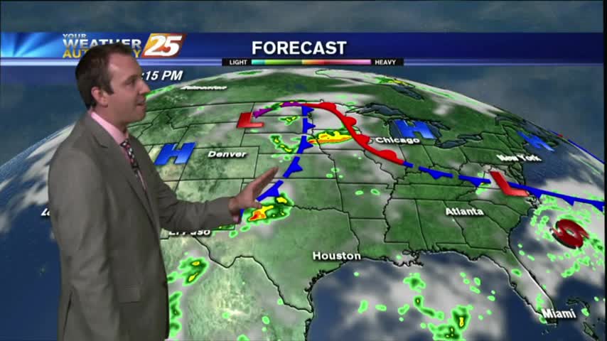
Today's Weather - The Gulf Coast states are under the influence of several atmospheric phenomena today. Namely, we're being affected by an upper-level trough of low pressure that extends from off of the south Texas coast eastward to the east…
As the moisture flow continues, showers and t-storms have developed over the northern Gulf/sound...