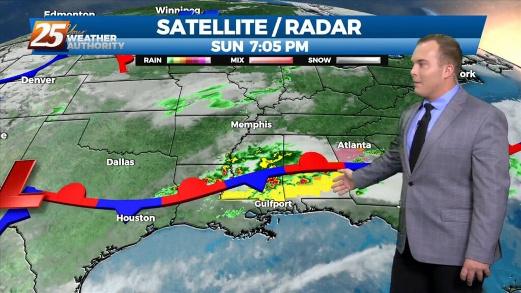
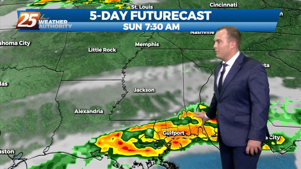
3/26 - Jeff Vorick's "Unsettled Pattern" Sunday Night Forecast
The front has retreated north helping to bring a very warm and humid airmass into the region. The majority of the activity has been well to our…
The front has retreated north helping to bring a very warm and humid airmass into the region. The majority of the activity has been well to our…
Scattered showers have developed generally along and north of the I10/12 corridor over the last few hours. The special 18z sounding shows plenty of instability. However, a…
Scattered showers have developed generally along and north of the I10/12 corridor over the last few hours. The special 18z sounding shows plenty of instability. However, a…
Warm temperatures, breezy conditions, and cloud coverage will dominate this afternoon. High temperatures will be in the 80s with winds gusting nearly 30 MPH. Inclement weather in…
Clouds and patches of fog are back this morning. Winds will elevate to gusts of 25 MPH this afternoon. Some peeks of sunshine can be expected later…
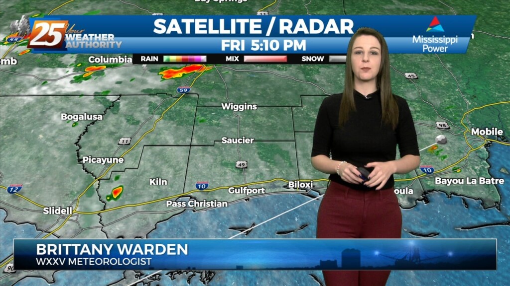
Late Friday into Saturday morning, a shortwave system will move through the area. Strong warm air advection due to southerly winds ahead of the system will help…
Late Friday into Saturday morning, a shortwave system will move through the area. Strong warm air advection due to southerly winds ahead of the system will help enhance instability.…
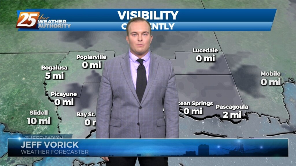
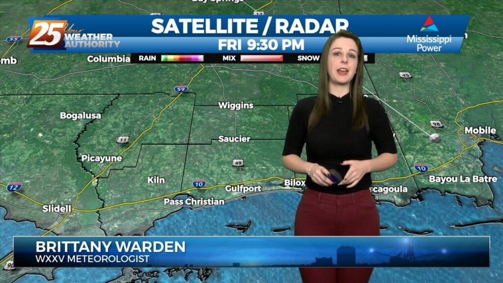
Patches of dense fog will be around this morning. Once daylight arrives, the fog will gradually dissipate through the start of the day. Winds will become…
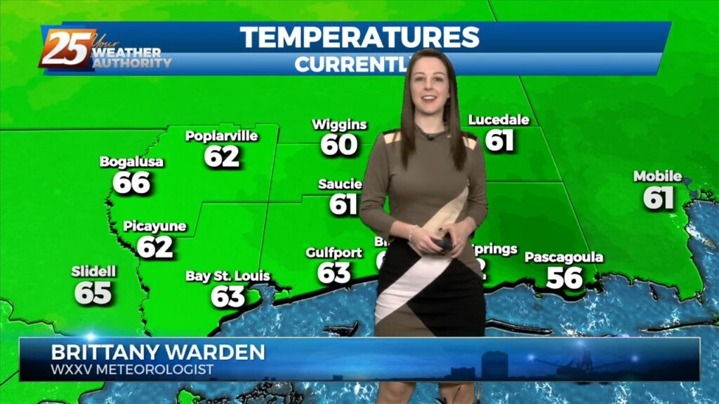
With high pressure to our east, moisture recovery continues as evidenced by dewpoints now approaching or exceeding 60 degrees in most places across the forecast area. Mostly clear skies…
With high pressure to our east, moisture recovery continues as evidenced by dewpoints now approaching or exceeding 60 degrees in most places across the forecast area. Mostly…
Fog will become an issue tonight but winds should stay too high nearest the coast and a cloud deck at 2k` starts to move in…
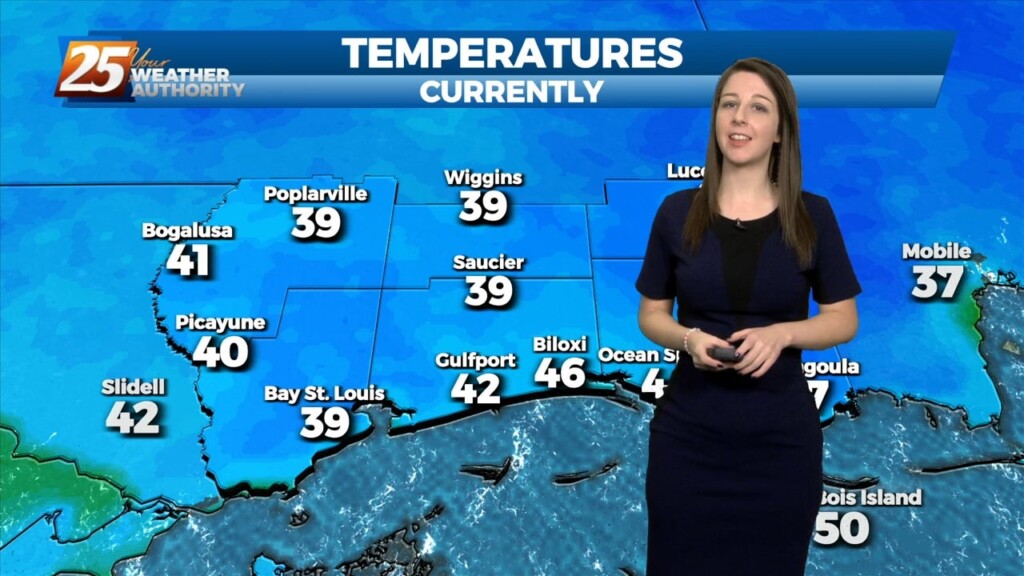
A the moisture returns and temps getting into the 50s and 60s along with dew point temps, we will need to turn to those variables that…
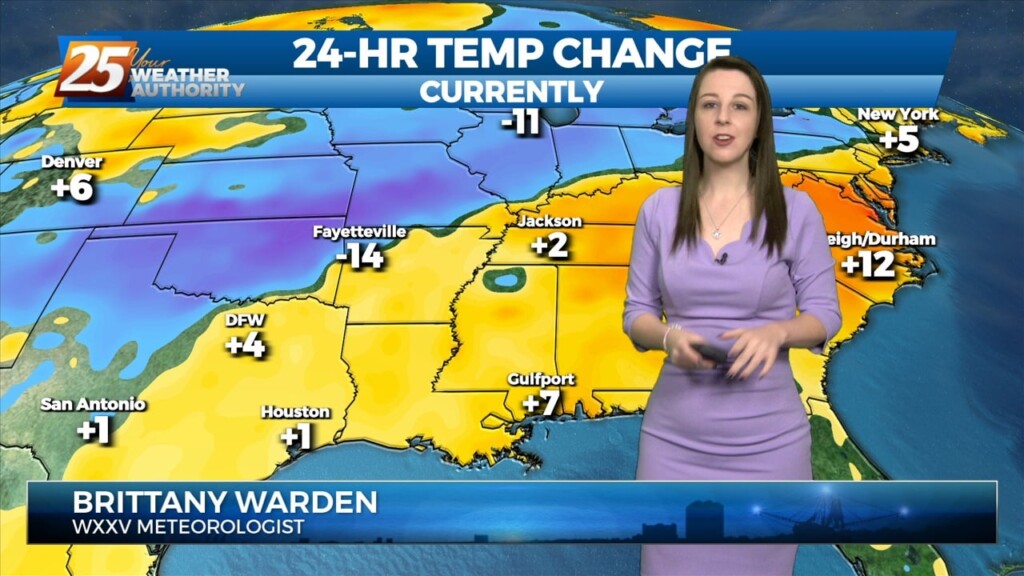
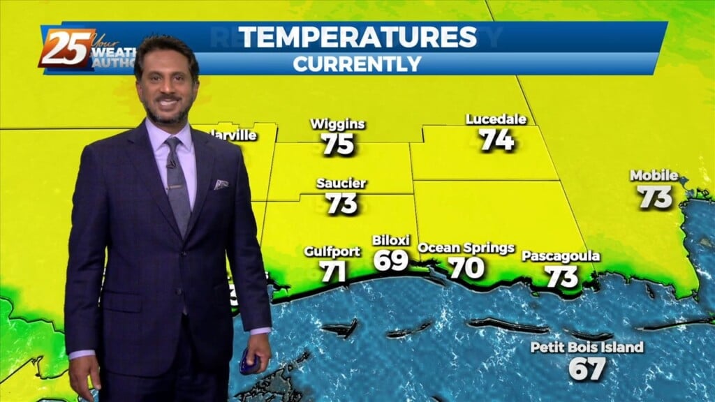
Surface high pressure will continue to shift eastward with onshore winds bringing more humid air into the area from the Gulf of Mexico. Warming trend will continue into Wednesday…
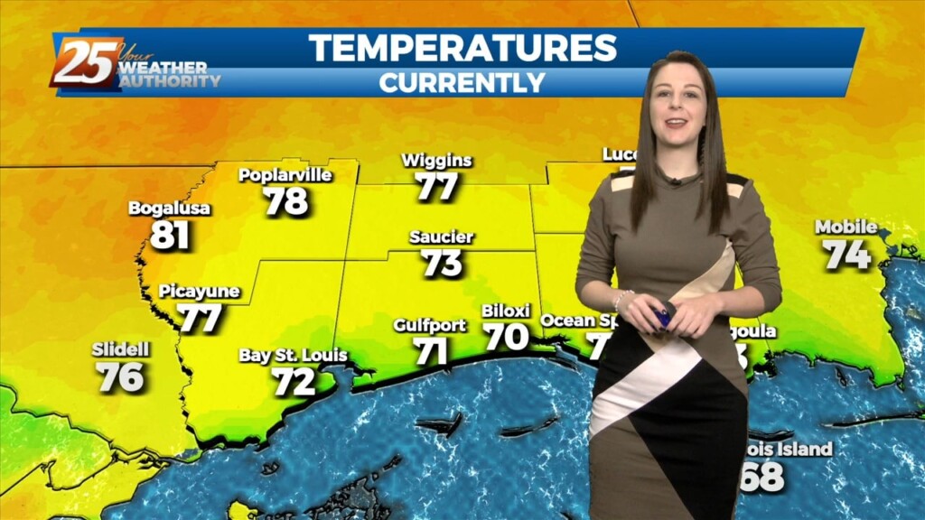
The warm-up has begun across our area! Temperatures are soaring well into the 60s this afternoon under plenty of sunshine. Winds are breezy out of the…
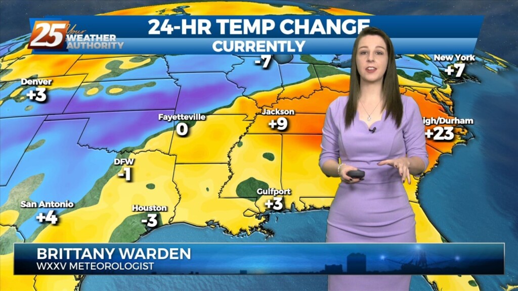
The return flow will become more established today and remain that way through the short term. This will help add to the warming trend over…
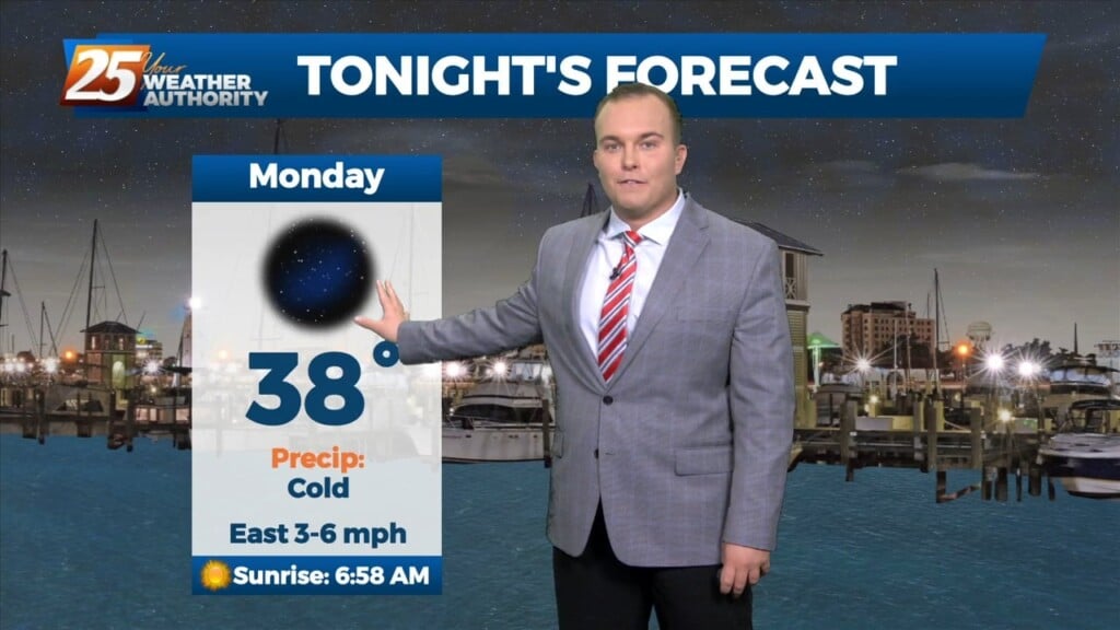
One more colder than normal night tonight before the high shiftseastward and temperatures fully moderate. Main forecast challenge for tonight is determining just how cold it will get,…
One more colder than normal night tonight before the high shiftseastward and temperatures fully moderate. Main forecast challenge for tonight is determining just how cold it will…
Spring begins later today, but first, Mother Nature has one last grip of winter on us. Temperatures will max out 15 or so degrees below seasonal averages this…
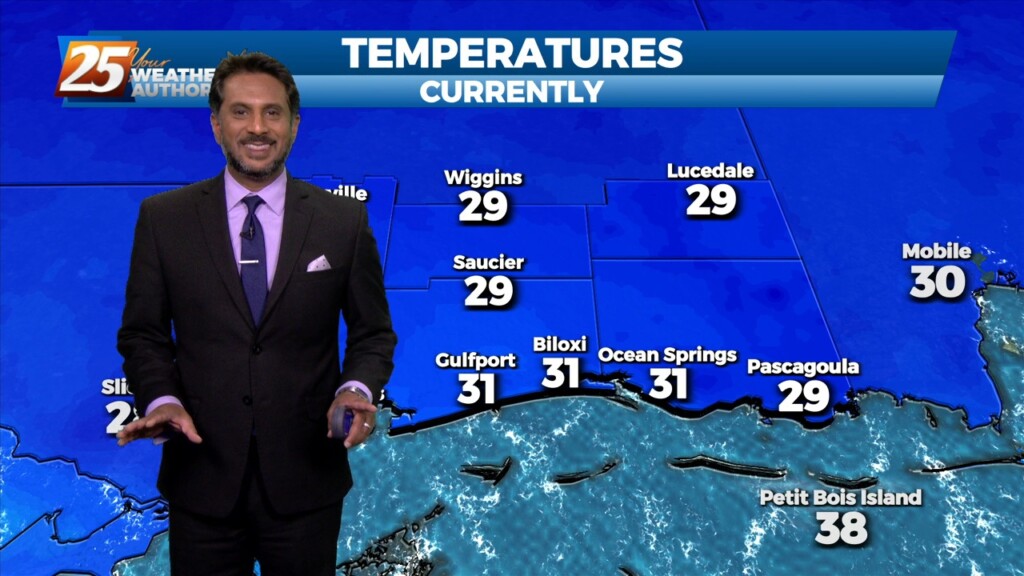
A TRUE winter morning on this final day of the season, as a FREEZE WARNING is in effect through 10 am. Temperatures will rebound quickly after…
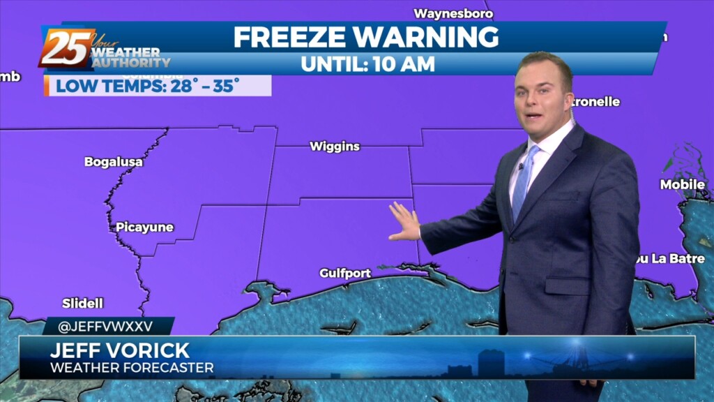
The late season chill will stick around for a little longer across South Mississippi. A Freeze Warning is in effect for all of the Southern Six…
Cold front has cleared pretty much all land areas in Louisiana and Mississippi and continues to push eastward through the coastal waters. A broad band…
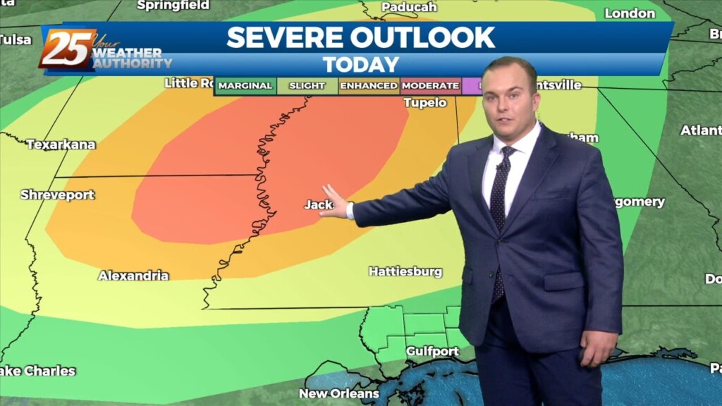
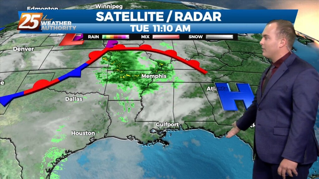
A line of showers/t-storms to the west associated with an approaching cold front will move into through area this morning into early afternoon. A…
All is quiet now as we await our next weather system. The upper trough is currently over the Dakotas with a weaker shortwave/jet type feature moving…
All is quiet now as we await our next weather system. The upper trough is currently over the Dakotas with a weaker shortwave/jet type feature moving across the…