3/17 – The Chief’s “Heavy Rain/Cold Front” St. Patrick’s Day Morning Forecast
A line of showers/t-storms to the west associated with an approaching cold front will move into through area this morning into early afternoon. A surface low pressure system is moving through the mid-west with a front stretched back to the southwest. Locally, heavy rainfall will begin to move in shortly after sunrise.
The overall issue with getting severe weather is the lift, which is well into the mid-west with some “messy” scattered lift over the area. There is also very little overlap between the “okay” lift and the “okay” shear/instability. The best shear stays north and west of the area however, the instability won’t increase until we get afternoon heating and that will be as the line moves farther into SE LA/S MS. So while there is a Slight Risk from SPC, that is probably a little overdone. Thunderstorms are most likely in the line before noon, with just scattered storms remaining in the showers as the line breaks up across S Mississippi. I can’t rule out an isolated strong wind gust or a brief tornado but the chances are low.
Behind the front, winds will be gusty as a tight pressure gradient remains between the upper low to the north and high pressure building over the Caribbean. Because the upper low is slow to move, this gradient will keep winds gusty at least through Sunday. Sustained winds around 20 knots with gusts of 25-30 MPH are possible Friday night through Sunday morning.
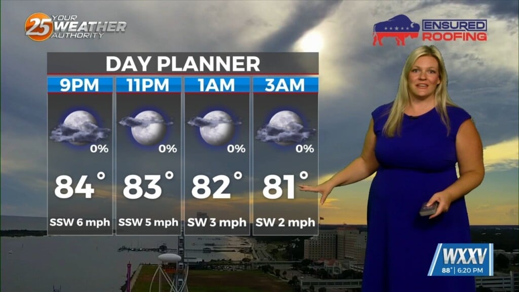
With the front moving through early this morning, temps will generally fall throughout the day, especially north and west of the lakes. Their high temp will probably be around midnight with temps by the afternoon falling into the mid-50s. It will be breezy and cool Saturday with highs in the lower 50s and lows Saturday night in the mid-30s to lower 40s.