8/16 - Rob Knight's "Midday News" Forecast
After a rain-free start to the day, showers and t-storms are moving into and developing along the viewing area...
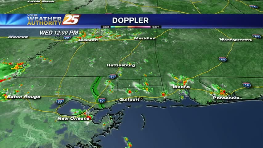
After a rain-free start to the day, showers and t-storms are moving into and developing along the viewing area...
A HUMID start to the day with areas of light patchy fog and isolated showers/t-storms moving in from the south...
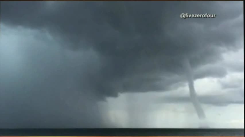
Showers and storms were a bit more active today (including this waterspout in Louisiana), but relatively drier conditions are expected before the weekend. Watch the full forecast for details.
Many new and exciting projects are in the works in Biloxi. One of those projects is the return of a passenger rail service. News 25’s Shelby Myers is at Biloxi City Hall with more.
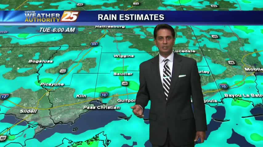
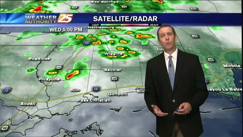
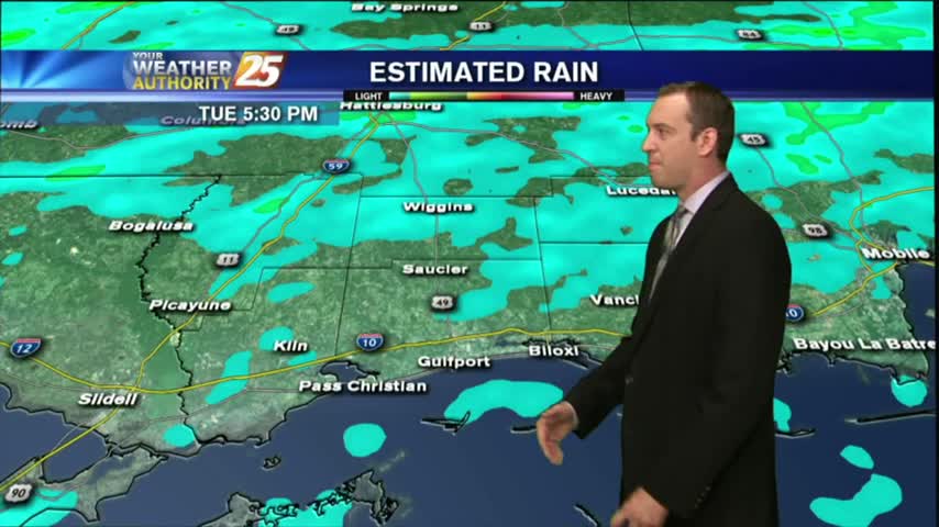
Showers and thunderstorms have developed across the area as an unstable and very tropical air mass continues to dominate across the Mississippi Gulf Coast.
Naturally...it's a WARM/HUMID start to the day as showers/t-storms to the south begin to develop and move into the area...
After another day of predictable afternoon showers and storms, we'll see more of the same as we head into tomorrow. Click the forecast link for more details.
Showers and thunderstorms will develop this afternoon because of fairly typical August weather.

Check back for NASA's Live stream event of the Eclipse for August 21st 2017, starting at 11 am. Watch live video from nasa on www.twitch.tv How to View the 2017 Solar Eclipse Safely At times we all forget how dangerous…
A WARM morning along the Gulf Coast as showers/t-storms are beginning to move in from the south...
Showers and thunderstorms continue to clear out of the area. More rain is in the forecast.
Just like the last few nights, earlier showers and storms have dissipated but we can expect them to return through the weekend. More details inside.
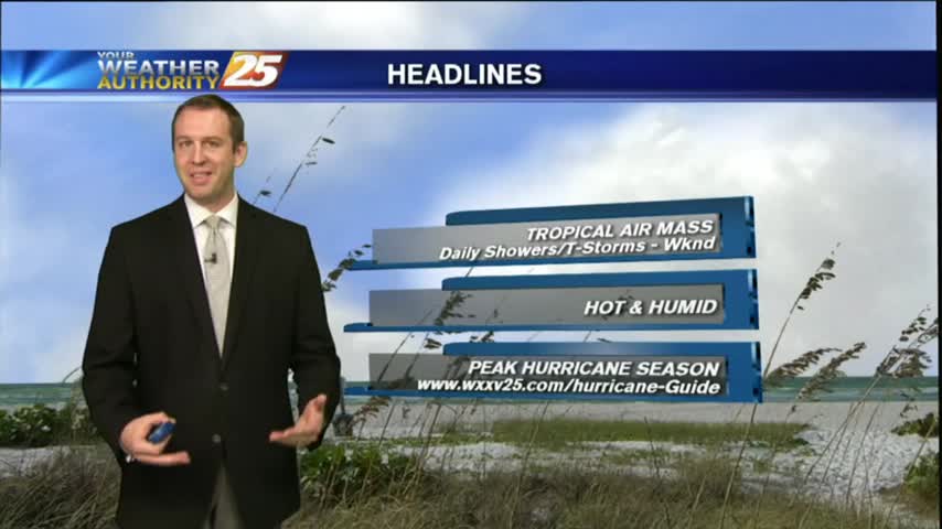
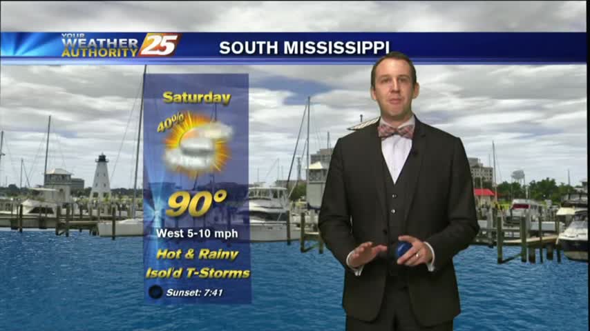
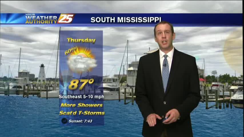
After a dry start to the day, showers and thunderstorms are across the area, and unfortunately it looks like the hot and stormy afternoons will continue into the weekend as not much change will happen to the upper air pattern.
Unfortunately it looks like another hot and stormy afternoon for the area with the best chance for showers and thunderstorms this afternoon.
While last night was the exception, we're again seeing our earlier showers & t-storms dissipating and and even some slight sky clearing. Rain returns quickly though, so watch the full forecast for details.
A clear start to the day has changed as clouds have moved in from the west and SW...along with isolated showers/t-storms...
As the very tropical air mass continues to dominate the region, isolated showers/t-storms are moving in from the south...
Didn't see much rain this morning/afternoon, but early evening thunderstorms helped light up the night sky. This will dissipate quickly, and more rain expected soon, but you'll have to watch the forecast for more.
Some dry air moved in this afternoon as expected, keeping the showers a bit more few and far between than the day before. Watch the full forecast for more details.

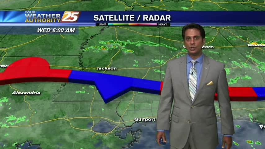
Very isolated activity across the area this afternoon as a stationary front along the Mississippi Gulf Coast stretching west to east will continue to linger in the region through the rest of the workweek.
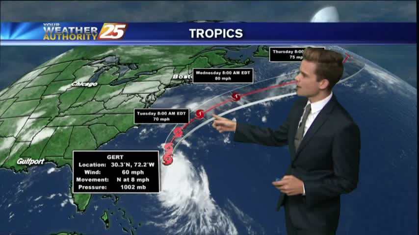
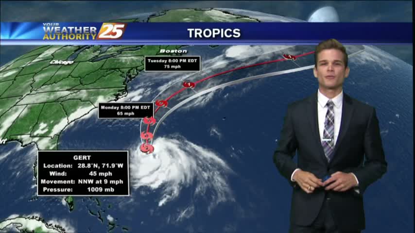
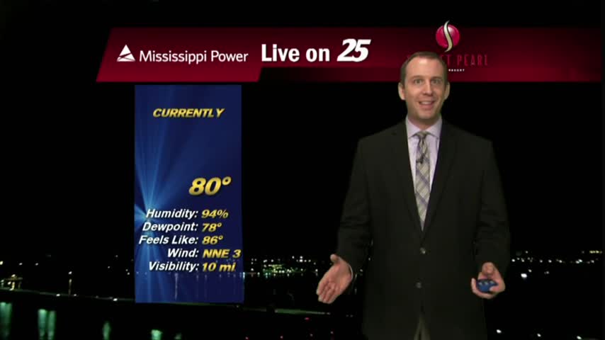
As TS Franklin moves west across the bay of Campeche, it's a warm/humid start to the day with light rain moving in from the GOM.
Our earlier showers have all but cleared, though more rain is expected every afternoon through the rest of the week. Watch the full forecast for more.
Overcast and rainy as expected, but most of the rain stayed North of the three coastal counties. Expect much more in the coming days, but you'll have to watch the full forecast for details.
We continue to see isolated showers and thunderstorms starting to develop.