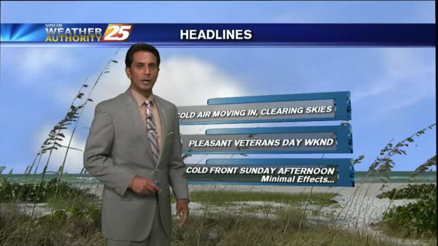
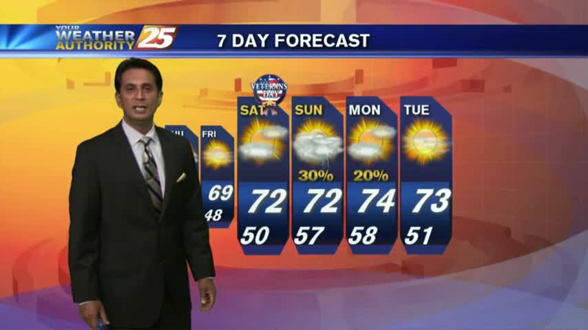
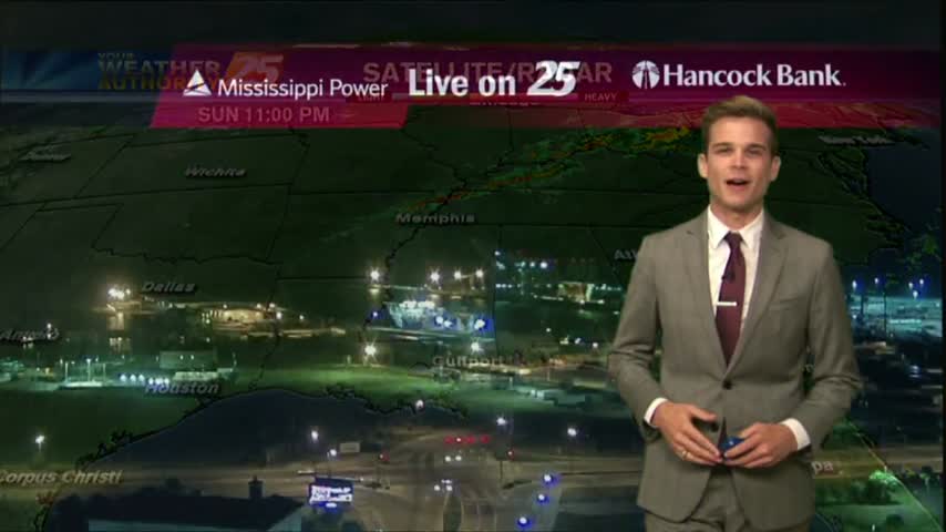
11/10 - Rob Knight's "Veterans Day" Weekend Forecast
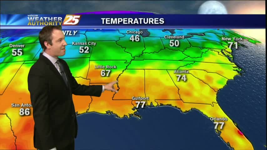
After a VERY COLD start to the day, temperatures have warmed but still on the chilly side under sunny skies...
After a VERY COLD start to the day, temperatures have warmed but still on the chilly side under sunny skies...
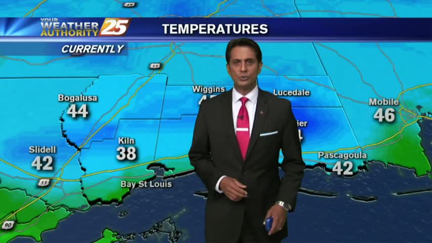
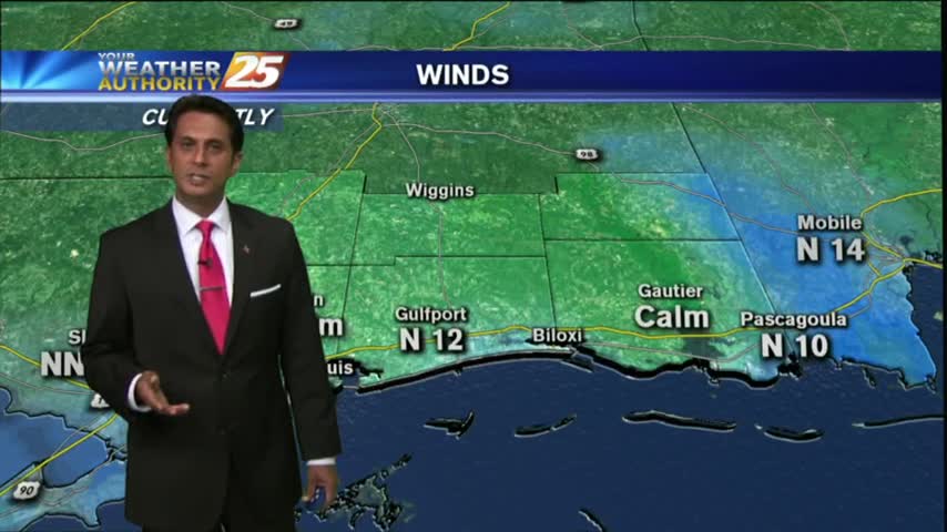
Clear skies last night with a north wind has brought COLD number to the area this morning...in the upper 30s to low 40s...
Clouds will tonight after our cloudy day, with much cooler and drier conditions tomorrow. Watch the full forecast for details.
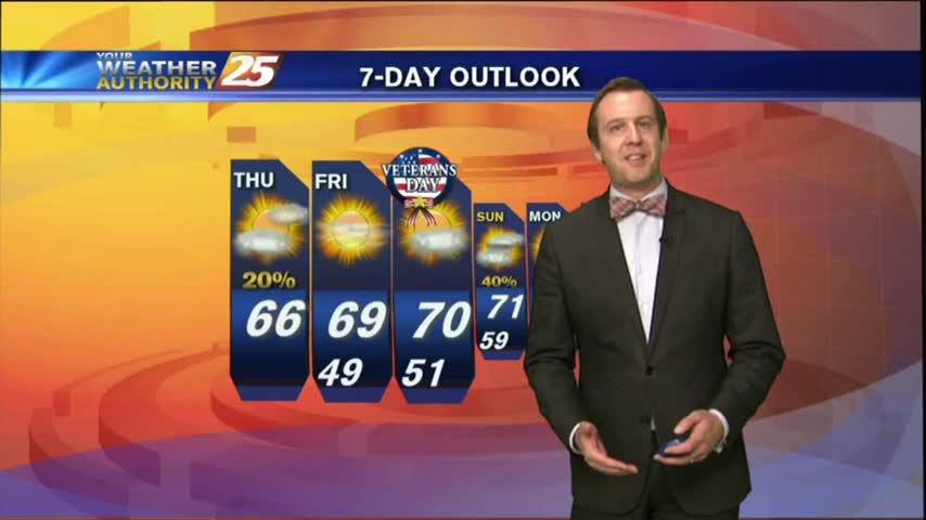
Finally seeing some cooling & clearing on the backside of the cold front that moved through overnight, and tomorrow afternoon's weather is looking great! Expect plenty of Sun tomorrow, with a high near 69 and considerably drier air. Evenings will…
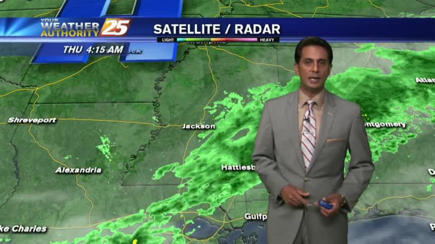
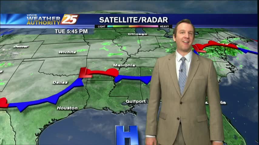
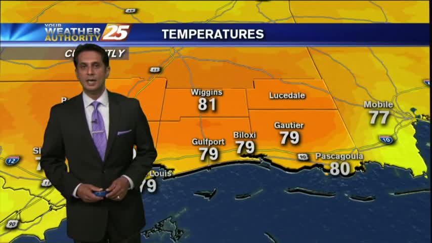
With cloudy skies and light rain moving across the region, cooler temperatures have moved into the Mississippi Gulf Coast...
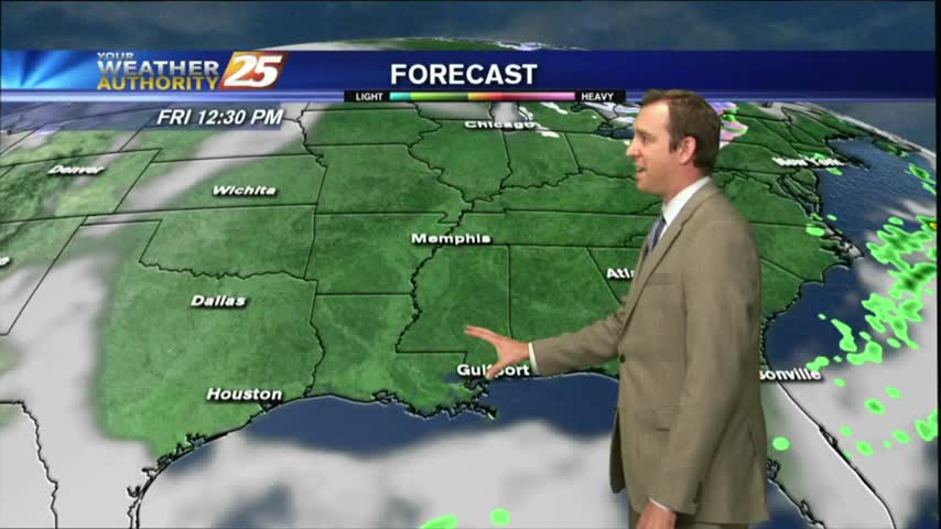
After a cloudy and cooler start to the day with light rain moving across the area, skies have cleared with BREEZY conditions moving in...
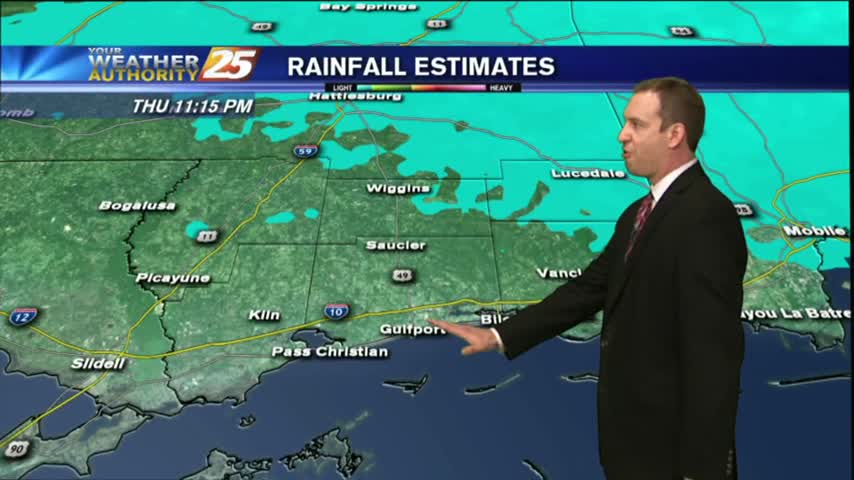
We're finally starting to see some rain in South MS, and you can expect it to continue through the night and into the morning. We'll see cool and sunny weather on the backside, details within.
It was a gloomy day in South Mississippi, and we're still in for some showers as we head through the overnight hours. Watch the full forecast for details.
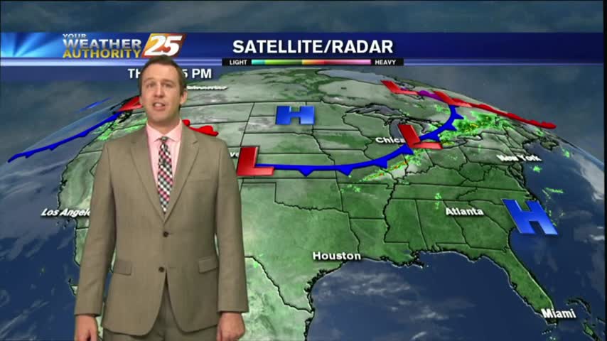
Disruptive weather (Fog) continues as a cold front is now overhead...providing for isolated rain through the region.
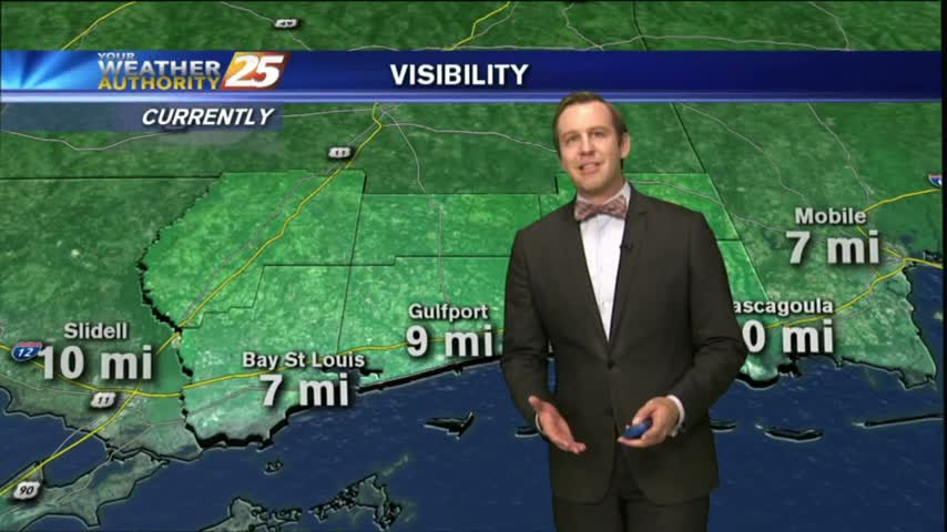
After a FOGGY start to the day, visibility has improved considerably with cloudy skies and light rain in the area/region...
Still expecting a warm, humid, and foggy night tonight, but changes will begin as early as tomorrow as winds shift and cooler/drier air moves in. Details inside.
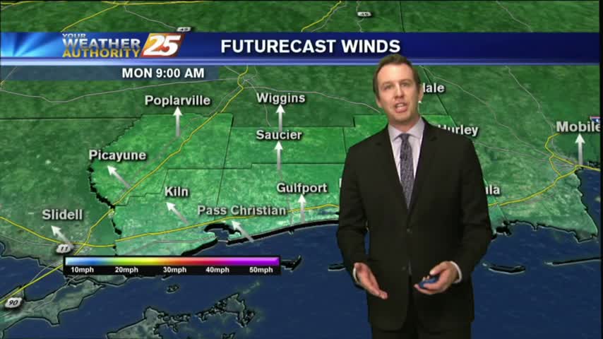
A cold front has moved into the Northern parts of the State, and will bring some cooler/drier conditions for the weekend. Click the link for the forecast details.
Gloomy start to the day, but more clouds and rain are on the way.
As a zonal flow continues, warm/humid conditions along the Mississippi Gulf Coast continues to provide areas of PATCHY DENSE FOG...
Nothing changed through the weekend as the warm & humid conditions continued, but we'll begin seeing some changes soon. Watch the full forecast for details.
Another warm & humid one in a long string of them, with little change expected tomorrow. We will some some changes soon though, so watch the full forecast for details.
Fog will likely impact your morning commute.
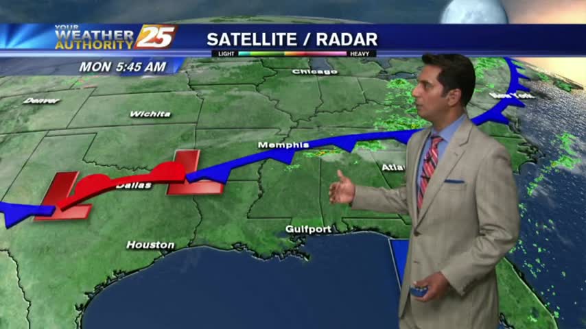
Disruptive weather to start off the work week...DENSE FOG has developed with an ADVISORY in effect through mi-morning...
Another nice and warm day, but we are tracking a cold front on its way to South Mississippi.
It definitely feels more like summer than fall right now, but that's honestly not too bad...just unseasonably warm and humid. Click the link for the full forecast.
The fog we've been expecting all week long finally arrived last night, and will continue through the weekend. Watch the full forecast for the details.
This morning started off with warm/humid conditions along with DENSE FOG, this afternoon and the weekend will bring Summer-like conditions...

Another warm & humid start with above seasonal conditions and areas of DENSE FOG. A DENSE FOG ADVISORY is in effect through mid-morning...
We've been talking all week long about how the increasing moisture would eventually lead to some significantly foggy evening, and those are finally moving in. Details within.