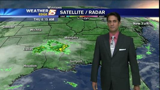
Unsettled weather holds off until next week
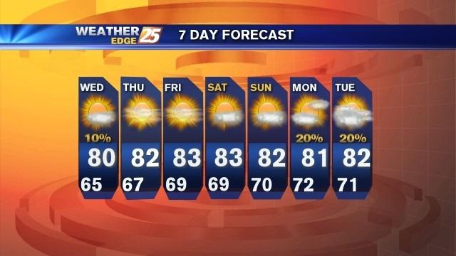
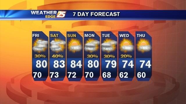
Mostly sunny skies continue to end the workweek with highs in the lower to middle 80s. Overnight lows will drop into the upper 60s with a few passing clouds.
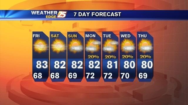
Mostly sunny skies continue to end the workweek with highs in the lower to middle 80s. Overnight lows will drop into the upper 60s with a few passing clouds.
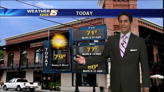
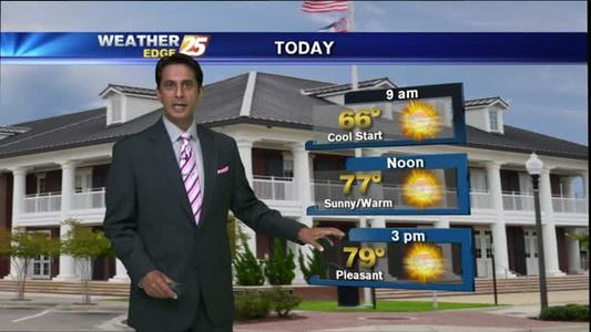
Areas of PATCHY FOG...with sunny & warm conditions ahead.
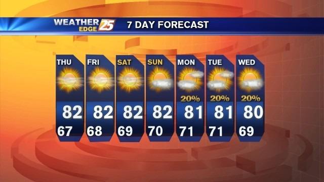
Pleasant weather continues to end the workweek. Expect mostly sunny skies for Thursday with highs in the lower 80s. A few passing clouds overnight with lows in the middle 60s.
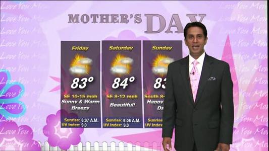
A sunny & mild start with BEAUTIFUL conditions ahead...
Mostly clear skies can be expected tonight with lows dropping into the lower to middle 60s inland and middle 60s along the coast.
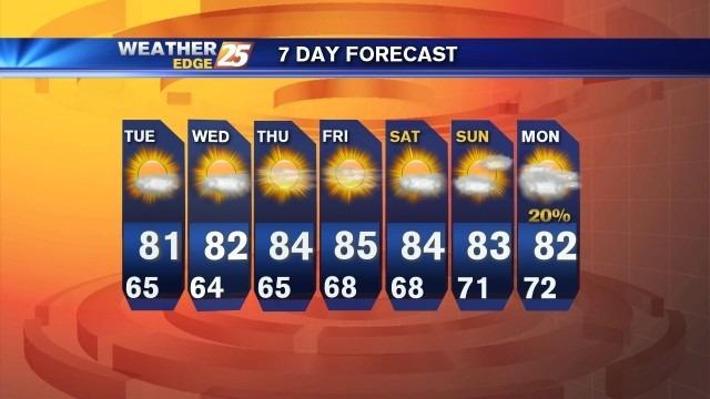
A few passing clouds will be possible throughout the day on Tuesday, but overall expect dry conditions with highs in the lower 80s
After a DRY weekend, it's a HUMID start on this Monday morning...
Beautiful weekend!
Temperatures cooling off Sunday!
A cool & dry start with PLEASANT conditions for the weekend...
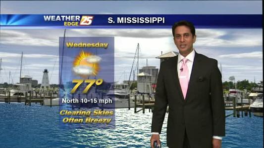
Mostly clear skies tonight with south winds at 5 to 10 mph and lows in the lower to middle 70s.
A cool and dry start with BEAUTIFUL conditions ahead...
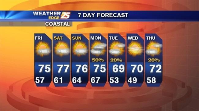
Skies will be partly cloudy tonight, with lows falling into the middle to upper 50s along the coast and lower to middle 50s inland.
A cloudy start with clearing skies through today...
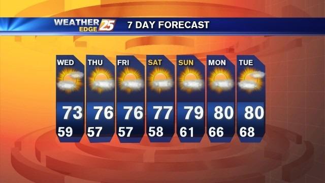
Expect mostly cloudy skies tonight with a chance for showers and isolated storms. Expect lows to drop into the upper 50s with winds shifting from the northwest around 10 mph.
A cloudy and damp start with t-storms later today...
Rain continues through Wednesday.
Sunny and warm start to December
A warm & humid start with t-storm later today/tonight...
Wet and hot weekend.
Great looking weekend.
A mild & humid start with t-storms tonight...
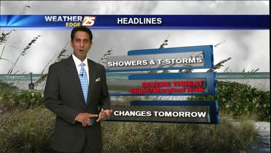
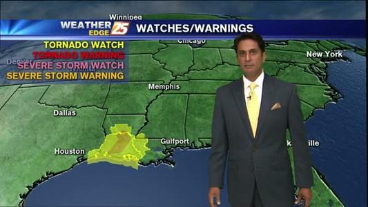
There is a slight risk for severe weather Friday and Saturday, with large hail and damaging winds the main threat. Expect mostly cloudy skies for tonight, with the best chance for scattered showers and storms early. Lows will be near 70.
It's a cloudy start with showers & t-storms to develop late morning...