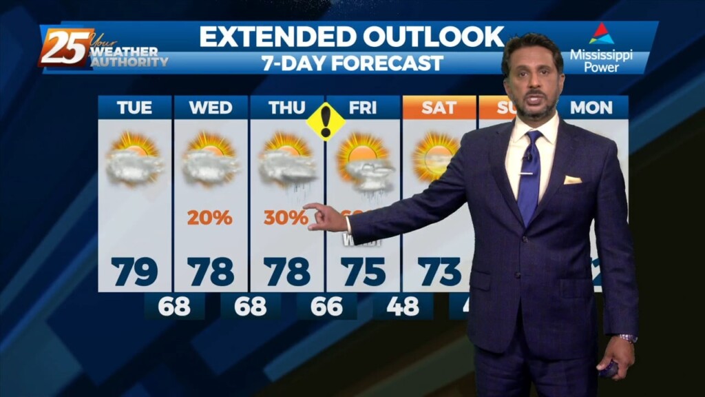
4/11 - The Chief's "Flooding Concerns Ahead" Tuesday Morning Forecast
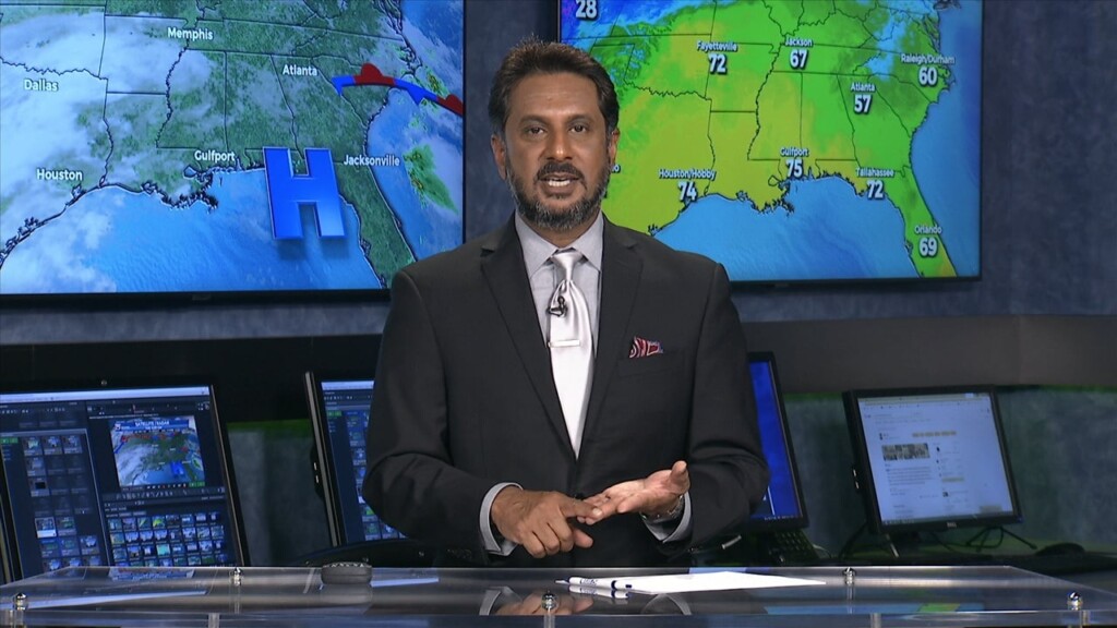
A surface low pressure system will be directly under a split flow south of the Miss delta while the upper low will be to the WNW…
A surface low pressure system will be directly under a split flow south of the Miss delta while the upper low will be to the WNW…
The feature that is about to give rise to our forecast is currently located over the Nebraska/Kansas border. This is seen as a weak low pressure…

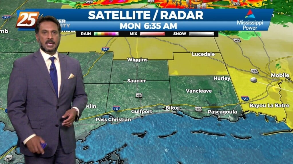
A cold front remains over the forecast area early this morning. Just behind the front, stratiform showers and a few elevated thunderstorms have develop generally along…
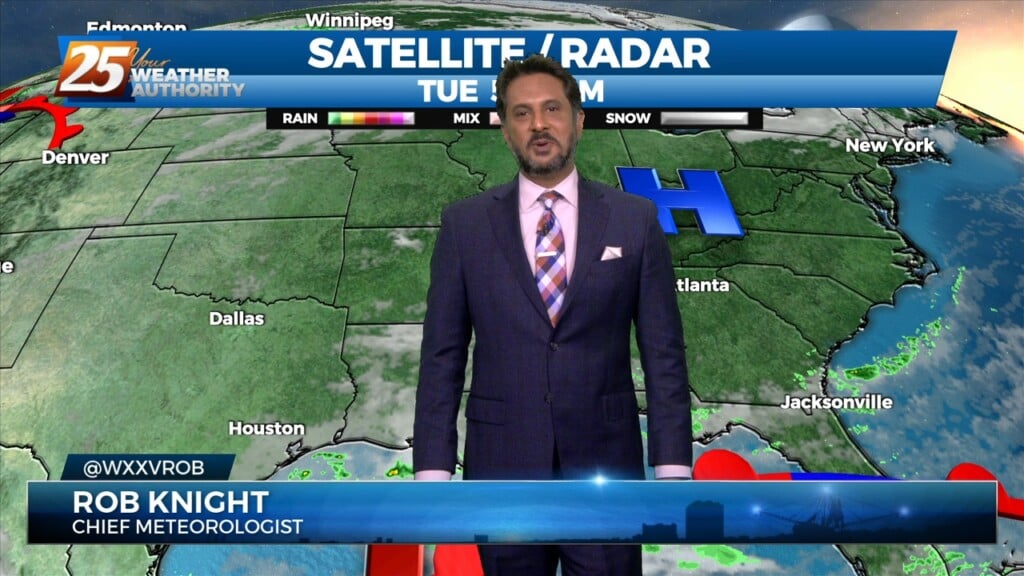
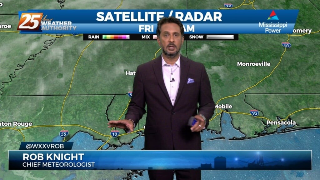
Starting off with early this morning, recent radar trends illustrate some isolated showers developing generally along the I-10 in coastal MS. The main story for today…
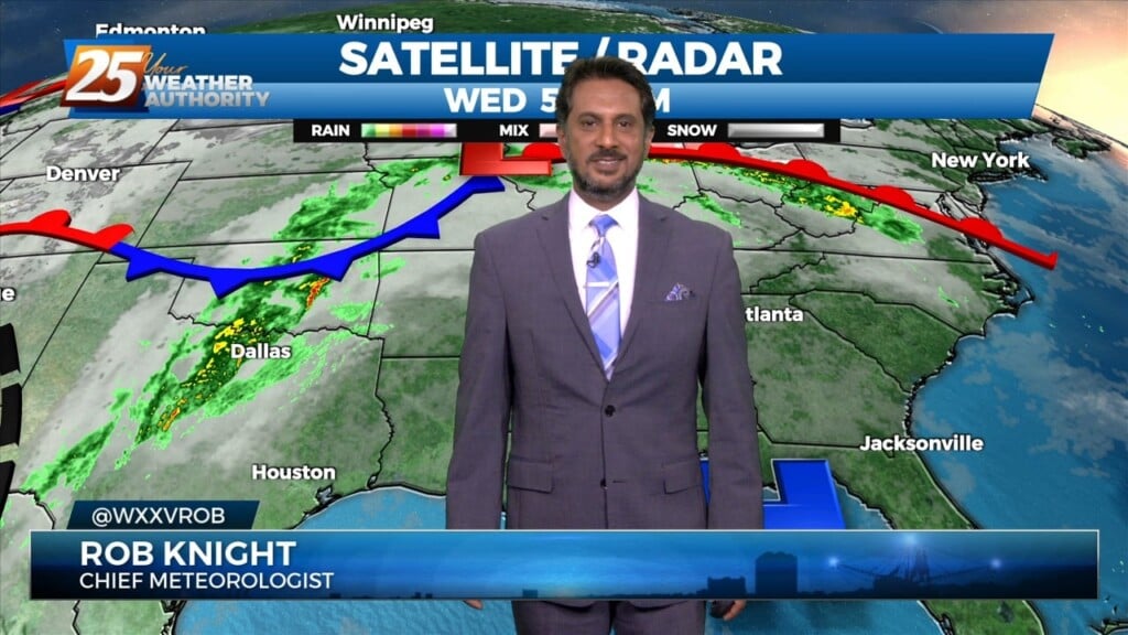
A cold front drapes south into the southern Plains where severe weather is ongoing across the AR/OK/MO region and will continue NE into the Ohio Valley…
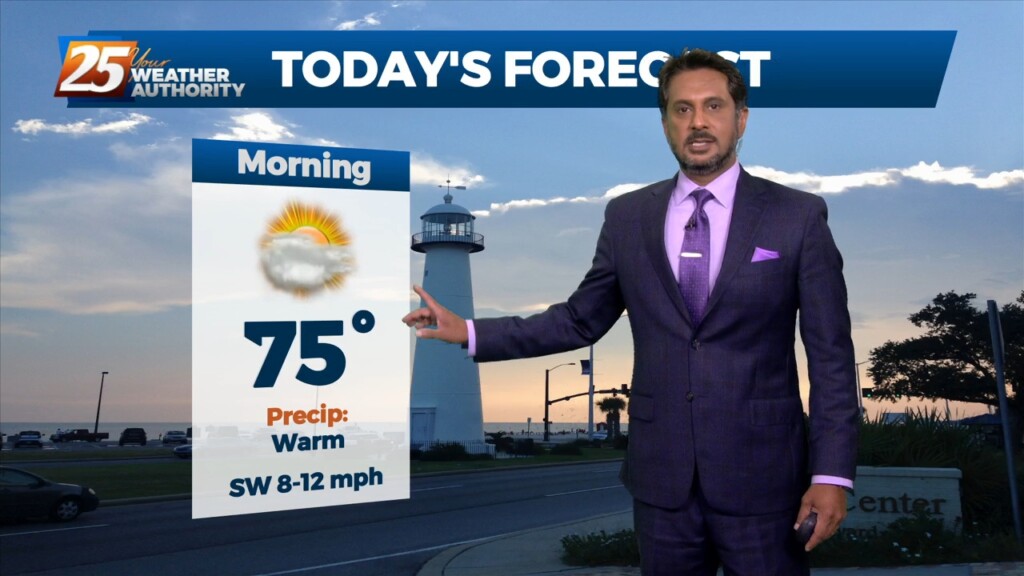
Starting out with early this morning, geez it's a bit muggy! Moist, onshore return flow continues to pump low to mid 70 dew-points well north…
An upper level disturbance Memphis is moving quickly eastward in zonal flow across the southern states. Another strong upper disturbance is moving onshore in the…
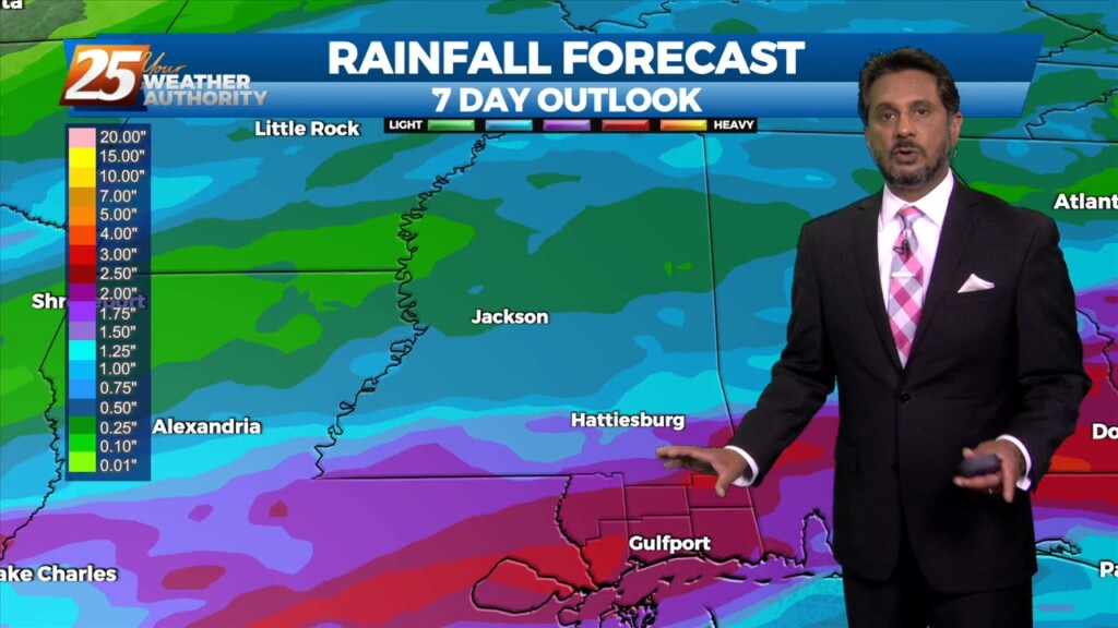
A meandering frontal boundary currently located just north of the area in south-central Mississippi and central Louisiana will drift southward this morning in response to a…

A the moisture returns and temps getting into the 50s and 60s along with dew point temps, we will need to turn to those variables that…
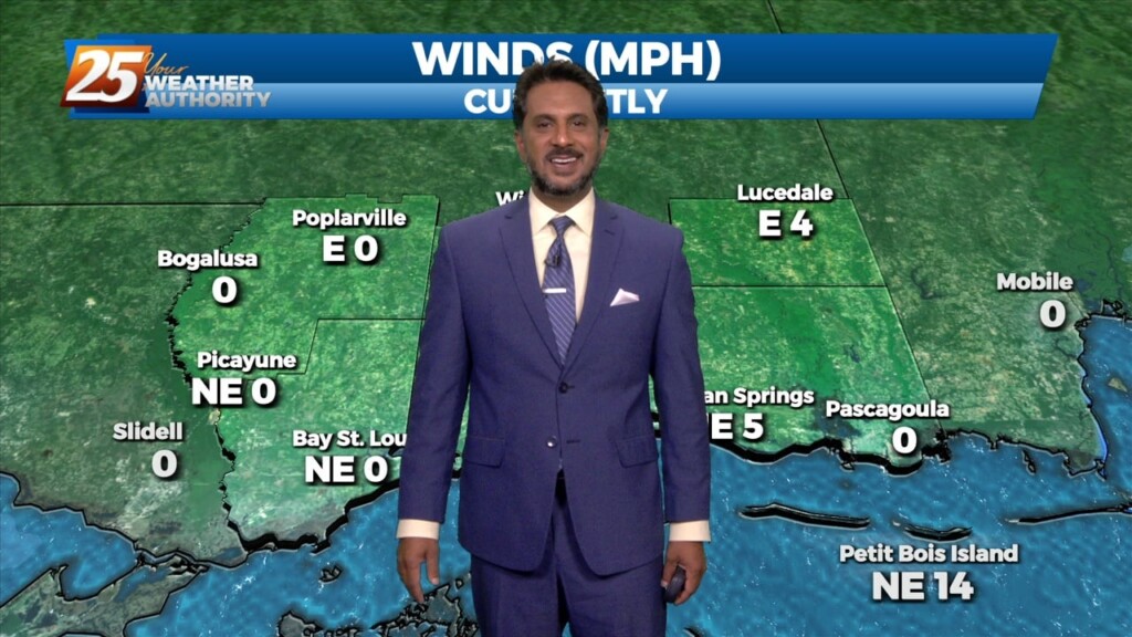
The return flow will become more established today and remain that way through the short term. This will help add to the warming trend over…
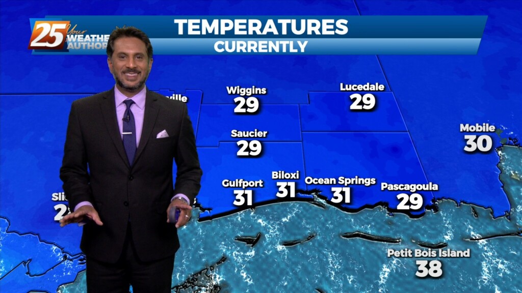
A TRUE winter morning on this final day of the season, as a FREEZE WARNING is in effect through 10 am. Temperatures will rebound quickly after…

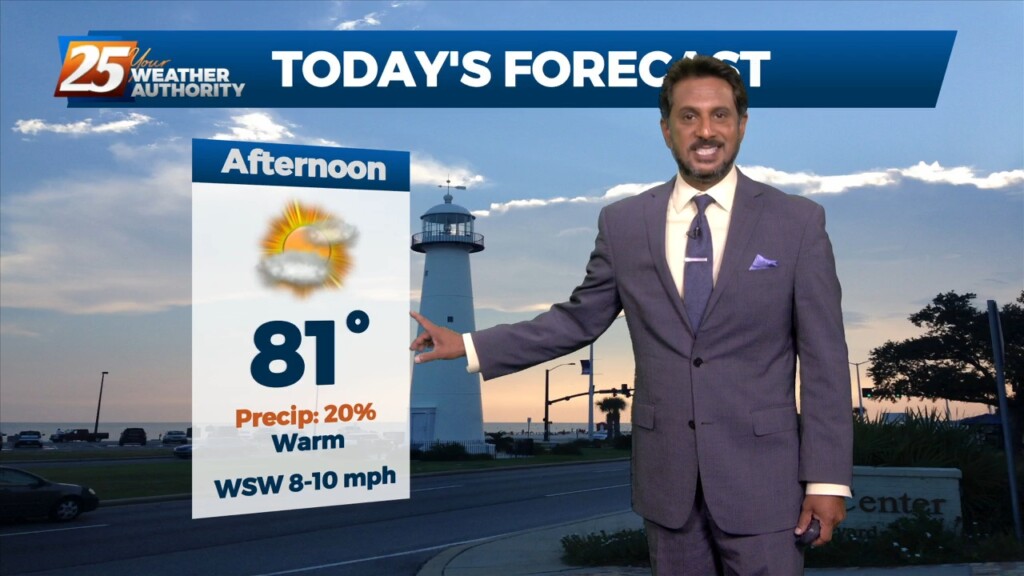
As last night’s cold front continues downstream, cold air advection will continue to be the story, along with decreasing clouds later in the afternoon from…

A weak backdoor frontal has dropped south in to the area and will be a focal point for a few afternoon showers/t-storms. To the south of…
A very warm start to the day with another warm day expected across the region and no sign of a change at least in the…
A warm front moving north this morning over south shore locations could bring enough vertical depth to get some showers out of it today…otherwise just…
Currently there is a narrow line of showers across western Louisiana. Expect that to continue to move off to the east through the late morning hours.…

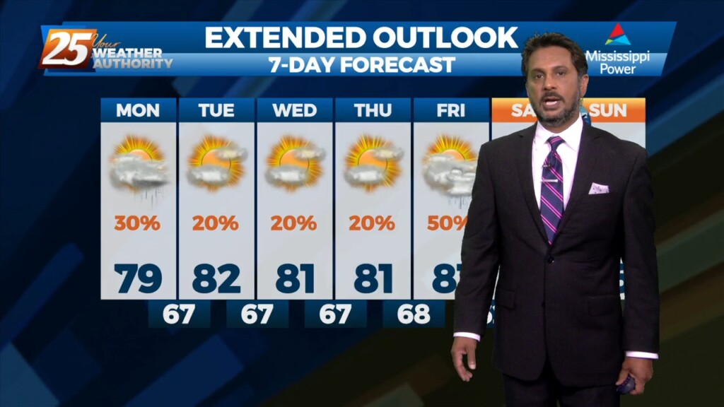
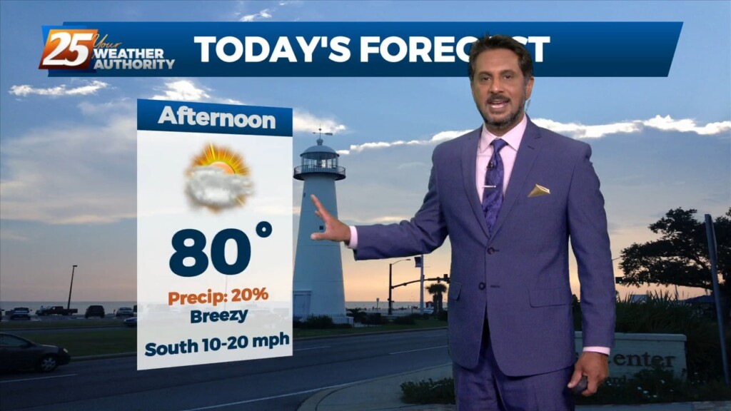
Another warm day expected across the region with most of the area warming into the upper 70s to low 80s along with breezy conditions. All eyes…

Continued unseasonably warm conditions will persist for the next few days as the surface high over the Bahamas causes southerly surface flow into…
Another well above average day is expected in terms of temperatures across the region. At the surface a weak stationary front north of Hattiesburg will…

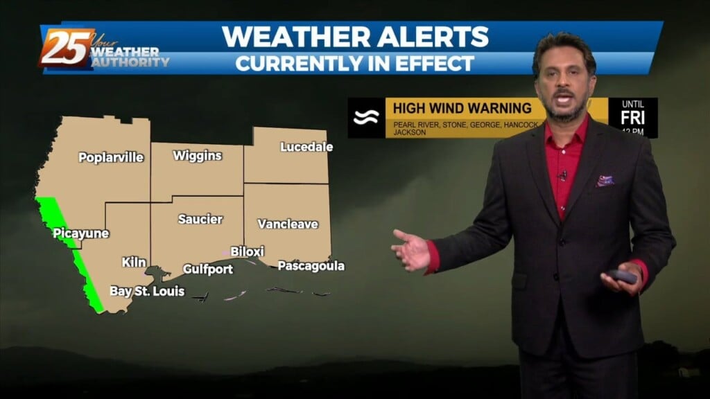
Ahead of a front today will be quiet the windy day and warm. Because we will be able to mix out quite high we will…
What month is it again? What a wonderful warm trend we’re in with plenty to discuss, starting out with a broad overview beginning at the surface.…
A weak frontal boundary will reside pretty close to our northern area border today. With the closer proximity to the boundary, the surface pressure gradient…
Early this morning some sea fog has overspread portions of the Mississippi Gulf Coast dropping visibility down to around half a mile or so over…
Additional cloud cover expected today across the region as low level winds continue to advect a very rich airmass over the region. High pressure will continue…