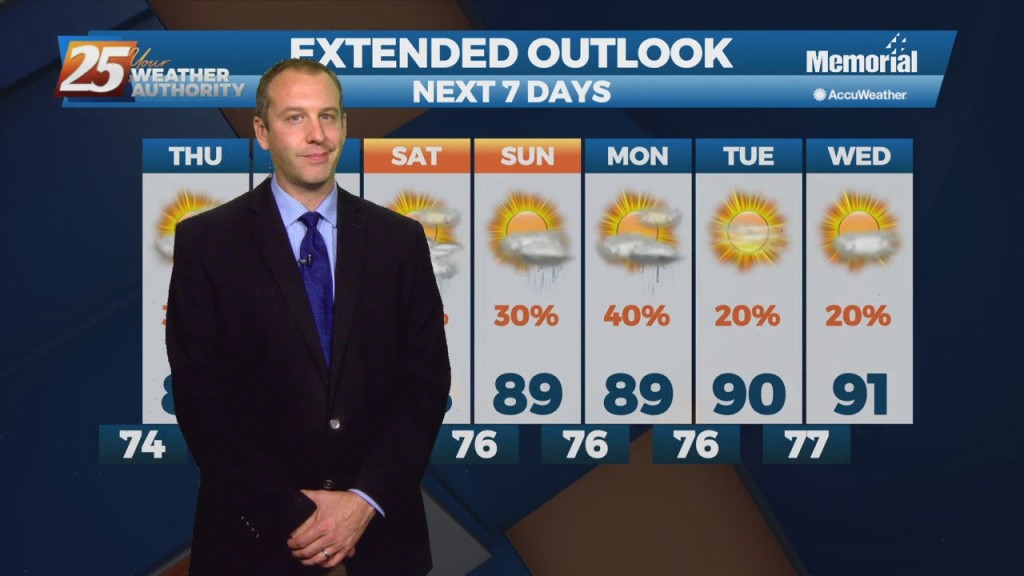
07/07 Ryan's "Drier" Wednesday Night Forecast
It may not seem like it at first glance, but tonight will be a bit drier than the last few evenings we've seen. Still expecting an isolated shower or two, but considering the…
It may not seem like it at first glance, but tonight will be a bit drier than the last few evenings we've seen. Still expecting an isolated shower or two, but considering the…
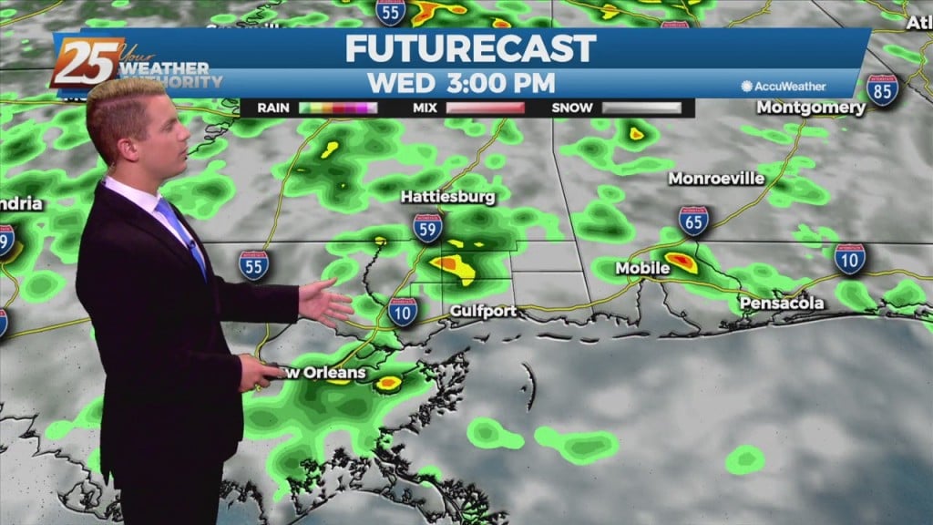
Widespread flash flooding is still not expected given the overall scattered nature of the slow moving showers and storms. No severe organized convection is expected through the period. However, some storms could produce frequent lightning and some gusty winds due…
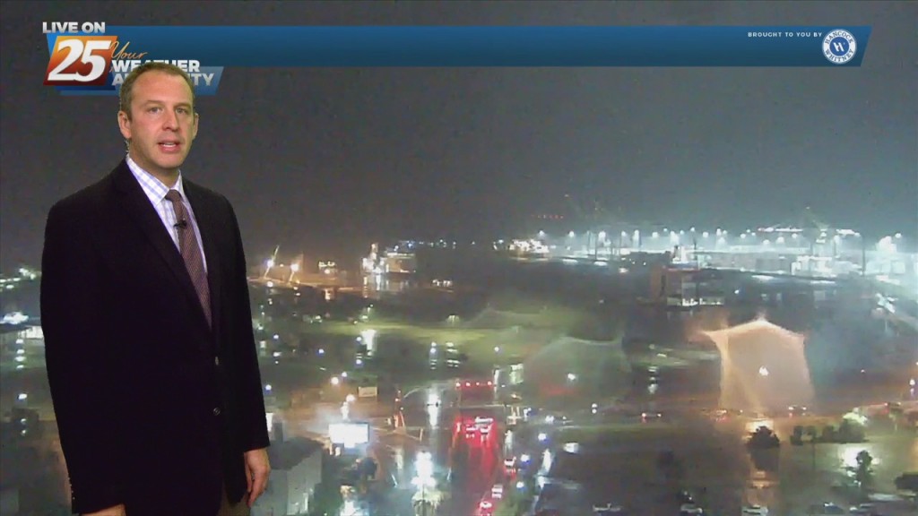
We really just can't catch a break with this rain as even more falls tonight. There hasn't been much activity over the last few hours, but what we have seen has been heavy,…

HATTIESBURG, MISS. – Hurricane season is officially underway and the Mississippi Department of Transportation (MDOT) is urging South Mississippi residents to prepare now. “We’ve already had a tropical system threaten the Mississippi Coast, and we’re only a month into hurricane season,”…
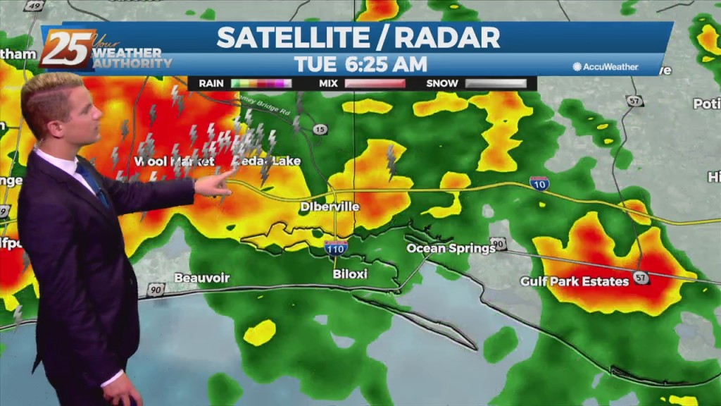
Some showers and storms that develop through the day will likely be efficient rain makers. Additionally, with weak wind flow, storms will be very slow moving. This causes a concern for localized areas receiving brief periods of very heavy rainfall…
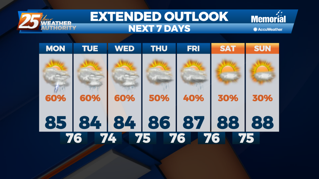
With Elsa moving into the Gulf, deep layer southerly flow becomes re-established over the Southeast and Gulf moisture moves inland. Scattered to numerous showers and thunderstorms are expected. Increased cloud cover over the forecast area will combine with increased storm…
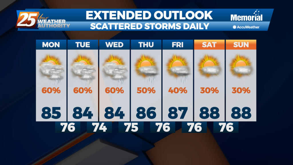
With Elsa moving into the Gulf, deep layer southerly flow becomes re-established over the Southeast and Gulf moisture moves inland. Scattered to numerous showers and thunderstorms are expected. Increased cloud cover over the forecast area will combine with increased storm…
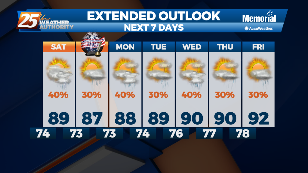
This week was pretty wet, and that isn't going to change as we head into Independence Day weekend. A front moved in today which acted as a jumping off point for enhanced afternoon showers, and it'll still be close enough…
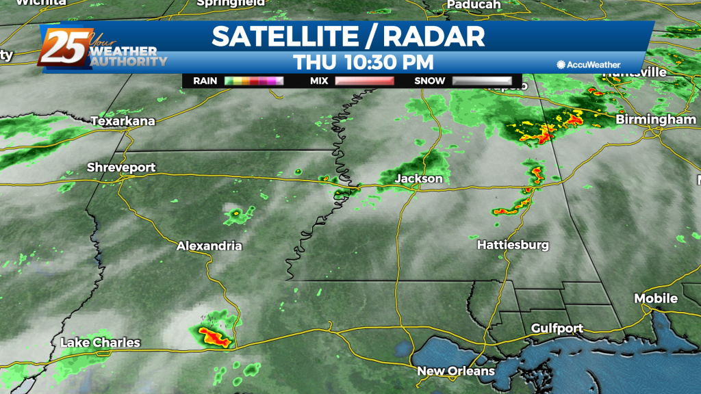
Didn't see much in the way of afternoon showers today, but our rainy weekend ahead will more than make up for it. There were still a few afternoon showers today, but they were much fewer and more far between with…
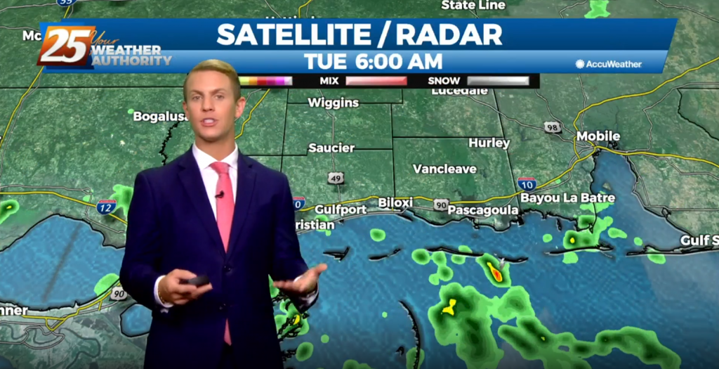
Temperatures will continue to remain warm with highs approaching 90 on Thursday before rain limits how hot the temperatures can get. It will be humid with dew points in the 70s. This will also lead to uncomfortable low temperatures in…
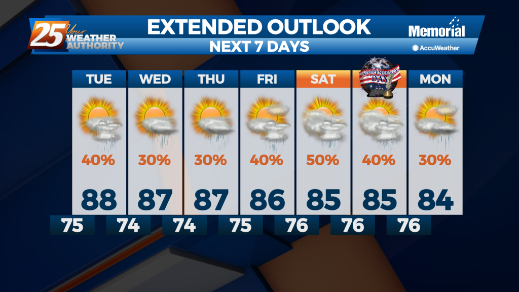
More of the same expected for the next several nights as we hit a bit of a rut in South MS. Little will change in terms of the heat or the humidity, but shower chances will fluctuate all week long.…
A typical late June forecast for the north central Gulf Coast region will be in the works during the extended period. Scattered showers and a few thunderstorms will be possible each day for the next week or so and any…
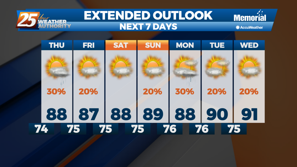
We still saw a few afternoon thunderstorms, but drier mid-level air kept them from lingering for long. That's a trend I expect to continue for the next few afternoons, limiting evening activity and cloud cover. That means you can expect…
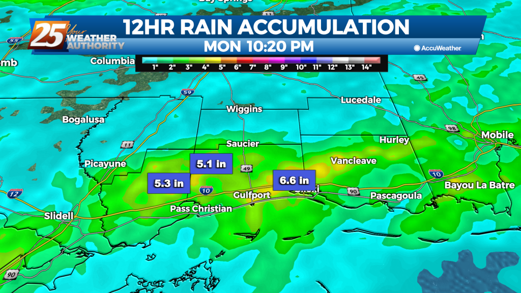
Tropical Storm Claudette started the weekend off, and even after it has moved on we're left with more rain. Flooding issues abound across South MS as the scattered showers and thunderstorms have lingered. One area of Harrison County near d'Iberville…
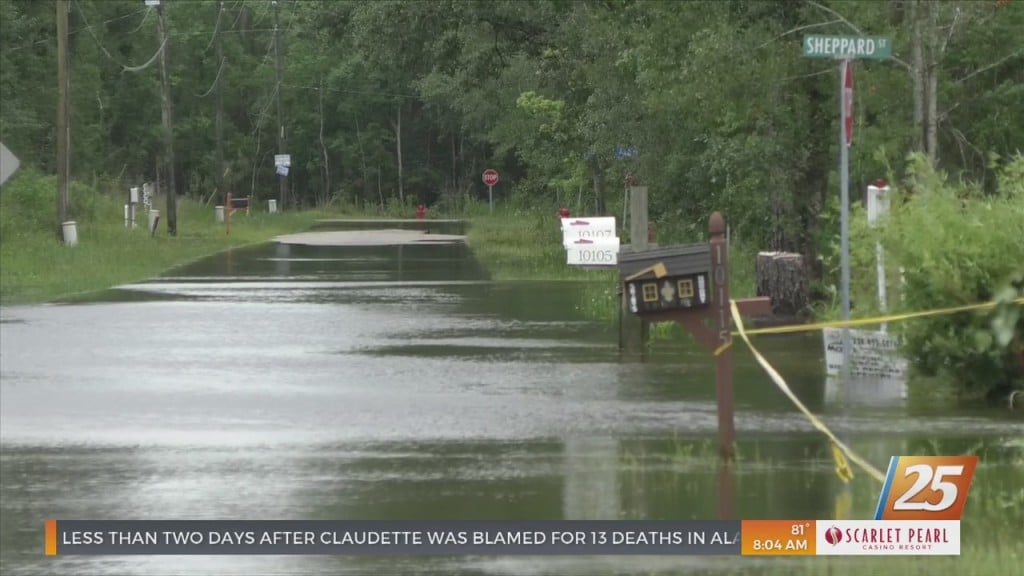
During Tropical Storm Claudette, rain was one of the biggest concerns for residents in Bay St. Louis. Parts of Shoreline Park were flooded, leaving those to bring their belongings to higher…
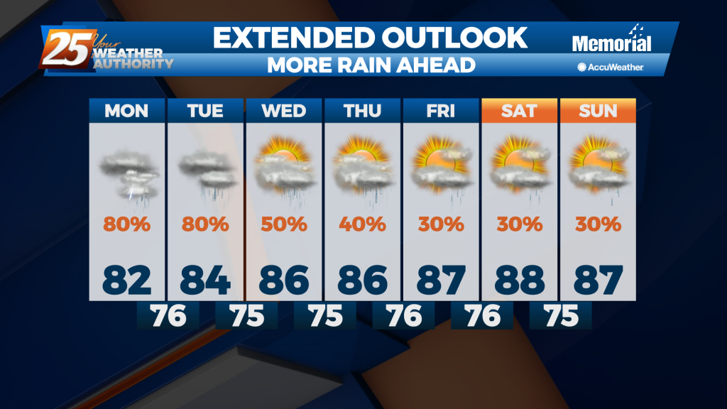
Monday, a lingering boundary off the marine waters will cause enhanced rain chances, especially along the coastal areas. Southerly winds will help to increase moisture and warm air moving into the atmosphere, which will enhance instability. As a result of…
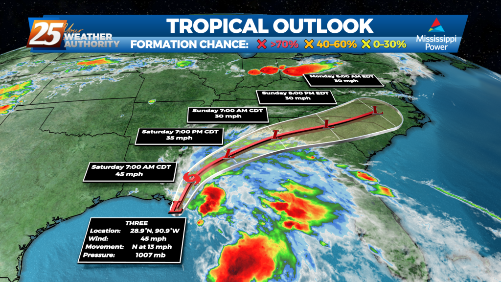
What should have been Tropical Storm Claudette by now still remains "Potential Tropical Cyclone 3." The reason for this is the system has not yet developed a closed center of circulation. It's close, the winds are at the threshold, and…
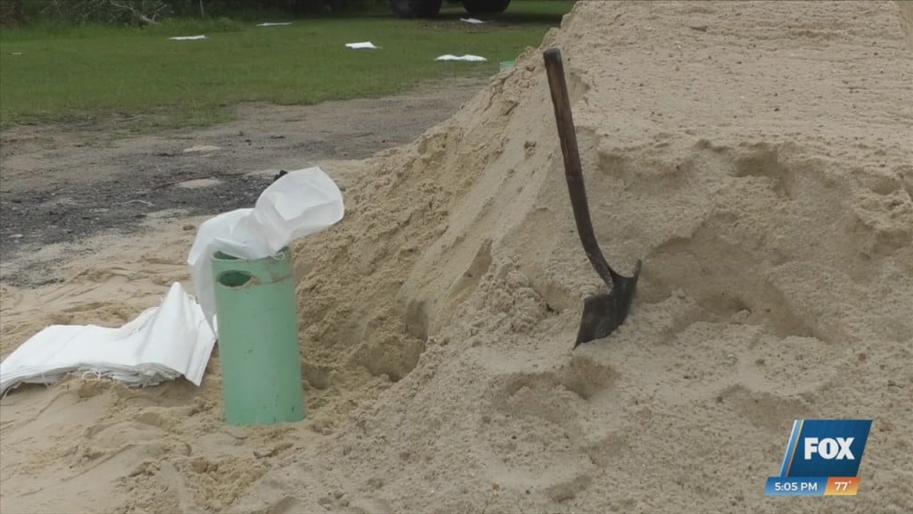
With the tropical system moving into our area, Jackson County is helping residents prepare for a wet weekend. Sand bag locations are popping up across the Gulf Coast…
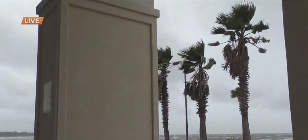
Continuing to track the potential tropical cyclone in South Mississippi and current weather conditions, News 25’s Grace Boyles is in Gulfport for an update on the impact of…
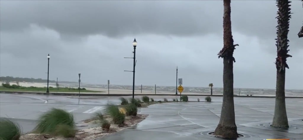
Now let’s take a look at the scene down along the shoreline in Gulfport. These are the conditions down at Jones Park just over an hour ago. Steady wind and rain…
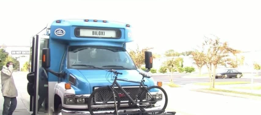
Due to severe weather conditions from potential Tropical Cyclone Three, Coast Transit Authority will have a delayed start on Saturday, June 19th, in order to ensure safe operations. Coast Transit Authority will begin all transit services from the Biloxi and…
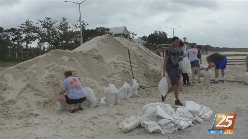
Today, residents in Long Beach were preparing for the wet weather as well. Residents in Long Beach know all too well about the severity of any tropical activity. Armed…
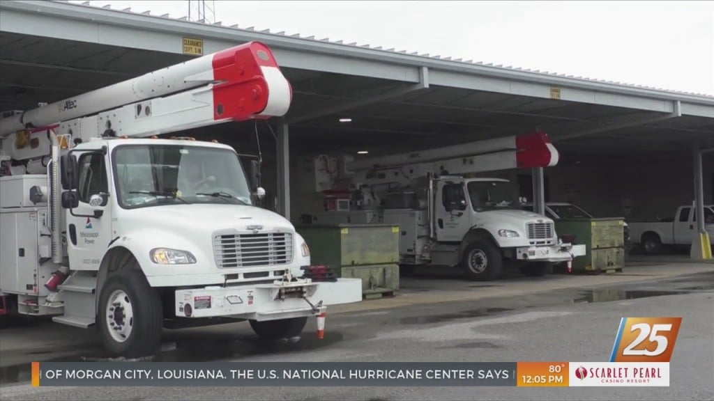
Mississippi Power is ready for whatever severe weather may come across the Coast. The storm center is activated and crews will be available 24/7 ready to assist customers in case of…

Multiple events across the Gulf Coast have been canceled due to the incoming weather. Here is a list of closures and cancellations: The De Soto National Forest has closed all…