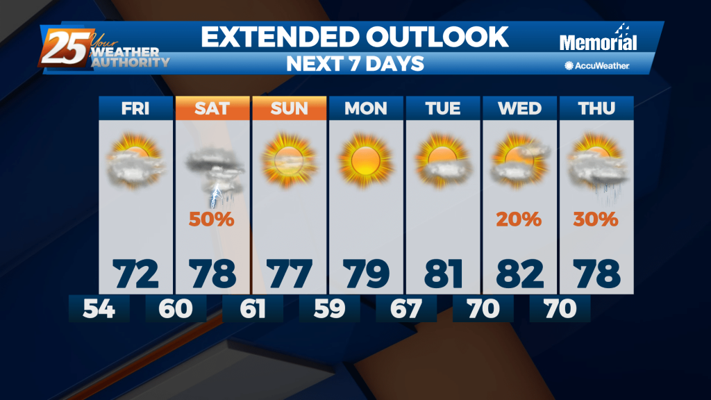
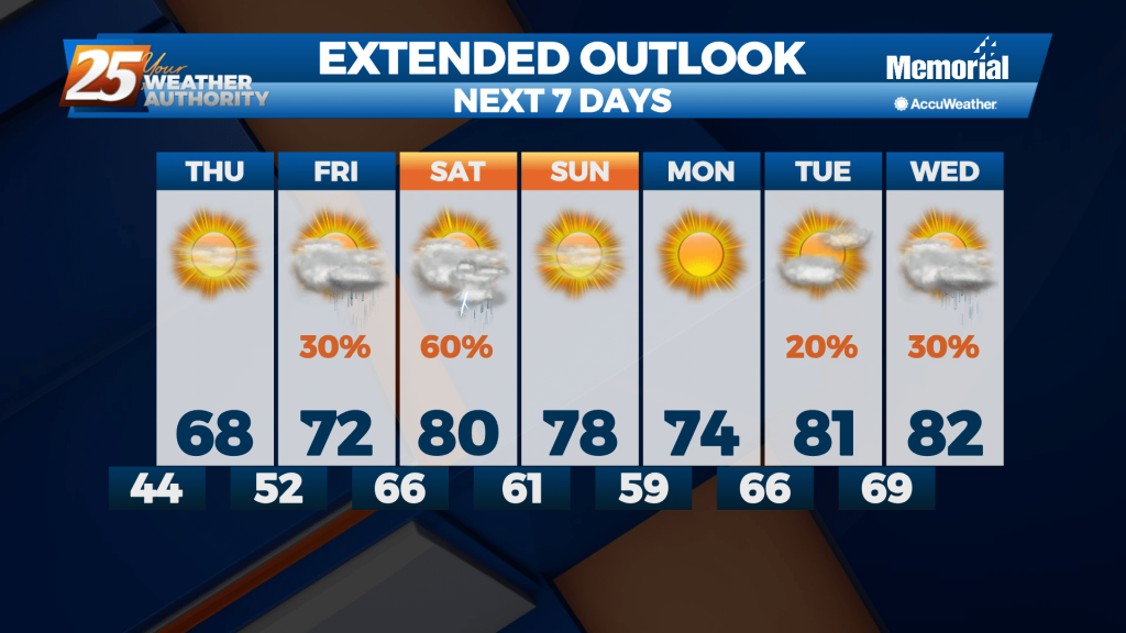
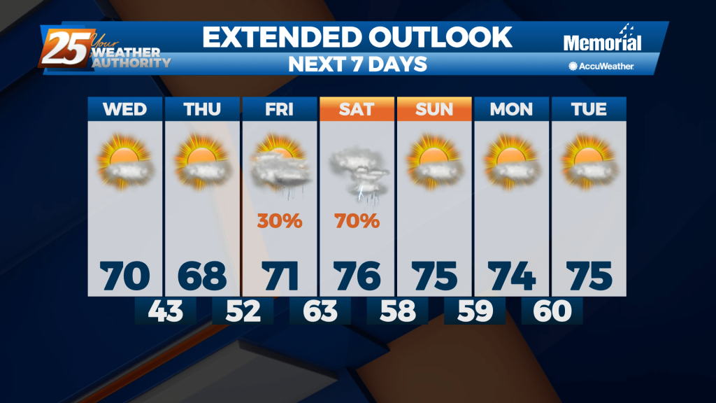
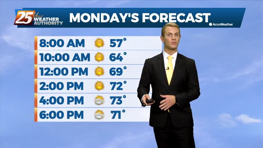
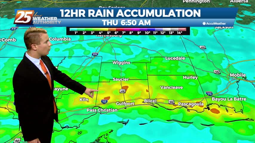
04/29 – Brantly's "Warm and Muggy" Thursday Forecast
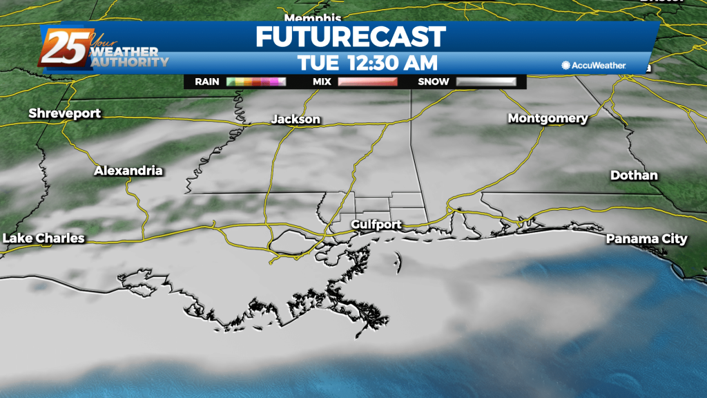
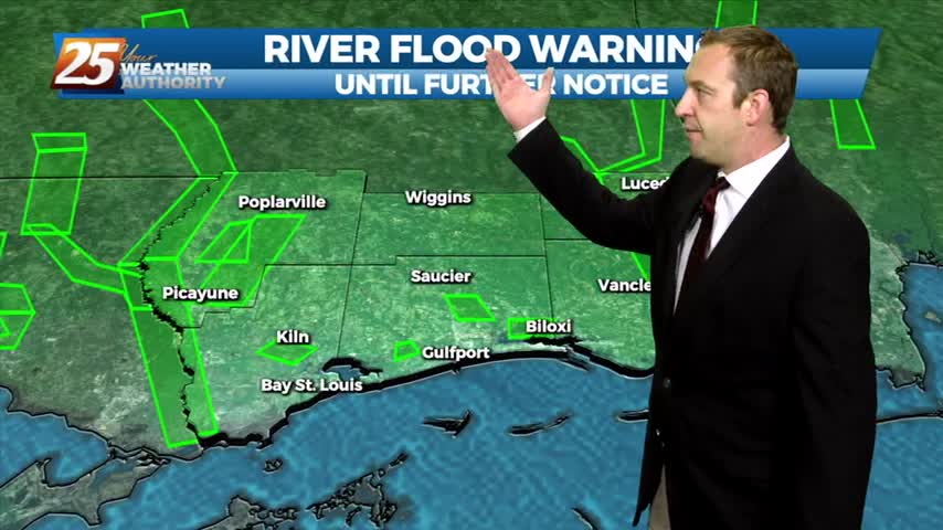
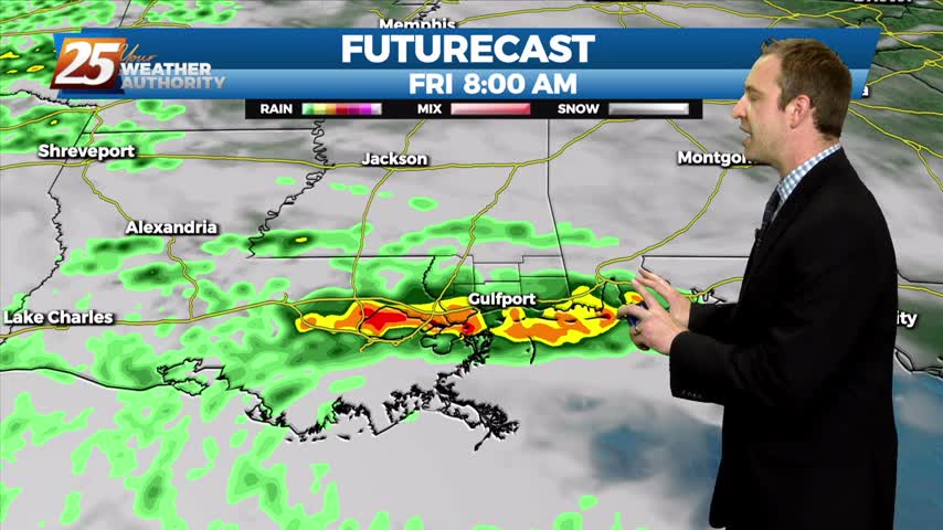
As the weak front slowly moves through the area, this will support slight chance to a good chance of rain returning to the area late Thursday night and Friday. Lows tonight will be mostly in the mid 60s with patchy…