03/04 Ryan's "Stormy" Mardi Gras Afternoon Forecast
The weather has been sunny and beautiful for any Mardi Gras related activities up until now, but as the day itself arrives we're looking at a potentially stormy evening ahead. I should rephrase…
The weather has been sunny and beautiful for any Mardi Gras related activities up until now, but as the day itself arrives we're looking at a potentially stormy evening ahead. I should rephrase…
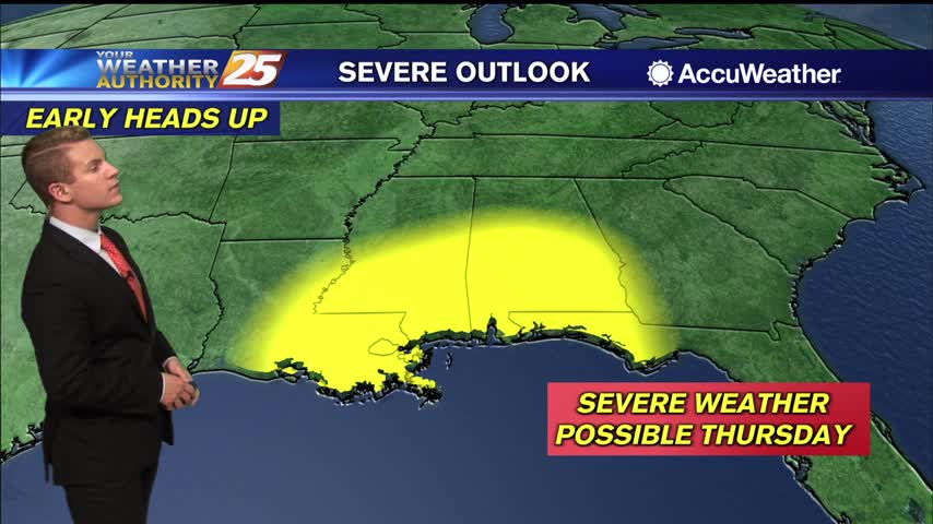
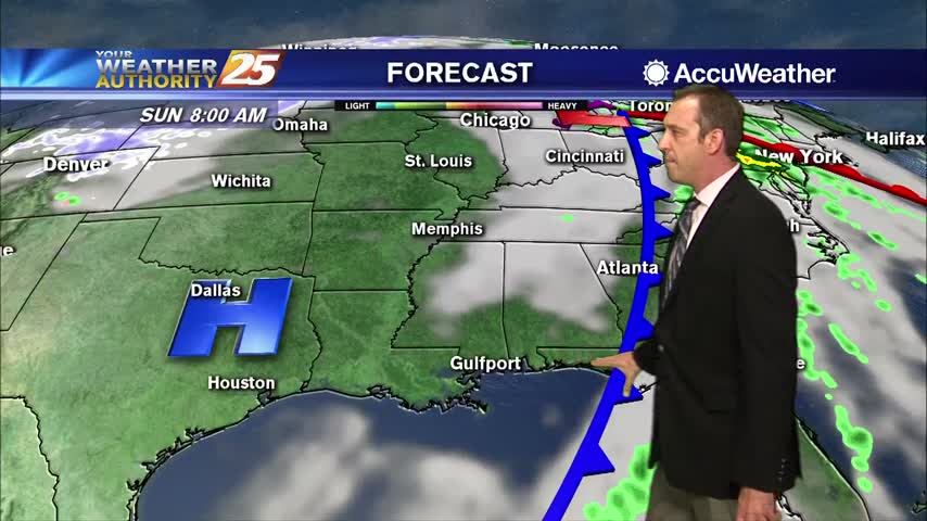
Bottom line up front...main concern for this forecast package will be with the storm system expected to impact the Gulf Coast Tuesday into Wednesday morning,…
Expect stormy weather to linger in South Mississippi through the evening, but it will eventually clear out. Exactly when is still a bit up in the air though. It…
Expect stormy weather to linger in South Mississippi through the evening, but it will eventually clear out. Exactly when is still a bit up in the air though. It…
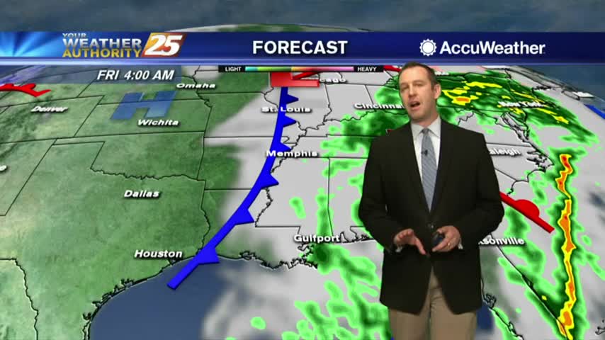
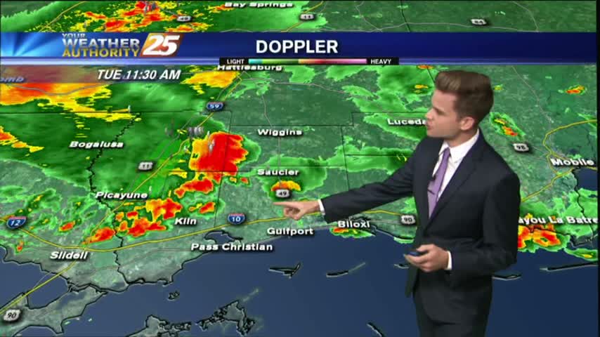
It has been several days since our last round of active weather, but that changes now as showers and storms move in quickly overnight.
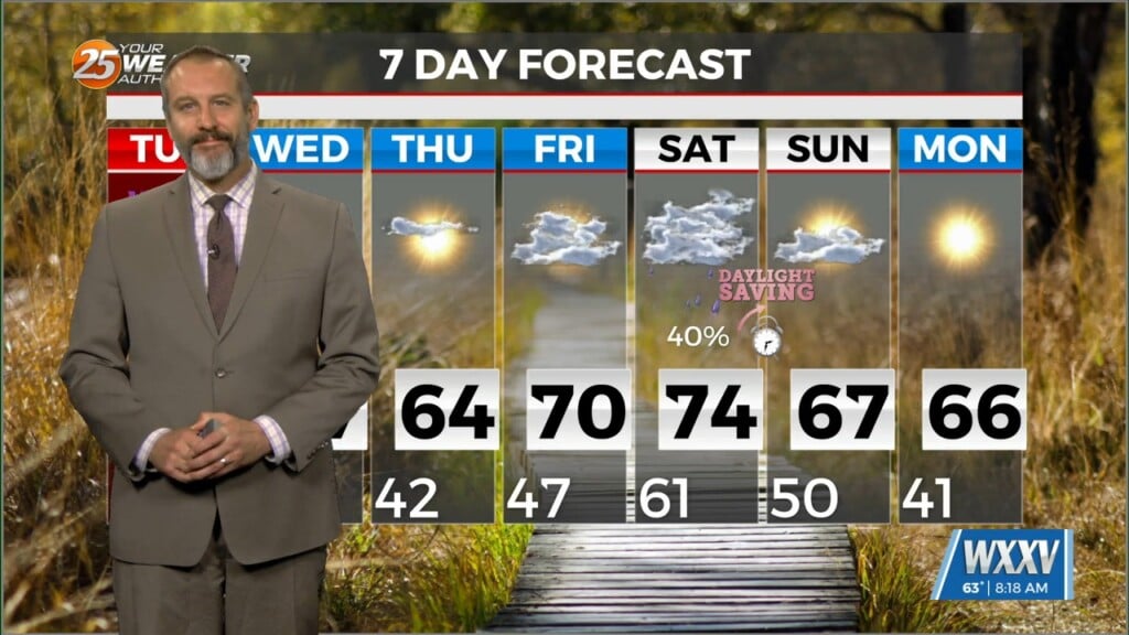
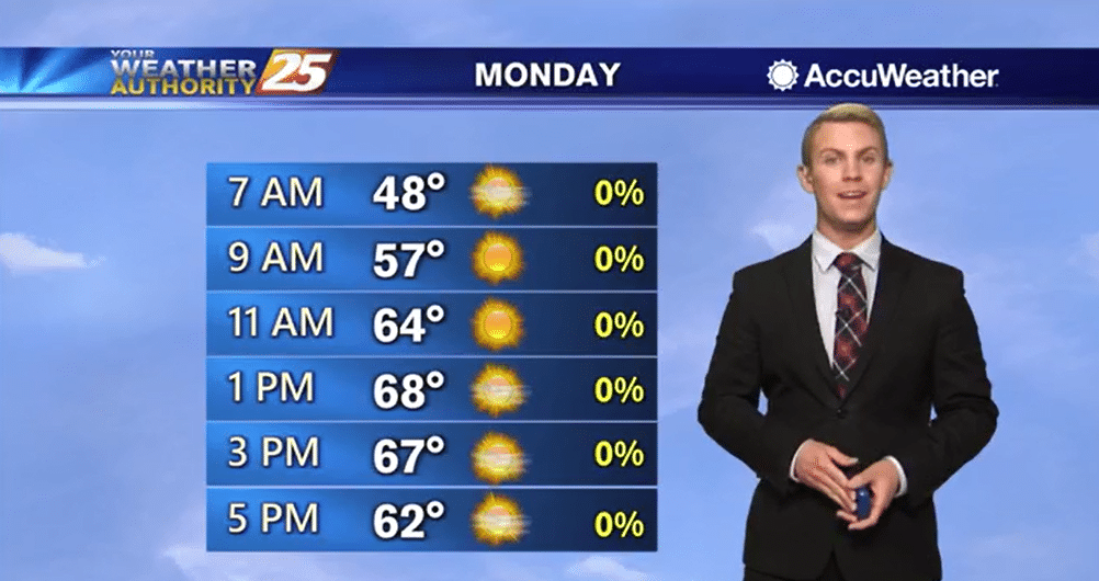
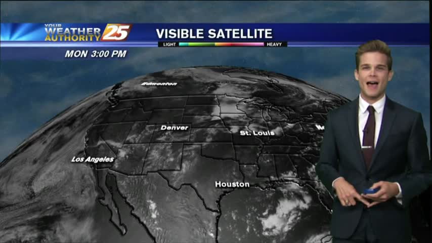
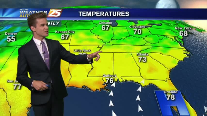
It was a very pleasant day across the region today. Skies were mostly sunny through much of the day and temperatures climbed into the mid 60s to lower 70s. Winds remained light. The bulk of this forecast focuses on our…
High pressure centered over the Southeastern United States will remain in control over the next few days. Southerly winds at the surface will allow the airmass over our region to modify through the first half of the week with unseasonably…
Much more cloudy today than recent days and with our first "active" weather in over a week!
Rain will continue through the night, but will clear quickly tomorrow....
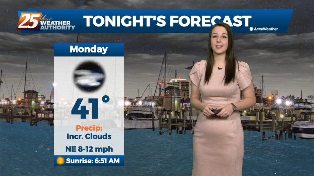
Starting off the week on the wet side, but much better, more fall-like days lie ahead....

The rain we expected moved into MS and brought deadly flooding to the North, but stalled before moving over the Gulf Coast....
The rain is finally here, and we won't be done with it for at least another day, but drier weather is ahead....
It's been cloudy and rainy all day long, and I expect similar conditions tomorrow. Next week looks drier though....
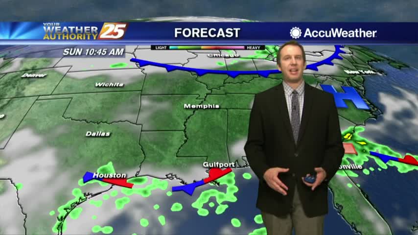
The warming trend continues, but a stormy Sunday looks likely.
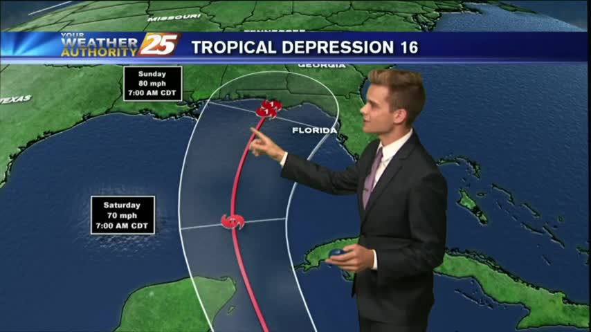
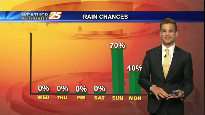
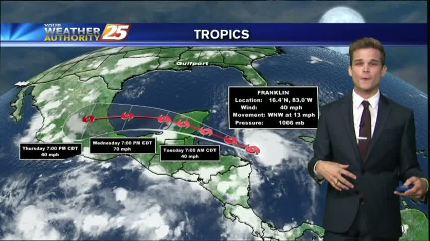
Tropical Depression 16 has formed, and could impact portions of the Gulf Coast this weekend.
Showers and thunderstorms are starting to develop across the area this afternoon.
It was a hot & muggy weekend with occasional isolated showers and thunderstorms.
The solar eclipse of 2017 has come and gone, but left some neat things to look at! The moisture was on the return into the area today, along with a disturbance in the Gulf of Mexico, which is moving our…

Tomorrow is the big day across the United States! The solar eclipse will be at its max around 1:30 pm.
After a dry start to the day, showers and thunderstorms are across the area, and unfortunately it looks like the hot and stormy afternoons will continue into the weekend as not much change will happen to the upper air pattern.
Unfortunately it looks like another hot and stormy afternoon for the area with the best chance for showers and thunderstorms this afternoon.
We continue to see isolated showers and thunderstorms starting to develop.
An isolated shower is not out of the question tonight, but most should remain dry.
Today will bring the same scenario with the activity in the area. An additional 2-4 inches of rain is not out of the question with the strongest storms.