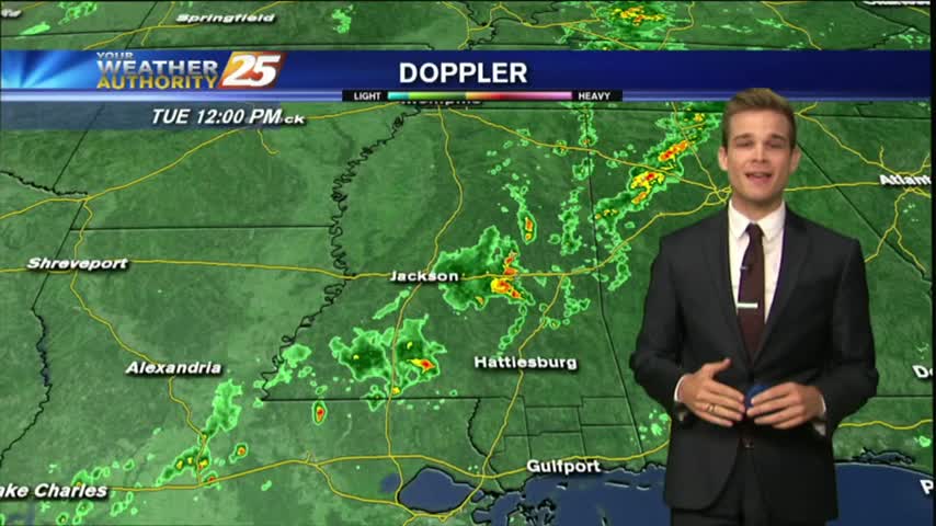
10/10 - Payton's Tuesday Afternoon Forecast
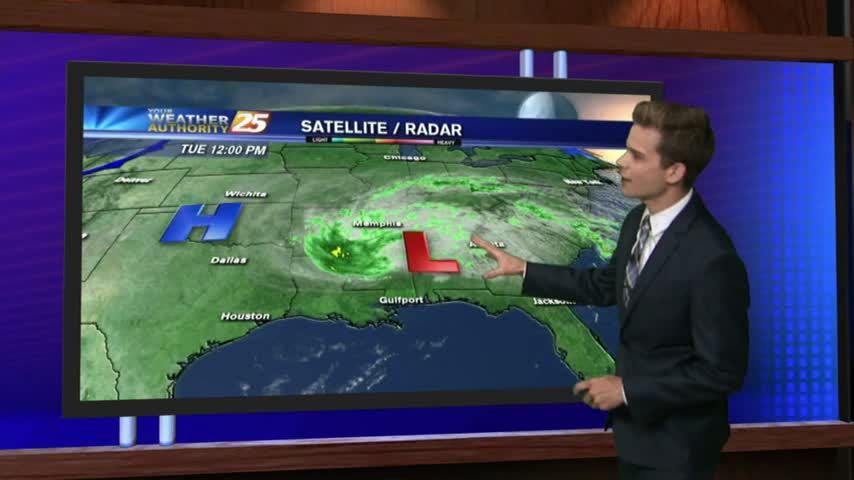
A very weak cold front is approaching the area from the west…currently located in Eastern Tx.
A very weak cold front is approaching the area from the west…currently located in Eastern Tx.
After a relatively quiet day behind Hurricane Nate yesterday and last night, but rain has returned today.

See the latest on storm reports in South Mississippi...
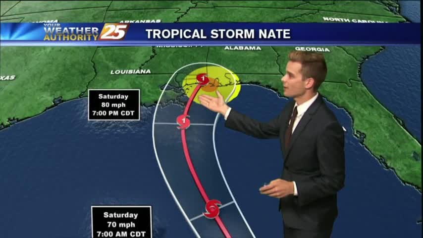
A Hurricane Warning and Storm Surge Warning for South Mississippi...
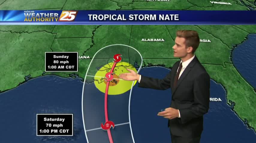
The Gulf Coast is under a Hurricane Watch and Storm Surge Watch...

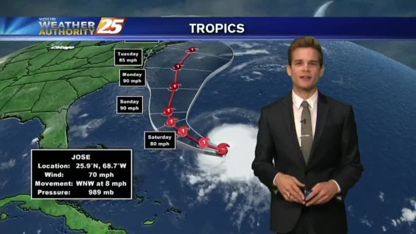
Tropical Storm Nate could impact South Mississippi this weekend. Check back regularly for updates.
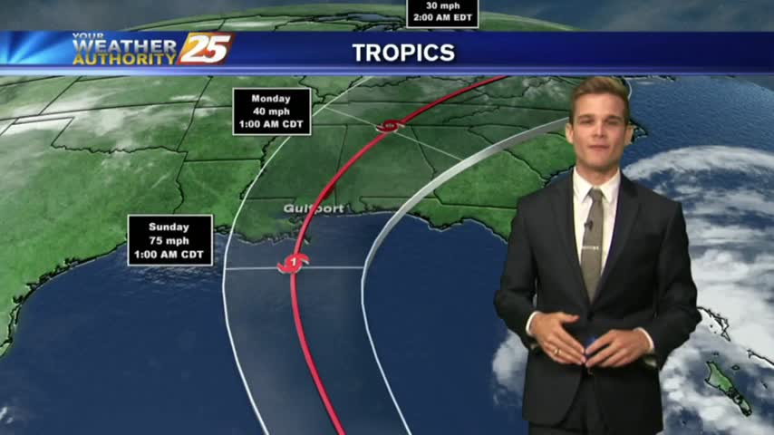
Forecasts continue to trend west with the track of the storm, which means the storm could have a bigger impact on South Mississippi.
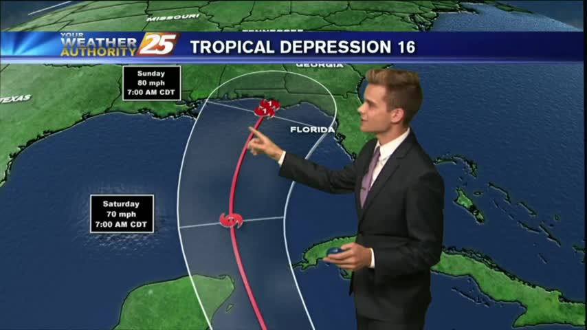
Tropical Depression 16 has formed, and could impact portions of the Gulf Coast this weekend.
Drier are has moved into the area, and that means nice weather for the next few days, but changes are on the way.
Precipitation should stay low as we approach the weekend with a few passing showers possible from day to day.
Expect overcast and on and off showers and thunderstorms for your Monday.
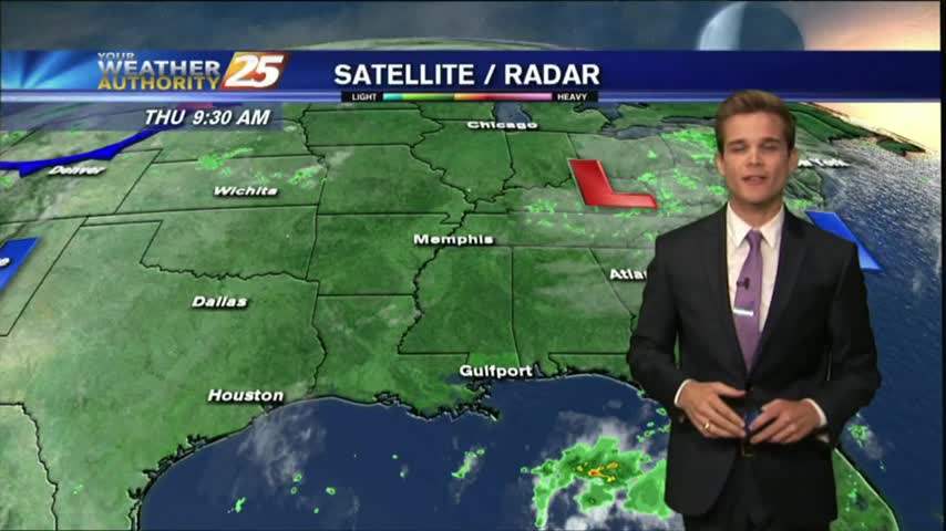
Showers and thunderstorms that moved off the waters this morning continue to slowly dissipate, but we could see more this afternoon.
Seeing a few showers in the area this morning ,but drier weather is on the way.
Showers and thunderstorms are starting to develop across the area this afternoon.
It was another warm and humid day with showers and thunderstorms.
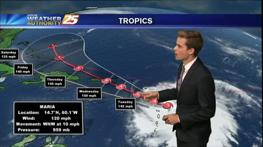
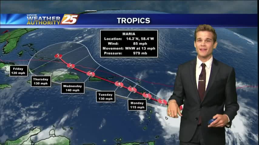
HURRICANE MARIA: CATEGORY 5 (MAJOR HURRICANE) EXPECTED TO MAKE LANDFALL IN PUERTO RICO WEDNESDAY MORNING...
We continue to see a few showers and thunderstorms popping across the area as High-pressure centered directly over the Gulf.
It was a hot & muggy weekend with occasional isolated showers and thunderstorms.
Showers and thunderstorms have started to develop late this morning across Jackson and Harrison County.
A much more typical summer day in store for South Mississippi as the cooler drier air is no longer around.
Temperatures this afternoon are in the mid 80s and we continue to see southerly winds increase moisture in the area, but ran will hold off until tomorrow.
One final day of nice weather across South Mississippi before the rain returns.

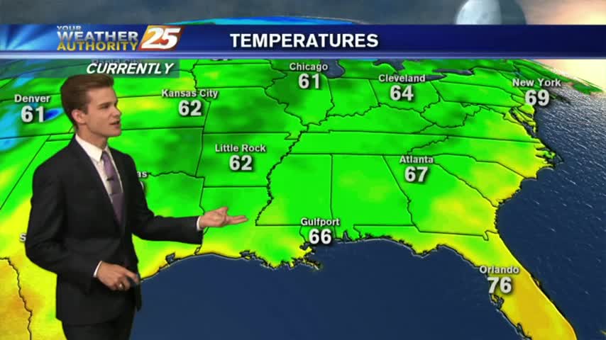
It was a chilly and dry start to the morning with temperatures in the mid 50s to lower 60s.
As IRMA continues its track to the NW…now moving through N’tern Alabama as a low pressure system, the lovely conditions will continue here in South Mississippi.