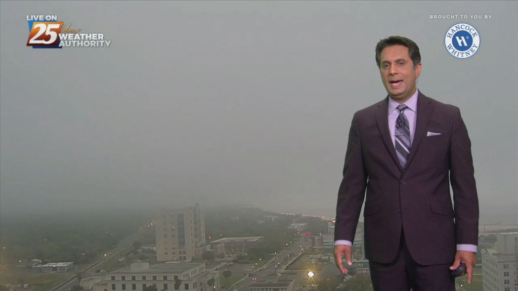
7/5 - The Chief's "Threat For Heavy Rain" Tuesday Morning Forecast
High-pressure is currently centered near the Texas-Louisiana border, with a north-south axis into the Dakotas early this morning with an easterly wave wrapping around the…
High-pressure is currently centered near the Texas-Louisiana border, with a north-south axis into the Dakotas early this morning with an easterly wave wrapping around the…
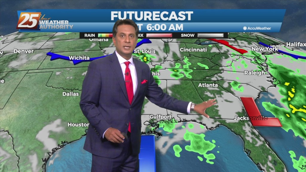
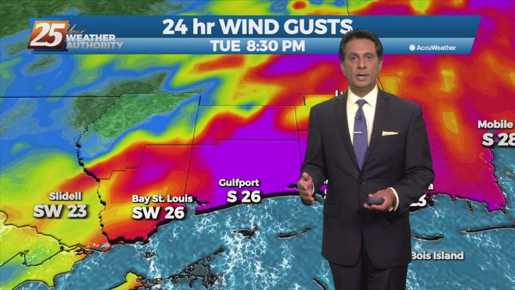
Onshore flow has been a little more persistent along the Mississippi coast, and a cluster of showers/storms has been moving northward across portions of Harrison, Hancock and…
High-pressure is currently over the Rockies, with low-pressure along the Atlantic Coast. The area of disturbed weather over the Gulf of Mexico appears to…
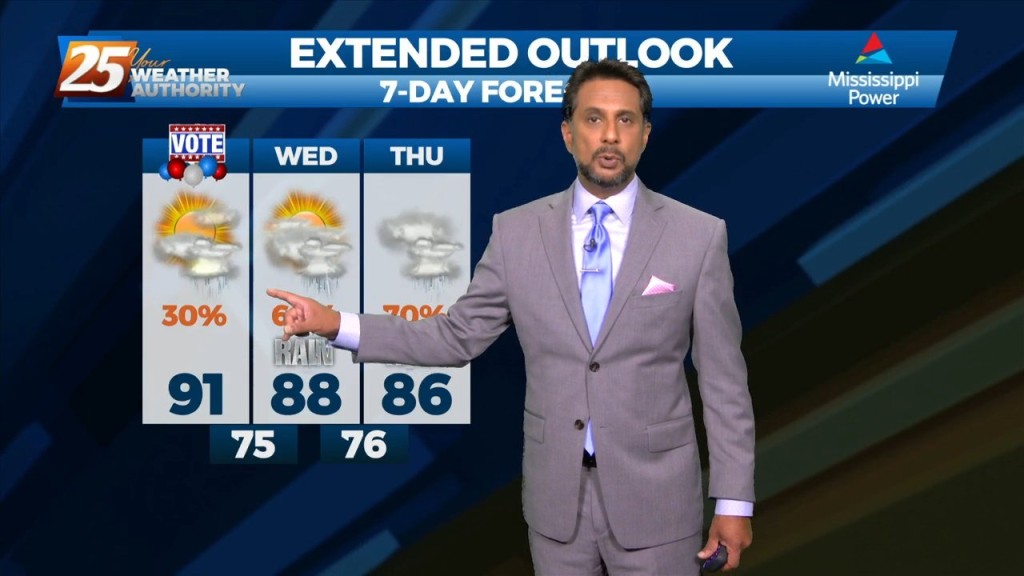
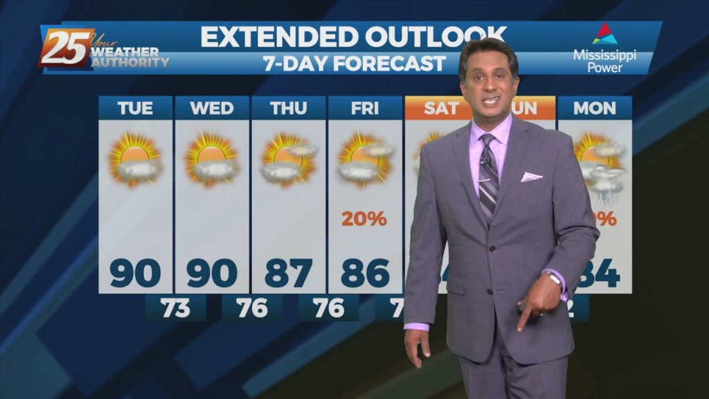
The good news is that the threat of heat related issues has diminished for the next several days. However, that also means dealing with showers…

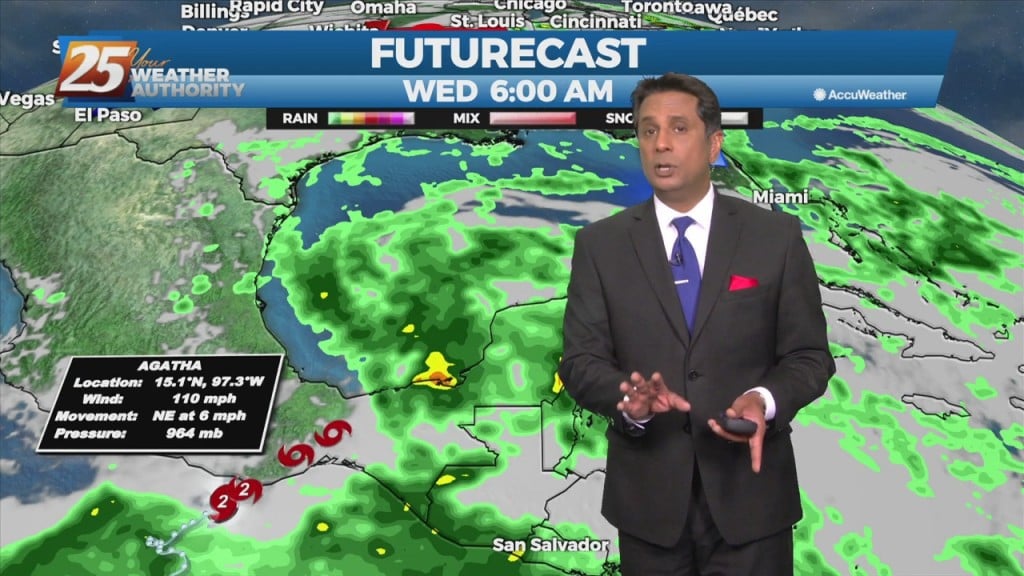
Not a lot of change as all indications for a frontal boundary to sag into the area and stall through Saturday. The interaction between the Caribbean…
Much, but not all, of the short term forecast period will be dry, with a good bit of sunshine. A weak disturbance currently across the area will…
An upper-level low pressure over southern Illinois this morning will slowly drift off the eastern seaboard tonight into the weekend. High-pressure will be the main factor shaping…
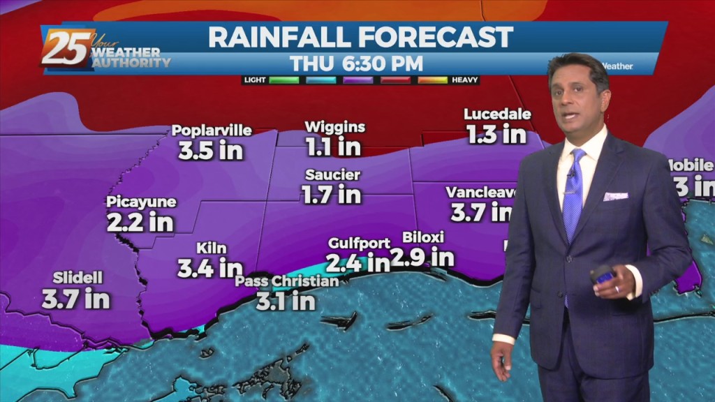
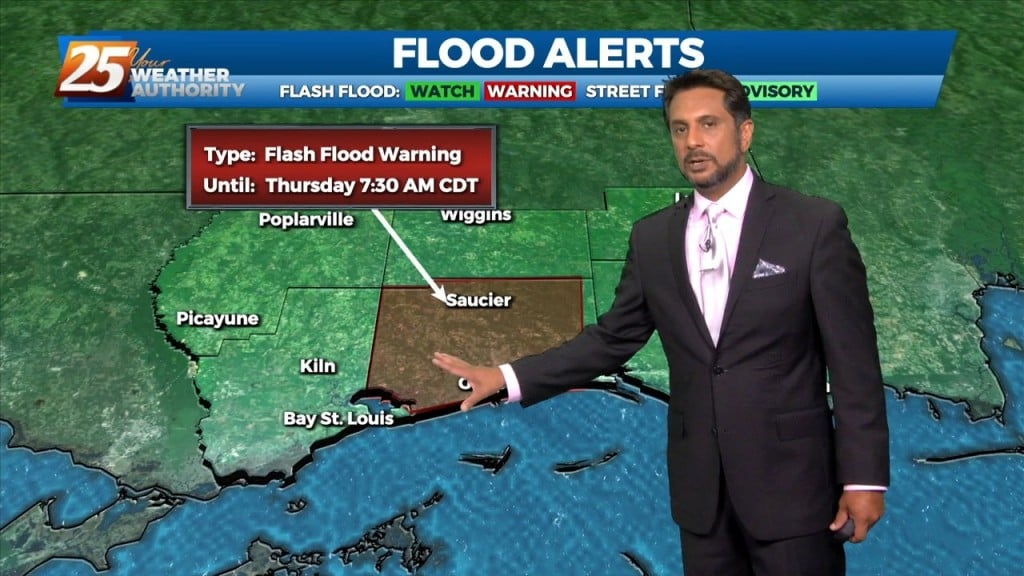
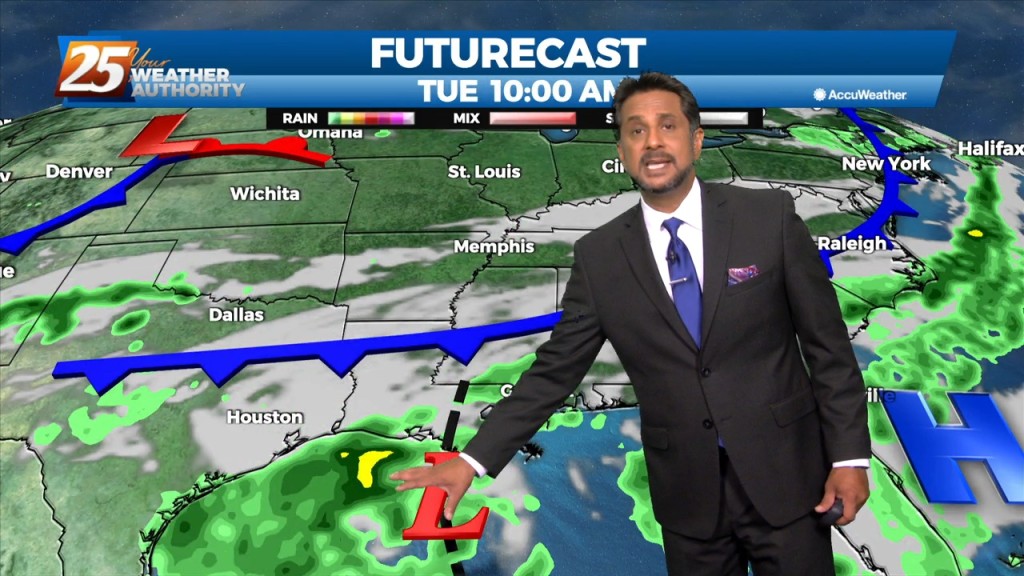
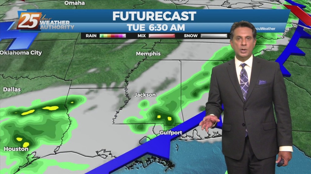
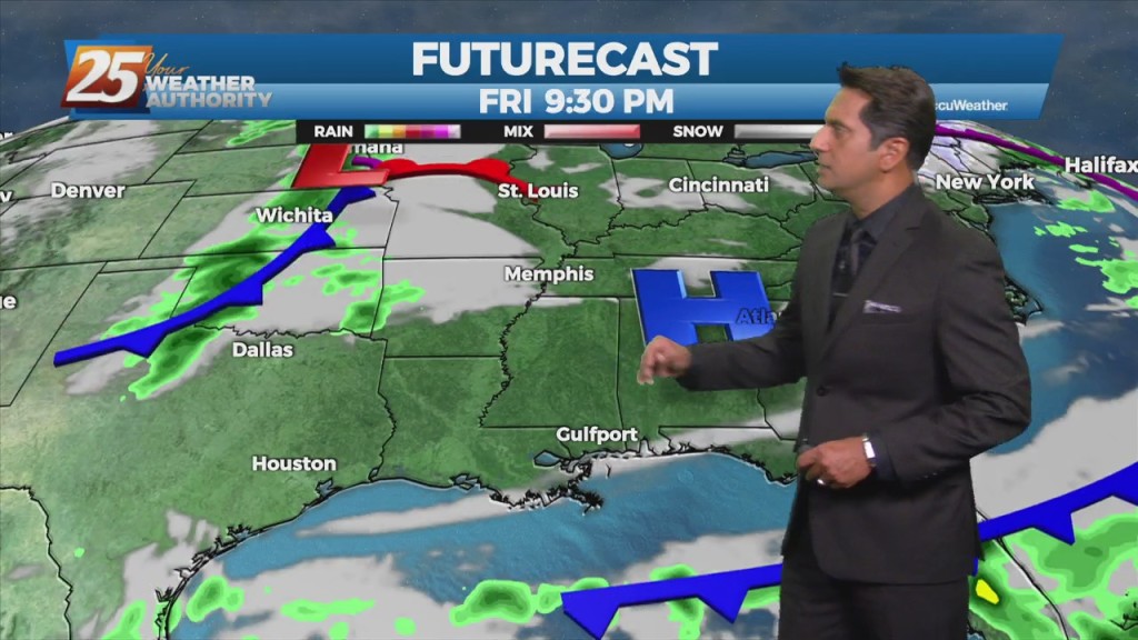
The main concerns are for heavy rain in the first 36 hours of the forecast...or in other words, today and Thursday. The disturbance swinging through the…
The upper pattern will start the transition into a wetter one late in the day with a weak disturbance sliding across the region. It’s not until Saturday…

The synoptic pattern will hold through the short-term period with a broad area of high pressure off the Southeast U.S. coast extending westward along the…
Today and Wednesday, high-pressure will set up over the area. Conditions will be dry primarily, looking at the models. Today will mainly be a transitional day where…
An upper level low-pressure system currently centered in the western Atlantic will move west into FL/GA today. At the same time, an upper level disturbance to the…
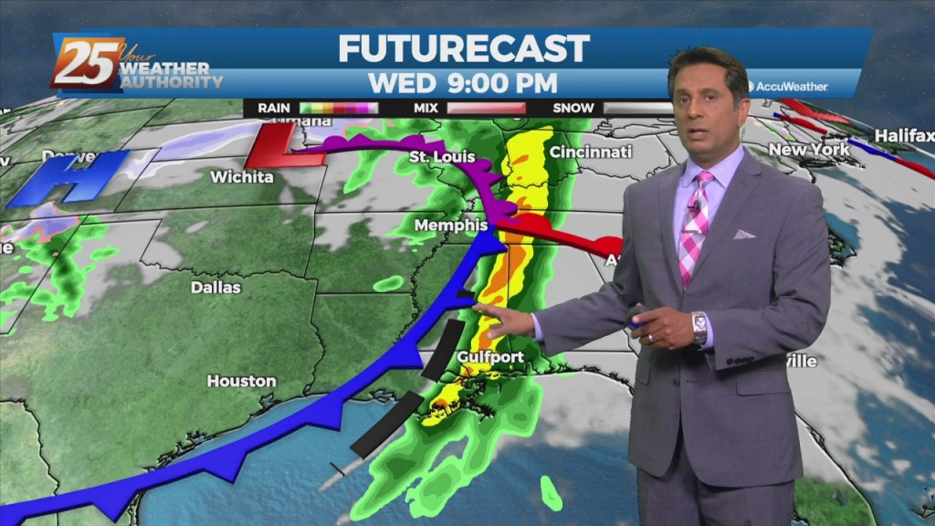
An upper low-pressure in the northern part of the country will move across the Great Lakes and into Canada. This will drive a cold front south to central LA and MS late in the day. Showers and thunderstorms along/ahead of…

Surface high-pressure building in from the north and keeping yesterday mild is quickly sliding east. Onshore flow develops today as elevated winds will bring in…

Post front airmass continues to push in today as upper level high-pressure to the NW shapes the short term forecast. This will bring another below normal temperature…

A zonal flow regime will remain in place across the Gulf South both today and tomorrow in the mid and upper levels. In the low levels, a departing high-pressure…
An area of low-pressure remains near Lake Michigan, with upper level high-pressure to the NW. Any cloud cover associated with the upper low is well to the north…
A weak upper disturbance will move across the region later this morning with the actual cold front pushing through in the evening. Showers and a few…
The front is now well east of the area after leaving extensive damage through the region including South Mississippi. Multiple areas were hit by damaging straight…
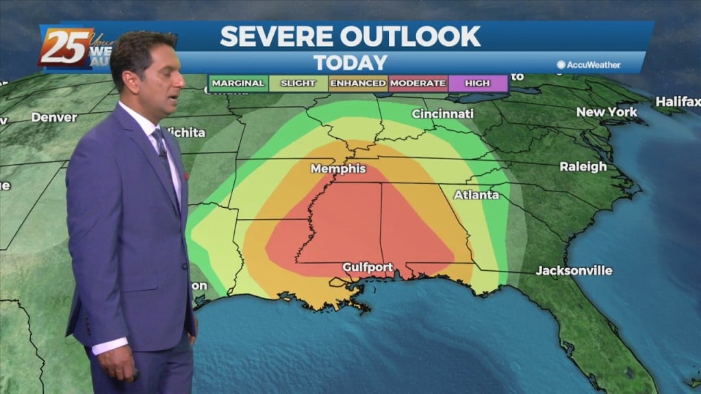
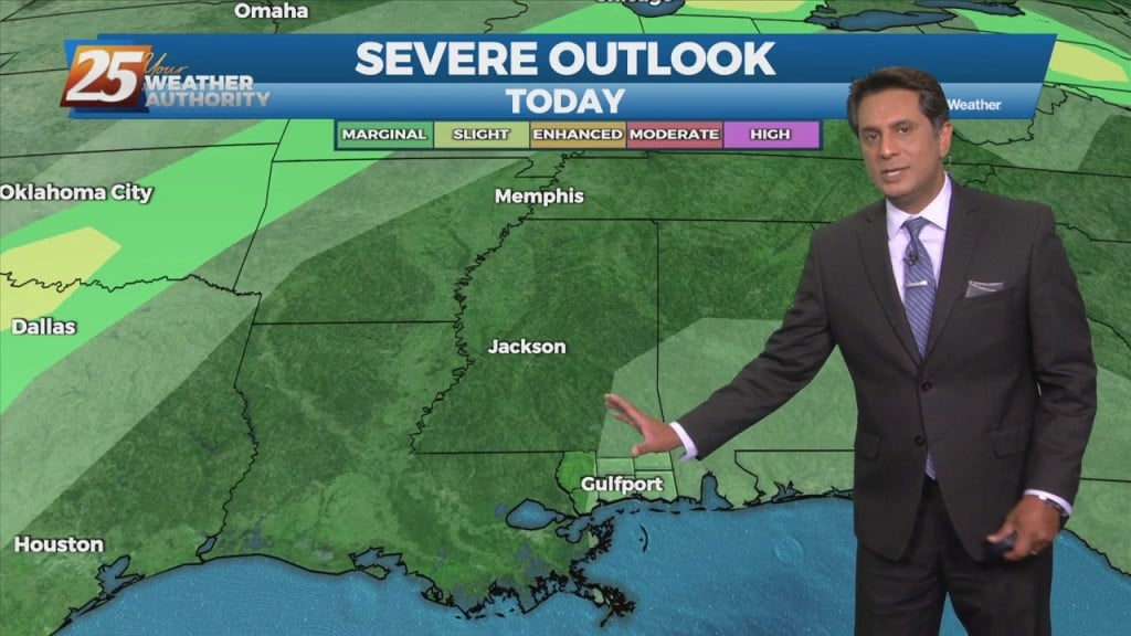
THE AREA/STATE IS UNDER A MODERATE (LEVEL 4 OF 5) SEVERE POTENTIAL THROUGH TONIGHT... A cold front to the west with a squall line in advance…
Very strong wind event and severe weather potential is expected Wednesday and Wednesday night... A quiet day with the exception of fog this morning but…
Upper level moisture/disturbance will move only slowly eastward over the next couple of days, and may take until about Friday to totally clear the region. Lower…
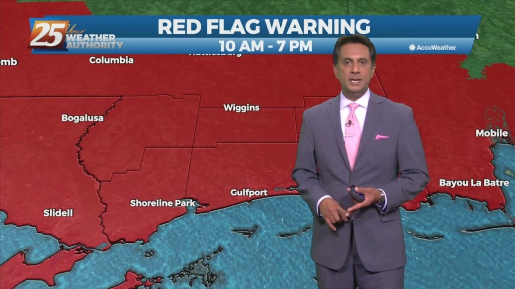
The area is under an ENHANCED/MODERATE threat for severity...especially noon through midnight WATCHES/WARNINGS include: Wind Advisory, Flood Watch, Coastal Flood Advisory & Small Craft Advisory. Some prefrontal…
Behind the front, drier and cooler air will move in for the weekend. The front may linger over the coastal waters for about 24 hours, so…