5/25 - The Chief's "Sunny & Warmer" Thursday Morning Forecast
Showers and a few thunderstorms continue over portions of the Gulf waters this morning. This area is also the most favored for convection a disturbance south…
Showers and a few thunderstorms continue over portions of the Gulf waters this morning. This area is also the most favored for convection a disturbance south…
Under a further amplifying disturbance, the region will remain on the dry side of this feature. The best lift and instability will be through the Gulf South.…
A deepening upper level disturbance is situated over the Southeast U.S. An approaching weak backdoor cold frontal boundary is expected in the region later this…
Some weak marine convection has developed near and east of the mouth of the MS River this morning. A few lightning strikes have occurred, but…
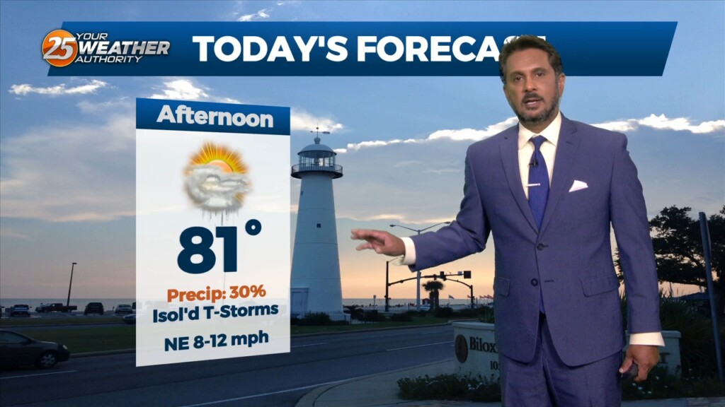
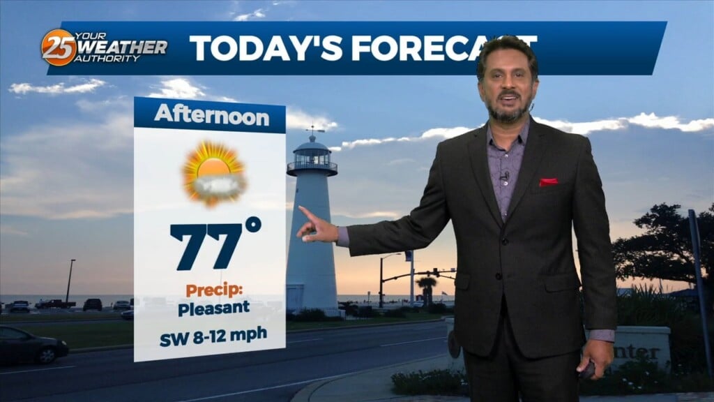
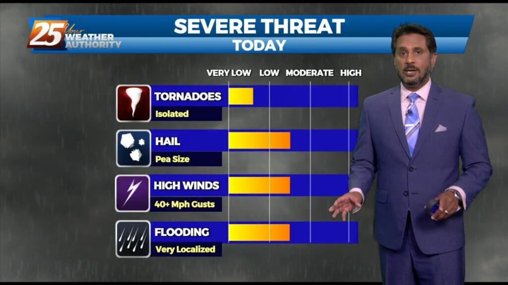
Today I’m expecting temperatures to climb into the lower 90s (heat indices nearing mid 90s) today across much of the area so be mindful to stay hydrated…
Mid-level dry air is moving into the area from the west this morning on the backside of the exiting upper level disturbance retrograding back to the…
More of the same summer-like weather will persist today despite the mid-level high pressure gradually waning. Convective temperatures in the upper 80s to low 90s will be…
Overall, a complicated forecast through the short term, mainly due to the upper level pattern over the region. An upper level weakness continues to reside…
The high pressure that has been over the region has been providing for little to no resistance to convection working into the area from the…
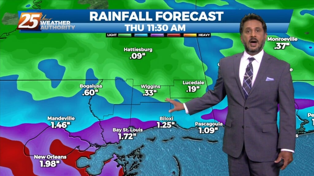
A line of showers & t-storms moving across SW Mississippi should continue to slowly spread/work east-southeast through the pre-sunrise hours and slide east through 9 a.m. before…
Not much has changed with the overall pattern though the region. A strong upper level low pressure system is currently located over the Ohio Valley and…
A weakening upper low currently moving through the Central Plains will continue east across the lower/mid-Mississippi Valley this afternoon and evening. With increasing low level moisture, cooling…
Today will bring a fairly quiet weather pattern with cloud coverage varying through this evening with slightly warmer as low-level winds start turning more onshore flow. The…
An area of low pressure remains over the Great Lakes this morning, with a disturbance moving into the Pacific Northwest. High pressure was noted over the…
Early this morning, a strong upper disturbance extended from the Upper Mississippi River Valley southward into Texas. At the surface, a cold front extended from…
There is upper troughing over the northwest and northeast corners of the country with high pressure over the northern Mississippi River Valley. The shortwave that moved…
The surface low has exited our area at this point, with some weak high pressure expected to pass through today. This keeps things rather quiet today,…
The feature that is about to give rise to our forecast is currently located over the Nebraska/Kansas border. This is seen as a weak low pressure…
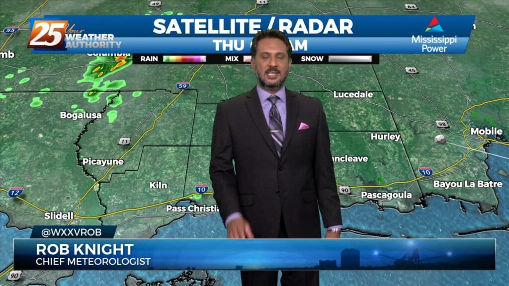
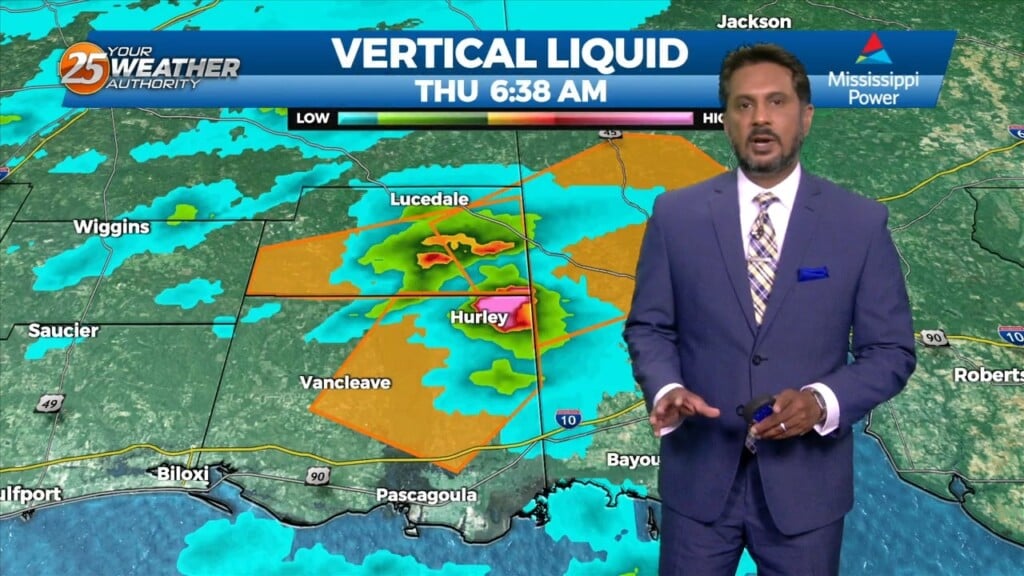
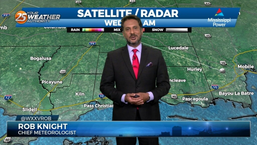
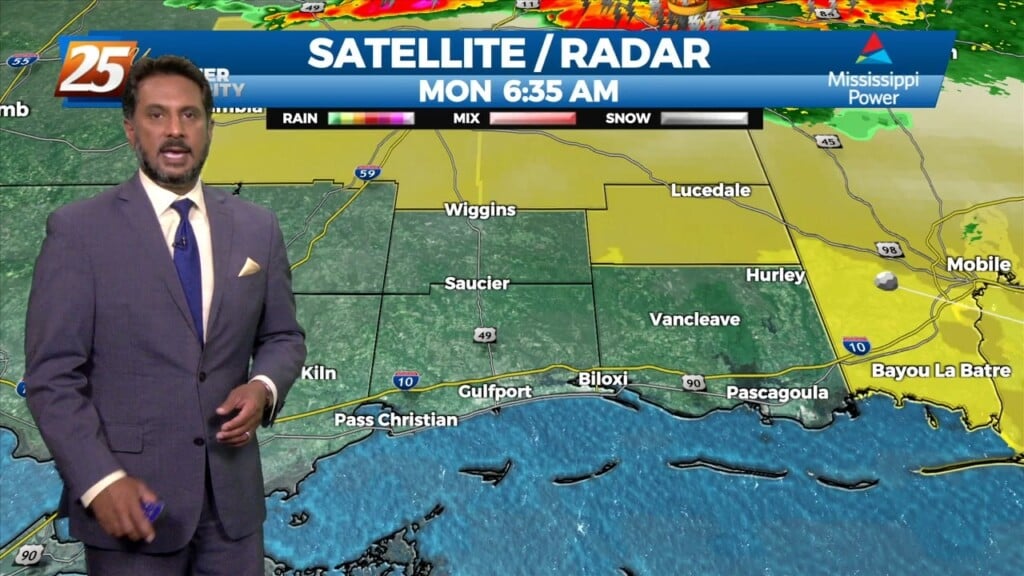
Starting off with early this morning, recent radar trends illustrate some isolated showers developing generally along the I-10 in coastal MS. The main story for today…
A cold front drapes south into the southern Plains where severe weather is ongoing across the AR/OK/MO region and will continue NE into the Ohio Valley…
An upper level disturbance Memphis is moving quickly eastward in zonal flow across the southern states. Another strong upper disturbance is moving onshore in the…
We continue to see scattered t-storms develop along a boundary well to the southwest, with strong to severe storms noted over the Gulf of Mexico to…
A meandering frontal boundary currently located just north of the area in south-central Mississippi and central Louisiana will drift southward this morning in response to a…
A the moisture returns and temps getting into the 50s and 60s along with dew point temps, we will need to turn to those variables that…