08/22 Ryan's "Sticky Summer" Tuesday Afternoon Forecast
We can now safely begin our post eclipse lives, and get right back to the normal forecast. Today was cloudy and dry, but heavy rains are ahead. Details within.
We can now safely begin our post eclipse lives, and get right back to the normal forecast. Today was cloudy and dry, but heavy rains are ahead. Details within.

Today was one of the most "hyped" days in weather/science we've seen, and for many the eclipse didn't disappoint. Things get back to normal quickly, so click the link for the full forecast.
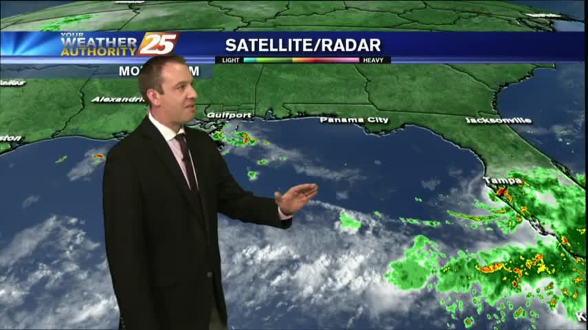
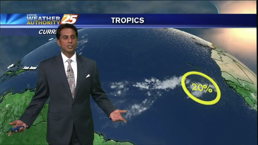
The solar eclipse of 2017 has come and gone, but left some neat things to look at! The moisture was on the return into the area today, along with a disturbance in the Gulf of Mexico, which is moving our…
The eclipse will happen from noon until 3:00 pm, but the max eclipse will be at 1:31 pm. Remember to use special solar eclipse glasses to view the event.

Tomorrow is the big day across the United States! The solar eclipse will be at its max around 1:30 pm.

Another nice South MS day with afternoon showers and thunderstorms, but only the Eastern areas saw any rain. Expect many similar days ahead, full details inside.
Showers and thunderstorms will develop this afternoon because of fairly typical August weather.
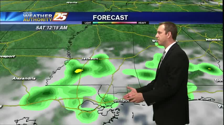
Showers and thunderstorms continue to clear out of the area. More rain is in the forecast.
After a dry start to the day, showers and thunderstorms are across the area, and unfortunately it looks like the hot and stormy afternoons will continue into the weekend as not much change will happen to the upper air pattern.
Unfortunately it looks like another hot and stormy afternoon for the area with the best chance for showers and thunderstorms this afternoon.
Didn't see much rain this morning/afternoon, but early evening thunderstorms helped light up the night sky. This will dissipate quickly, and more rain expected soon, but you'll have to watch the forecast for more.
Some dry air moved in this afternoon as expected, keeping the showers a bit more few and far between than the day before. Watch the full forecast for more details.

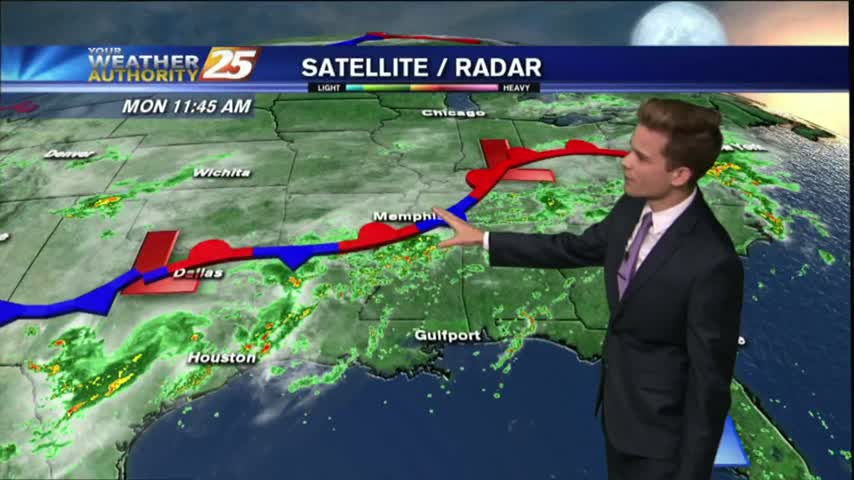
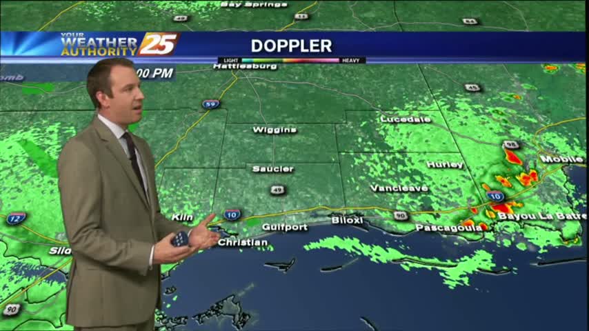
Very isolated activity across the area this afternoon as a stationary front along the Mississippi Gulf Coast stretching west to east will continue to linger in the region through the rest of the workweek.
We continue to see isolated showers and thunderstorms starting to develop.
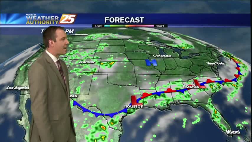
A frontal boundary is moving into the Southeast, but is not expected to pass through South MS. It will however, linger in the area causing several rainy days. Forecast details inside.
Isolated showers and thunderstorms are possible this afternoon.
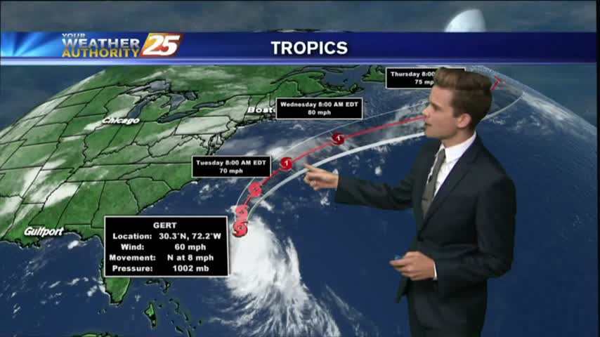
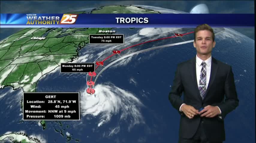
Drier and slightly cooler conditions moved into South MS, just as a developing Tropical Storm moved East! Great conditions last a little longer, but change soon. Read full forecast for details.
The beginning of the week will be hot and dry, but with less moisture it won't feel quite as hot as it has the past couple weeks.
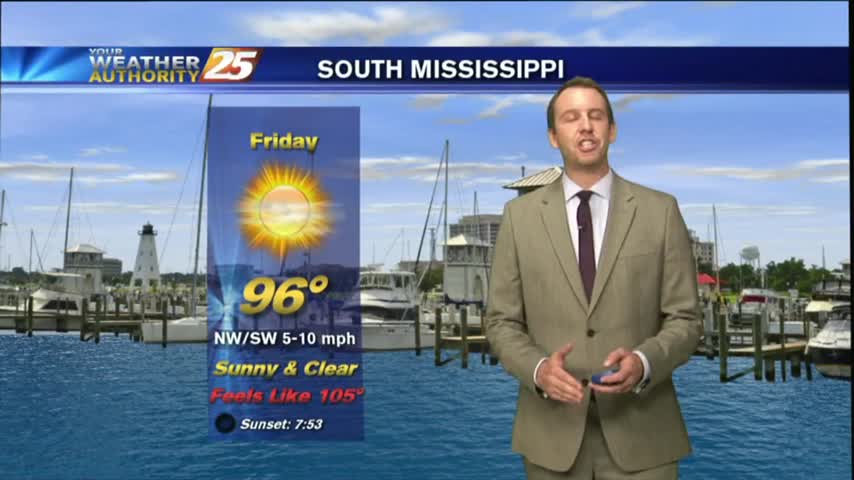
Mostly clear skies will help us cool into the mid-to-upper 70s, but we'll see very hot conditions tomorrow. Watch the full forecast for details.
Much drier today with only a few showers popping up in the West, but the high heat indices we expected definitely showed up. Another dry and hot day ahead before rain arrives, so watch the full forecast for details.
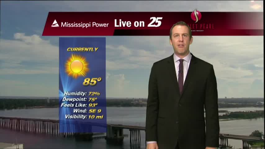
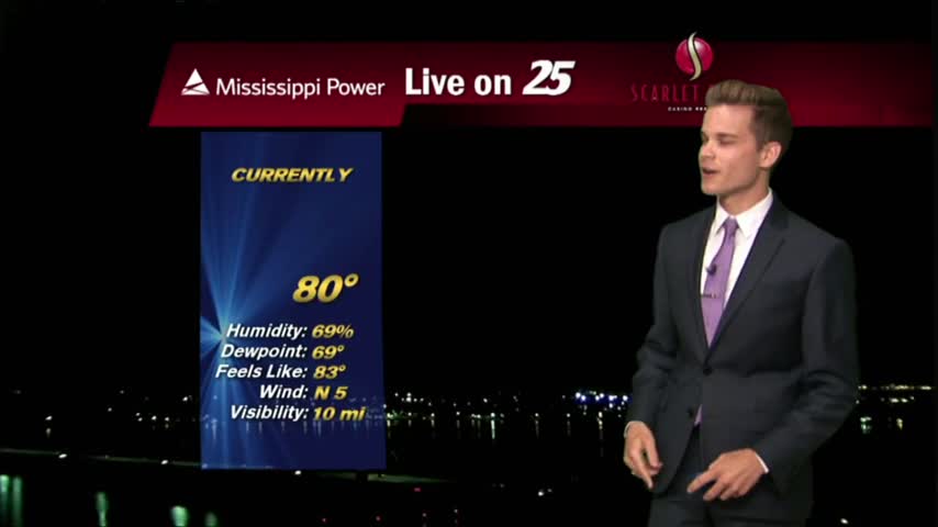
After a rain-free start to the day, HOT and HUMID conditions are along the Mississippi Gulf Coast...
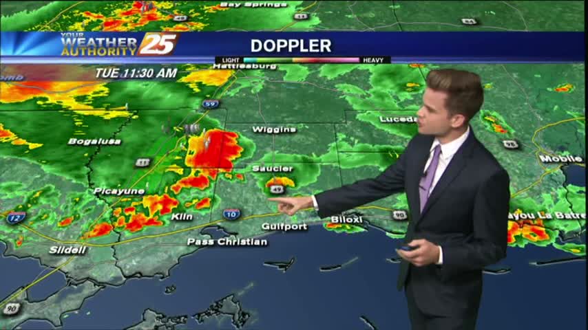
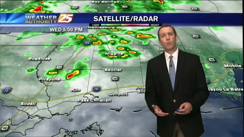
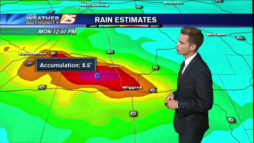
Today will bring the same scenario with the activity in the area. An additional 2-4 inches of rain is not out of the question with the strongest storms.
a FLASH FLOOD WATCH continues until 7 pm Tuesday for much of the area.
I expected less rain today, and we ended up getting a smidgen more than expected. I expect more of the same tomorrow, but you'll have to watch the full forecast for details.