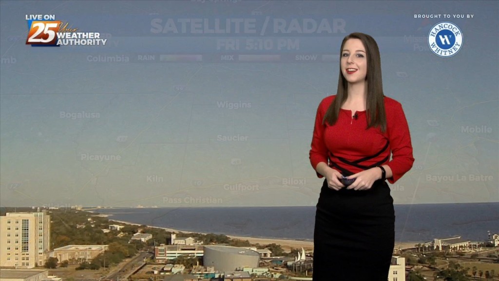
11/7 - Brittany's "Total Lunar Eclipse" Monday Evening Forecast
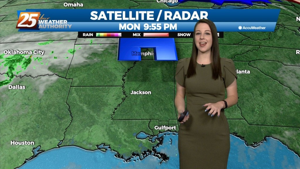
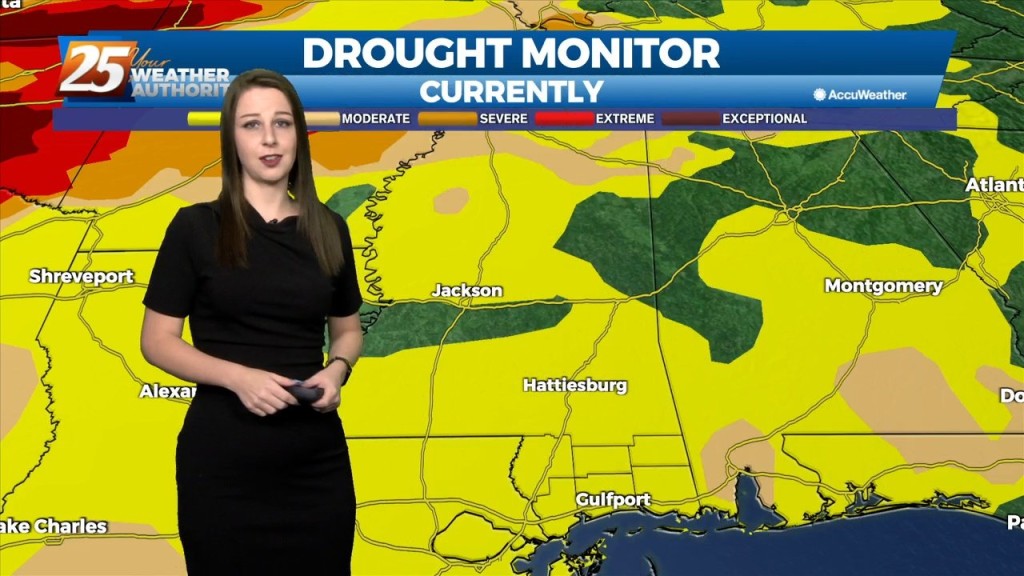
Not too bad of a start for the new work week. The uncharacteristically warm temperatures continue and while most of us have been dry, a few locations…
Not too bad of a start for the new work week. The uncharacteristically warm temperatures continue and while most of us have been dry, a few locations…
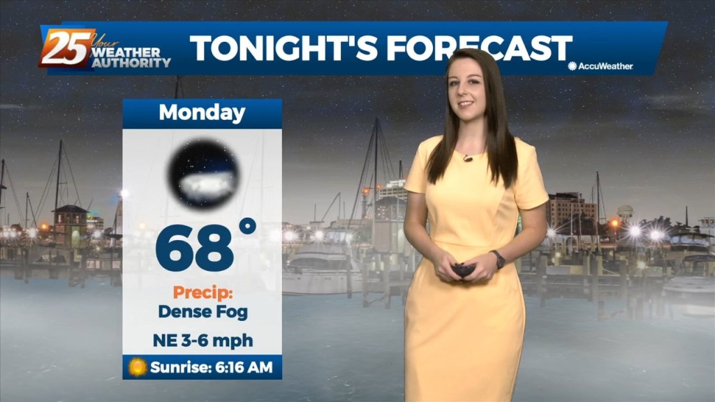
Tonight will be another mild night with the overall-moist airmass hanging around. With light winds and abundant moisture, expect dense fog to develop. A Dense Fog…
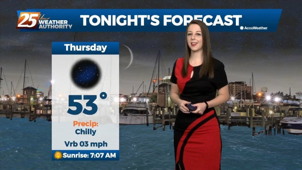
The warm conditions will continue and the average overnight lows tonight will be about 8-12 degrees warmer than seasonal average. We'll have clear skies tonight but then…
The quiet weather is expected to continue as high pressure continues to sit over the northern gulf coast. Temperatures will remain about the same as the…

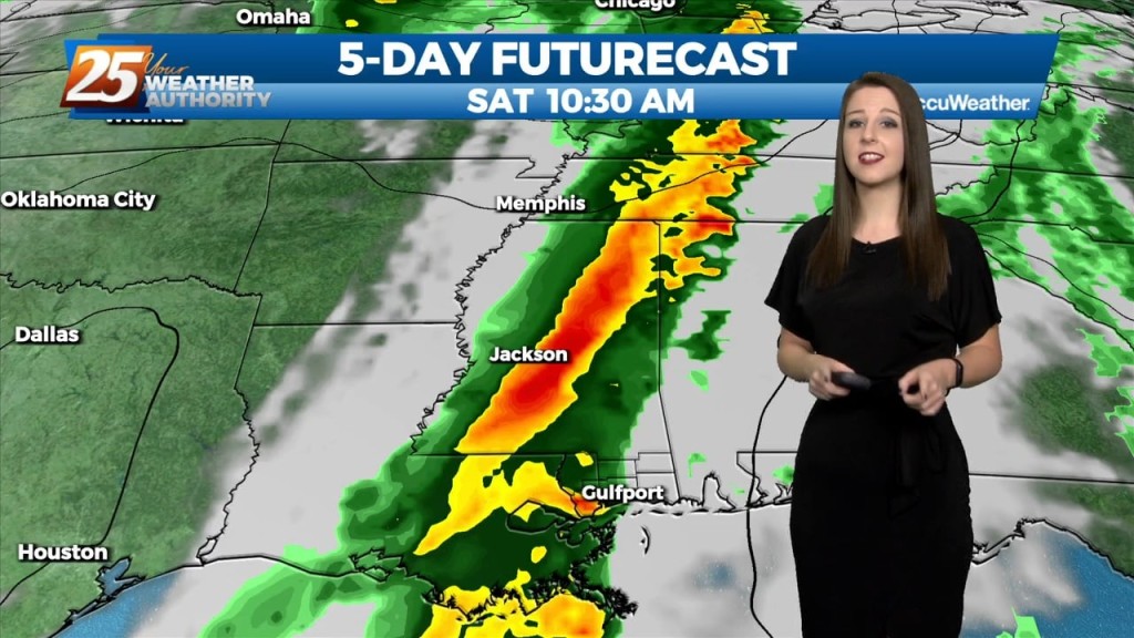
A moist air from the gulf continues to filter in this afternoon which could cause some fog issues tomorrow morning. Showers are expected to come in Friday…
We're on tap for a clear, cool, and muggy night. Tomorrow, we'll have rain free and sunny conditions yet again with warm temperatures. Subtle changes will begin on Friday…
The only real impact overnight with an area of weakness moving NE, was a deck of mid clouds over the region which should clear out slowly…
Upper level moisture/clouds continue to stream through the area in advance of a weak upper level disturbance moving NE. The disturbance will move northeastward and deamplify,…
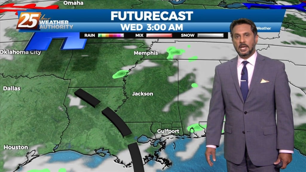
Currently there is an upper level disturbance over East Texas, with surface high pressure centered near Meridian MS. Upper jet max transporting a lot of moisture at upper…
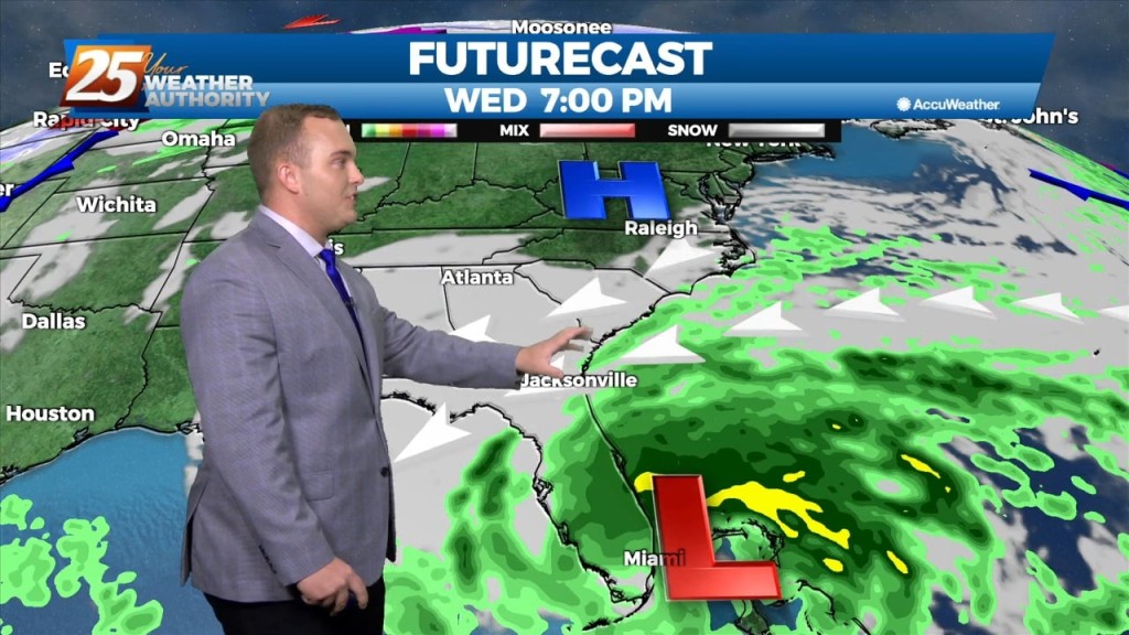
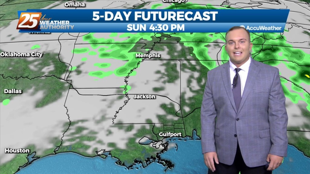
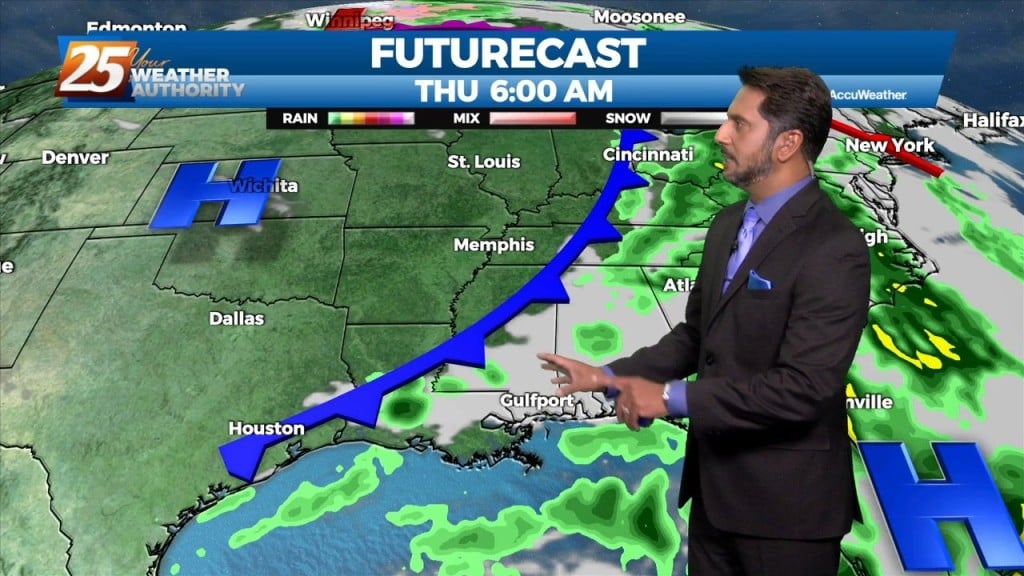
Changes area ahead as we get ready to close out this workweek. Basically one weather event for the long term forecast period, and that will be Friday…
After a lovely day with sunny skies and below seasonal temperatures...changes area ahead. An upper disturbance over the Inter-mountain West will continue to move eastward into West…
High pressure to our north is in control of our weather pattern today. Winds have become easterly in South Mississippi as transition of the pattern is underway. The upper disturbance over…

The next in a series of upper disturbances extended from the Canadian Prairie Provinces to near Salt Lake City to Baja California. This is beginning to turn…
The upper flow is expected to remain zonal across the area today and tonight before the Pacific Coast disturbance reaches the southern Rockies tomorrow. This will cause the upper…
High pressure will continue to bring in a colder drier air mass which will begin to modify Thursday afternoon/evening. The upper flow is expected to remain zonal…
After a bumpy start to the day, the front is now east of the area and skies will rapidly clear this evening. Dry weather is…
The main weather impacts for the local area come in Tuesday as an upper level disturbance digs south through the 4 Corners region will begin heading…
The bulk of the cold airmass has begun to slide east. High pressure to our north will continually move to its southeast which will provide for…
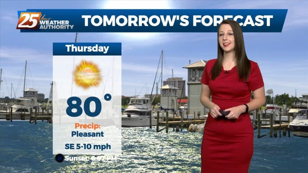
High pressure will continue to shape the forecast. It will provide a nice evening with southeast winds around 5 to 10 MPH becoming light and variable tonight.…

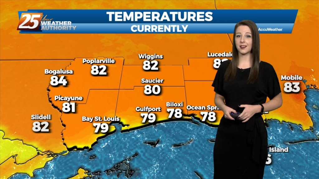
Temperatures have warmed quickly today under a dry airmass. It will get to around 80 degrees this afternoon with east winds shifting to southeast at 8 to 12…
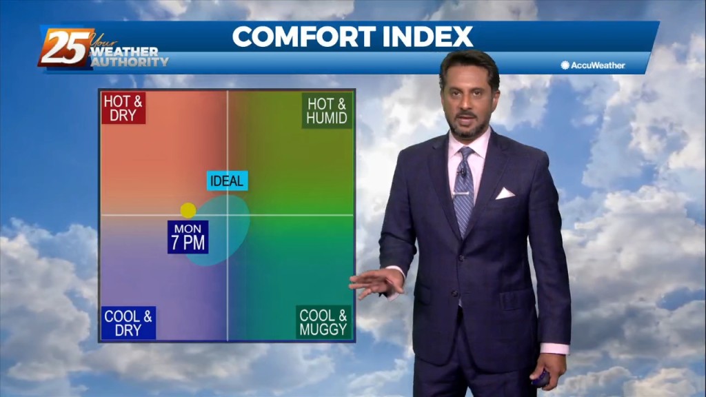
The pattern will moderate from the recent dry air pattern to a more humid flow through the day today. This morning, we will find clear skies…
After a beautiful day to start the workweek, high pressure to the north will begin to move to the east and the return flow will begin. Humidity…
High pressure to our north is in control of today’s weather and will remain in control most of tomorrow. It will be breezy at times with…
Dry high pressure will continue to control the area`s weather through the short term. Expect cool nights and warm afternoons with near to slightly below normal overnight…