8/27 - Payton's Sunday Night Forecast
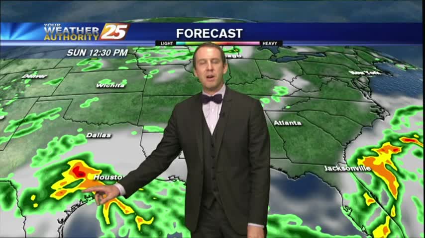
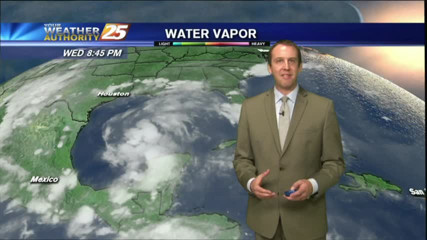
Harvey will continue to linger in Southern Texas, but eventually will start to move gradually off to the north and east.
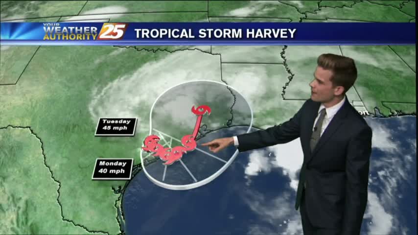
Harvey will continue to linger in Southern Texas, but eventually will start to move gradually off to the north and east.
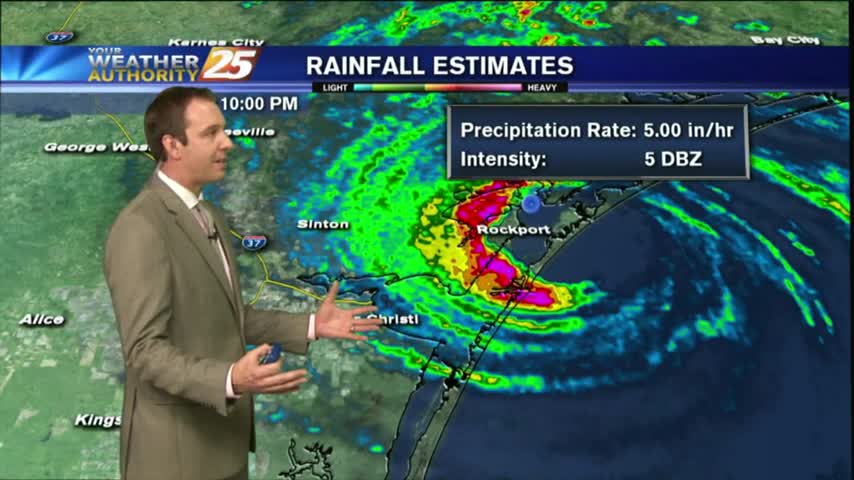
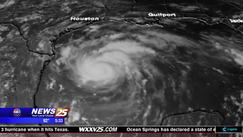
Category 4 Hurricane Harvey officially made landfall tonight, and is slowly roaring through the town of Rockport, TX. Click the forecast link for a full report, as well as local effects.
Mostly cloudy skies continue along the viewing area as an east wind is dominating the N'tern Gulf of Mexico...
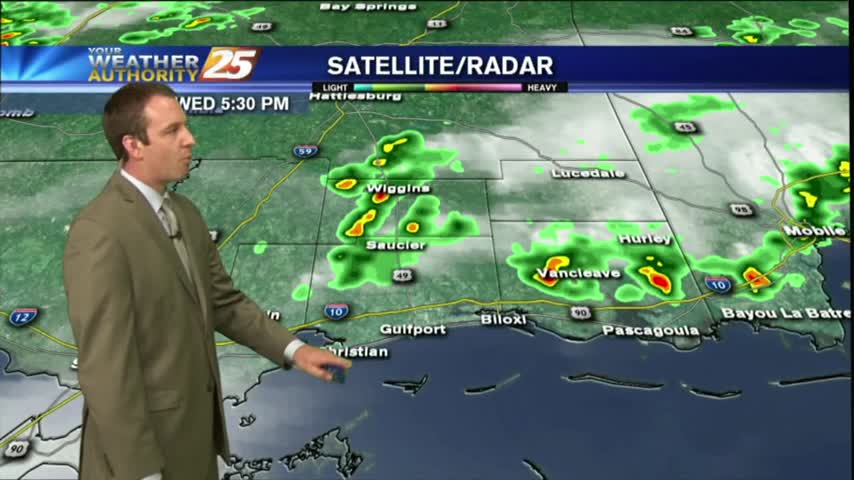
The local radar is fairly quiet this morning as most eyes are on Hurricane Harvey...
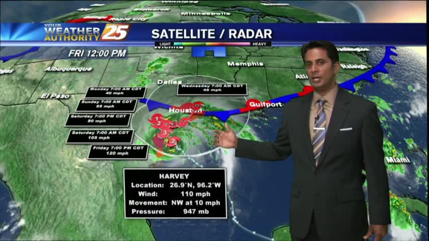
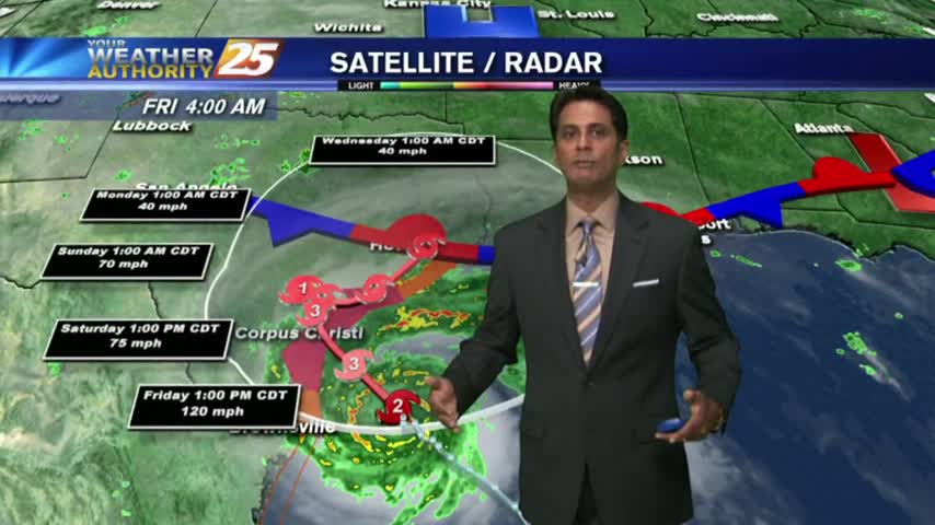
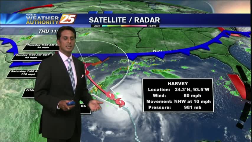
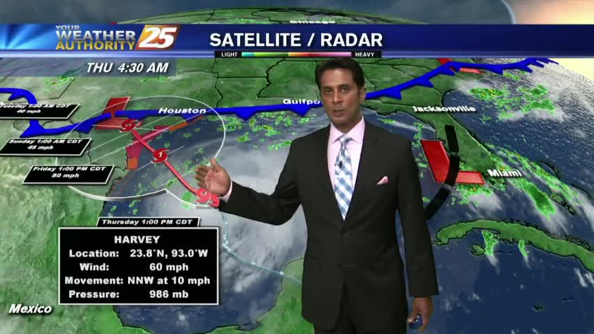
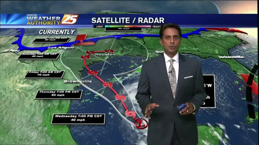
Harvey continues its rapid intensification, and will strike Southeastern TX overnight tomorrow. We'll see some enhanced rain locally, but you'll have to click the link for details.
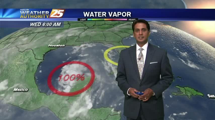
Evacuations are underway for parts of Texas as Hurricane Harvey turns in the Gulf of Mexico. While the tropical system is hundreds of miles away from South Mississippi, people are still preparing for effects of the storm. All eyes are…
Cloudy skies continue as a weak cold front overhead will go stationary...providing for isolated showers/t-storms this afternoon...
A mild start to the day as a weak cold front over head has the area under mostly cloudy skies...
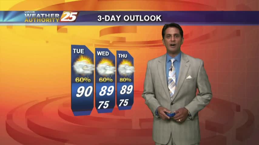
Rainfall totals will likely be high through the weekend, but some depends on tropical moisture from Harvey. We'll continue to hope for the best while preparing for the worst as we watch this developing situation. Details inside.
It was another hot & humid day with short-lived afternoon showers and thunderstorms. Expect more of the same as we approach the weekend, but heavy rains after. Details within.
Warming temperatures but still no showers/t-storms in the area...
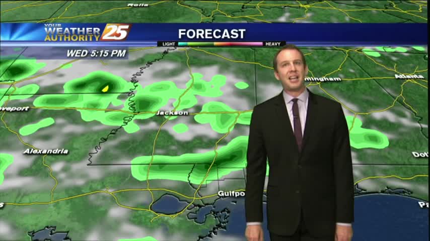
It's a warm and humid start to your "Hump Day", with isolated showers and t-storms moving into the area from the south...
Today ended up a drier, but cloudy day today and the skies have continued to clear through the night. Expect the rain to return quickly though; full forecast within.
We can now safely begin our post eclipse lives, and get right back to the normal forecast. Today was cloudy and dry, but heavy rains are ahead. Details within.

The best chances for showers and thunderstorms will remain in the morning over the waters and along the coast, and then chances move inland throughout the morning and afternoon hours.
A warm and humid start to the day as isolated rain moving in from the south is dissipating before hitting the coastline...

Today was one of the most "hyped" days in weather/science we've seen, and for many the eclipse didn't disappoint. Things get back to normal quickly, so click the link for the full forecast.
The solar eclipse of 2017 has come and gone, but left some neat things to look at! The moisture was on the return into the area today, along with a disturbance in the Gulf of Mexico, which is moving our…
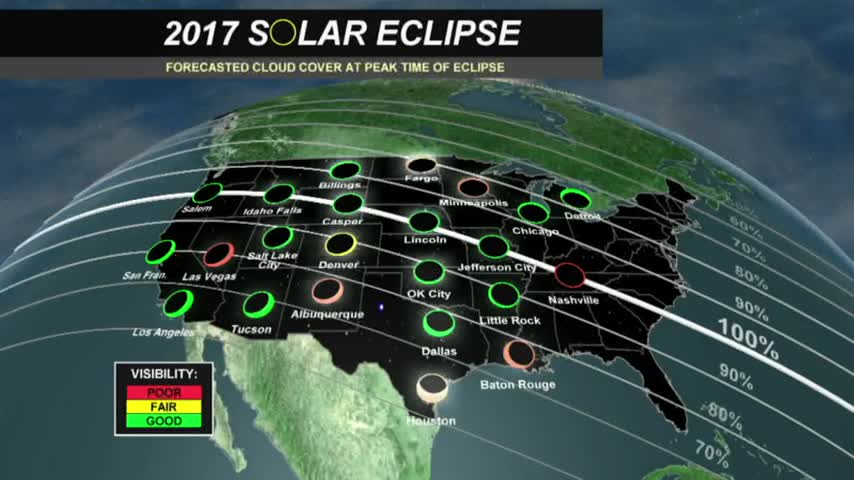
The eclipse will happen from noon until 3:00 pm, but the max eclipse will be at 1:31 pm. Remember to use special solar eclipse glasses to view the event.
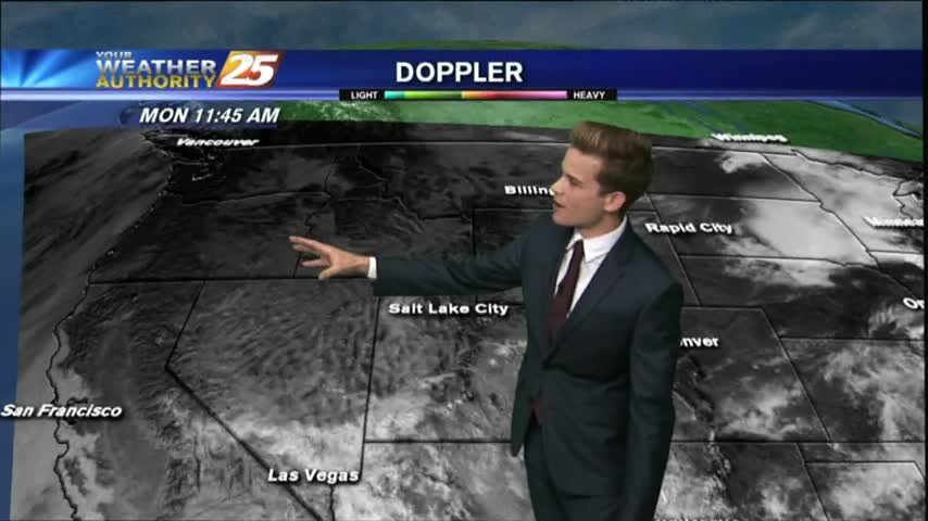
A warm start to the day/week with isolated showers moving into the area from the south...

Tomorrow is the big day across the United States! The solar eclipse will be at its max around 1:30 pm.

Another nice South MS day with afternoon showers and thunderstorms, but only the Eastern areas saw any rain. Expect many similar days ahead, full details inside.
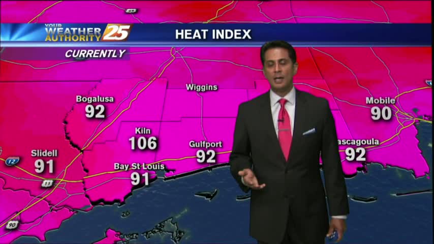
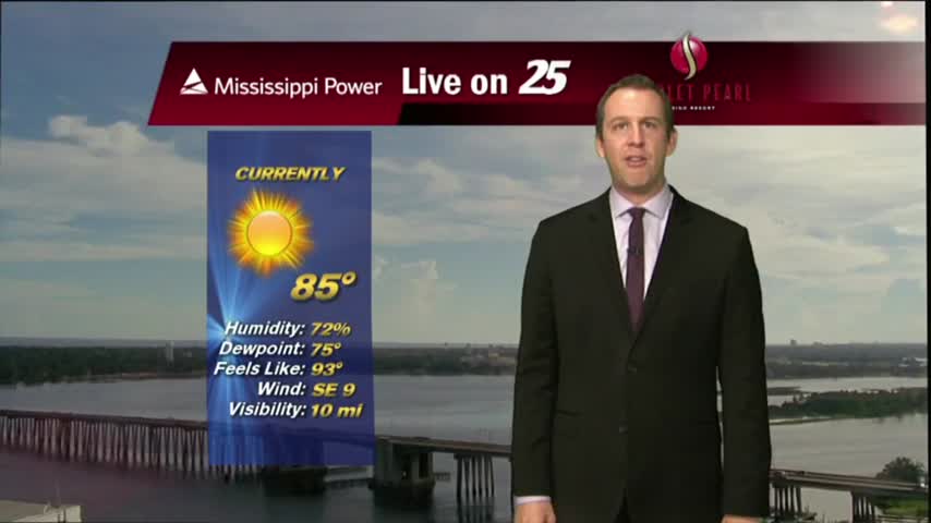
After a HUMID start to the day...warming temps has EXTREMELY HOT and HUMID under a few/partly cloudy skies on this Friday afternoon...
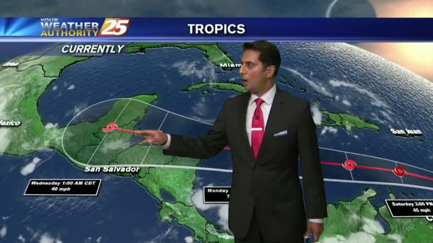
As the TROPICS continue to heat up, it's a warm/humid start to the day along the Gulf Coast with rain-free conditions...