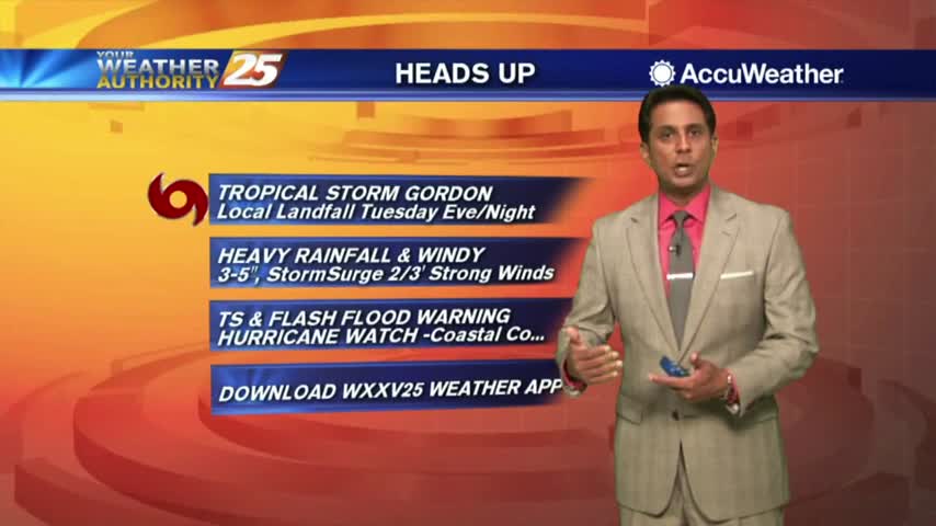
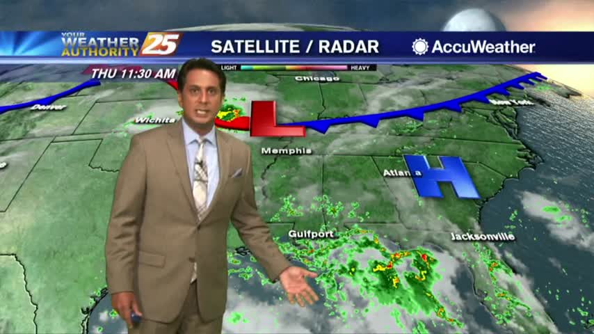
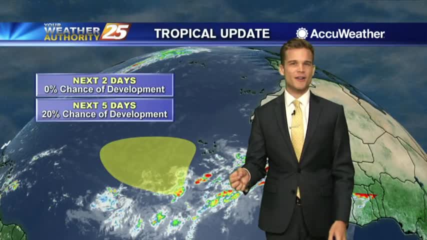
9/3 - Monday Evening Tropical Update
Latest on Tropical Storm Gordon
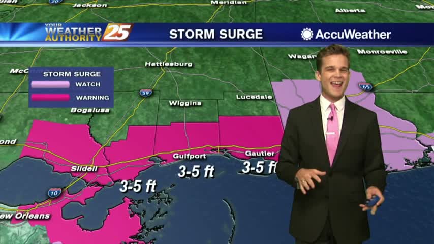
Latest on Tropical Storm Gordon
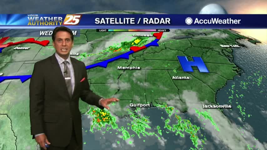
Showers and t-storms continue to move in and develop as we keep a watch on Tropical Storm Gordon...
An already wet start on this Labor Day morning as a TROPICAL STORM WATCH is in effect...
Tropical Storm Conditions Possible Tuesday into Wednesday.
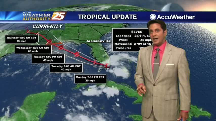
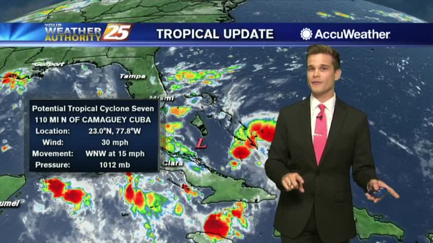
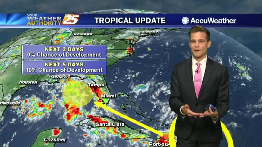
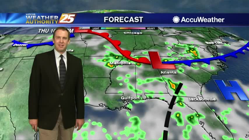
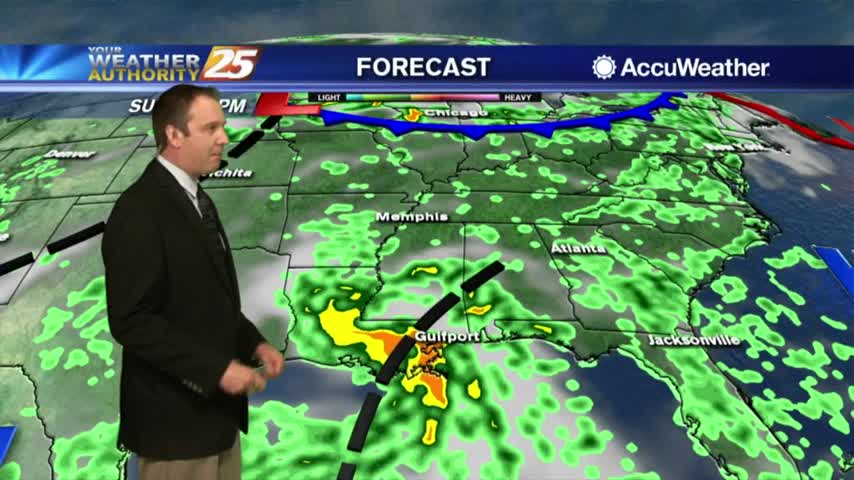
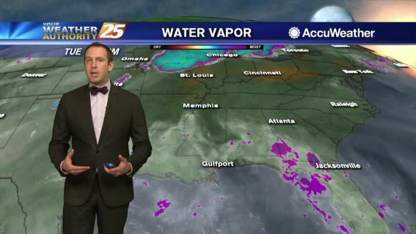
9/1 - Saturday Afternoon Tropical Update
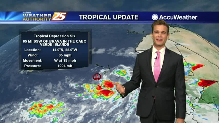
Rainy weekend, and the tropics continue to heat up.
A very wet weekend, and we're keeping close eye on the tropics.
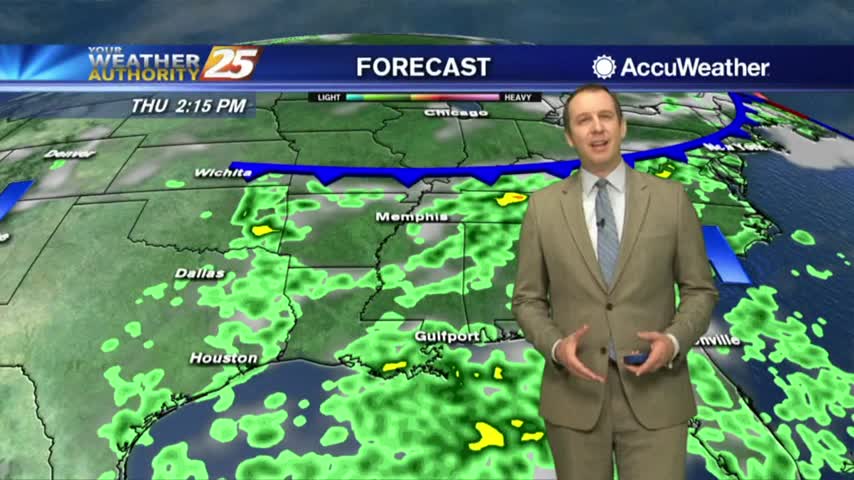
Rainfall has been moving in from the Gulf of Mexico, and it will continue...
Another humid start to the day with isolated showers south moving north into the coastal counties...
The rain thins out again for the nighttime hours, but we'll see more moving in again each afternoon through the weekend and into next week....
More showers moved in this afternoon and are already moving out for the evening, but will be right back....
We have only seen minimal activity thus far, but it will continue to develop this afternoon...

Activity tapered-of before midnight but a few showers are already moving in from the south...
The showers moved in during the afternoon and out for the evening, but will come right back for the next several days....
We're much better off today than we were on this day 13 years ago, but the rain will keep coming all week long....

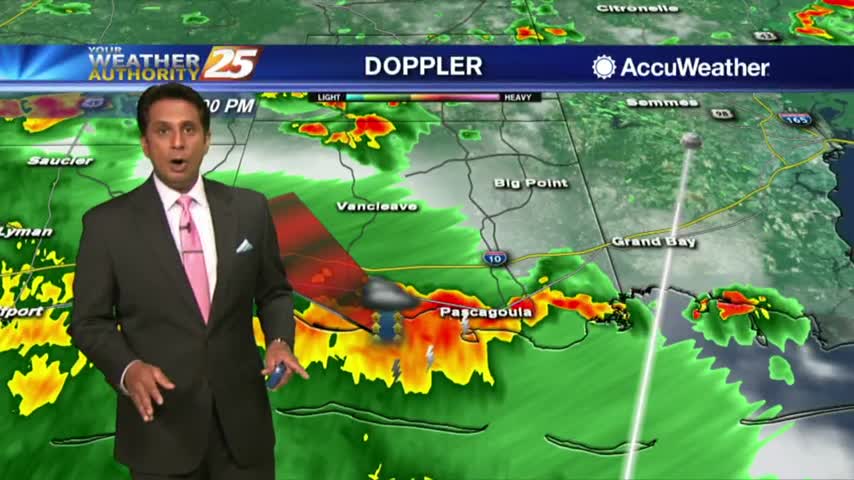
Early morning activity continues to plague the area with pockets of heavy rainfall...
HEAVY RAINFALL has already moved across the viewing area this morning, with more to come...
Expect the afternoon's showers to clear before the overnight hours, a trend we'll see continued all week long....
Scattered showers moved in this afternoon, and we'll see even more in the days ahead before things dry up....
Rain chances aren't going anywhere anytime soon.
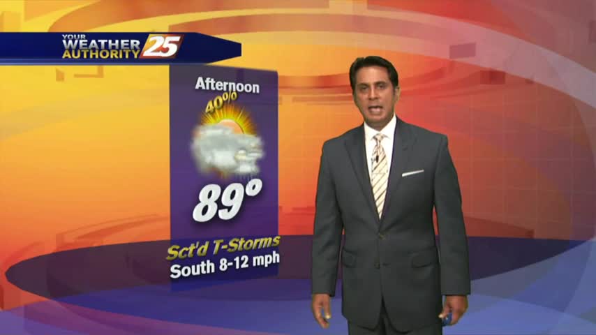
A humid start to the day with a few showers in the area and moving in from the GOM...
Rain will move in each afternoon and out each evening, so we'll see some every day this week....
We're starting off this week as rainy as expected, but it looks like the weekend will be a little drier....
Heat, humidity, Rain...no change in the forecast anytime soon.