01/07 Ryan's "Cold, Windy" Thursday Night Forecast
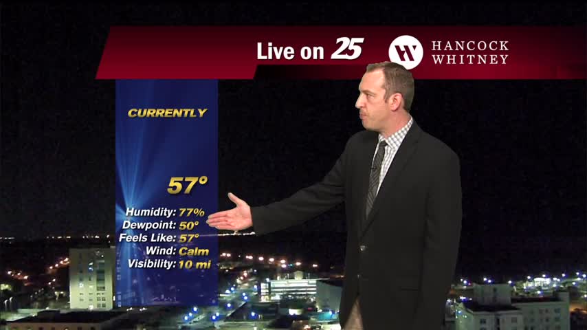
This morning's front is gone, but we'll be feeling the effects for days to come as it cools dramatically....
This morning's front is gone, but we'll be feeling the effects for days to come as it cools dramatically....
Our early morning weather was windy and wet as a front moved through, and now we're seeing that colder, drier air starting to take over....
Extensive cloud coverage will continue this afternoon and overnight along with windy conditions...
A cloudy and windy start to the day with the cold front now to the east of the area...
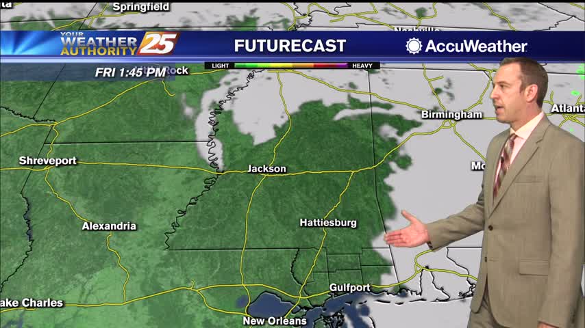
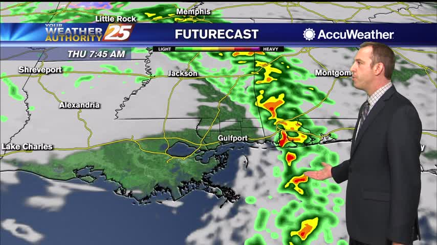
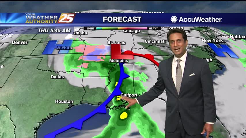
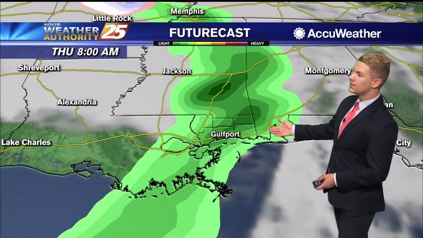
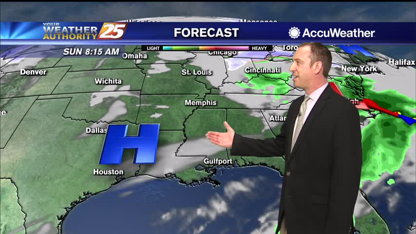
Rain will rapidly come to an end from west to the east by daybreak or shortly after for the entire forecast as low pressure tracks through north Louisiana bringing an associated cold front through the area this morning. Skies will…
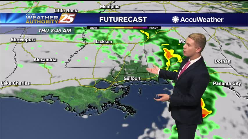
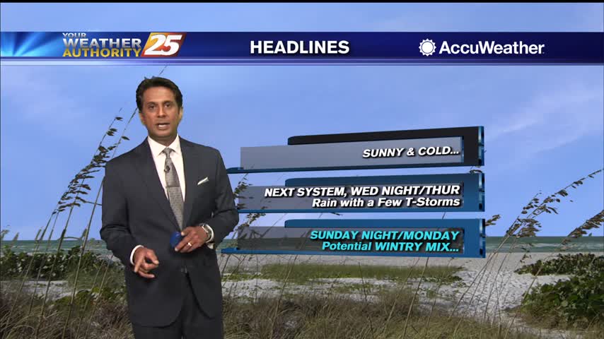
Our next front is closing in and active, potentially stormy weather will be moving in during the wee hours of the morning....
Cool temperatures this afternoon as upper-level clouds continue to move in from the west...
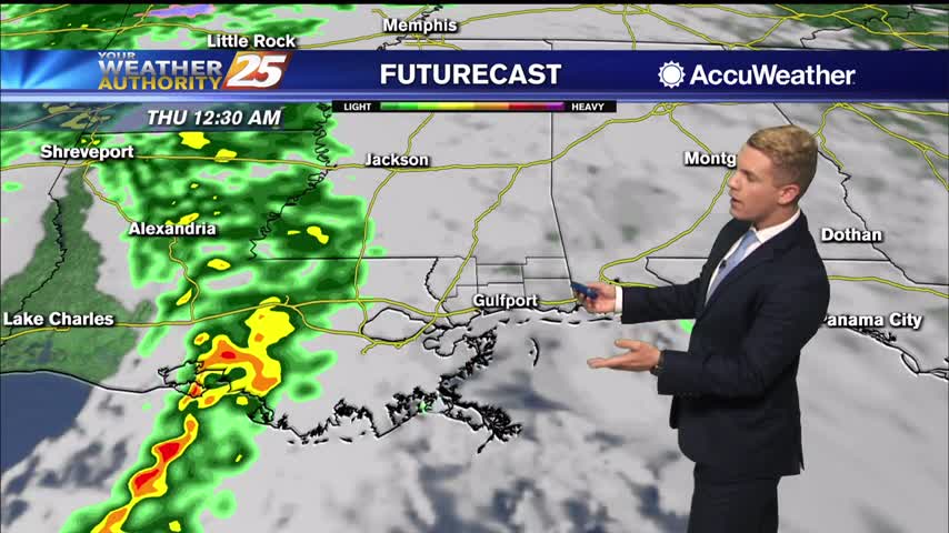
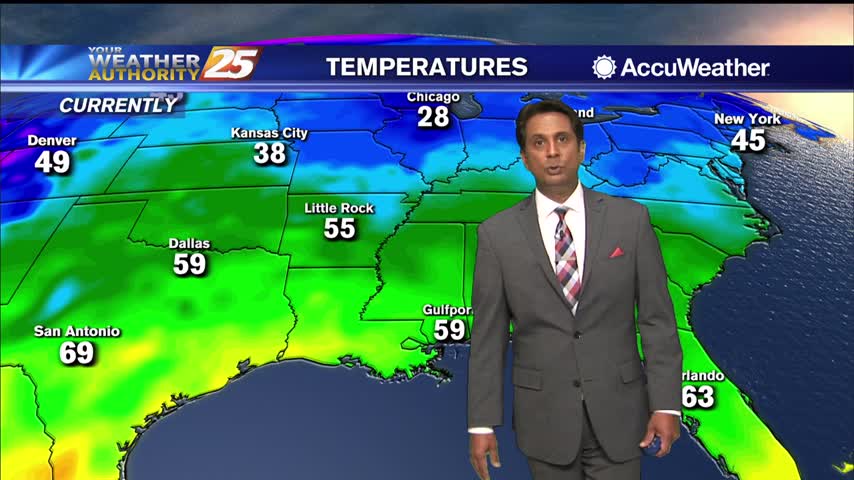
High pressure will move off to the east of the area by this afternoon. A low pressure system will dig through northeast Texas by this afternoon bringing a fast moving cold front into the Gulf Coast states. Numerous showers and…
Weak front last night cleared the skies, but clouds are moving right back in overnight as our next frontal system moves in.
A lovely early January afternoon ahead with sunshine and above seasonal temps...
A cool start to the day with pockets of DENSE FOG affecting your commute...
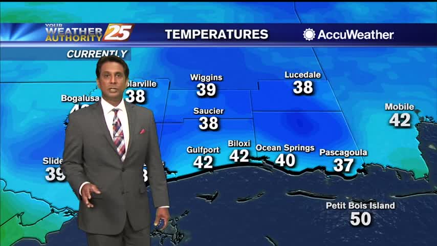
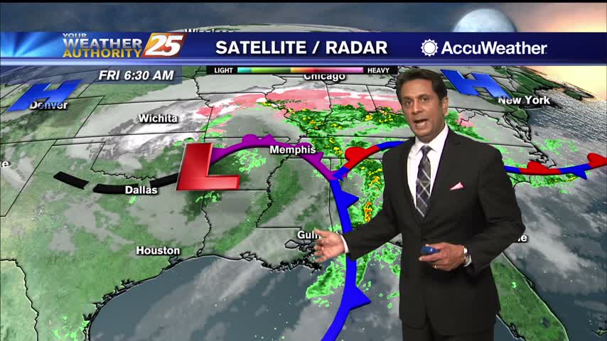
The cold front has moved through most of the area and in its wake, areas of dense fog have been noted west of I- 65. The areas of fog were quite visible on satellite imagery and matched up well with…
Going to have a few up and down days before more consistent cooling moves in after a front later this week.
A lovely afternoon ahead with sunshine and seasonal high temperatures...
A COLD start to the day/workweek with the warm-up beginning this afternoon...
High pressure will remain in place providing dry weather through Wednesday afternoon. Highs today and Tuesday will be 60 to 65, and lows tonight range from around 40 well inland to the mid 40s at the coast. Dry conditions will…
Another sunny day with little cloud cover, though still a bit on the cool side. Expect a slight warm-up before our next front later this week.
Last night's front came and went without any significant problems, and things are going to be pretty quiet for the next week or so....
The first forecast of 2021 calls for boring weather, which is just fine after 2020's stormy end....
A pleasant start to the new year with a couple of spotty showers in the area...
2020 was quite the year and came to a rainy, windy end as a front pushes through, but we'll begin next year with much more sunny weather...
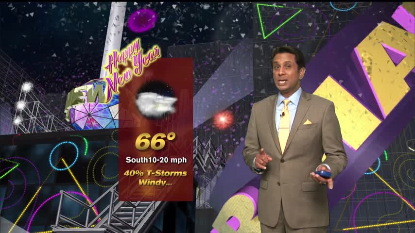
A warm and humid final afternoon of 2020 under partly cloudy skies...
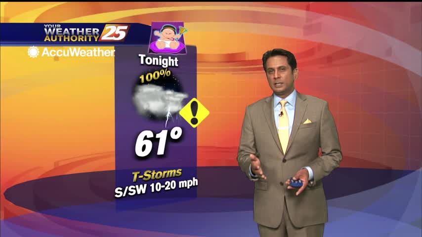
A warm start to this final day of the year with patchy fog and light rain moving in from the south...
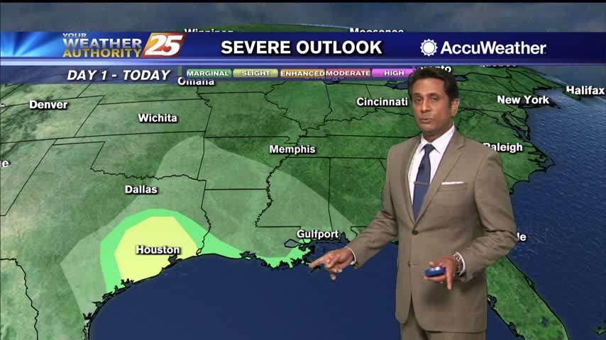
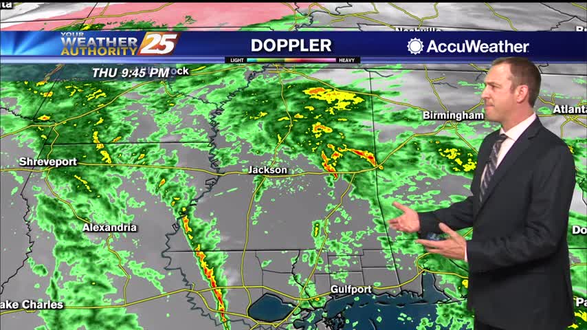
Not much will change tonight other than some increasing cloud cover, but stormy, potentially severe weather is expected tomorrow.