02/10 Ryan's "Low Visibility" Wednesday Night Forecast
End of this week will be quite wet, but much cooler, drier air lies ahead as well....
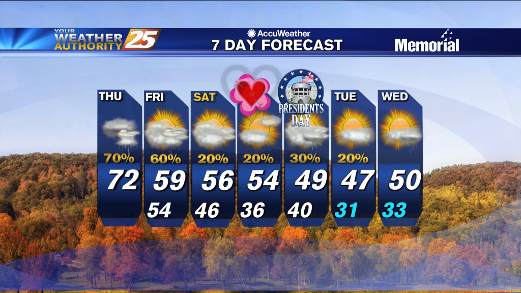
End of this week will be quite wet, but much cooler, drier air lies ahead as well....
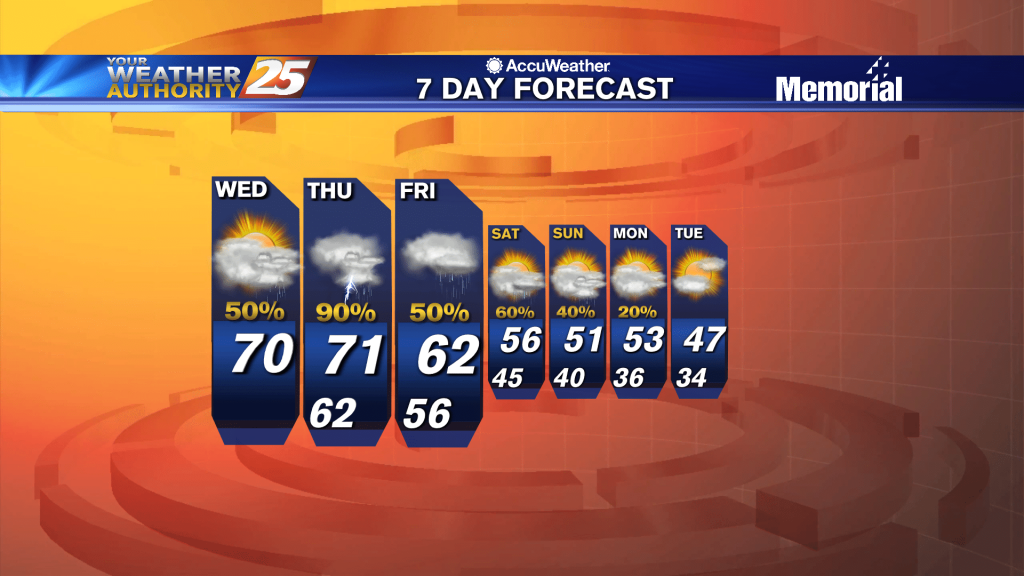
The area has already seen heavy rainfall this morning, with more to come this afternoon...
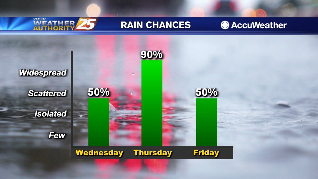
High pressure draped across Florida and portions of the Gulf of Mexico, with clockwise flow, is sending moisture from the northern Gulf into our region. This setup has been and will continue to produce muggy and warm conditions locally. Low-level…
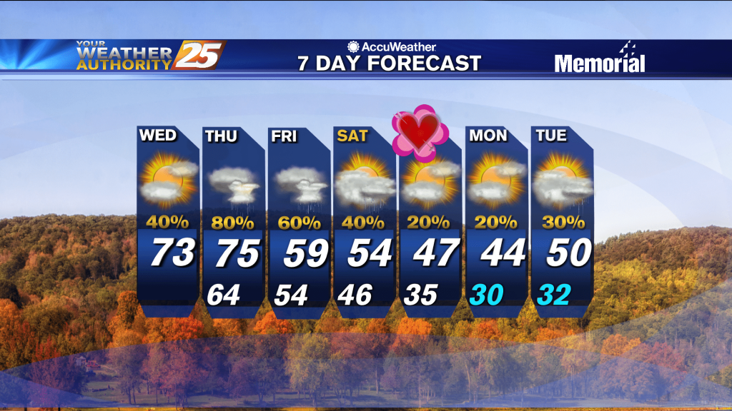
Another foggy night ahead with calm, humid conditions...and rain returns before long.
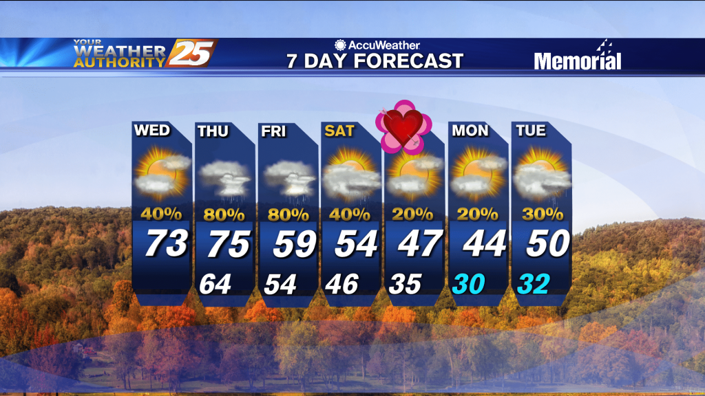
Only change from last night is even warmer and more humid air continues to flow in ahead of a series of fronts.
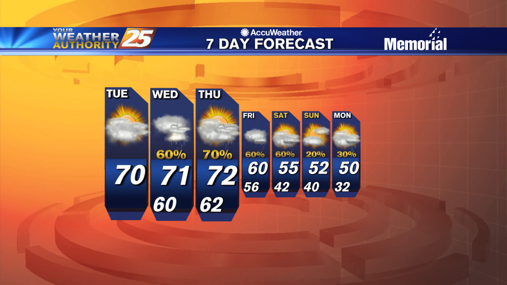
Rain has temporarily departed the area as temps climb into the 70s this afternoon...
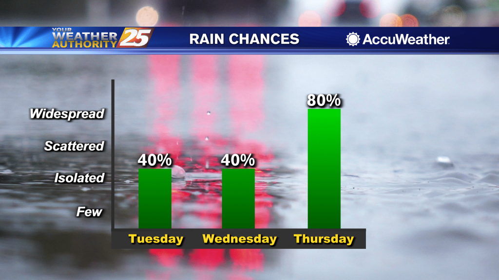
Showers and thunderstorms moved across the coast overnight. That rain has now come to an end, but we are still looking at that moisture lingering behind. It will be warm and humid today. Temperatures will top out at around 70°…
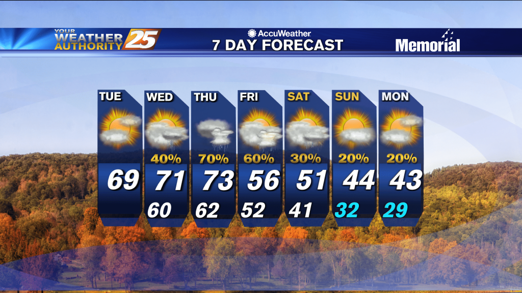
Going to be considerably warmer and more humid than the weekend was, and get ready for a big change by the start of next week!
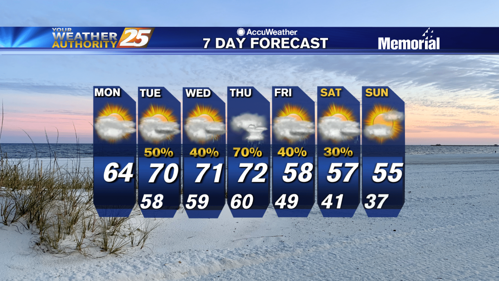
Highs today will likely climb into the mid to upper 60s and conditions will gradually become more humid. Partly cloudy skies are expected through the middle of the day, and then cloud cover starts to build once again moisture pushes…
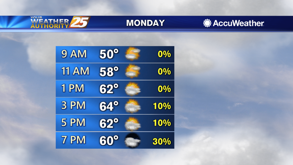
Dry and milder weather is expected for the start of the week, then moisture starts to flow back into the area Monday night into Tuesday. Today will be significantly warmer as southerly wind flow increases. Highs will likely climb into…
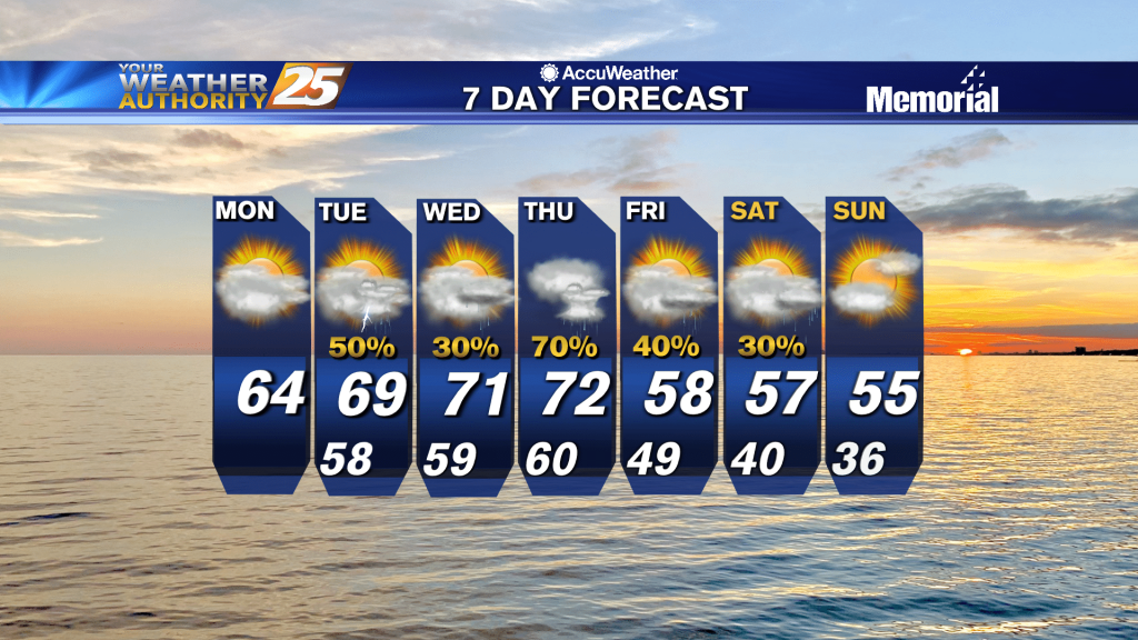
Clear weather and cooler air has moved over the area behind the cold front that came through yesterday. Dry and milder weather is expected for the start of the week, then moisture starts to flow back into the area Monday…
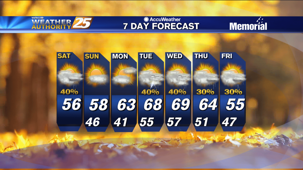
The weekend will start cloudy, but we'll see a bit more sun as we begin next week...just won't last long.
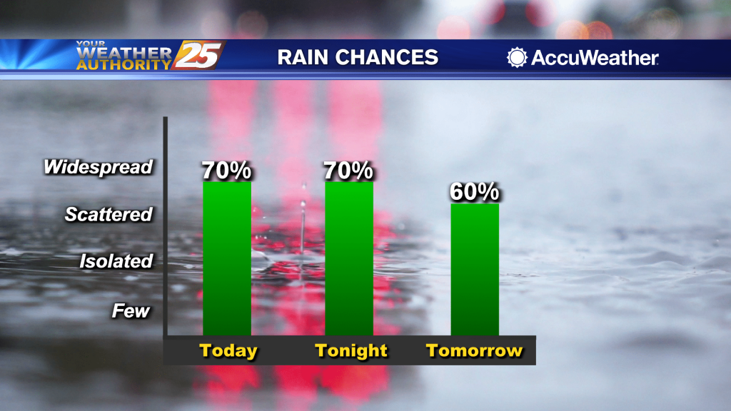
Rainfall is moving east across south Mississippi with pockets of fog...
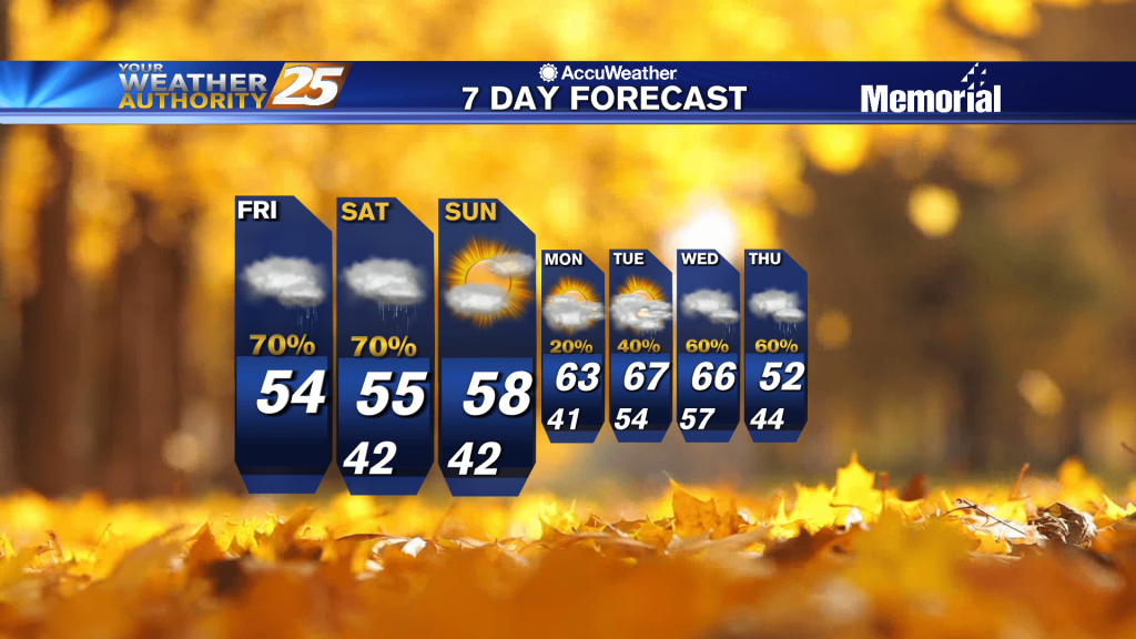
Rainfall is moving east across south Mississippi with pockets of fog...
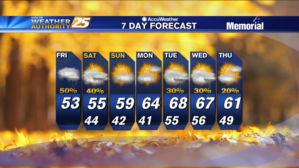
It was nice and sunny again today, but clouds have already begun to build in and rain arrives around midnight as a front closes in.
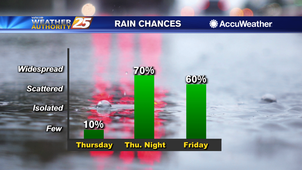
With a warmer, more damp air mass moving in throughout the day, temperatures will quickly rise into the middle to upper 60s for most locations, particularly across inland areas away from the water where there is a possibility we hit…
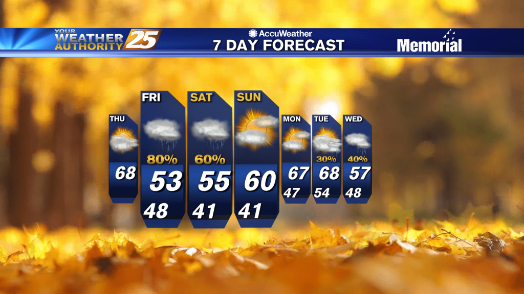
A warmer start to the day with spring-like conditions ahead...
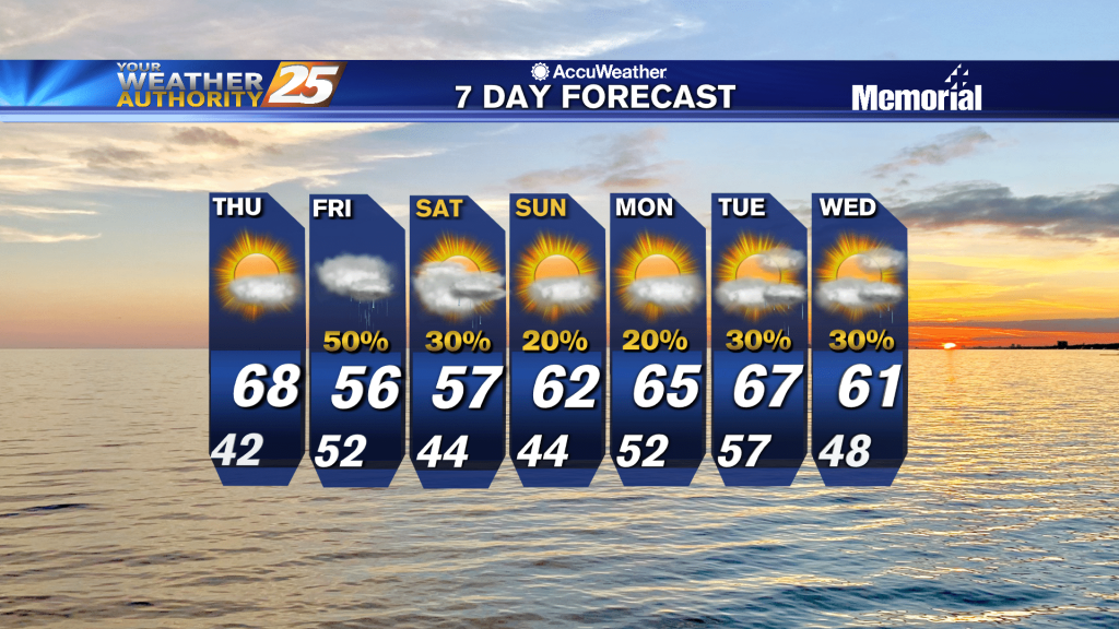
Temperatures and winds will be the main focus for the next day or two given the dry conditions preceding the front and any sensible weather impacts from the cold front limited to the short term period in the Thursday night…
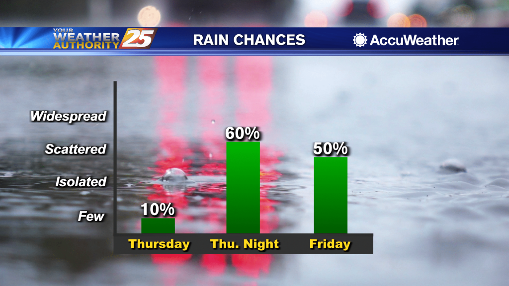
Temperatures and winds will be the main focus for the next day or two given the dry conditions preceding the front and any sensible weather impacts from the cold front limited to the short term period in the Thursday night…
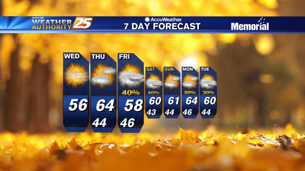
A beautiful sunny afternoon ahead as winds will switch to the south...
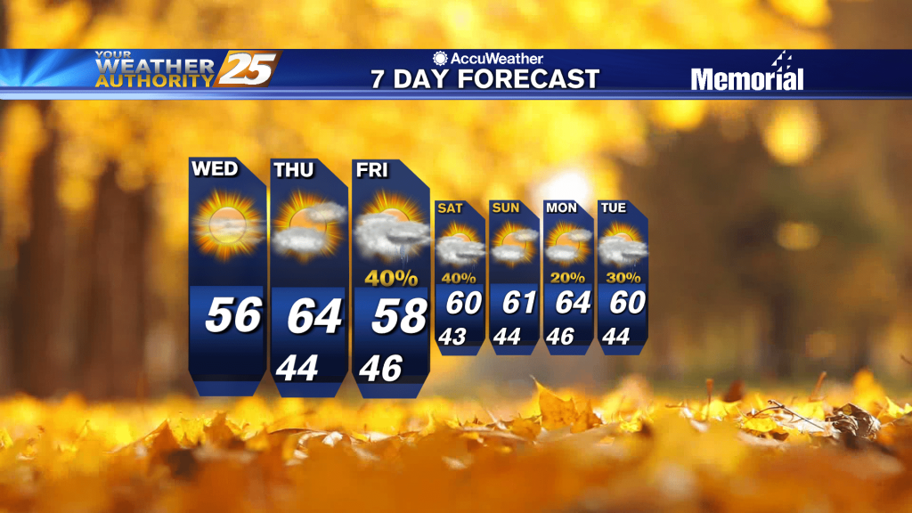
Another very cold start but the air mass will begin to modify later today...
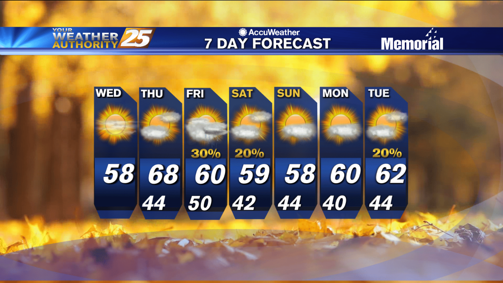
Expecting another cold night ahead and cool afternoon tomorrow, but things warm up quickly from there.
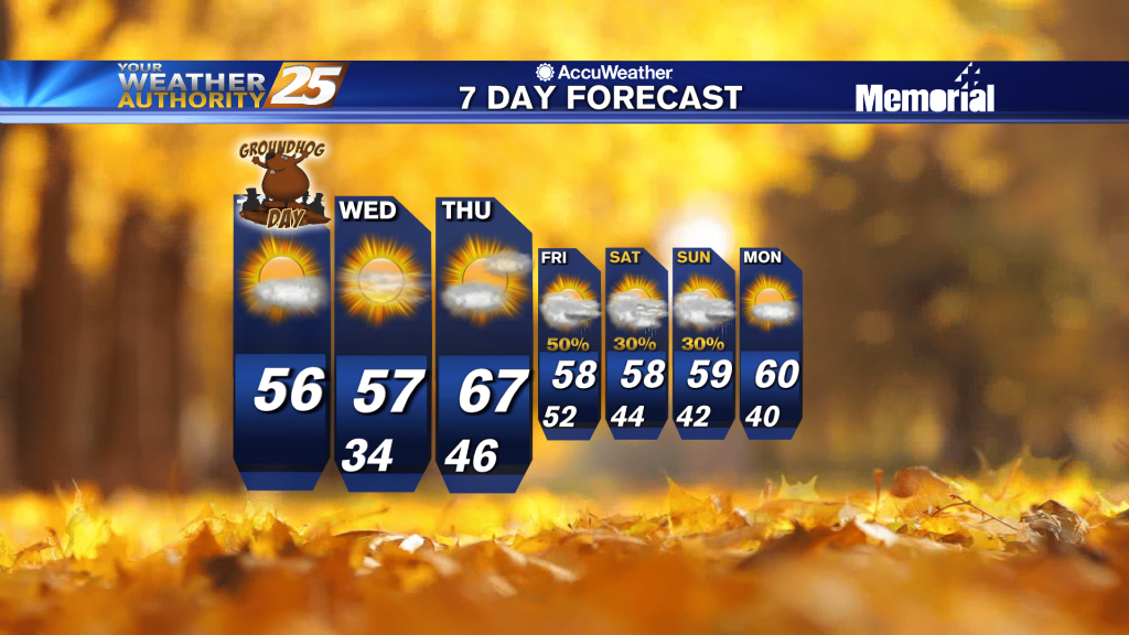
Upper level clouds continue to move out of the area with sunny skies ahead...
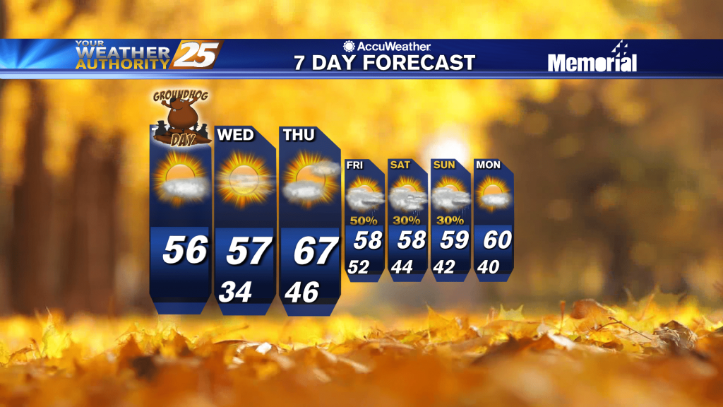
A very cold start to day day with light winds continuing from the NNW...