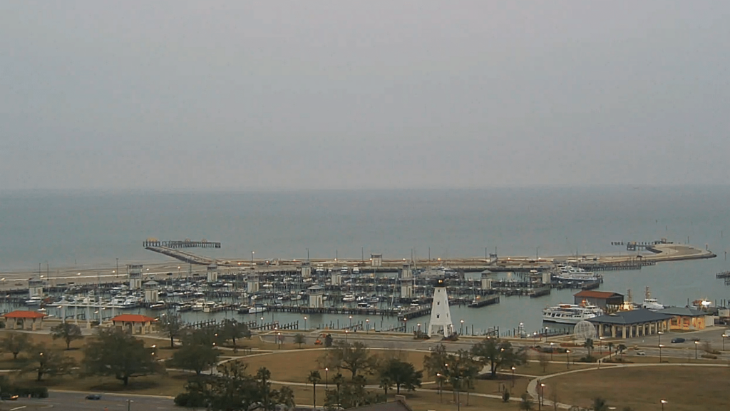
01/18 Ryan's "Warmer" Monday Evening Forecast
Warmer weather is on the way after a sunny, yet cold weekend. Expect a bit more rain though....
Warmer weather is on the way after a sunny, yet cold weekend. Expect a bit more rain though....
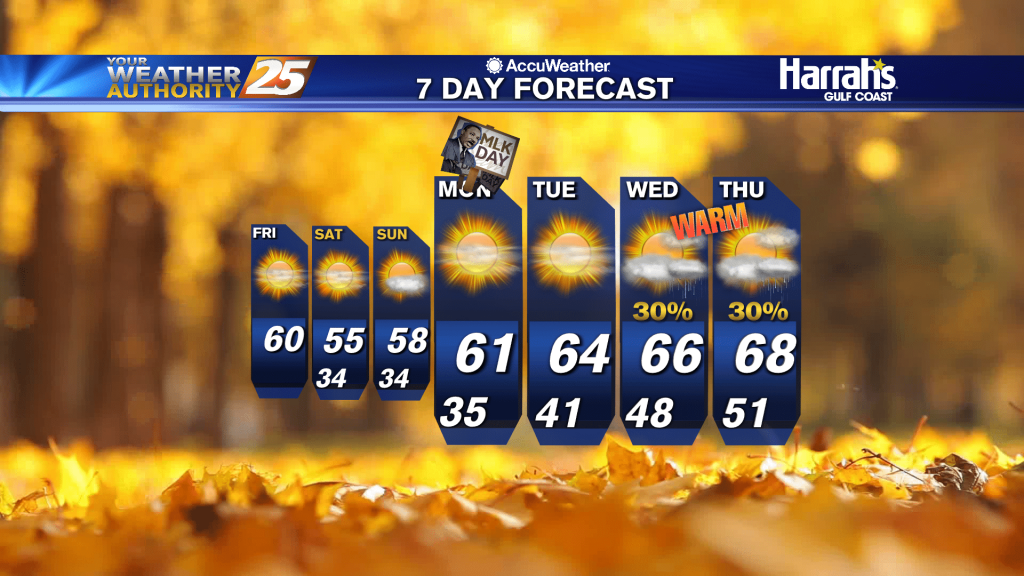
Sunshine with MUCH warmer temperatures ahead through the workweek...
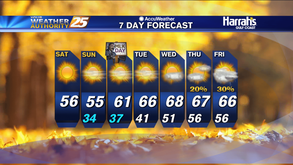
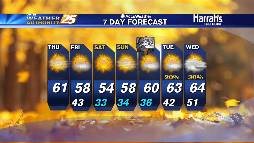
After a cool to cold night, pleasant afternoon temperatures can be expected today. High temperatures will then be a little bit warmer than what we saw on Sunday, topping out in the upper 50s to lower 60s. High pressure builds…
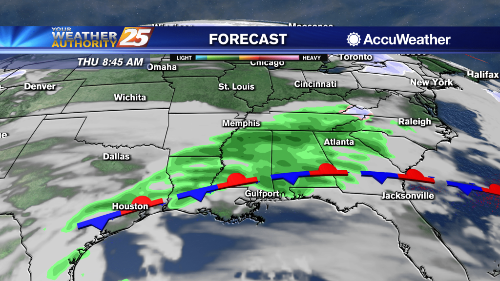
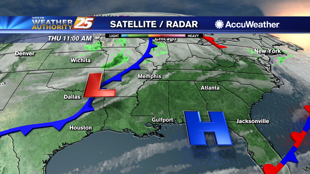
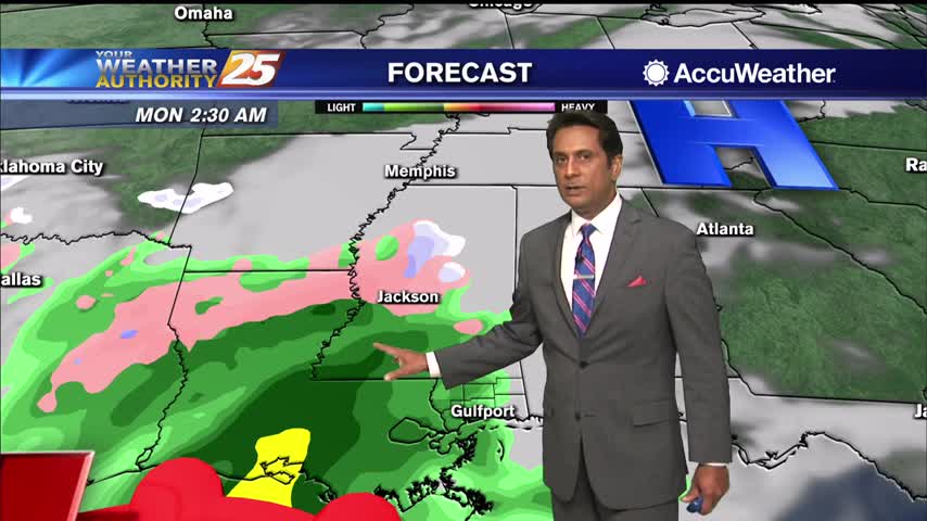
Dry conditions with no rain chances will be the main story through at least Monday. Clouds will decrease this evening with the passage of the cold front and clear skies are expected by late tonight into Monday morning. Lows tonight…
Last night's barely noticeable front didn't do much for the day, but much colder air is moving in for the weekend.
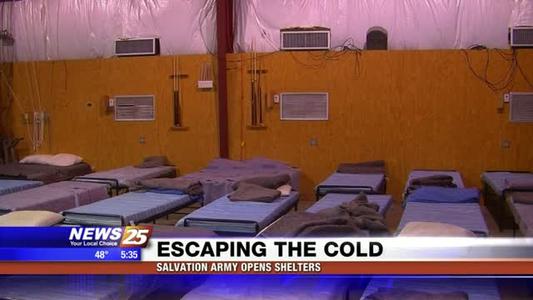
The Salvation Army Mississippi Gulf Coast Area Command is opening its cold weather shelter this weekend because of anticipated winter temperatures. The Salvation Army provides shelter to anyone in need when it is 40 degrees if precipitation is present, or…
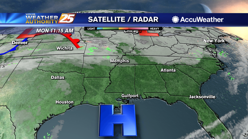
A much warmer start to the day with the cold front now to the east...
Hard to tell, but a front is moving through the area tonight and will bring colder, drier air into South MS once again.
A lovely sunny afternoon with warmer temperatures...

A pleasant day is in store today with warmer air being pushed into the region by southwesterly winds ahead of our next cold front, which is expected to move across the Lower Mississippi River Valley later today. The result is…
Finally a nice warming trend moving in, but it isn't going to stick around long before more nights near freezing move in.
It's finally warming up a bit, but we'll see more chilly nights and cool days ahead.
A beautiful sunny afternoon with cool temperatures...

Today’s highs look to remain on the cool side with upper 40s/lower 50s interior to the lower half of the 50s for coastal sections. If clouds hold in longer than expected today, then a lower adjustment to highs will be…

Another small chance of a wintry mix tonight, but much more consistently sunny weather is on the way...it just won't be any warmer.
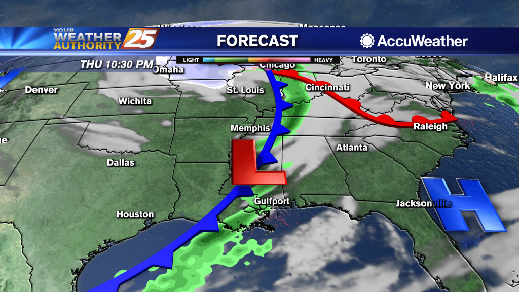
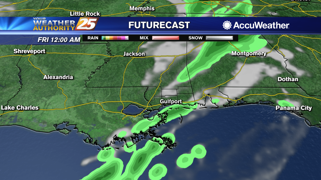
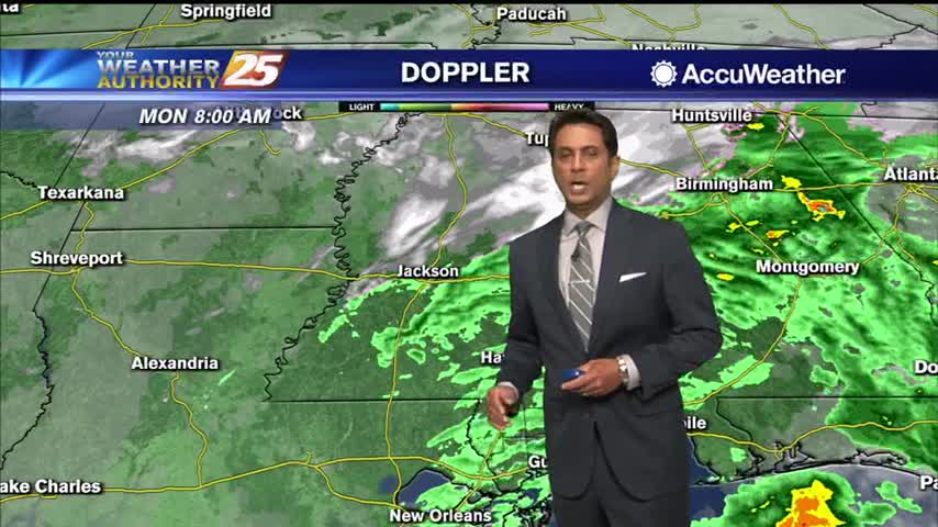
A low cloud deck is holding firm this morning across the Southeast stretching out over the northern Gulf. Clearing skies forecast going into the afternoon, but some clouds will return tonight as a weak system pushes across the area. The…
Wintry weather didn't quite make it to South MS, but it was wet and exceptionally cold with little change expected in the days ahead temperature-wise....
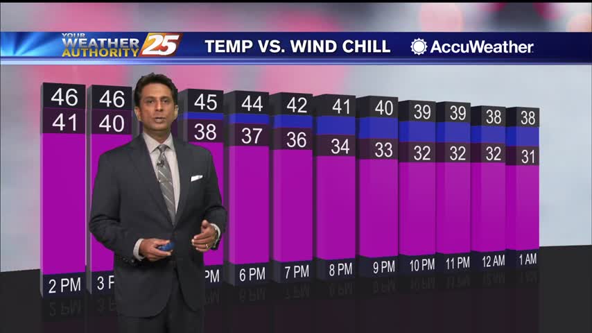
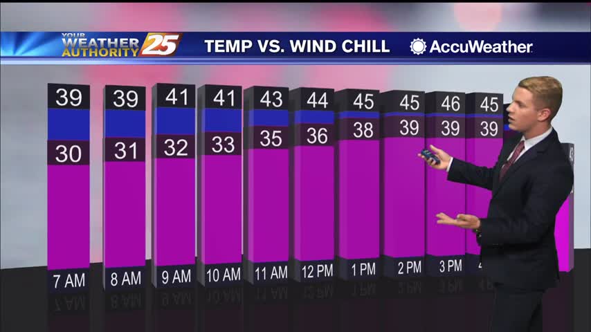
A cloudy afternoon as the wind chill will be in the upper 30s...
A cold and wet start to the day as the rain/snow line is well north of the area...
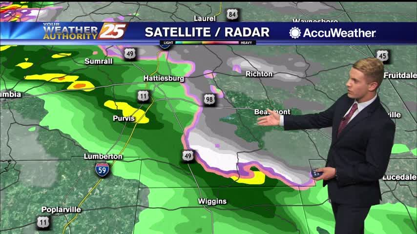
Today expect on and off rain with cold temperatures and windy conditions as a low pressure system continues to slide eastward across the Gulf Coast. The rain is expected to continue across the forecast area as it spreads from west…
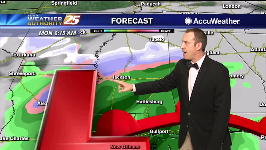
There is a very low chance for a possible wintry mix over the northern portion of the WXXV viewing area from late tonight into early Monday morning. Otherwise, expect a very cold on and off rain as a low pressure…
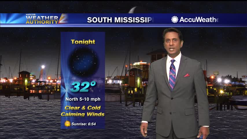
Absolutely frigid night ahead with little warmth for the rest of the week, including the possibility of early morning wintry weather to start next week.
Clearings skies will begin this afternoon as below seasonal temperatures continue...
A cold start as cloud coverage continues trough much of the region...