5/17 - The Chief's "More Afternoon T-Storms" Wednesday Morning Forecast
Surface warming will once again commence bringing us to convective temperatures in the upper 80s by noon, however, more abundant high clouds may just keep us…
Surface warming will once again commence bringing us to convective temperatures in the upper 80s by noon, however, more abundant high clouds may just keep us…
High pressure is centered pretty much over our area as the disturbance that brought the heavy rainfall to portions of the area yesterday, is well…
A weak upper disturbance will move across the region later this morning with the actual cold front pushing through in the evening. Showers and a few…
Today we will see the moisture axis that is currently draped north to south over southeastern Louisiana almost stall out and continue to sit over the area as…
Surface high pressure that has been dominating the area will begin to shift off to the east today as an upper level disturbance extends down into our…
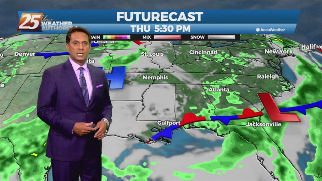
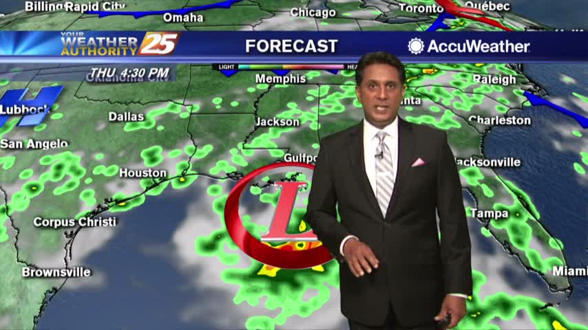
Rapidly changing weather conditions will be the rule over the next 24 hours, with the threat of severe weather and heavy rainfall continuing to be a…
Today and Thursday, the normal summertime pattern will dominate the area. Southerly surface winds will help to advect warm air and moisture into the area, which will ultimately help with lifting in the environment. As a result, the rainfall will…
Early this morning, what is left of a weak stationary front remains draped across our area. The front is now south of the area making a transition to a stationary front. This will bring a drier air mass into the…

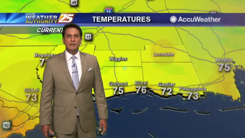
A CHILLY start to the day as strong high-pressure moves in from the NW...
A very pleasant start to the day with warm temperatures and low humidity...
A wet start depending on your location as t-storms continue to move in from the south...

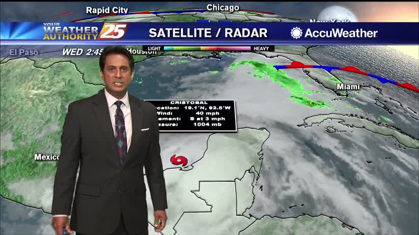
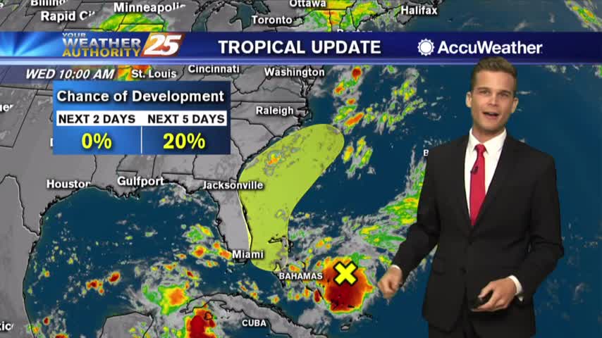
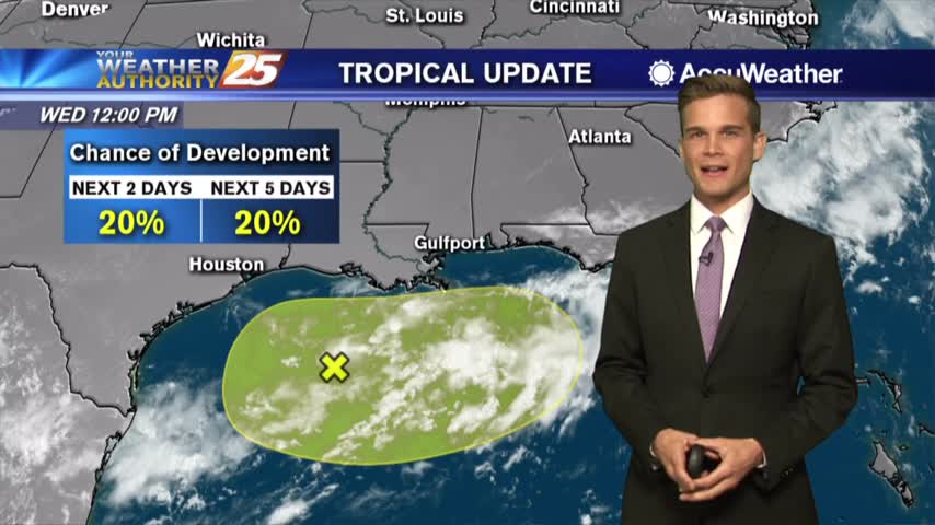
Tropical development is possible in the Gulf of Mexico later this week.
No big changes in today's forecast, but heavy rain is possible by this weekend.
Hot and dry pattern continues

Drier Thursday and Friday and the latest on Tropical Storm Dorian

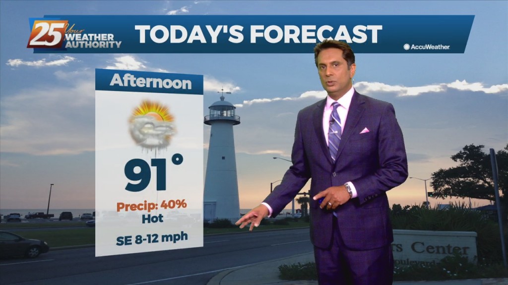
Today will be hot and humid with showers and t-storms possible.
We're watching the potential for heavy rain all the way into the weekend
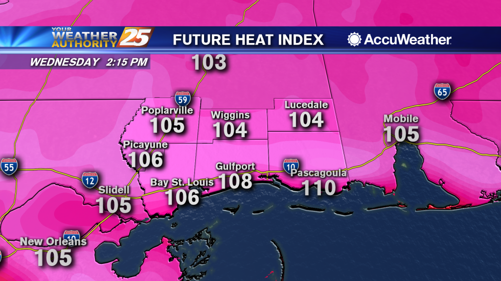
Heat index values over 105 possible this afternoon and into the weekend

Another hot and humid one with a few t-storms this afternoon.
A perfect day! Won't last for long though and we're keeping an eye on the tropics.
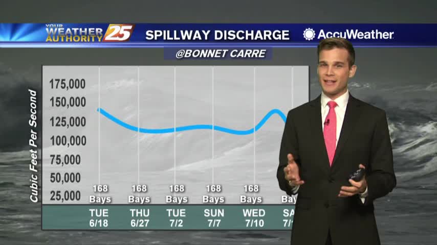
Heat index values over 100 and low rain chances...and an update on the Bonnet Carre Spillway
The heat will be with us for several days and heat index values will rise to around 105 each day.

The latest on the potential for tropical impacts.
The latest on the potential for tropical impacts in South Mississippi