01/01/26 Ryan's "Warming Trend" Thursday Forecast
A cold front passed through to start things off this week, leading to a few frigid days before we started a warming trend yesterday. That lead to a still…
A cold front passed through to start things off this week, leading to a few frigid days before we started a warming trend yesterday. That lead to a still…
A weak cold front on Monday brought some slightly cooler weather for yesterday and this morning, but we're kicking off a quick warming trend later today! That'll get highs…
Chilly Start for us but nothing new as we've had these kind of starts last week. Our Morning low was down to 34 for…
Drier air in the low levels is associated with a fairly strong surface high pressure centered over the region. Temperatures will also continue to run slightly below average…
An area of upper level high-pressure extends from western Mexico northward through the Rockies. At the surface, high pressure extended from New England to the Louisiana…
Very nice comfortable/dry conditions ahead today as highs top out in the mid-60s for most. Cool tonight, but no freezing temps expected. The nice continues into…
The upper level pattern is transitioning just slightly with a weak disturbance moving into the central Gulf States today. The best uptick in cloud…
It’s another cool or coldish morning across the forecast area as the air mass has been slowly modifying. In the upper levels, an area of high…
This afternoon will bring warmer temperatures but only by a few degrees. Aloft, the upper levels will begin to shift to a more zonal pattern through the day…
High pressure yesterday just west of Shreveport/Bossier City La has shifted to our NE. This will innate the return flow from the Gulf of Mexico. Warmer…
There really isn’t a whole lot of material for discussion in the package as we’re in a period of benign weather. Upper level northwest flow on…
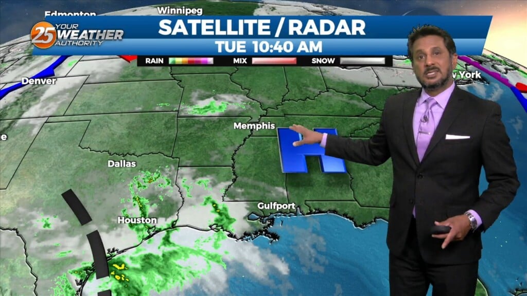
A weak disturbance moving across Louisiana will move across the local area late this afternoon and tonight. Considering the dry airmass, I don’t anticipate any precipitation,…
The upper troughs are located north of the Great Lakes and off the British Columbia coast this morning with high pressure over the center of the…
A the moisture returns and temps getting into the 50s and 60s along with dew point temps, we will need to turn to those variables that…
Surface high pressure will continue to shift eastward with onshore winds bringing more humid air into the area from the Gulf of Mexico. Warming trend will continue into Wednesday…
The return flow will become more established today and remain that way through the short term. This will help add to the warming trend over…
Surface high pressure and an upper level ridge are sliding to the east primarily bringing a shift in wind direction through southeasterly and ending up southerly and…
Surface high pressure and an upper level ridge are sliding to the east primarily bringing a shift in wind direction through southeasterly and ending up southerly and around 10…
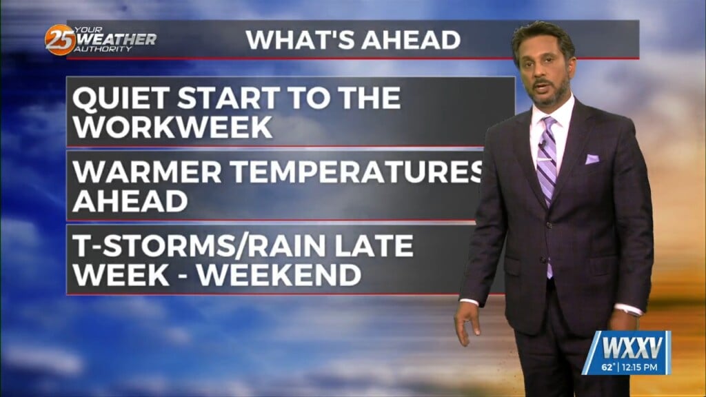
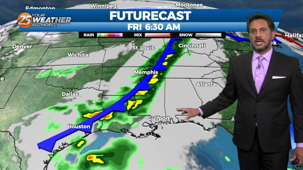
Warm and moist air will stick around until Thursday after the main cold front moves through. This will keep us warmer than average tomorrow and Thursday ahead…
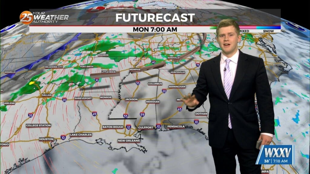
A cold front moves through Thursday and should enter the area around 9am and out of the area around 4pm. Instability and shear values are at the lower…
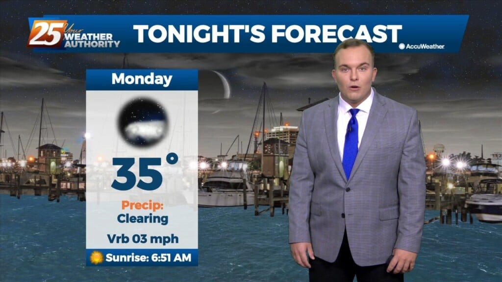
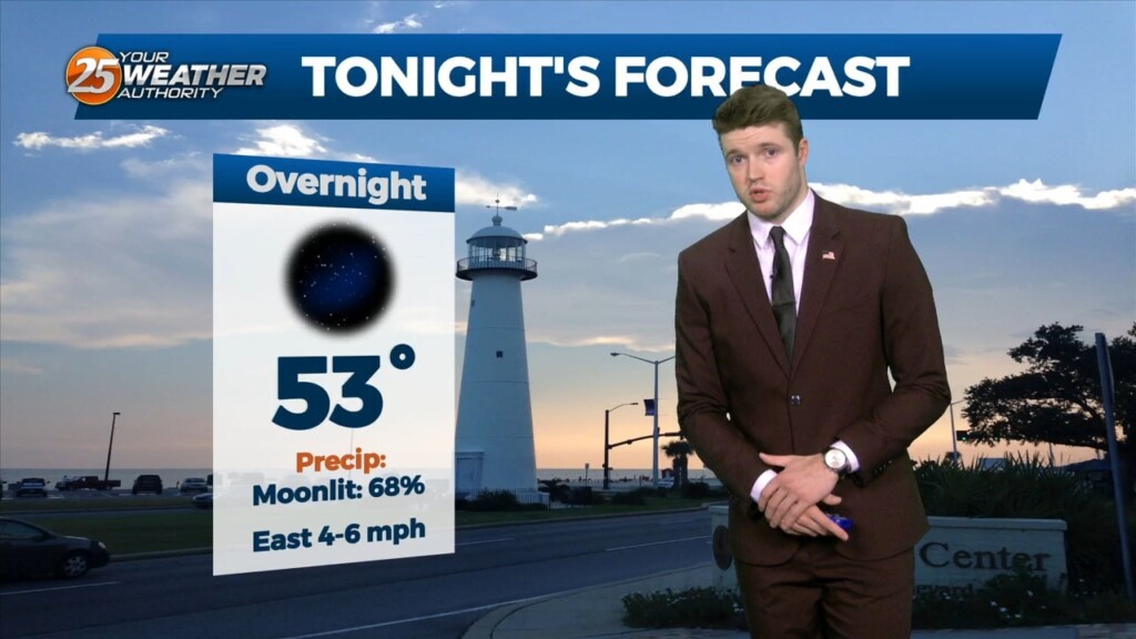
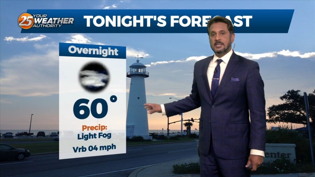
Temperatures are cold, but widespread freezing conditions are not on the table tonight. Clouds will be in the area thanks to a cold front that has made its…
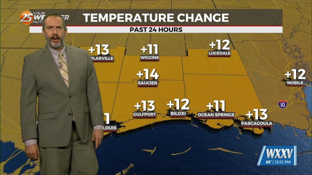
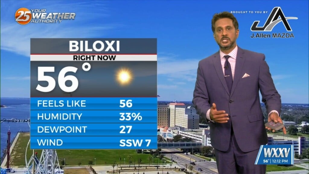
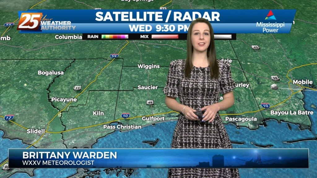
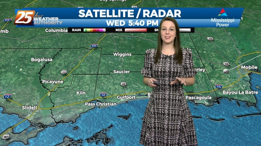
The warm-up is starting to take effect across our area. High temperatures managed to reach the 50s earlier today across South Mississippi. We will see cloud coverage…
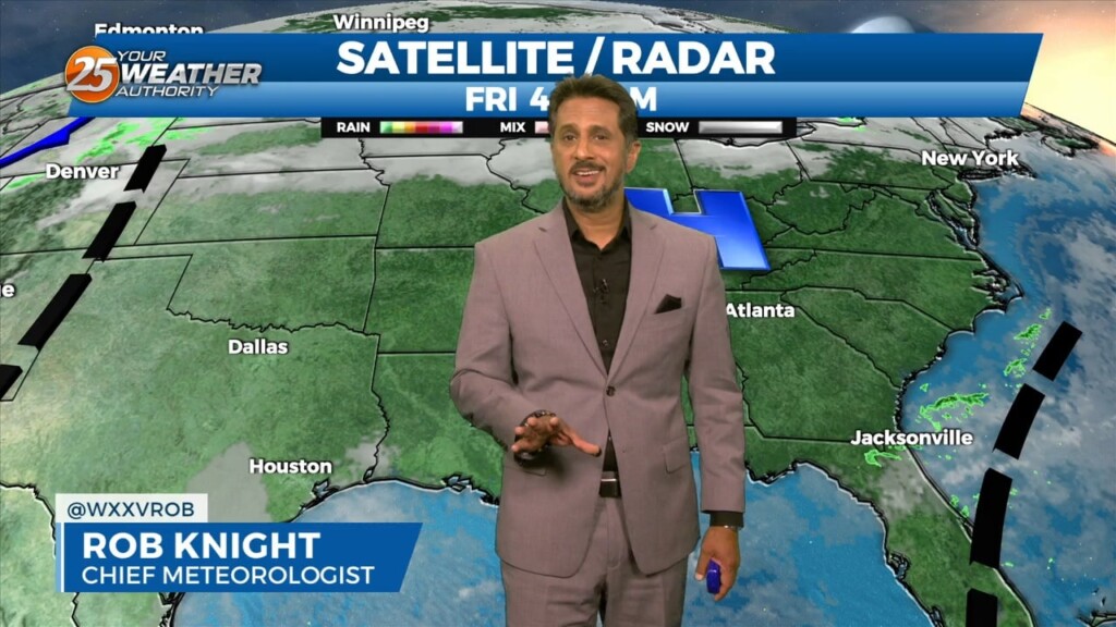
While the main upper level disturbance is moving off the East Coast, another minor feature is diving down the west side of the trough over…
A hard freeze is in store for many of us yet again. Plants, pets, people, and pipes need to be protected with inland temperatures in the 20s.…