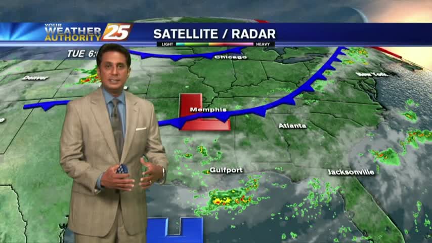
9/25 - Payton's Tuesday Afternoon Forecast
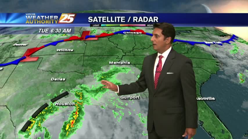
Cold front on the way along with greater rain chances.
Cold front on the way along with greater rain chances.
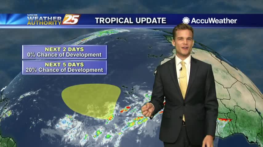
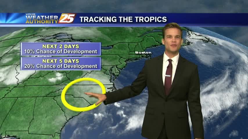
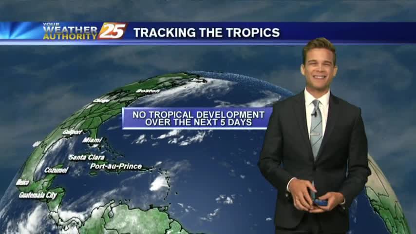
Hot here and the tropics finally calm down
We continue with typical summertime weather here in South Mississippi
Rain chances aren't going anywhere anytime soon.
The cold front is nearly here, and that means drier weather!
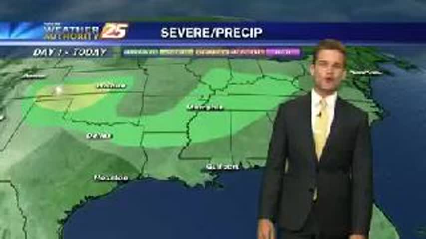
After a dry start to the week, a wetter pattern will start to setup.
A wet day is expected, and it will continue into Wednesday.
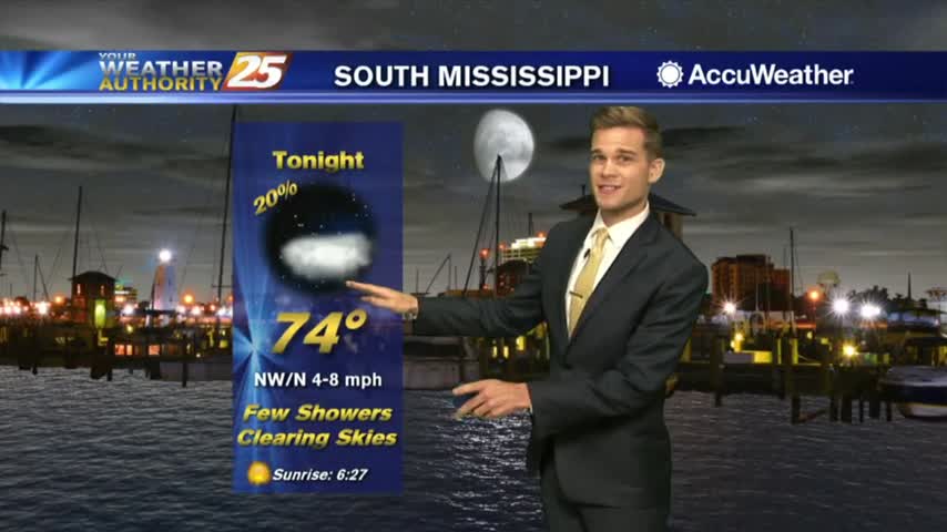
Less humidity, and it feels quite nice outside for summertime standards.
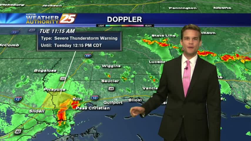
More heavy rain this afternoon, which could mean flash flooding.
After HEAVY RAINFALL yesterday, we are under mostly cloudy skies with another round of potentially heavy rain to come...
More showers and thunderstorms today, but rain chances decrease a little for July 4th.
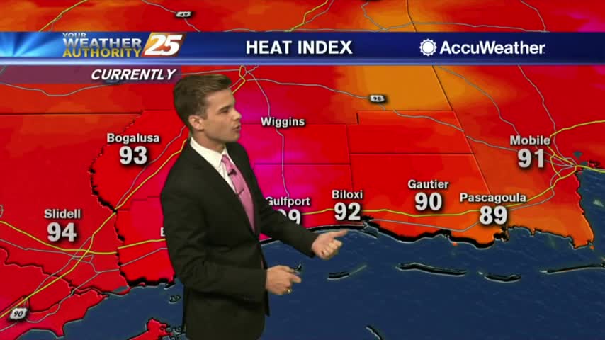
Heat Advisory just to the north, but we'll still be plenty hot on the coast.
Hot and humid again, and the first day of Summer is just days away.
A tropical wave has moved ashore E'tern Texas with warm & humid conditions along S. Mississippi...
Showers and thunderstorms going up, and the tropics are heating up.

The heavy showers and thunderstorms have moved out of the area, but more are on the way.
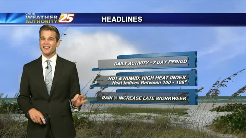
Heat and humidity will be the story as we head into this week.

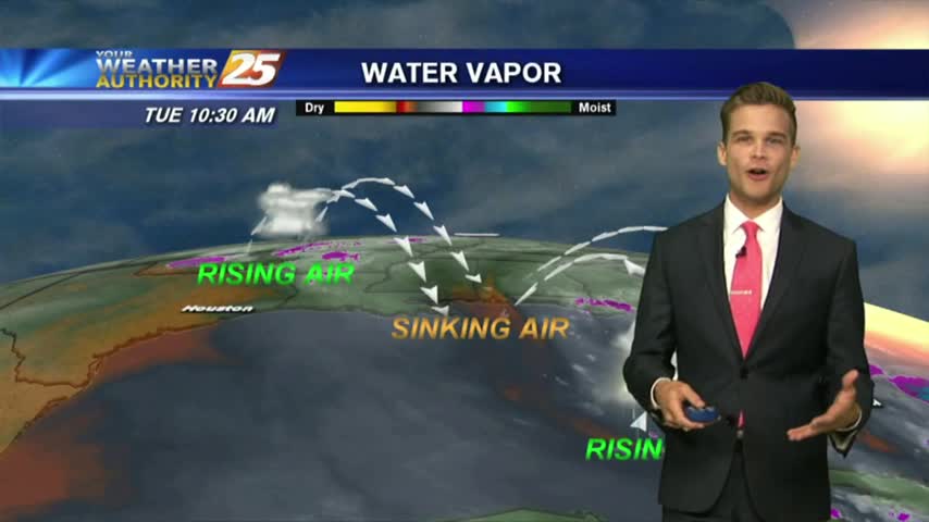
A mild start to the day with just a few mid/upper level clouds...mainly to the east.
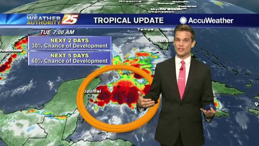
The tropics continue to heat up...what does that mean for South Mississippi?
More record heat today, but some relief is on the way.
The heat continues...we'll add more humidity later this week.

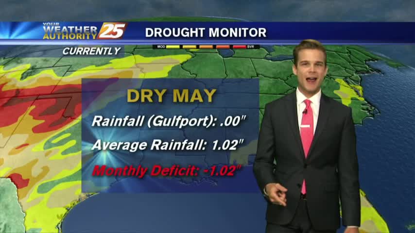
For the first day of May it's feeling like it. Warm, humid, breezy and even a little bit of a heat index!
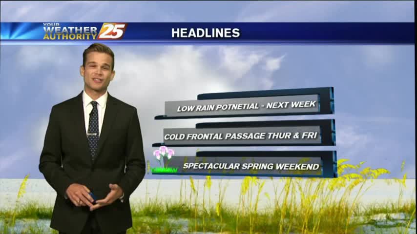
Another beautiful day before rain returns later this week.
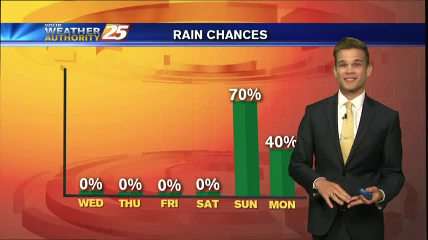
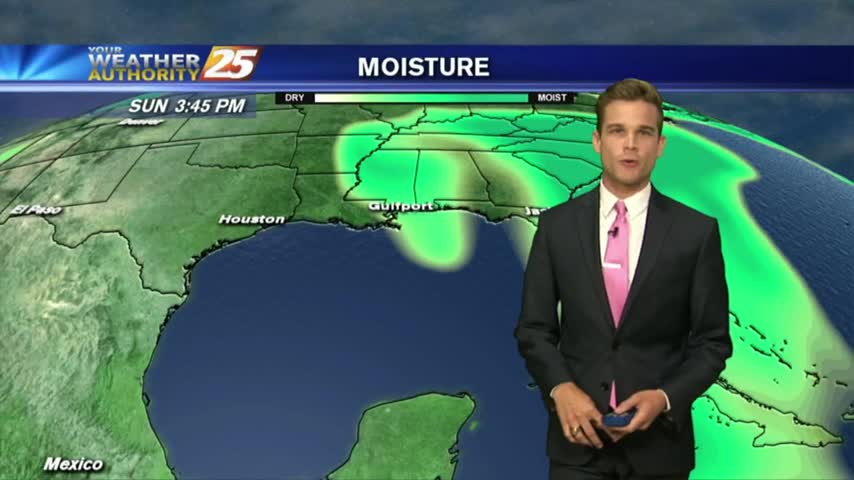
The warming trend continues, but a stormy Sunday looks likely.