09/08 Ryan's "Irma's Latest" Friday Night Forecast
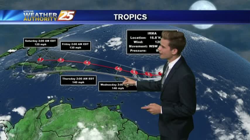
Irma's forecast path keeps shifting Westward, so click on the link below for the latest information (as of 10:45 PM).
Irma's forecast path keeps shifting Westward, so click on the link below for the latest information (as of 10:45 PM).
Irma continues to head North-Northwest towards South Florida, and is expected to turn North soon. Watch the full forecast for the latest update.
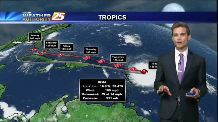
Irma continues to close in on a potential U.S. landfall, but the forecast path still holds on to a considerable amount of uncertainty through the weekend. Click the link for details.
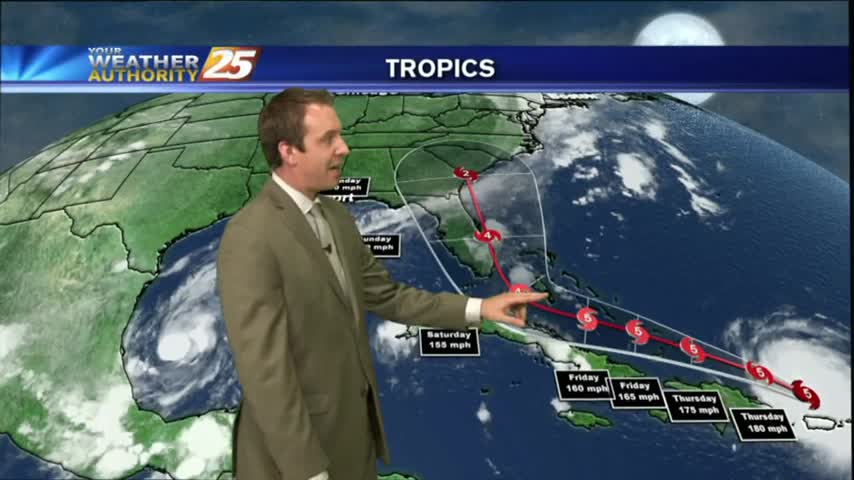
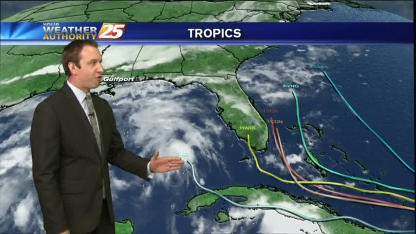
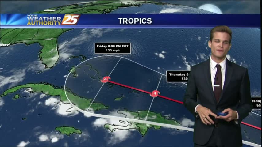
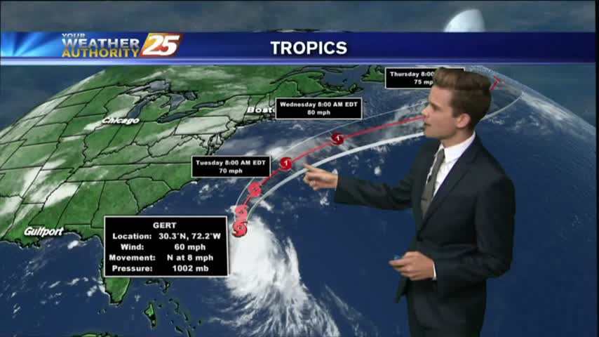
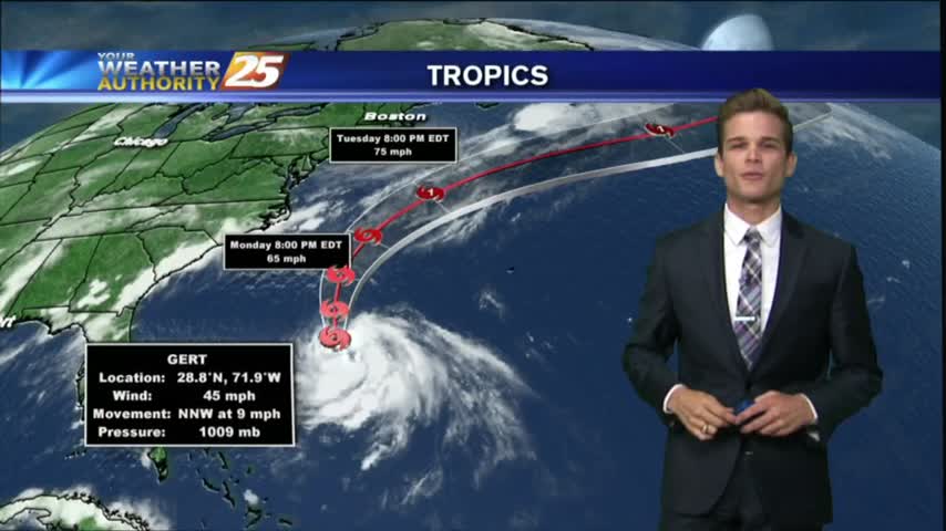
We ended yesterday with only one hurricane in the Atlantic, but we're ending today with three. Click the link for the latest on all the tropical systems.

The Atlantic tropics remain active, as now three hurricanes are expected to continue strengthening over the next few days. Click the forecast link for the full Tropical update.
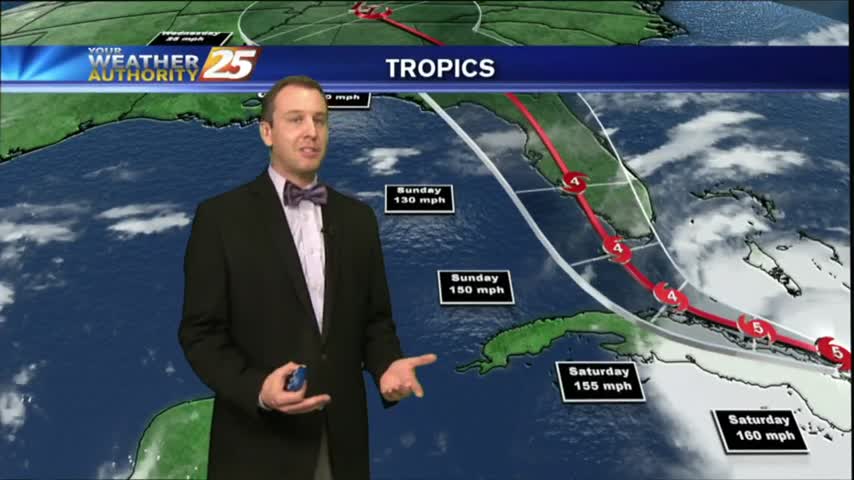
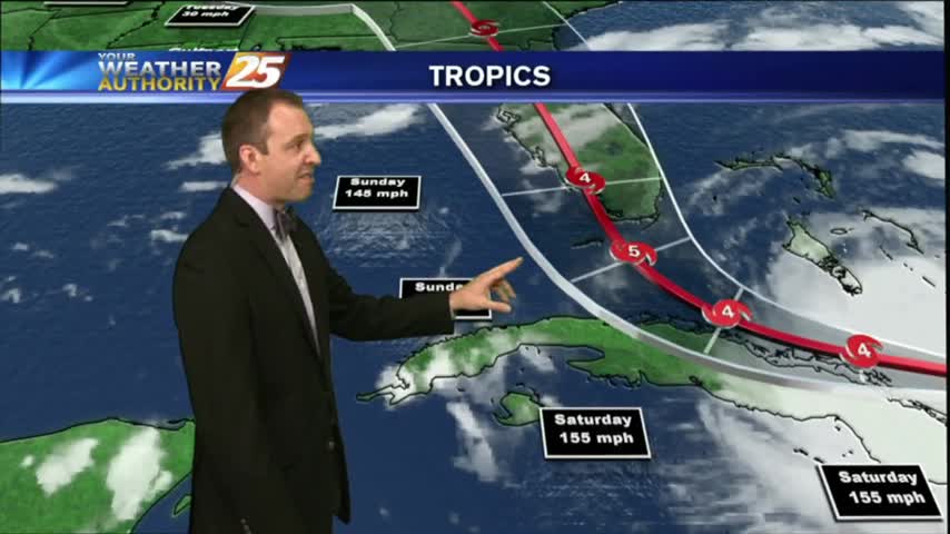
There is still a decent amount of uncertainty when it comes to Hurricane Irma's final path towards landfall in the U.S, and we discuss all the options in tonight's forecast. Details within.
With Irma, Jose, and now tropical depression 13 all moving about the Atlantic/Gulf at the same time, this forecast was very heavy on the tropics. Click the link for the latest.
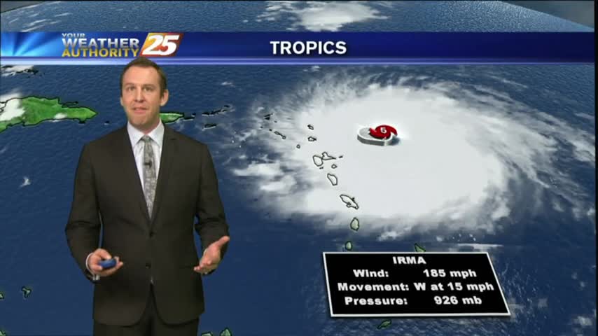
Irma continues to strengthen this morning and afternoon into the strongest Hurricane ever recorded in the Atlantic Basin with winds up to 180 mph.

It will continue to be humid with temperatures around 90 degrees so take it easy and drink plenty of water if you’re outside for the holiday.
Good morning South Mississippi! I hope you had a great weekend and enjoyed the somewhat drier conditions.
I hope you had a great weekend and enjoyed the somewhat drier conditions. That will continue into Labor with the area being hot and dry.
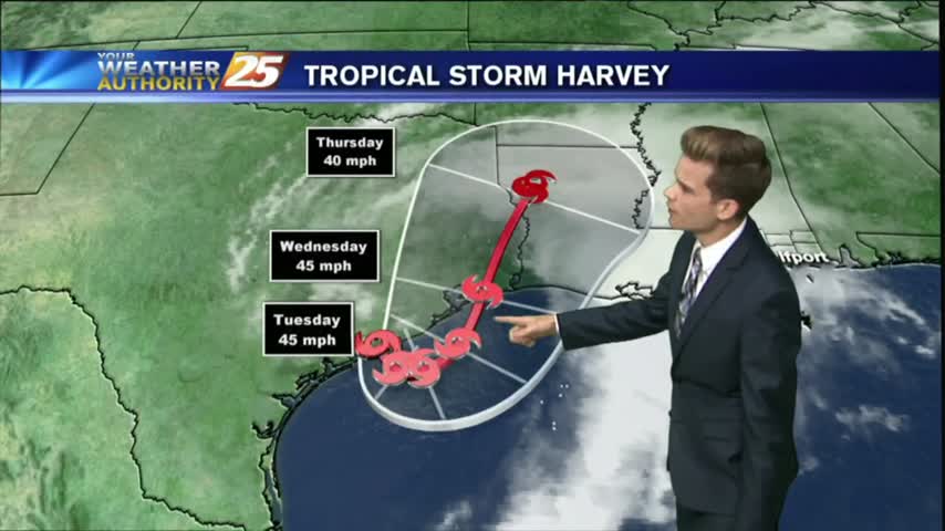
Tropical Storm Harvey will continue to be the main weather feature impacting the forecast through Wednesday as the system slowly moves offshore today and eventually pushes back inland near Houston tomorrow.

The best chances for showers and thunderstorms will remain in the morning over the waters and along the coast, and then chances move inland throughout the morning and afternoon hours.
The solar eclipse of 2017 has come and gone, but left some neat things to look at! The moisture was on the return into the area today, along with a disturbance in the Gulf of Mexico, which is moving our…
The eclipse will happen from noon until 3:00 pm, but the max eclipse will be at 1:31 pm. Remember to use special solar eclipse glasses to view the event.

Tomorrow is the big day across the United States! The solar eclipse will be at its max around 1:30 pm.
Showers and thunderstorms have developed across the area as an unstable and very tropical air mass continues to dominate across the Mississippi Gulf Coast.
Showers and thunderstorms will develop this afternoon because of fairly typical August weather.
Showers and thunderstorms continue to clear out of the area. More rain is in the forecast.
After a dry start to the day, showers and thunderstorms are across the area, and unfortunately it looks like the hot and stormy afternoons will continue into the weekend as not much change will happen to the upper air pattern.
Unfortunately it looks like another hot and stormy afternoon for the area with the best chance for showers and thunderstorms this afternoon.

Very isolated activity across the area this afternoon as a stationary front along the Mississippi Gulf Coast stretching west to east will continue to linger in the region through the rest of the workweek.
We continue to see isolated showers and thunderstorms starting to develop.
Isolated showers and thunderstorms are possible this afternoon.