
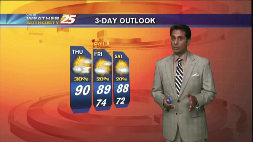
6/14 - The Chief's "Getting HOTTER Into The Weekend" Friday Morning Forecast
Activity will remain suppressed today and tomorrow as high pressure becomes centered over the region. Very dry air aloft associated with subsiding air will…
Activity will remain suppressed today and tomorrow as high pressure becomes centered over the region. Very dry air aloft associated with subsiding air will…

A stationary front along the coast will undulate north and south for several days, providing for rainfall and the potential for HEAVY RAIN. If…
A typical summer day is ahead with the exception of minor additional effects from TS Fred in the NE'tern GOM. With the trough in the upper levels moving south and the continued moist air mass; this should keep some convection…
Beautiful conditions heading into this afternoon under mostly sunny skies...
Extensive upper-level clouds and a north wind will keep high temperatures in the manageable zone this weekend...
A warmer start to the day as the humidity is beginning to move back into the area...

Hot temperatures heading into the afternoon won't feel as hot with lower humidity...
A rather pleasant start to the day as overnight t-storms have dissipated...
A warm and humid start with a few showers moving in from the S/SE...

A very warm and humid start this morning with areas of patchy fog...
A wet start depending on your location as t-storms continue to move in from the south...
After a pleasant start to the day, temperatures are now pushing the 90 degree mark...

A nice Friday afternoon with a few clouds and HOT temperatures, BUT low humidity...
A warm, humid and cloudy start with isolated showers moving in from the SW...

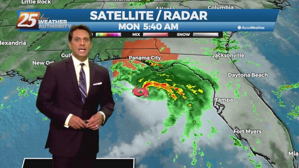
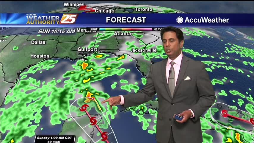
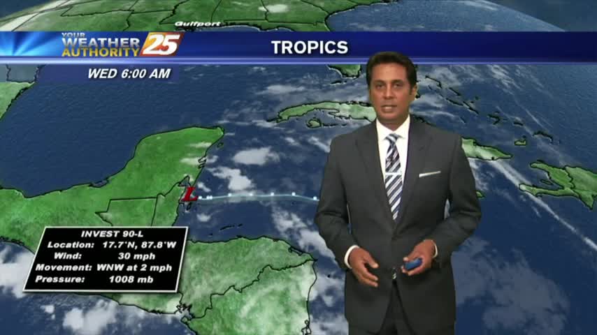
A cloudy start to the day as potential tropical cyclone #2 continues to develop roughly 200 miles south of Mobile bay...

After a beautiful start to the day, hot temperatures will continue under partly cloudy skies...

A much better start to the day with just a few clouds moving in from the south and mild temperatures...
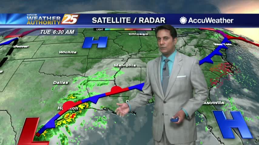
Another wet start to the day with a line of showers and t-storms moving in from the Gulf...

Showers and t-storms continue to move in and develop as we keep a watch on Tropical Storm Gordon...

A warm/humid start with cloud coverage developing and moving in from the west...

Sunrise activity diminished but starting to pop through the viewing area as daytime heating continues. TS ALBERTO is now in the Caribbean sea...
A mild start to the day as showers from the south are dissipating as they move closer to the coast...
The humidity is on the decrease as temps warm, BUT it is still a very HOT & HUMID afternoon for this final full day of Summer...

A drier stat this morning with a BEAUTIFUL sunrise and just a few thin upper-level clouds...