10/20 - Jeff Vorick's "Warming Trend Begins" Thursday Midday Forecast
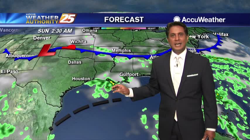
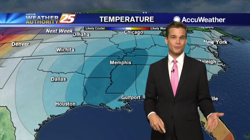
The bulk of the cold airmass has begun to slide east. High pressure to our north will continually move to its southeast which will provide for…
The bulk of the cold airmass has begun to slide east. High pressure to our north will continually move to its southeast which will provide for…
A FREEZE WARNING CONTINUES THROUGH 9 AM. As the bulk of the cold airmass starts to slide east, an area of high pressure will move in…
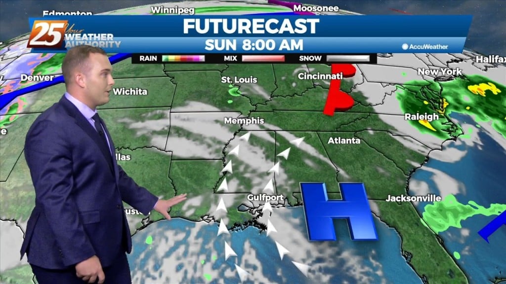
Dry high pressure has settled east of the continental divide and will remain in place for quite a while. Initially centered along the NW Gulf Coast, will migrate eastward slowly and park over NE Gulf Coast over the weekend into…
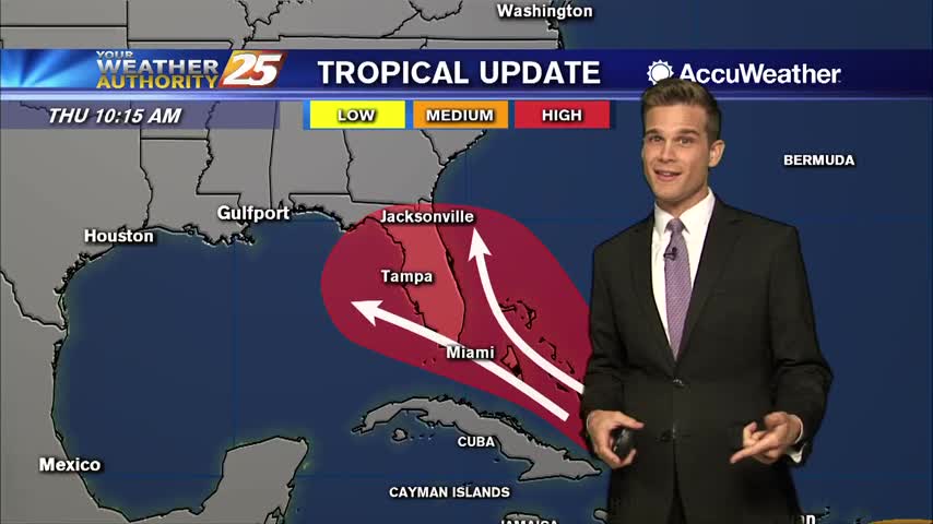
We're keeping an eye on the tropics as we head into the weekend, but there are a lot of unknowns

Here's the latest on what we're keeping an eye on in the tropics

A Heat Advisory this afternoon and the latest on Hurricane Dorian

A Heat Advisory is in effect Thursday

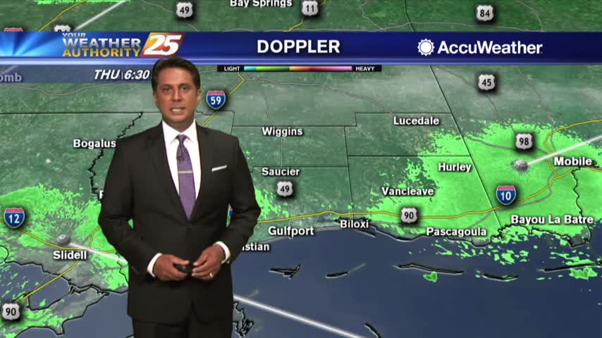
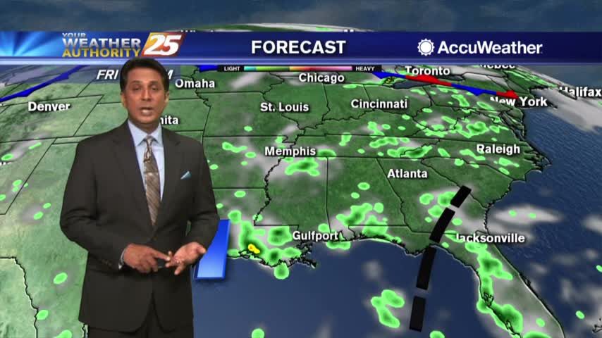
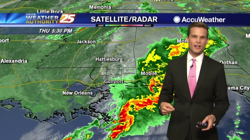
Rain chances still look likely as we head into the weekend as tropical moisture heads our way
More downpours this afternoon and into the weekend
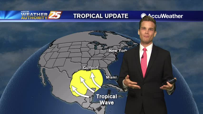
A little drier over the next few days...and let's talk tropics.
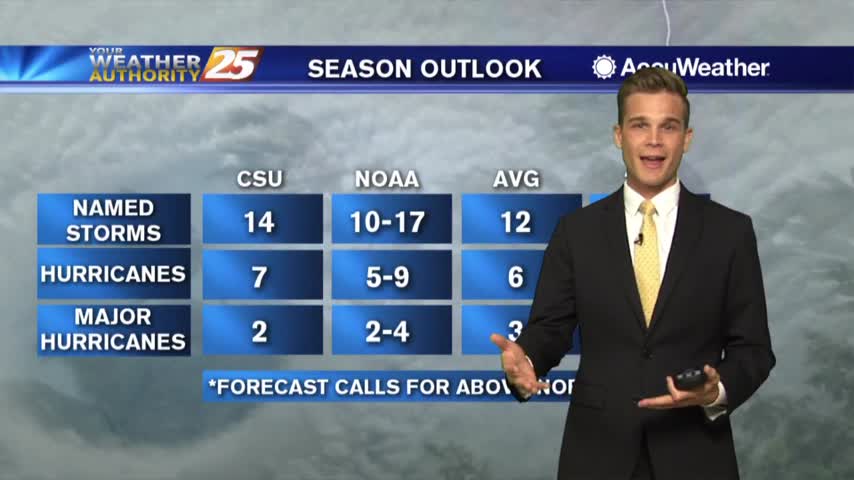
Be careful in the heat...also an update on NOAA's latest hurricane season outlook.
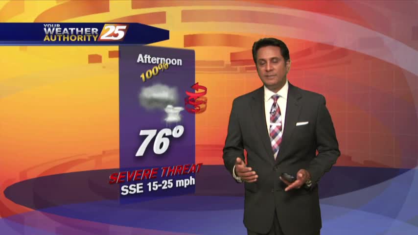
We are expecting another typical hot and humid day across the region.
One final day of beautiful weather before things return to normal.
Be careful in the heat...some relief possible next week.

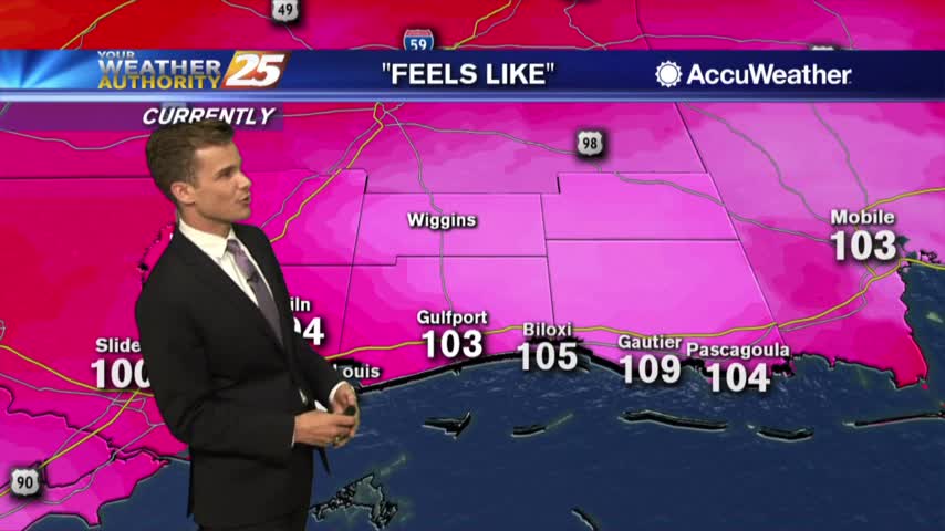
Heat index values over 100 this afternoon.
Subsidence was quite strong yesterday and will likely keep convection from becoming numerous today…but rain potential will be slightly higher.
Heat Advisory until 6 PM. Limit Outdoor Activities
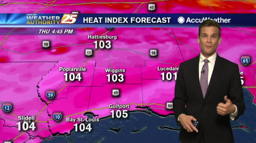
Heat indices over 100 this afternoon.
Another beautiful day with sunshine and low humidity!
Feeling like Summer out there!

Minor changes to the forecast, but still hot and humid.
Sunshine headed our way...and a lot of it!
Rain heading out...clear skies heading in!
A warm & windy start to the day as the system west continues to move east and develop...