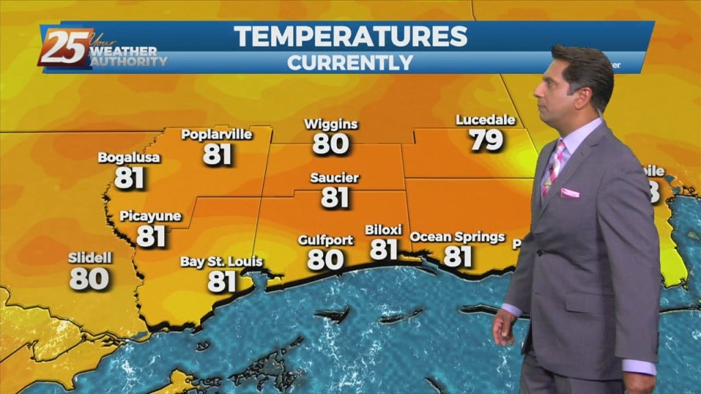
5/27- Rob Knight's "Sunny & Hot" Friday Morning Forecast
An upper-level low pressure over southern Illinois this morning will slowly drift off the eastern seaboard tonight into the weekend. High-pressure will be the main factor shaping…
An upper-level low pressure over southern Illinois this morning will slowly drift off the eastern seaboard tonight into the weekend. High-pressure will be the main factor shaping…
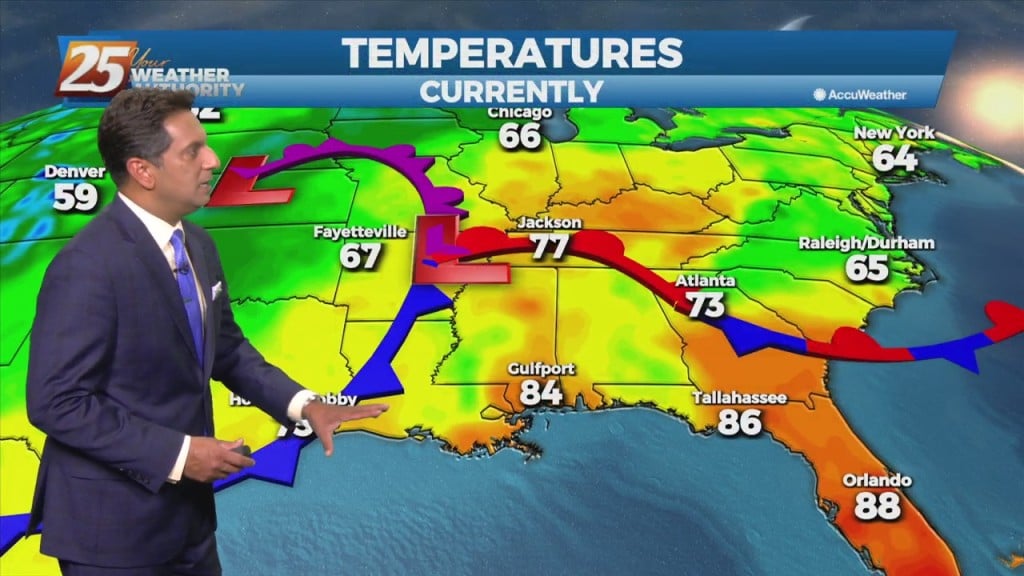
An upper low-pressure system this morning is moving into Missouri, with the associated cold front appears to extend from Jackson to Lafayette, probably just moving into the Baton…
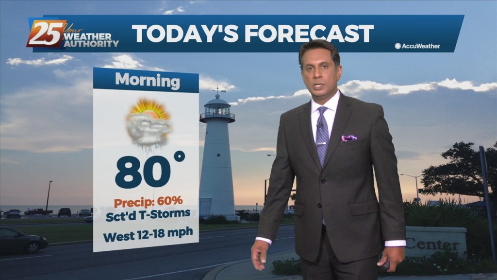
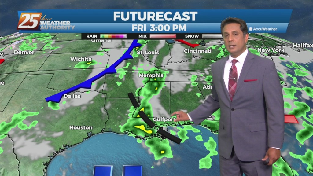
The main concerns are for heavy rain in the first 36 hours of the forecast...or in other words, today and Thursday. as showers…
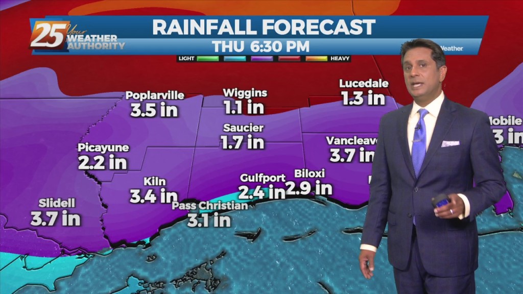
The main concerns are for heavy rain in the first 36 hours of the forecast...or in other words, today and Thursday. The disturbance swinging through the…
An upper level High-pressure remains off the Atlantic Coast with southwesterly upper flow across much of the southeast. Scattered showers and t-storms will taper off this…
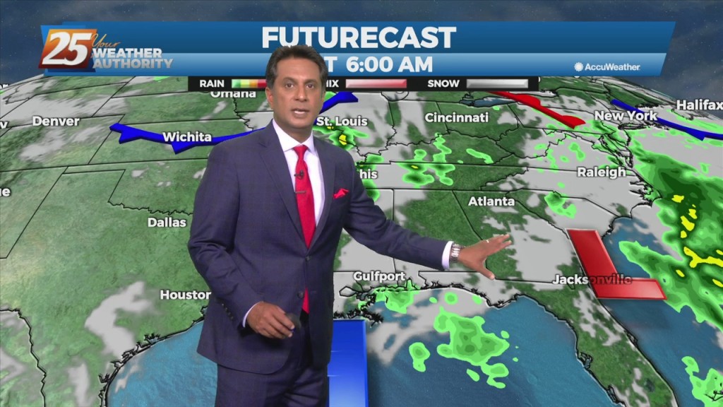
The hot and dry pattern will come to and end this weekend... The upper pattern will start the transition into a wetter one late in the…
The upper pattern will start the transition into a wetter one late in the day with a weak disturbance sliding across the region. It’s not until Saturday…

The synoptic pattern will hold through the short-term period with a broad area of high pressure off the Southeast U.S. coast extending westward along the…
Today and Wednesday, high-pressure will set up over the area. Conditions will be dry primarily, looking at the models. Today will mainly be a transitional day where…
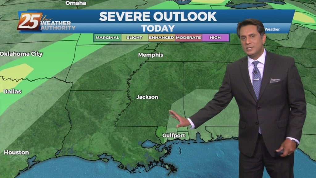
The main concern in the short term will continue to be the potential for thunderstorms and possible severe weather. We’ll remain in northwesterly upper flow…
At the surface, weak high pressure extended from Pennsylvania southwestward to the north central Gulf south of Louisiana, with an upper low-pressure to our east.…

The 32nd Annual Jackson County Industrial Trade Show will be held on Tuesday, May 17, 2022, at the B.E. “Mac” McGinty Civic Center (2902 Shortcut…

An upper level low-pressure system currently centered in the western Atlantic will move west into FL/GA today. At the same time, an upper level disturbance to the NW will…
An upper level low-pressure system currently centered in the western Atlantic will move west into FL/GA today. At the same time, an upper level disturbance to the…
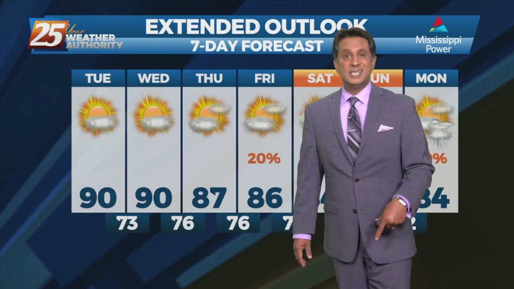
Hot and dry pattern continues as high-pressure extends SW to NE from the western Gulf of Mexico to the Great Lakes. This will easily support…
Hot and dry pattern continues as upper level high-pressure builds SW to NE across the Mississippi Valley. This will easily supports high temperatures around 90 degrees, with…
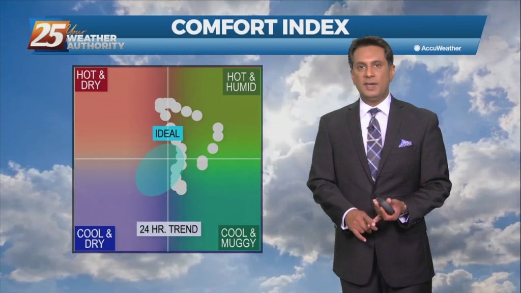
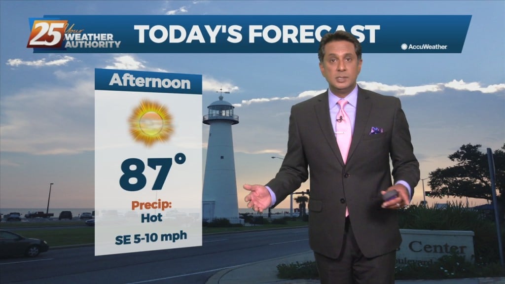
The heat will feel stronger today as moisture levels have clearly risen. The muggy hot feel will show heat index values in the mid-90s. Although, these…
Fog this morning in a few locations and may get dense in those locations around sunrise. But most areas are seeing temps high enough to keep fog…
Strong stability will move into the area once the cold front begins to move through later this afternoon. Clouds will clear the area this afternoon but since the…

Aside from a normal start to summer and high temps well above normal values, we will throw several thunderstorms on the pile for Thursday…
Quiet conditions will continue as the warm and humid flow dominates. A more unsettled weather pattern is expected to take hold on Thursday and continue through…
As high pressure to the east moves further east, southerly return flow has commenced below about 10,000ft. This could produce a few showers or perhaps a thunderstorm…
At the surface, high pressure extended from eastern Canada into the Carolinas with a westward extension across much of the eastern half of the Gulf Coast. Low…

At the surface, high pressure extended from the Great Lakes southward to Florida will shift slowly eastward over the next few days, to be centered…