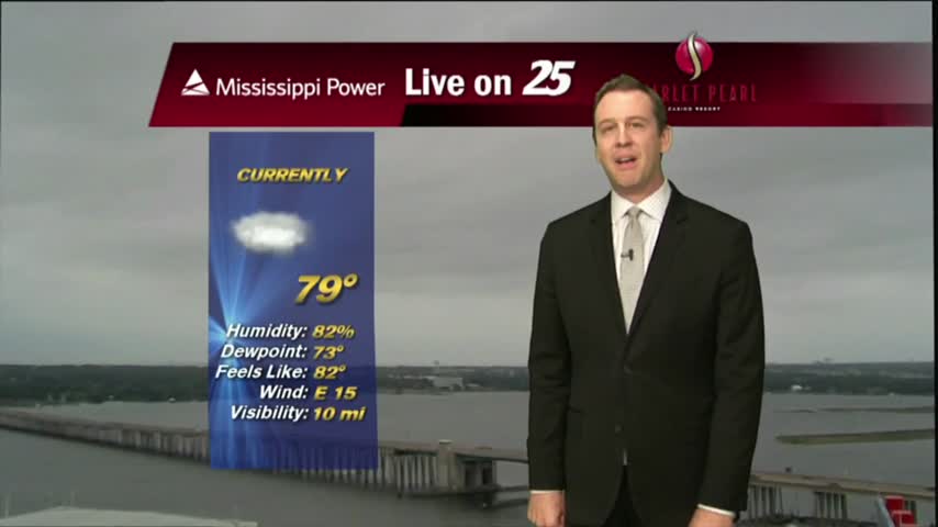
10/17 - Payton's Tuesday Afternoon Forecast
The beautiful weather continues for South Mississippi, and it's going to last a few more days.
The beautiful weather continues for South Mississippi, and it's going to last a few more days.
The cold front has passed, and fall weather is finally here!
A nice night as dry air continues to move into the area, but rain returns soon..
The cold front has finally moved through bringing drier weather, but it's not going to stick around long.
After a relatively quiet day behind Hurricane Nate yesterday and last night, but rain has returned today.
A Hurricane Warning and Storm Surge Warning for South Mississippi...
The Gulf Coast is under a Hurricane Watch and Storm Surge Watch...

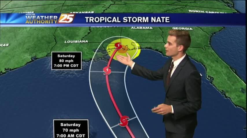
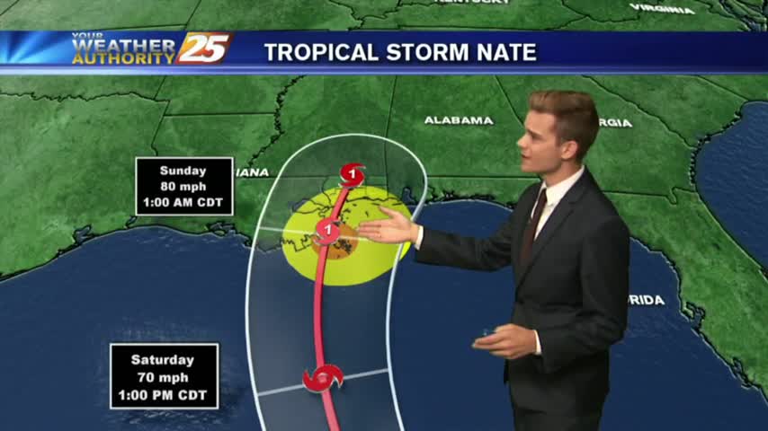
Tropical Storm Nate could impact South Mississippi this weekend. Check back regularly for updates.
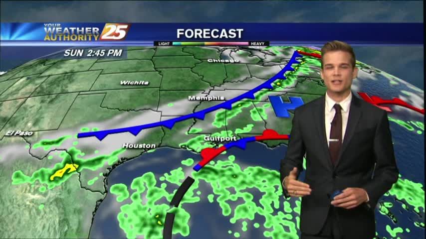
Drier are has moved into the area, and that means nice weather for the next few days, but changes are on the way.
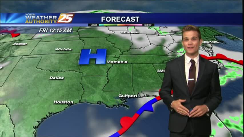
I expected this week to begin with clouds and rain, but we'll see clear and dry weather again very soon. Click the link for the full forecast.
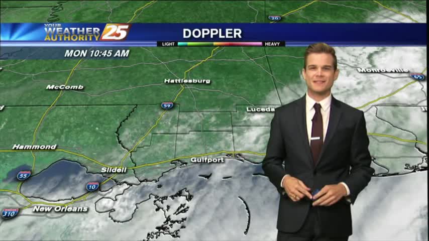
Expect overcast and on and off showers and thunderstorms for your Monday.
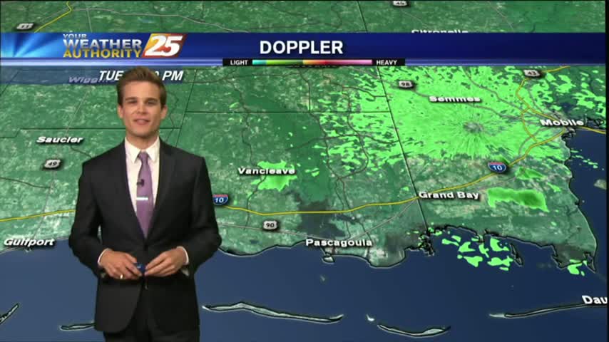
Showers and thunderstorms that moved off the waters this morning continue to slowly dissipate, but we could see more this afternoon.
Seeing a few showers in the area this morning ,but drier weather is on the way.
It was another warm and humid day with showers and thunderstorms.
Showers and thunderstorms have started to develop late this morning across Jackson and Harrison County.
Temperatures this afternoon are in the mid 80s and we continue to see southerly winds increase moisture in the area, but ran will hold off until tomorrow.
As IRMA continues its track to the NW…now moving through N’tern Alabama as a low pressure system, the lovely conditions will continue here in South Mississippi.

It will continue to be humid with temperatures around 90 degrees so take it easy and drink plenty of water if you’re outside for the holiday.

Heavy rains from the remnants of Hurricane Harvey moved into Louisiana. The National Weather Service has issued a flash flood watch all over southeast Louisiana, southwest Mississippi, and the Mississippi Gulf Coast through Thursday. Heavy rain from Harvey is forecast…
Flash Flood Watch for the area until Thursday night. Turn around, don't drown!
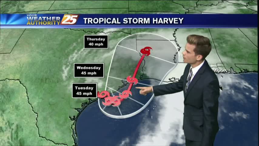
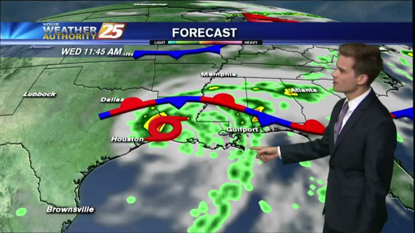
Tropical Storm Harvey will continue to be the main weather feature impacting the forecast through Wednesday as the system slowly moves offshore today and eventually pushes back inland near Houston tomorrow.
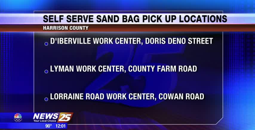
With all the rainfall expected to happen over the next few days and into the weekend, Harrison County Emergency Management has set up self-serve sandbag locations around the county. In D’Iberville you can pick up sand at the Work Center…

The best chances for showers and thunderstorms will remain in the morning over the waters and along the coast, and then chances move inland throughout the morning and afternoon hours.

Showers and thunderstorms continue to clear out of the area. More rain is in the forecast.