2/2 Sam Parker's "Consistent Warmth" Sunday Night Forecast
Even though Punxsutawney Phil the Groundhog calls for 6 more weeks of Winter, It looks like Spring in South Mississippi. After a warm mild weekend we go…
Even though Punxsutawney Phil the Groundhog calls for 6 more weeks of Winter, It looks like Spring in South Mississippi. After a warm mild weekend we go…
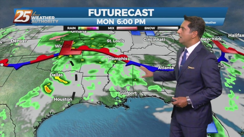
Conditions will remain relatively similar for the next few days with cloud coverage and breezy conditions from the south. The main feature on the map…
An area of upper level high-pressure extends from western Mexico northward through the Rockies. At the surface, high pressure extended from New England to the Louisiana…
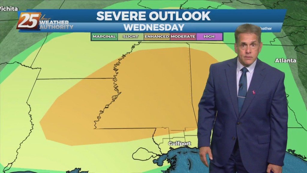
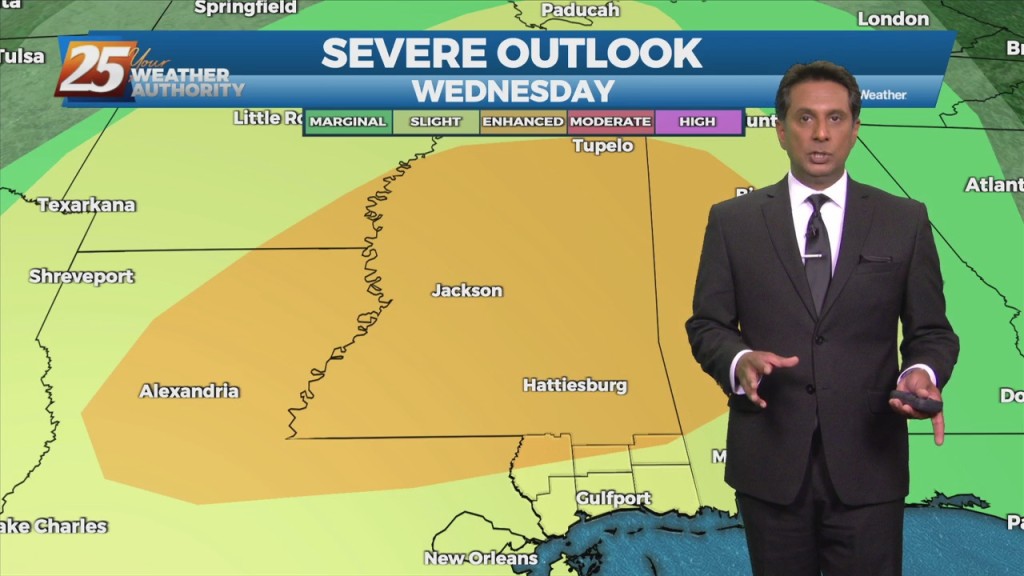
The high pressure that has been over the region has been providing for little to no resistance to convection working into the area from the…
Not much has changed with the overall pattern though the region. A strong upper level low pressure system is currently located over the Ohio Valley and…
Isolated t-storms will continue this morning with partial sunshine moving in this afternoon. Concerns overnight will be the prospect of locally dense fog forming. The near record…
Another warm day across the region and no sign of a change at least in the short term. Fog was an issue this morning and could be again tonight.…
A warm front moving north this morning over south shore locations could bring enough vertical depth to get some showers out of it today…otherwise just…
Continued unseasonably warm conditions will persist for the next few days as the surface high over the Bahamas causes southerly surface flow into…
A weak frontal boundary will reside pretty close to our northern area border today. With the closer proximity to the boundary, the surface pressure gradient…
The front has made it to the coast and now just to the south of the area. Not a lot of changes from current thinking, more…
The relatively dry air over eastern gulf has basically moved to the southern gulf and back up into the western gulf. Normally this process allows this air…
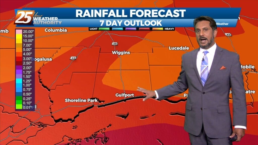
The forecast remains mainly unchanged, with heavy rain possibilities and fog potential remaining the focuses of the short term. Today will remain mostly quiet outside of…
High pressure has actually drifted a little further west than expected, and is now centered over west Texas northward into the Dakotas. This pattern will…
High pressure is over much of the lower Mississippi River Valley and extends westward across the northern Gulf of Mexico. Don’t see much indication of a frontal…
Today will fall into that bracket of typical summer thermal showers and thunderstorms. There won’t be as many around as yesterday. And whereas yesterday was a bit easier…

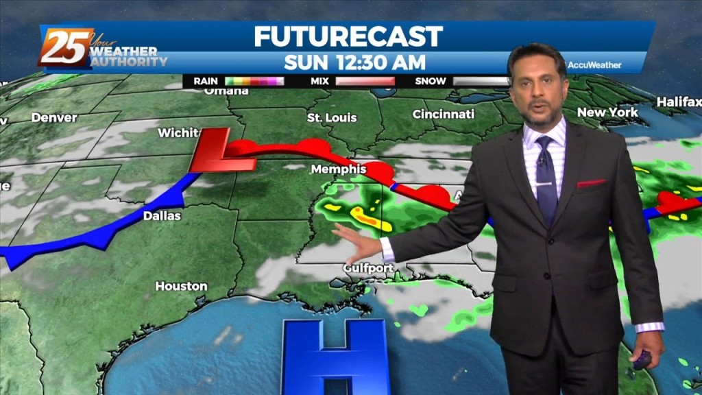
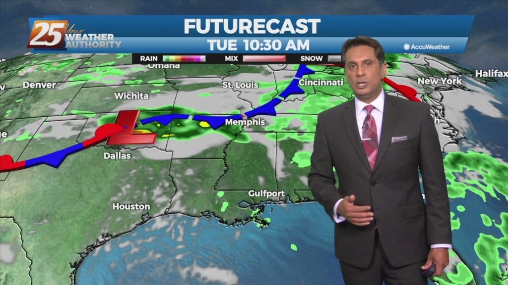
Not a lot of change as all indications for a frontal boundary to sag into the area and stall through Saturday. The interaction between the Caribbean…
A Texas disturbance will move across the area this afternoon and evening. It appears to be weakening at this time, with no significant convective development today. Beyond tonight, high-pressure…
Expect a pleasant Monday night and Tuesday with a few clouds through the night and more passing clouds Tuesday. Fog will be a factor Tuesday morning but…
A weak stationary front overhead will drift north with cloud coverage this morning then sunshine this afternoon. Fog will be a factor the next few morning but not in…

High pressure will continue to shape the forecast today, however cloud coverage will start making its way into the area beginning tonight. Patchy fog will be in the…
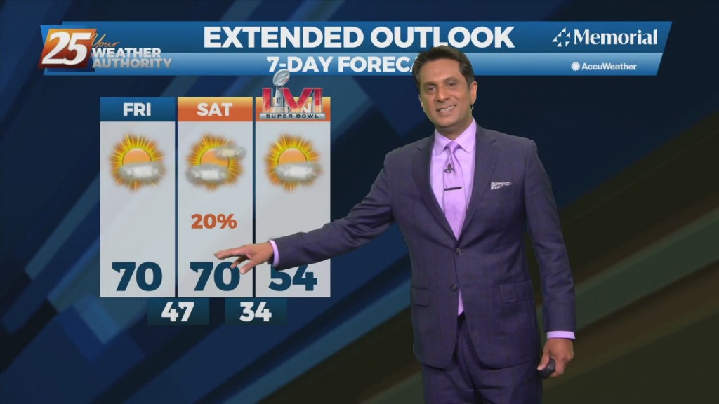
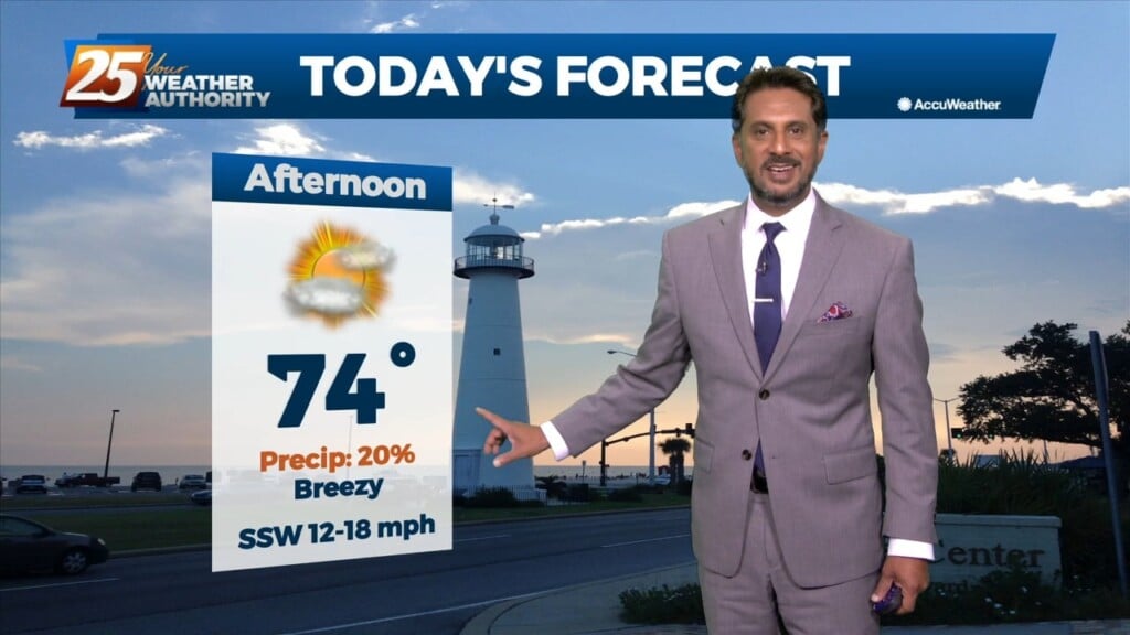
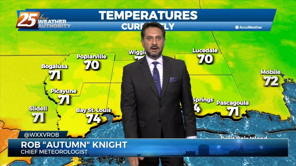
A lovely sunny day ahead with warm temperatures topping out around 70 degrees. Main forecast concern will be the cold frontal passage on Saturday. Somewhat of a…
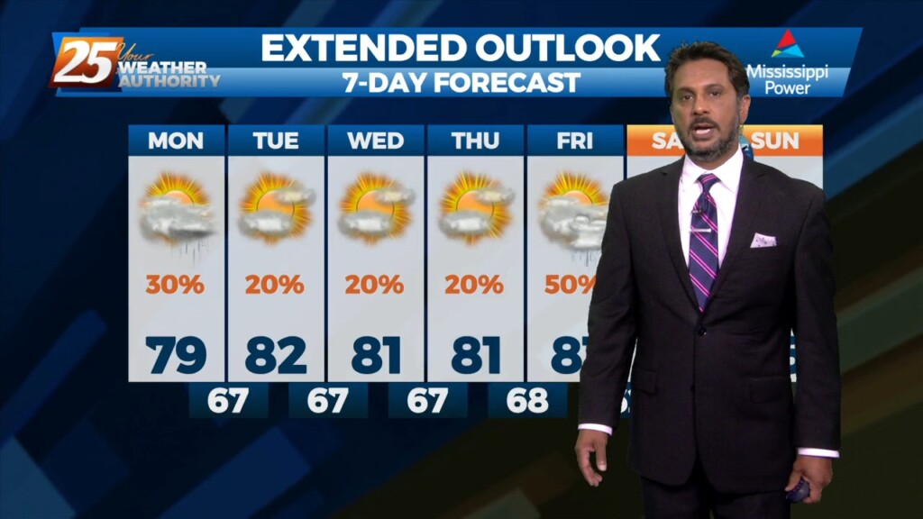
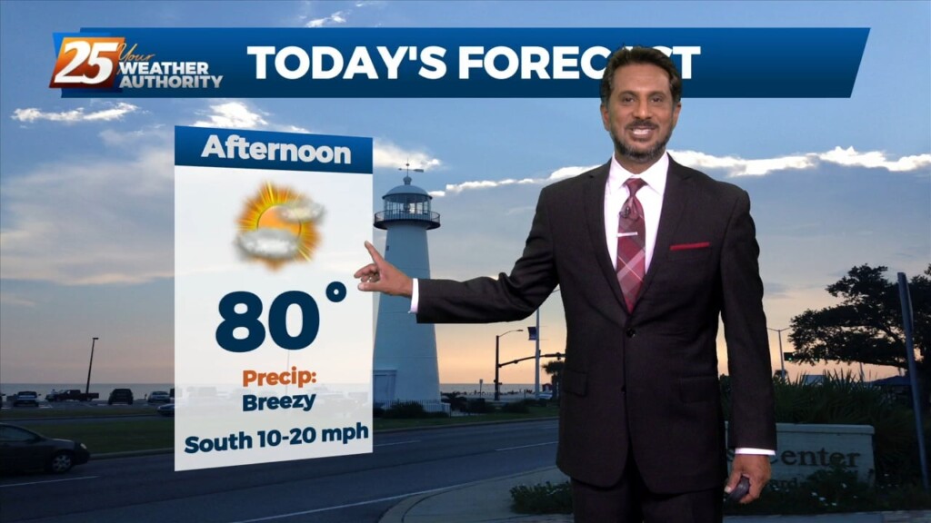
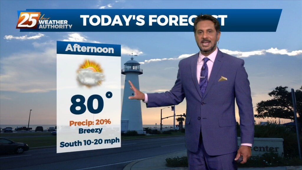
The warmer temperatures will continue as today will bring temps in the upper 70s, with many areas likely seeing 80, with some even surpassing it. Our attention shifts to…
Expect some fog, just patchy tonight, but we'll see more tomorrow night as a front closes in. Cloud cover will break up a bit through the evening, but…