3/28 – The Chief’s “Monday Morning/Workweek” Forecast
A weak stationary front overhead will drift north with cloud coverage this morning then sunshine this afternoon. Fog will be a factor the next few morning but not in every location and may be patchy dense. The next system will move through the region mid-week. There will be some activity ahead of the main line Wednesday most likely over southern Mississippi especially coastal Mississippi. But these showers will be developing in a strongly capped region and won’t be problematic.
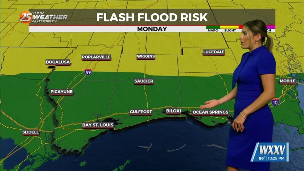
SEVERE THREAT POTENTIAL WEDNESDAY NIGHT
The cold front moving through Wednesday night will take advantage of increased moisture and additional warmth along with a few other severe parameters. Of these numbers with respect to heavy rainfall along the boundary but this should be progressive without lingering too long in one place. Rainfall rates could be high enough that any slower moving cells could cause a few poor drainage areas to flood.
All modes of severe weather will be possible including tornadic activity along with strong winds from downdrafts. The line should enter the region shortly after noon arriving in the Baton Rouge area around 4pm, New Orleans 7pm, Gulfport 9pm and exit the area around midnight Wednesday night into Thursday morning.