4/6 - The Chief's "Approaching Cold Front" Thursday Morning Forecast
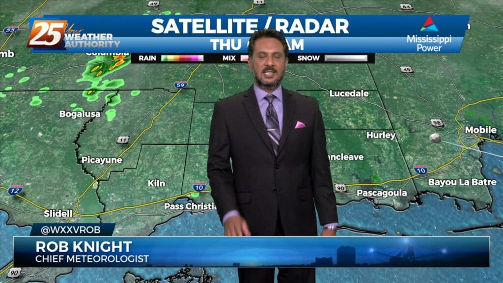
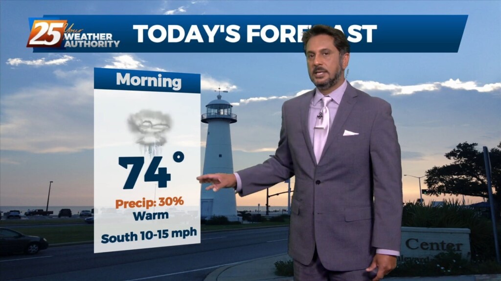
Starting off with early this morning, recent radar trends illustrate some isolated showers developing generally along the I-10 in coastal MS. The main story for today…
Starting off with early this morning, recent radar trends illustrate some isolated showers developing generally along the I-10 in coastal MS. The main story for today…
Last night’s cold front has moved well out into the central Gulf of Mexico, ushering much cooler and drier air into the area. A disturbance moving…
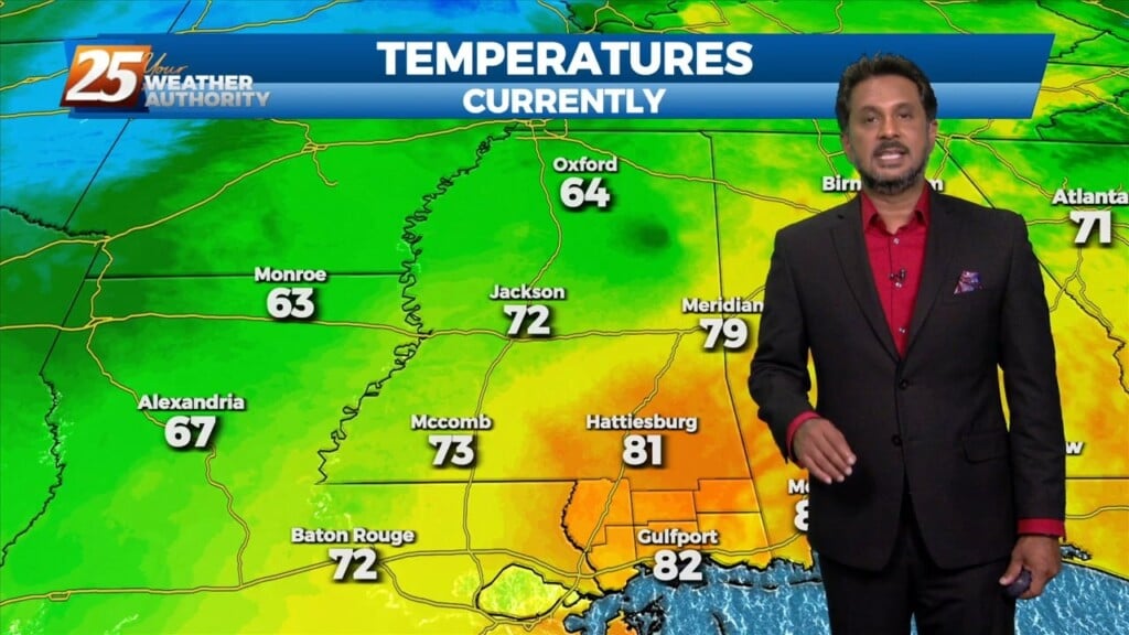
Generally a dry west or northwesterly flow currently resides over the region. At the surface, high pressure continues to spread eastward over the mid/lower MS River Valley…
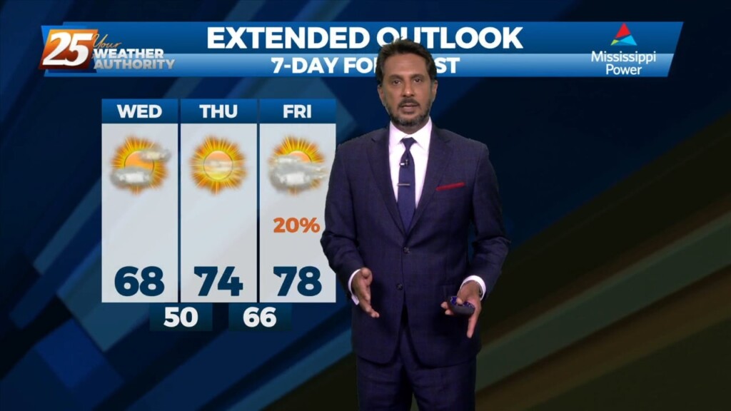
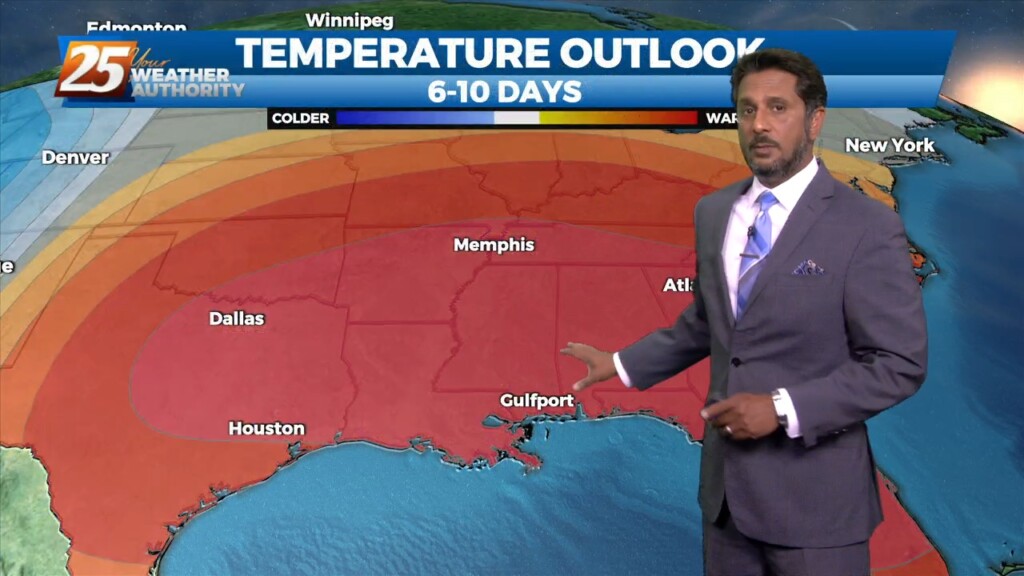
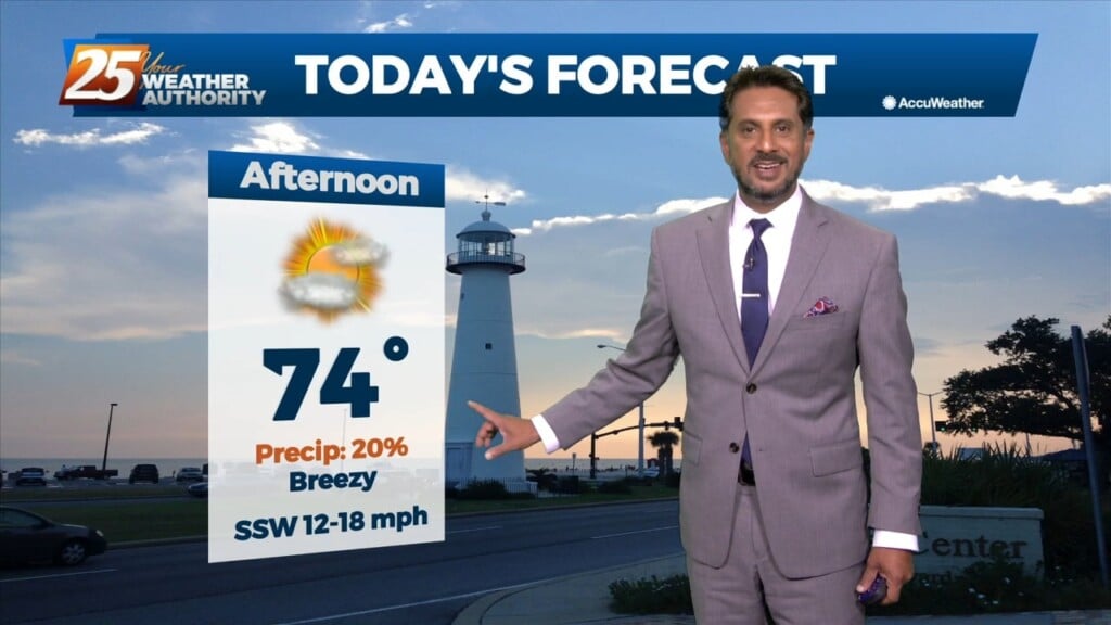
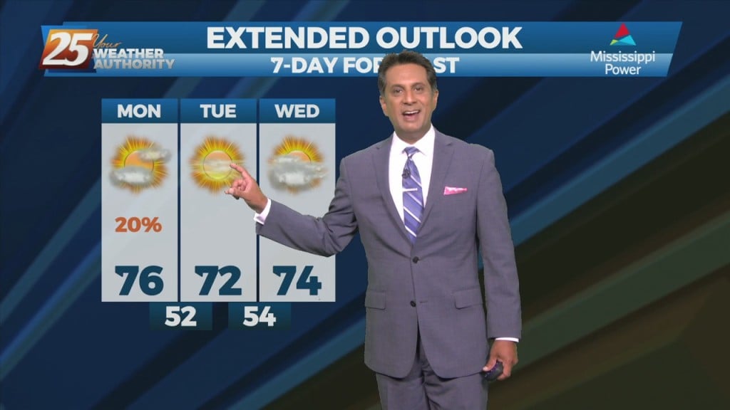
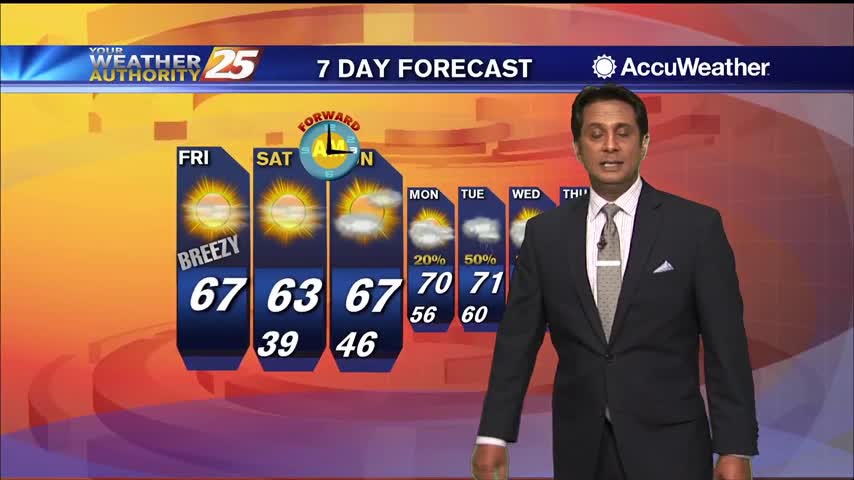
TOP TIER WEEKEND AHEAD... Behind the front this afternoon, winds will be gusty and we return back to more normal temperatures. These gusty winds and…
Today our area will reside between a strong upper level high pressure over the western Caribbean and southwest Atlantic and a strong upper level…
The old stalled cold front that retrograded west has primed the area with warmth and instability. But there is still a weak cap in the low levels…
The relatively dry air over eastern gulf has basically moved to the southern gulf and back up into the western gulf. Normally this process allows this air…
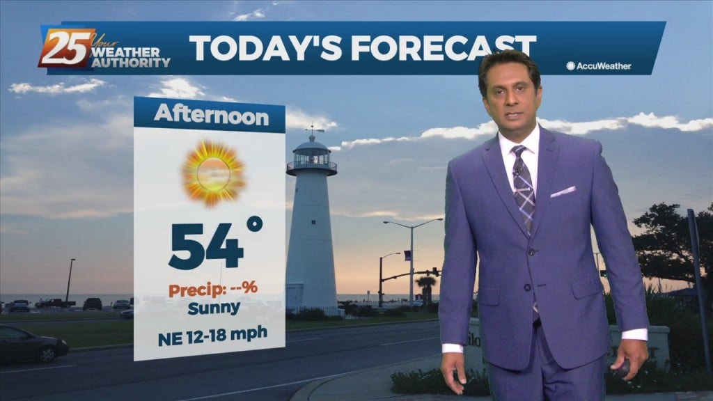
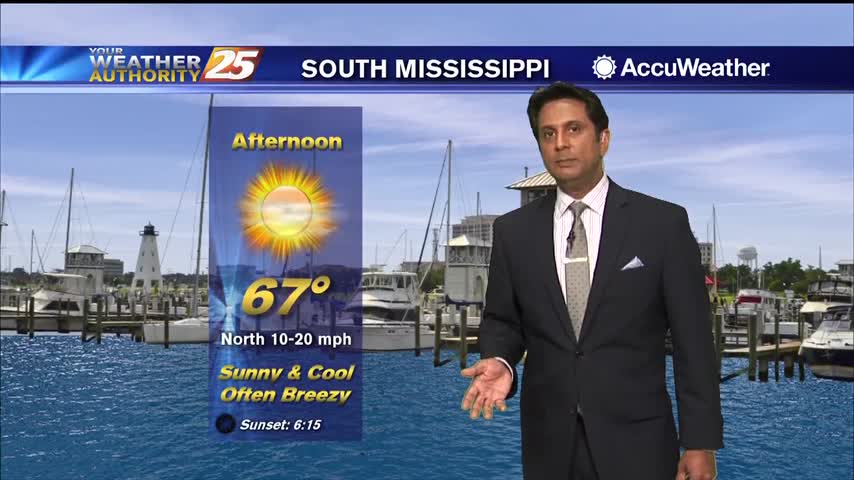
A drier/cooler northerly wind will develop across the region today behind the departing storm system. Temperatures will slowly cool back into the mid-60s this afternoon.…
A cold front east of the area continue to move east as high pressure to the NW will shape the short term forecast. Most of the…
The cold front will make its way through the entire area this morning bringing some very nice conditions once again. Cloudy coverage will clear by late morning…
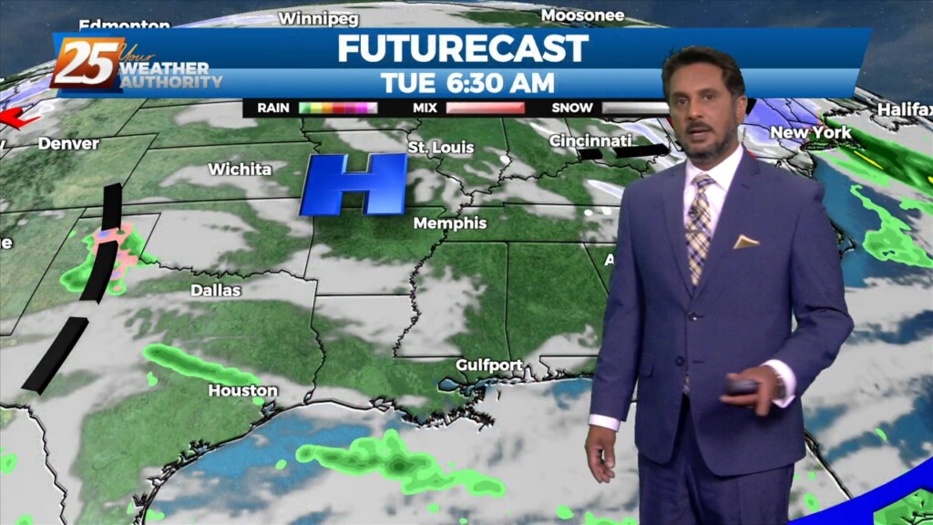
The first 36 hours of the forecast is pretty straight forward as high-pressure moves eastward across the area, with onshore flow returning Tuesday. Abundant sunshine will…
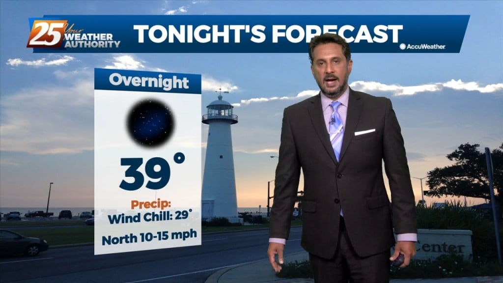
Daytime temperatures today will see almost 20 degree difference from yesterday's temperatures. Tonight temperatures will be chilly once again with lows in the upper 40s to low…
A much warmer start to the day with the cold front now to the east...
Clouds continue to clear as breezy conditions will taper-off later this evening...
Overnight rainfall/t-storms have moved east but cloud coverage continues...

A few mid/upper level clouds linger with winds gusting into the 20 mph range...
Light patchy fog this morning in advance of an approaching cold front...
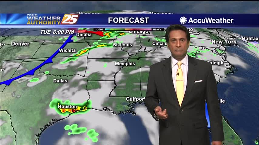
An approaching cold front will push showers/t-storms west of the area into south Mississippi...
After a lovely weekend, it's a chilly start with morning low temperatures in the /40s50s...
After a COLD start, temperatures are warming nicely into the 60s under sunny skies and breezy conditions...
A cold start to the day with a few upper-level clouds clearing to the SE...
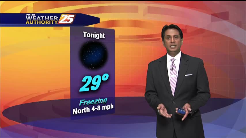
With high-pressure dominating the region, it's a very cold start this morning...

After a chilly start with a few clouds, skies have cleared with the mercury climbing into the 60s...
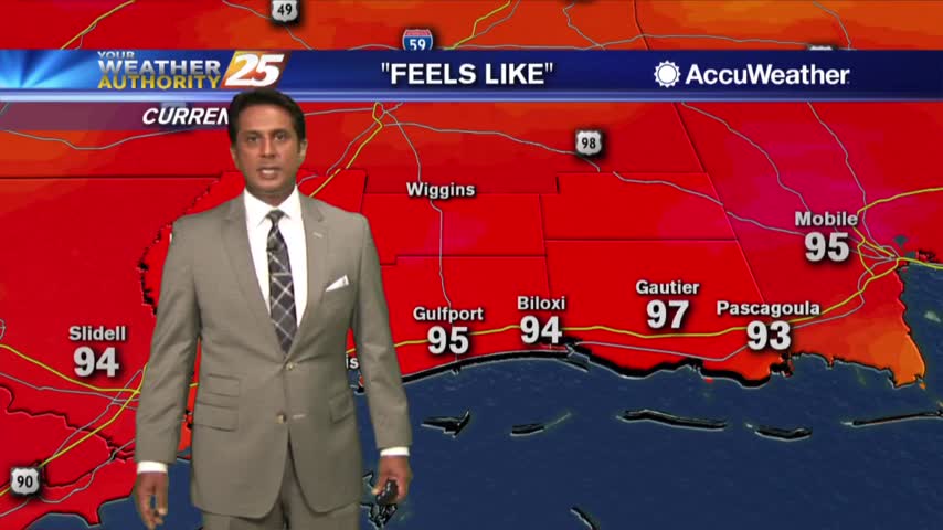
It's ridiculously HOT as temps soar into the upper 80s with HEAT INDICES in the mid-90s...