3/20 - The Chief's "Freeze Warning/Final Morning Of Winter" Forecast
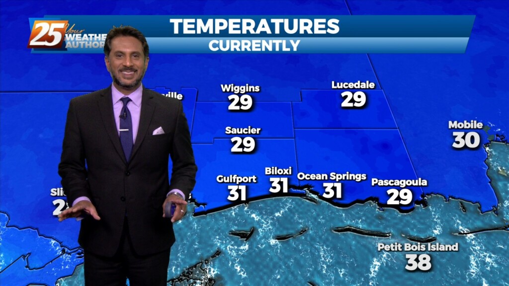
A TRUE winter morning on this final day of the season, as a FREEZE WARNING is in effect through 10 am. Temperatures will rebound quickly after…
A TRUE winter morning on this final day of the season, as a FREEZE WARNING is in effect through 10 am. Temperatures will rebound quickly after…
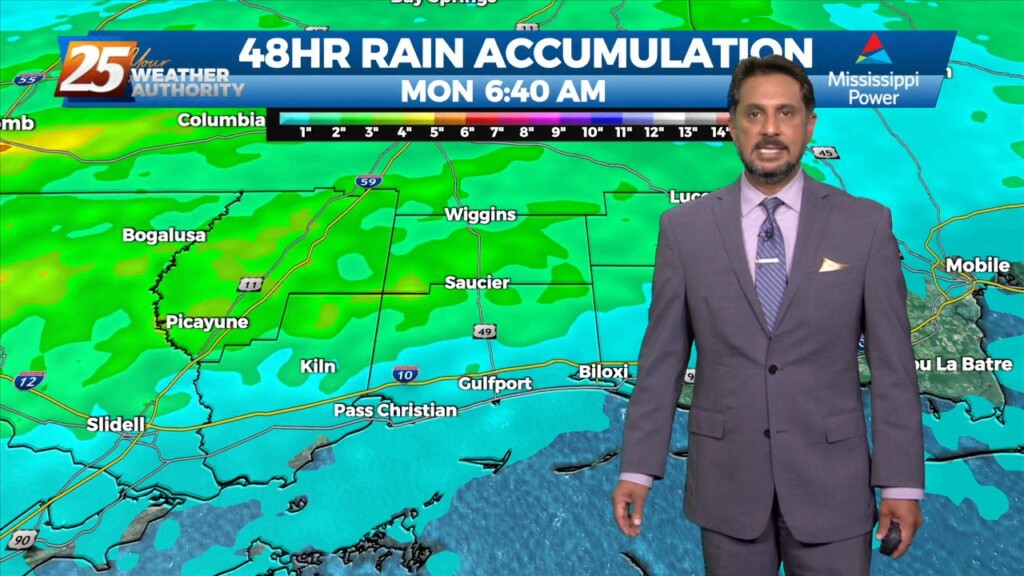
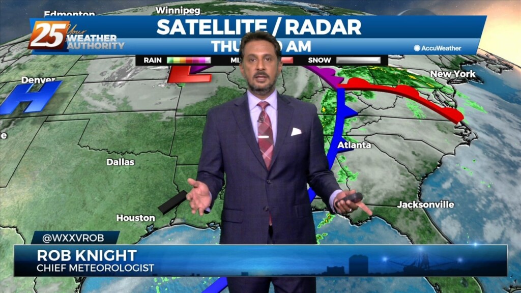
A line of showers/t-storms to the west associated with an approaching cold front will move into through area this morning into early afternoon. A…
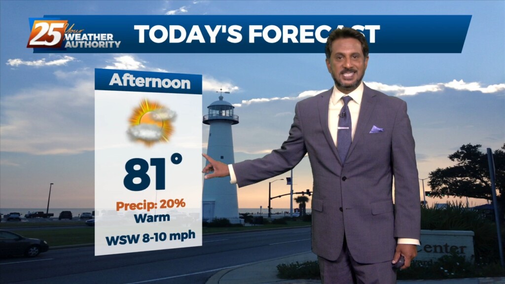
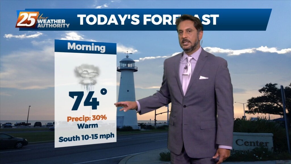
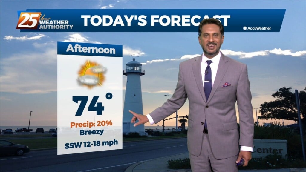
Today will be warmer with southerly return flow developing and slightly higher heights aloft. Mostly sunny skies early will give way to partly to mostly cloudy skies…
Generally a dry west or northwesterly flow currently resides over the region. At the surface, high pressure continues to spread eastward over the mid/lower MS River Valley…
A cold front just north of the area will slowly slip though south Mississippi later this afternoon/evening. High pressure to the SE will suppress the energy…

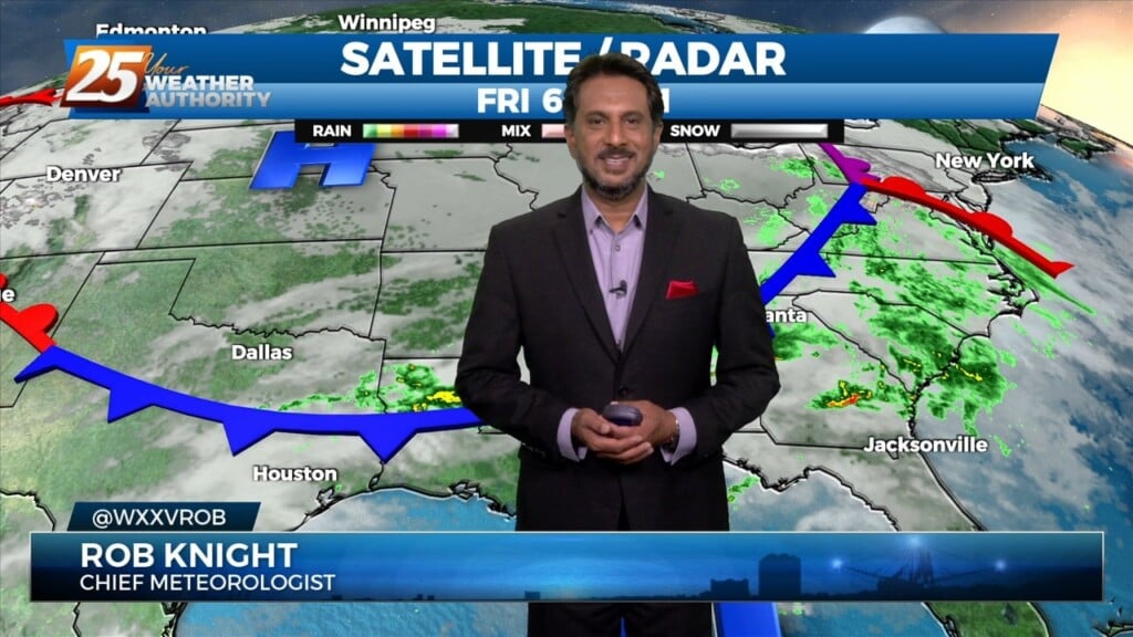
A weak backdoor frontal has dropped south in to the area and will be a focal point for a few afternoon showers/t-storms. To the south of…
A very warm start to the day with another warm day expected across the region and no sign of a change at least in the…
A warm front moving north this morning over south shore locations could bring enough vertical depth to get some showers out of it today…otherwise just…
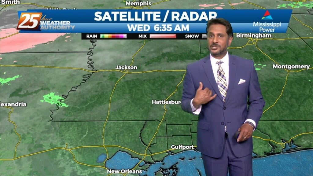
Currently there is a narrow line of showers across western Louisiana. Expect that to continue to move off to the east through the late morning hours.…
Another warm day expected across the region with most of the area warming into the upper 70s to low 80s along with breezy conditions. All eyes…
Another well above average day is expected in terms of temperatures across the region. At the surface a weak stationary front north of Hattiesburg will…
What month is it again? What a wonderful warm trend we’re in with plenty to discuss, starting out with a broad overview beginning at the surface.…
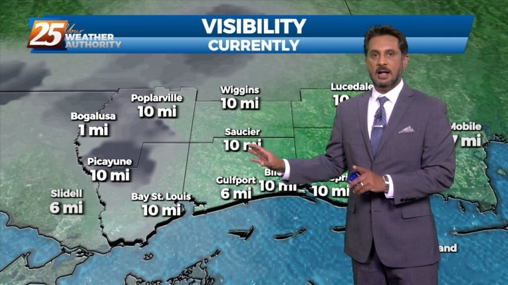
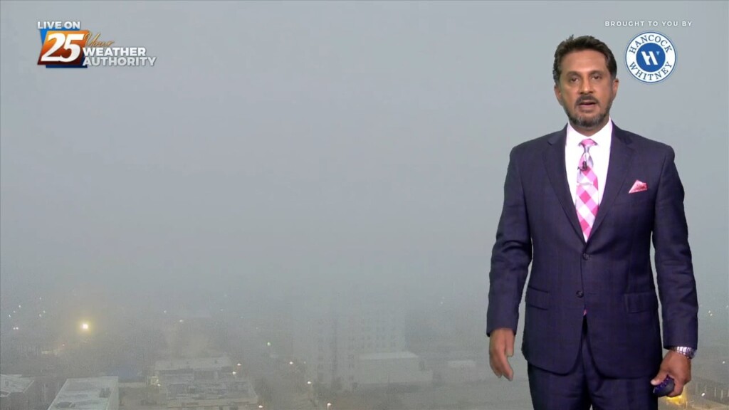
Early this morning some sea fog has overspread portions of the Mississippi Gulf Coast dropping visibility down to around half a mile or so over…
The old stalled cold front that retrograded west has primed the area with warmth and instability. But there is still a weak cap in the low levels…
A cold front moving toward the area today will do so at a rapid pace but will not only pump the brakes but will stand on them…
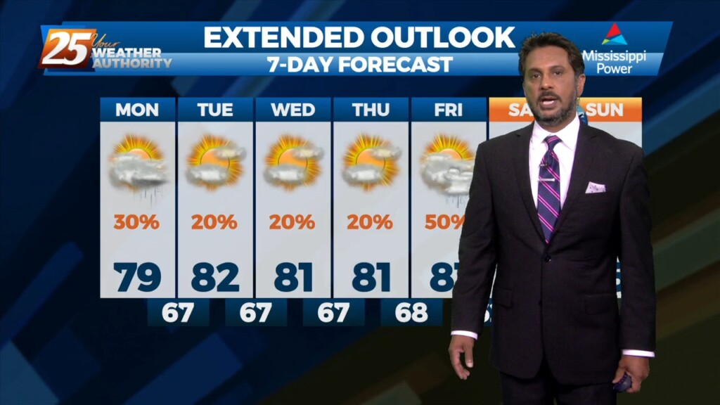
A beautiful start to our workweek is expected with high pressure remaining in control over the area. Afternoon high temperatures will sit in the low to…
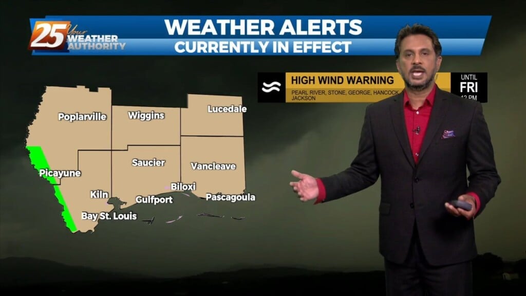
Today will bring clearing skies early this morning with windy conditions through today as high pressure settles in from the north. The biggest concern for the weekend…
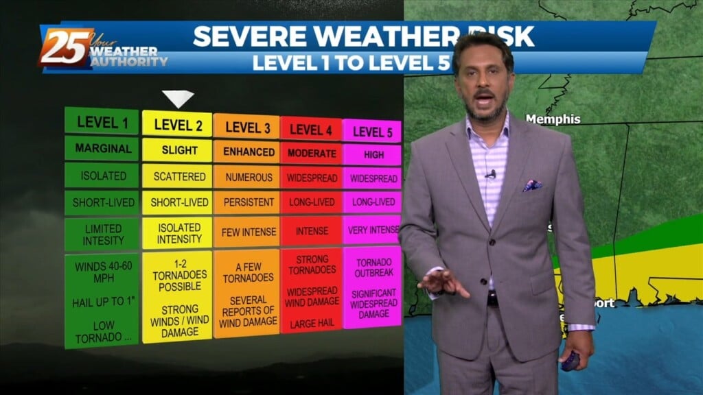
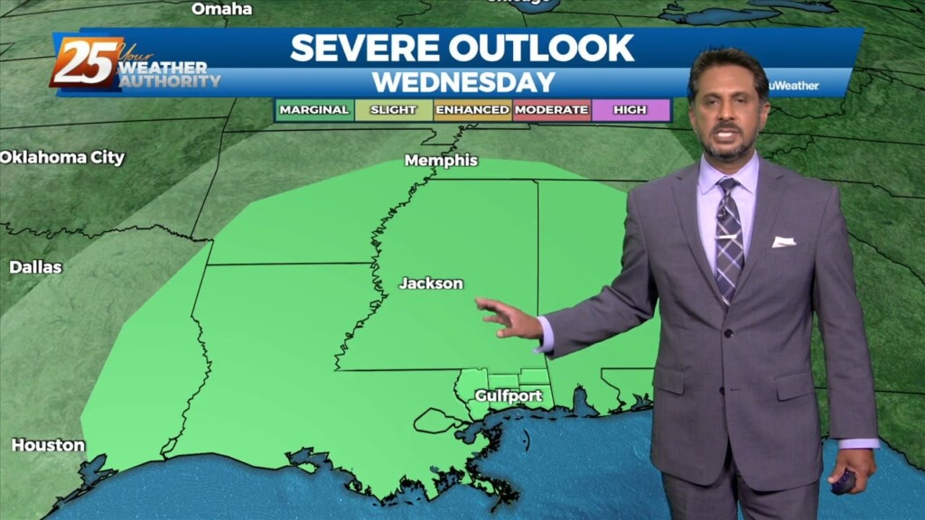
Finally seeing the models come into solid agreement on every variable and this has caused some sudden moderate changes in severe wx and rainfall risk levels…
The front has made it to the coast and now just to the south of the area. Not a lot of changes from current thinking, more…
Currently there is an area of high pressure over western Cuba, and a trough extending from the Great Lakes to the central California coast are combining to produce…
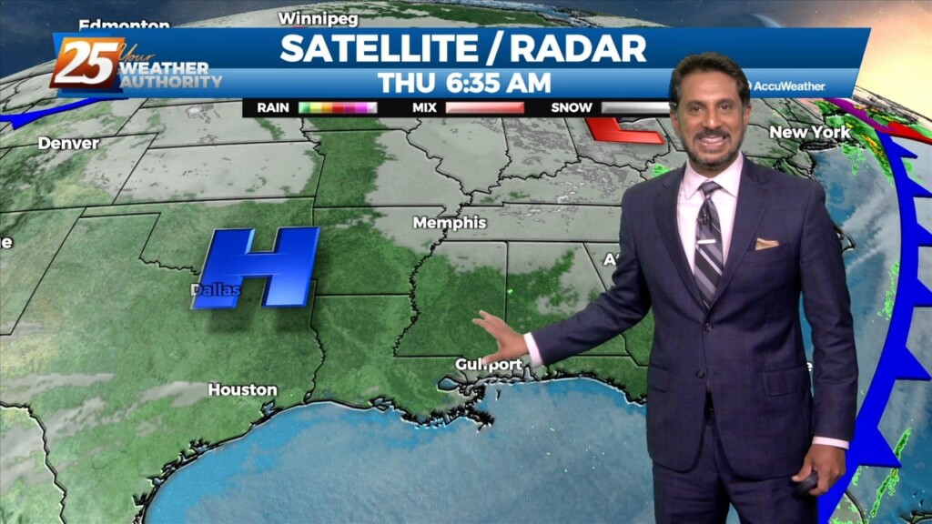
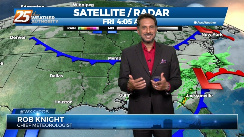
A disturbance over the Great Lakes has multiple bit of energy rotating through it. Flow is currently zonal across the southern states, with one disturbance exiting through…
The cold front is now east with high pressure shifting eastward across the area today and Friday in a very progressive upper pattern. This will provide a mostly…
The relatively dry air over eastern gulf has basically moved to the southern gulf and back up into the western gulf. Normally this process allows this air…
The pattern will remain quiet today with transitional conditions tomorrow. A fast-moving upper level disturbance will move past the area late tonight, but with little moisture…