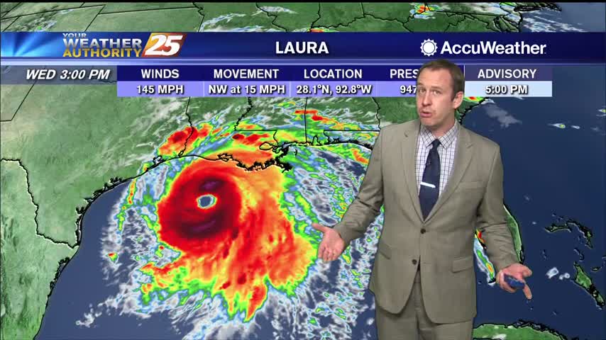
08/26 Ryan's "Category 4 Laura" Wednesday Evening Forecast
Hurricane Laura has continued to strengthen, and will make landfall later tonight as a major hurricane on the TX/LA border.
Hurricane Laura has continued to strengthen, and will make landfall later tonight as a major hurricane on the TX/LA border.
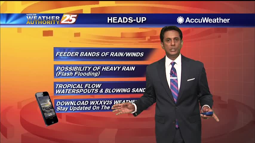
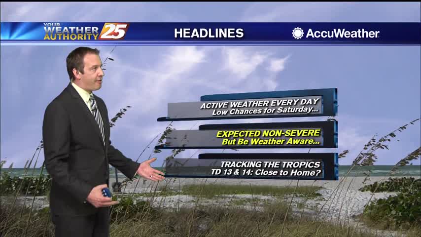
Hurricane Laura is currently in the central Gulf of Mexico currently moving northwestward. Satellite imagery does show Laura trying to have a bit more of a closed circulation and the storm has now increased to a CAT 2 hurricane. Laura…
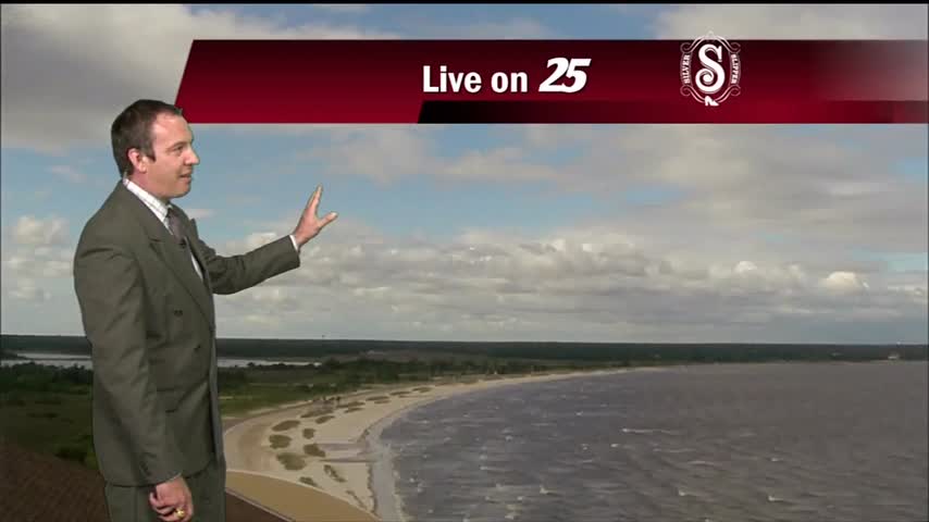
It's going to miss to the left, but Hurricane Laura is on its way and will bring us a few rainy days....
Hurricane Laura will miss us to the west, but we're still in for a few days of disturbed weather.
Marco is weakening rapidly, so we won't see much of a significant impact as it passes to the south, but Laura is slowly strengthening....
Dreary conditions this afternoon thanks to the tops of storms blowing our direction, otherwise not a lot of activity again today....
Finally a little cooler and drier, but it is over before it starts as the next few days get quite wet.
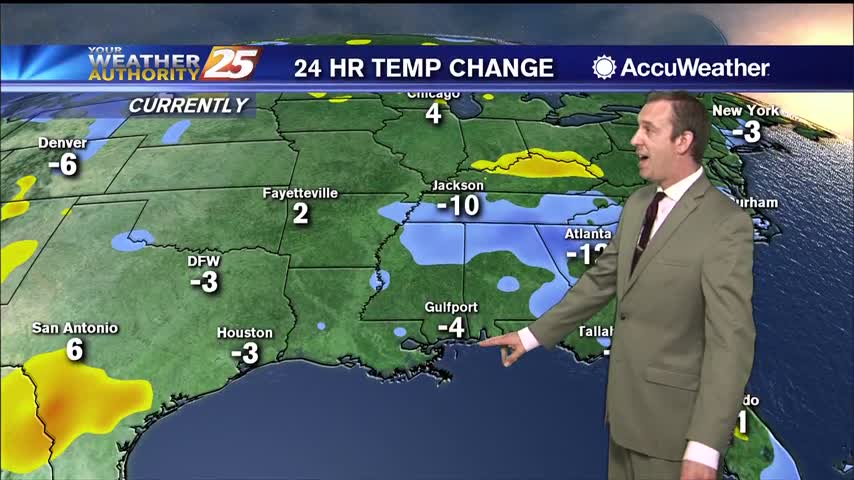
It was a few degrees cooler today, but more rain as we head into the weekend will bring highs down even further....
Very few showers out there today thanks to a weak sea breeze, which will be a bit stronger tomorrow.
A weak sea breeze tried to bring some afternoon rain, but not much was able to happen today thanks to upper level drier air.
Expect some slightly drier weather for the next few days, but rain returns again before next week.
The weather has been drier today and will be again tomorrow, but more rain and higher humidity soon after.
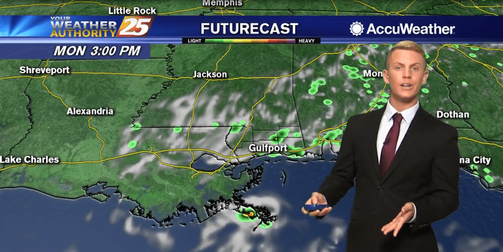
Showers and storms are currently ongoing over east and southeast Mississippi. The rest of tonight will then be quiet weather-wise. Monday looks to be mostly sunny with high temperatures topping out in the mid 90s once again. A few showers…
More evening showers tonight with more on the way over the weekend, but it is making things nice and cool.
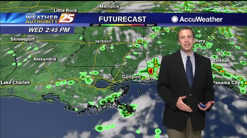
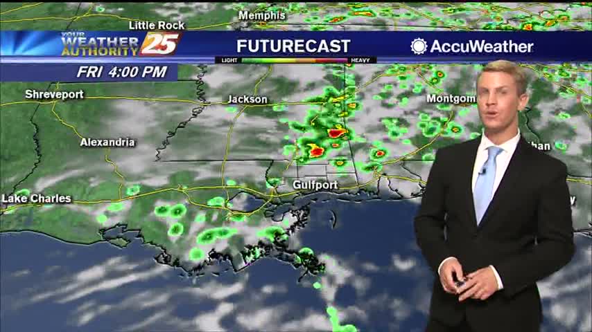
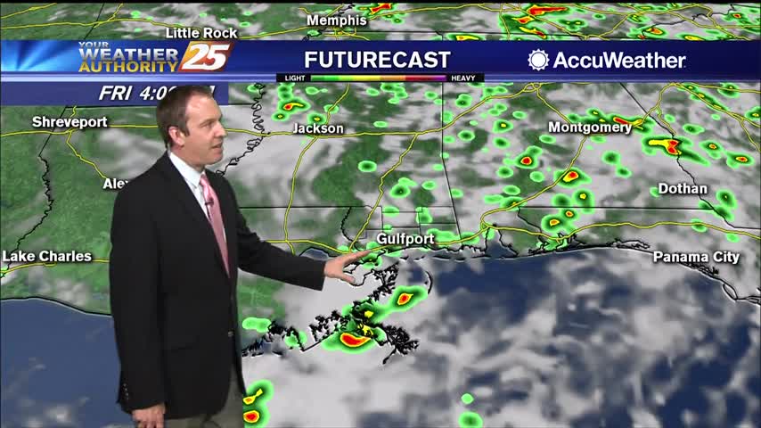
Scattered showers and storms by the middle of the afternoon, becoming more widespread in the late afternoon and evening. Rain chances are up to around 70 percent today. Tomorrow should be a bit of a transition day as drier air…
Skies start off partly to mostly cloudy today with humid conditions. Thanks to the increased cloud cover, highs today should be a little cooler, only topping out in the upper 80s. Scattered showers and storms by the middle of the…
Saw more rain today, though it largely stayed in the northern South MS counties. Expect it to spread out more tomorrow.
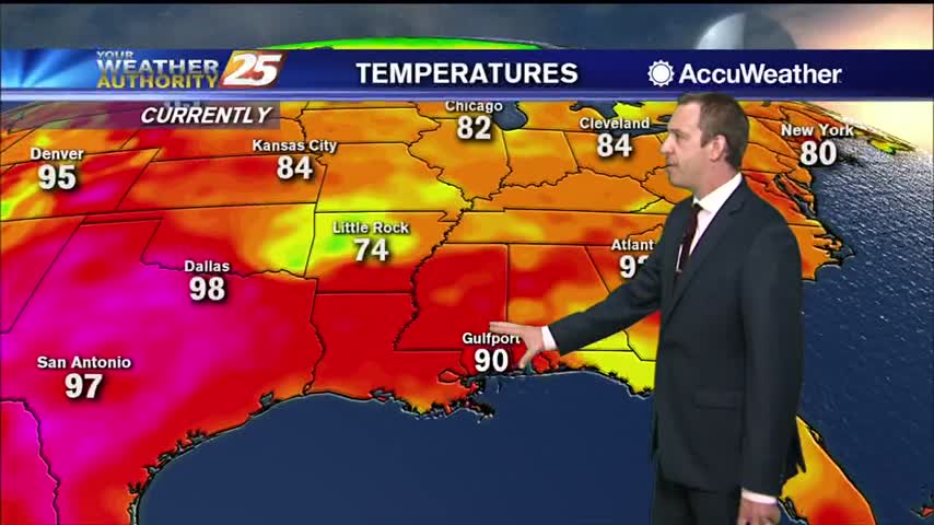
Today will bring similar conditions from yesterday, with the trend of diurnally driven summer convective pattern. Expect brief showers and thunderstorms during the afternoon hours. Max temperatures will again reach low to mid 90s with heat indices being in the…

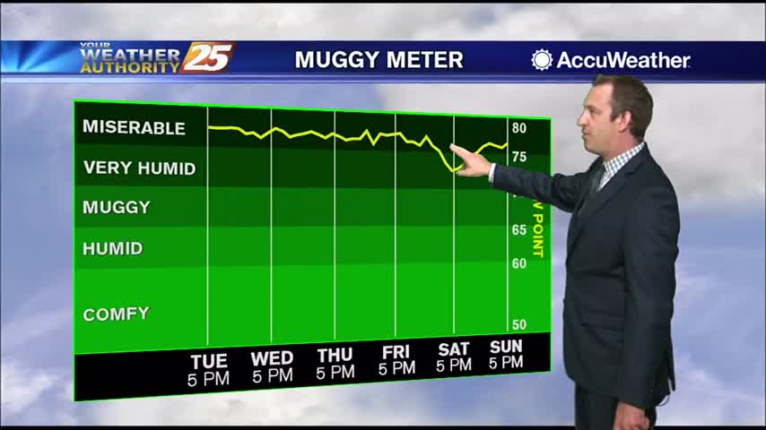
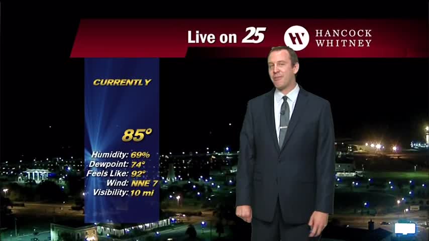
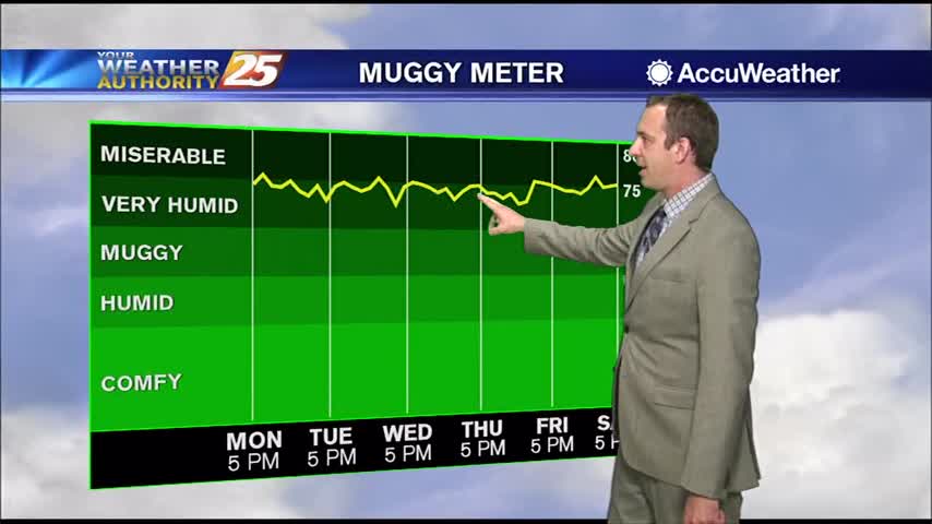
Not cooling far into the 70s each night for the rest of the week, and our afternoons will be just as hot and humid as the last few have been.
Another excessively hot and humid afternoon is in the books, with only a few afternoon showers coming to cool us down....
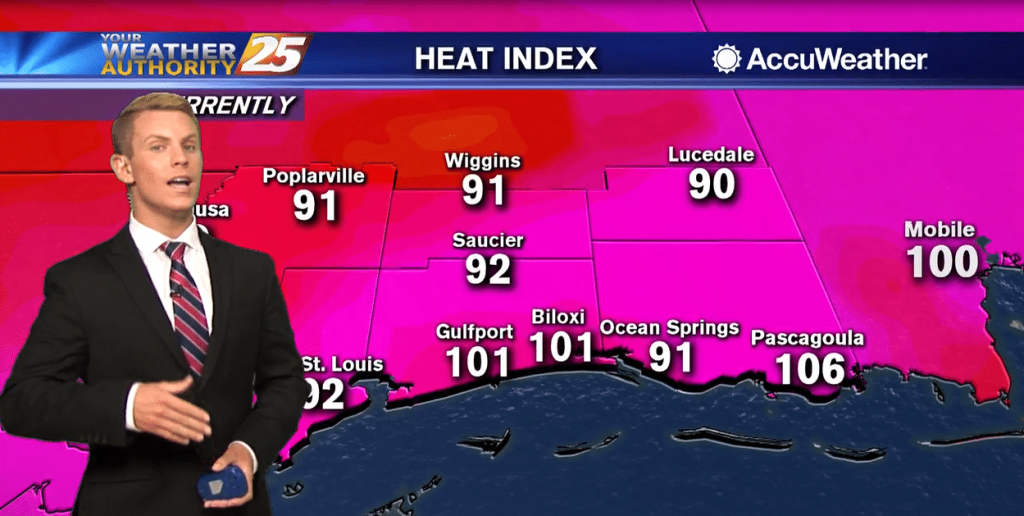
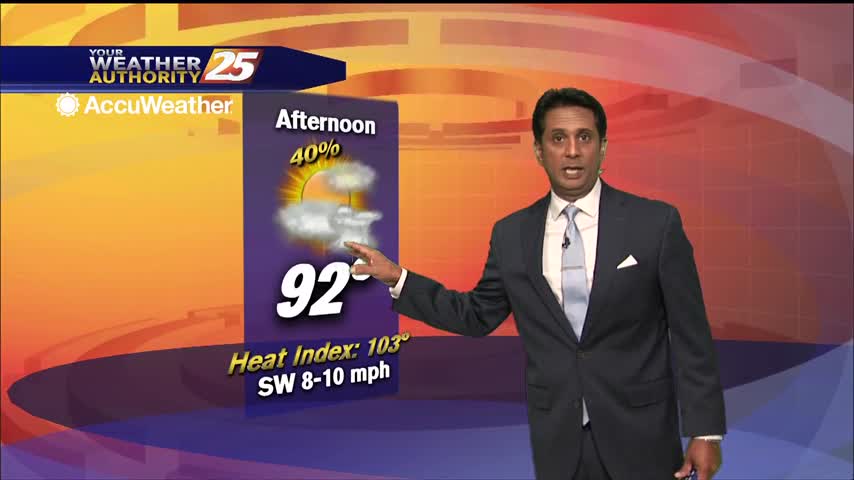
It's hazy, hot and humid along the Gulf Coast. High temperatures will likely top out in the mid 90s, but it will feel like it's between 100 and 108 degrees. Scattered showers and thunderstorms may help cool things down in…
The hot summertime pattern continues as the humid flow from the GOM dominates the region. The moisture flow will continue to saturate the atmosphere, thus leading to the sea-breeze interaction early afternoon. Isolated to scattered showers and t-storms will develop…
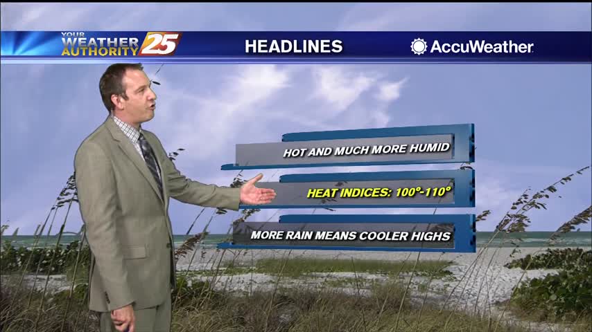
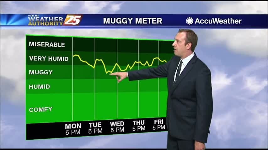
Hot and dry last week, but this week will be much more humid as deep moisture moves in....
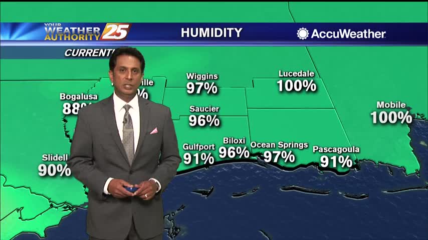
The high humidity has returned after a little bit of a break last week, so expect to be getting right back to some uncomfortably hot and humid weather.