3/23 - Rob Knight's "Warm & WET" Tuesday Afternoon Forecast
Rain continues to move into the area, as HEAVY RAIN is expected...
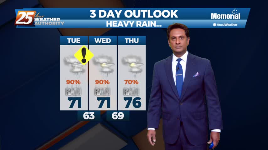
Rain continues to move into the area, as HEAVY RAIN is expected...
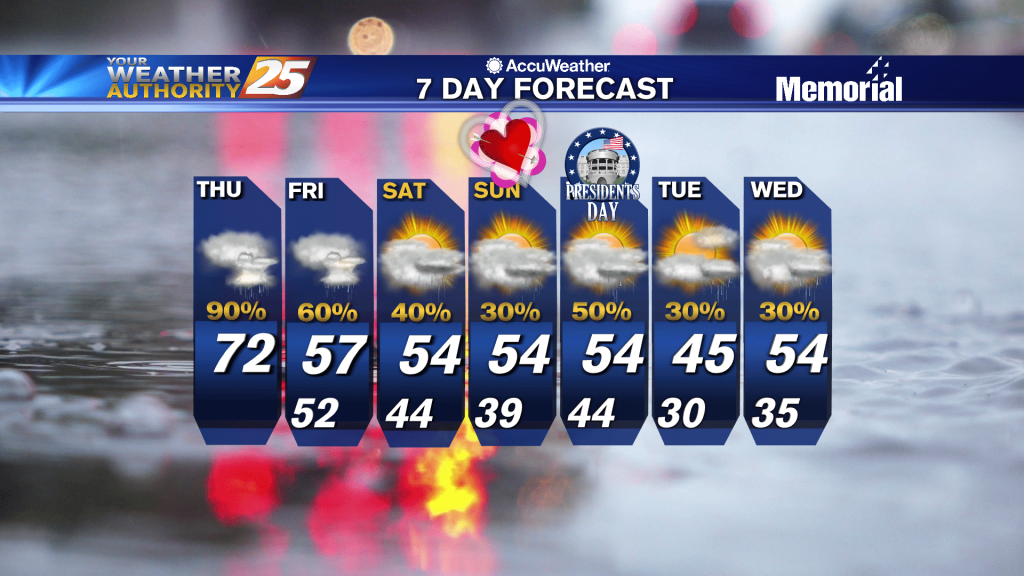
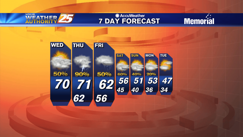
Clouds continue to move into the area as the rest of the workweek will bring rainfall...
DENSE FOG is once again affecting south Mississippi with an approaching cold front to the NW...
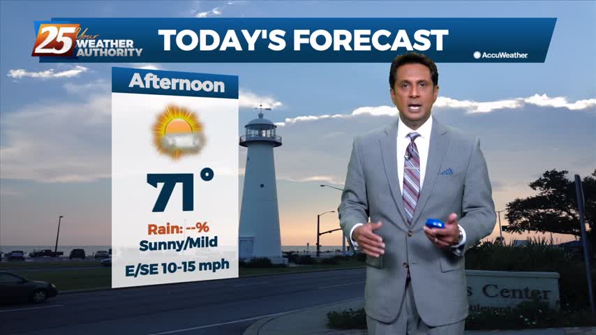
Wet conditions will continue this afternoon with the THREAT for heavy rainfall...
The area has already seen heavy rainfall this morning, with more to come this afternoon...
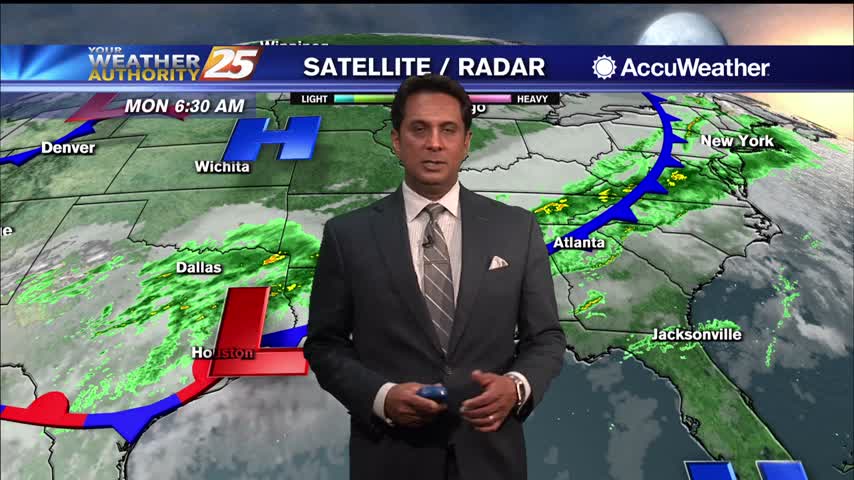
A warmer start this morning as a vigorous weather system will move through tonight...
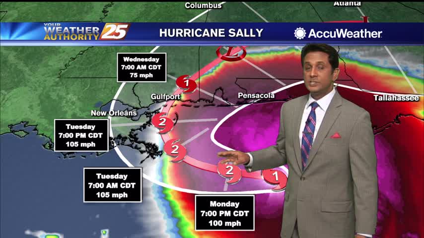
Clouds continue to move into the area as we are focused on HURRICANE SALLY in the Ne'tern GOM...
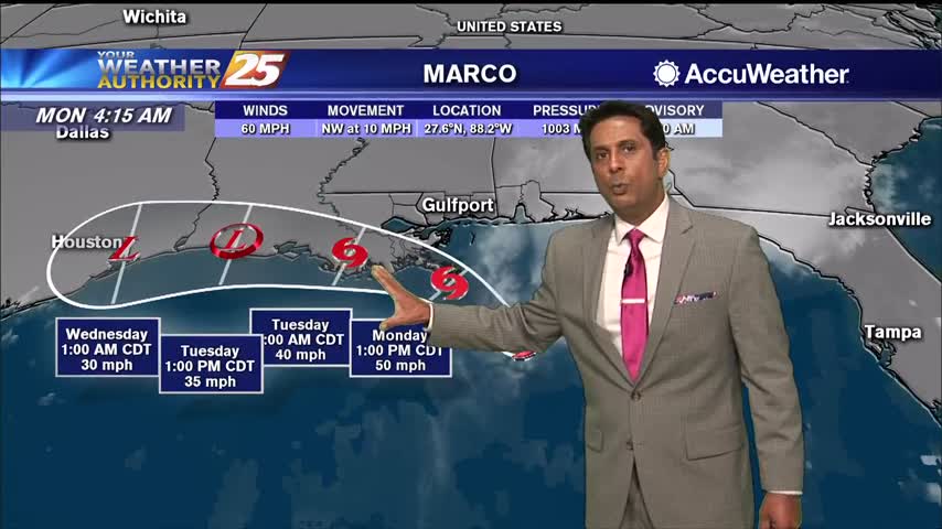
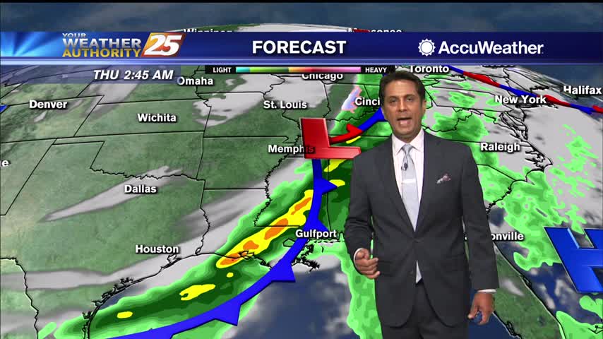
With TS Marco well south of the area, feeder bands of rain and winds are beginning to move into south Mississippi...
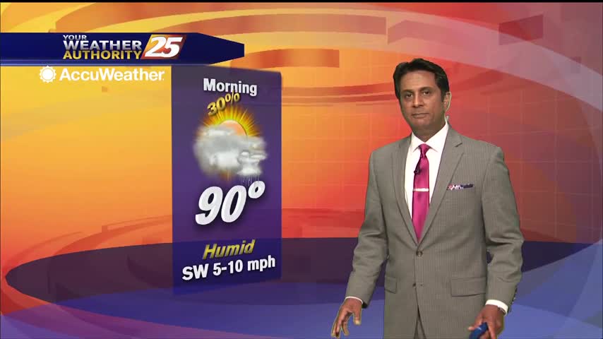
Our summertime pattern continues, so expect more hot and humid weather with afternoon showers...for at least one more day.

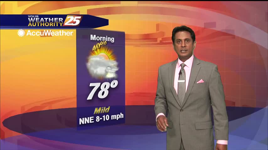
A very humid start to the day with areas of patchy fog north of the interstate...
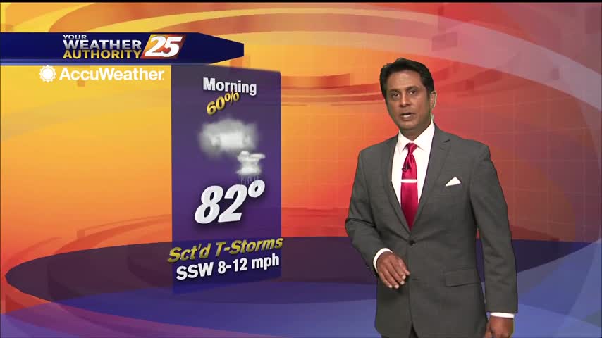
A warm and muggy start to the day with showers and t-storms north of the area...
A humid start with areas of light rain moving across the area...
Rainfall is already moving into the area from the SW, with a wet pattern ahead...
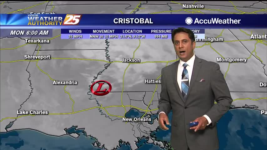
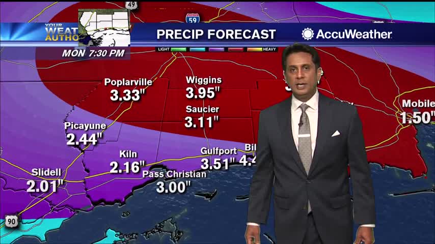
Cristobal now W/NW of Lake Pontchartrain continues to bring HEAVY RAIN and STRONG WINDS to South Mississippi...
Periods of HEAVY RAIN and STRONG WINDS continue to move into the area...
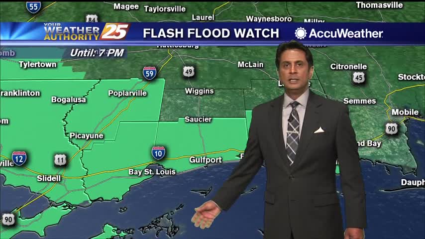
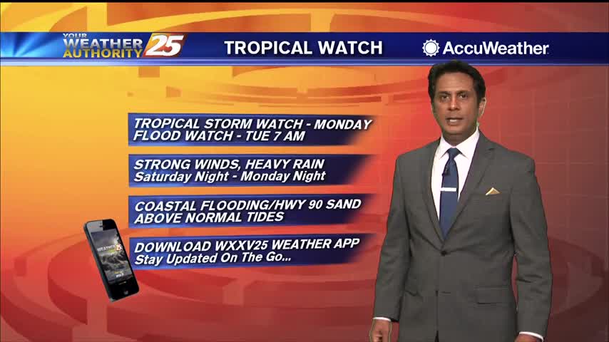
South Mississippi continue to be under a TROPICAL STORM watch...
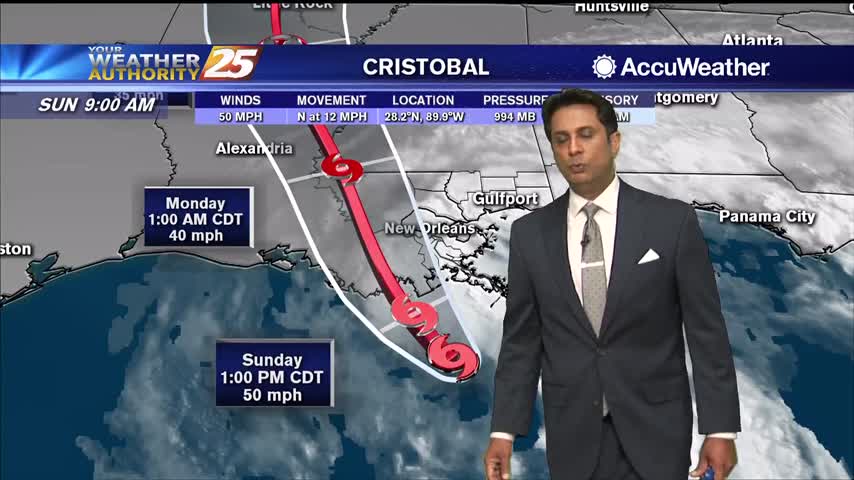
TS Cristobal continues to move closer to the SE Louisiana coast with landfall a bit earlier than projected...
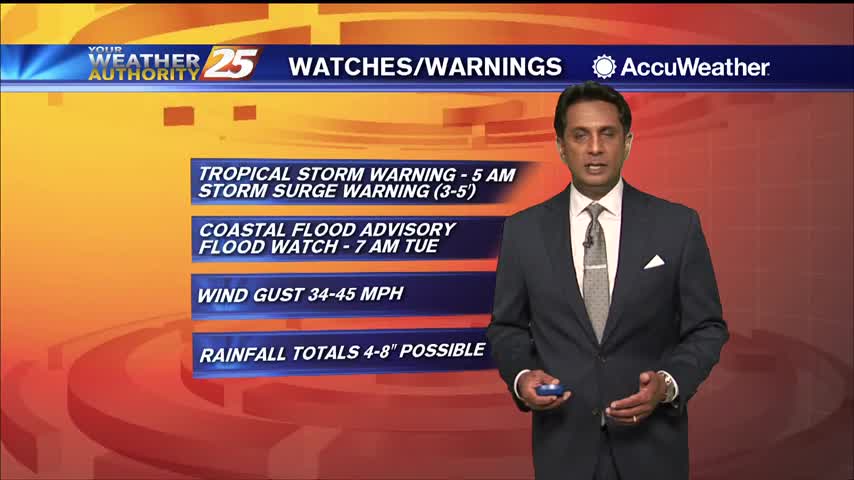
TS Cristobal continues to move North towards the SE Louisiana coast...
Feeder bands moving across south Mississippi bringing heavy rains and strong winds...
A very HOT day as the humid flow continues to move in from the Gulf of Mexico...
Spotty rain is moving in this morning with a cold front overhead...
Rain has been hard to come by, but gloomy weather remains in place across the coast.
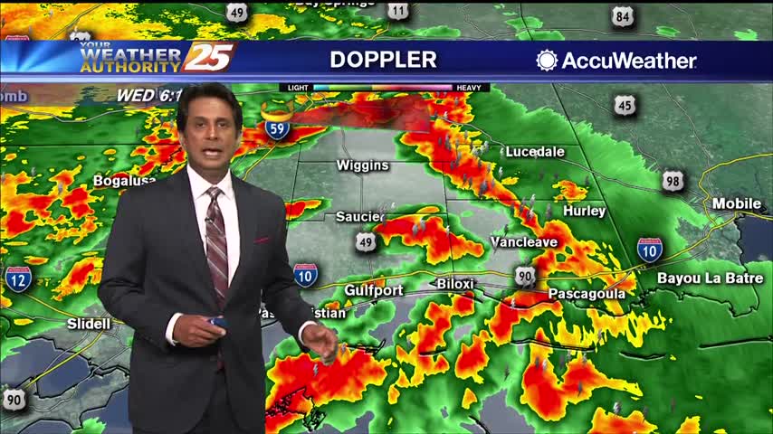
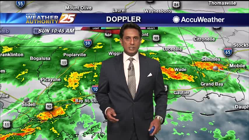
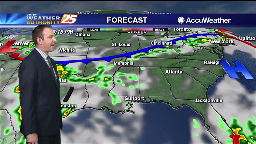
High rain chances will continue this morning with showers and scattered embedded storms along the front. A few strong to severe storms in this squall line are expected with hail and strong to damaging wind gusts being the main factor,…
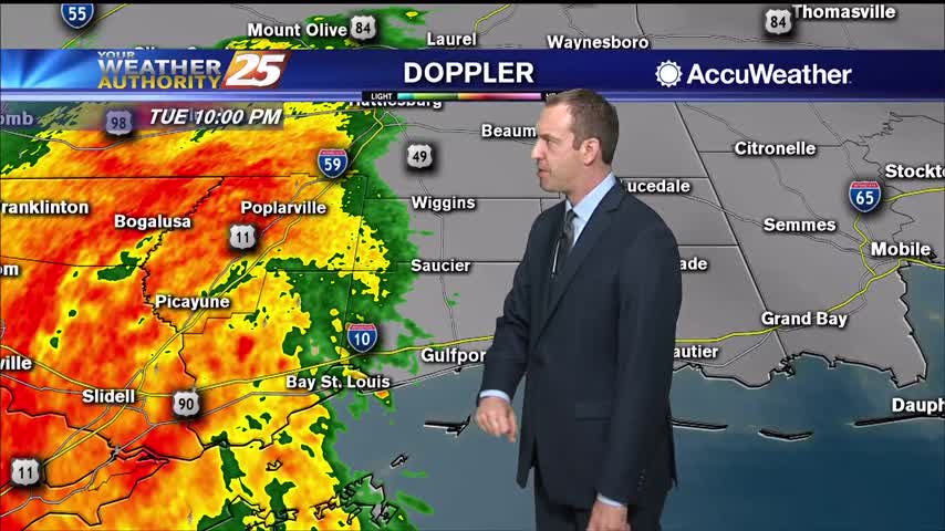
A small convective system brought a few thunderstorms before midnight, but we'll see the strongest activity with this frontal system move in tomorrow morning.