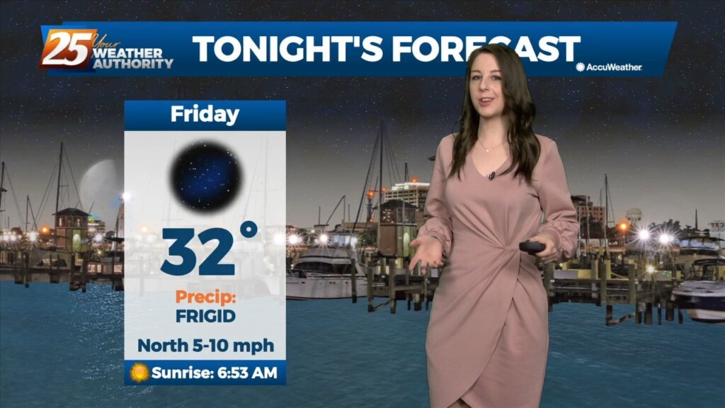
1/18 - Jeff Vorick's "Fog Dissipating" Wednesday Morning Forecast
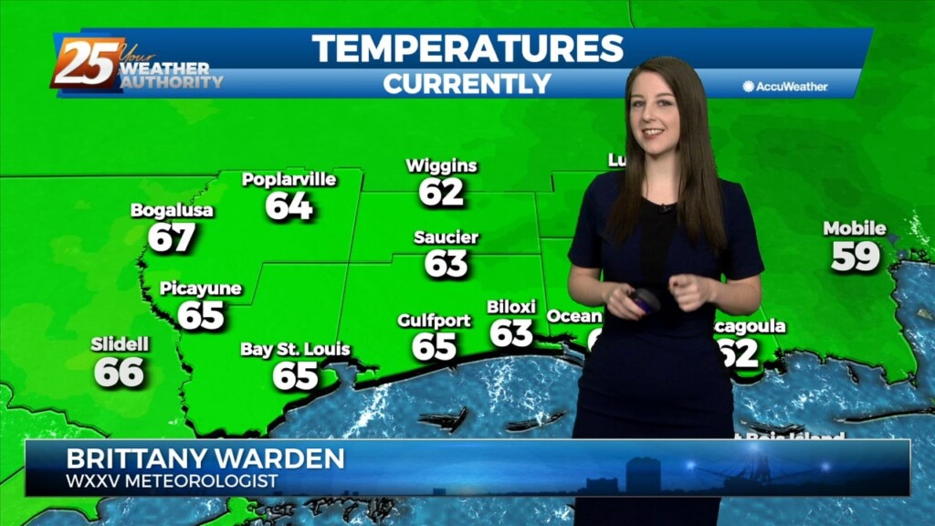
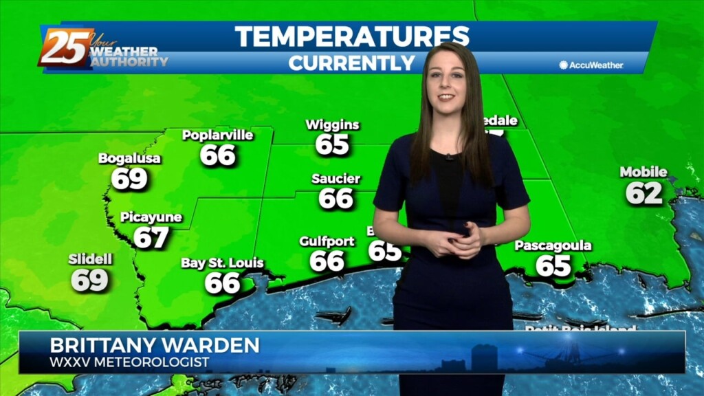
A Dense Fog Advisory is in effect until 9 AM due to reduced visibility across our area. Fog will dissipate later this morning and temperatures will warm…
A Dense Fog Advisory is in effect until 9 AM due to reduced visibility across our area. Fog will dissipate later this morning and temperatures will warm…
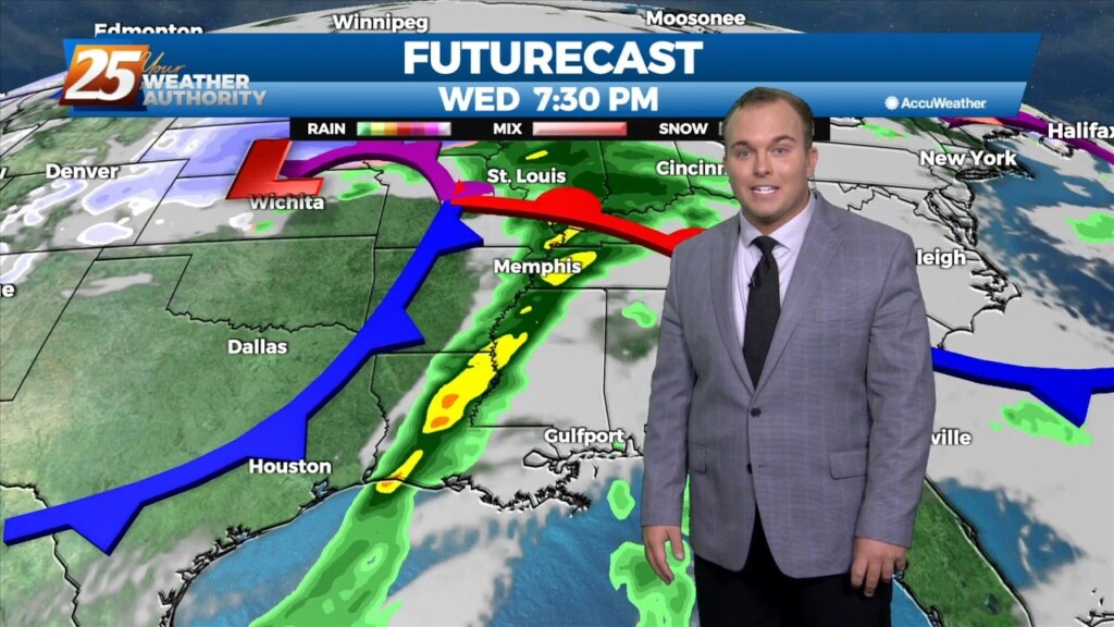
An upper low currently near the 4-Corners region will deepen as it crosses the southern portion of the Rocky Mountains. As this upper low moves across the Central Plains…
An upper low currently near the 4-Corners region will deepen as it crosses the southern portion of the Rocky Mountains. As this upper low moves across the Central Plains…
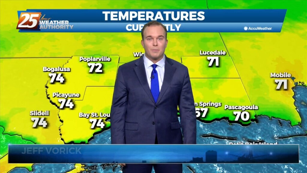
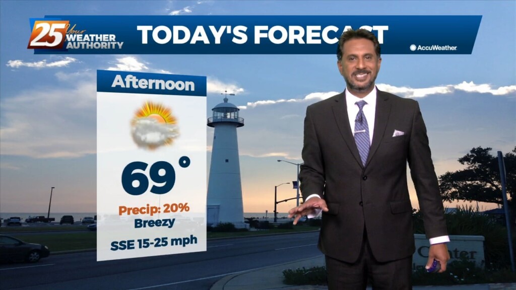
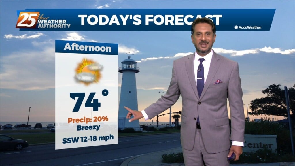
Temperatures are poised to climb well into the 70s across South Mississippi this afternoon. There will be peeks of sunshine along with breezy conditions. Winds will back…
A low pressure system over Wisconsin is dragging a cold front north of the !-20 corridor. Isolated rain south of the boundary exists all the…
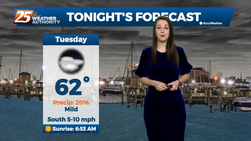
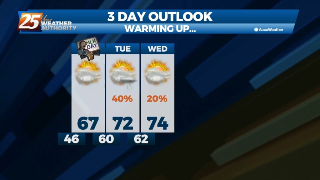
Tonight will be much warmer than compared to this weekend. Temperatures will bottom out in the low 60's with mostly cloudy skies and we'll see a 20%…
Tonight will be much warmer than compared to this weekend. Temperatures will bottom out in the low 60's with mostly cloudy skies and we'll see a 20% chance for…

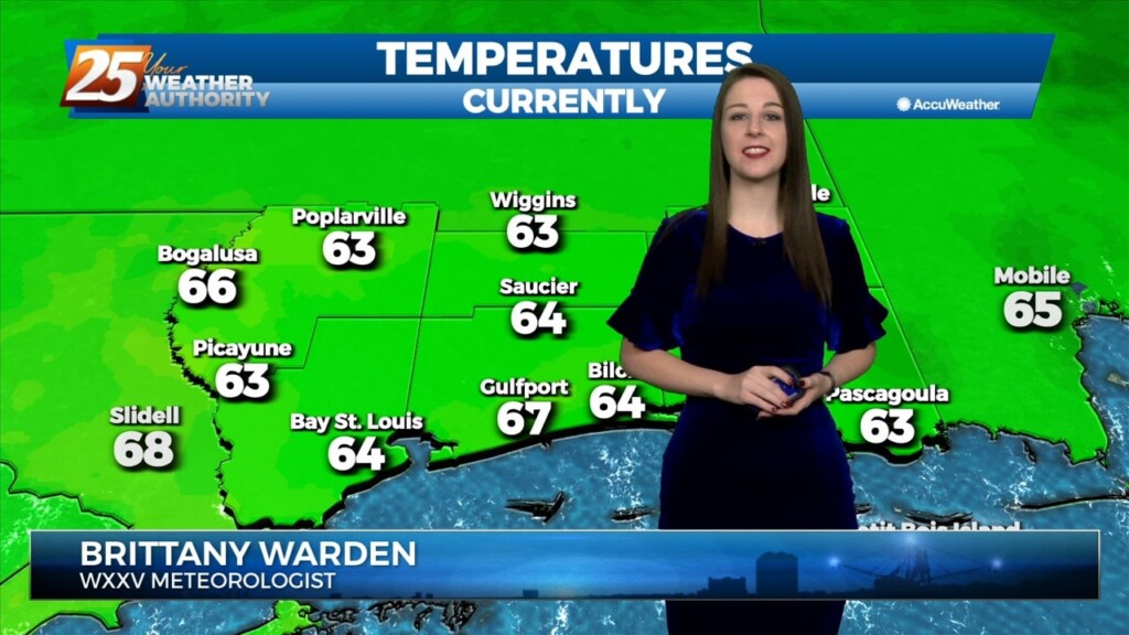
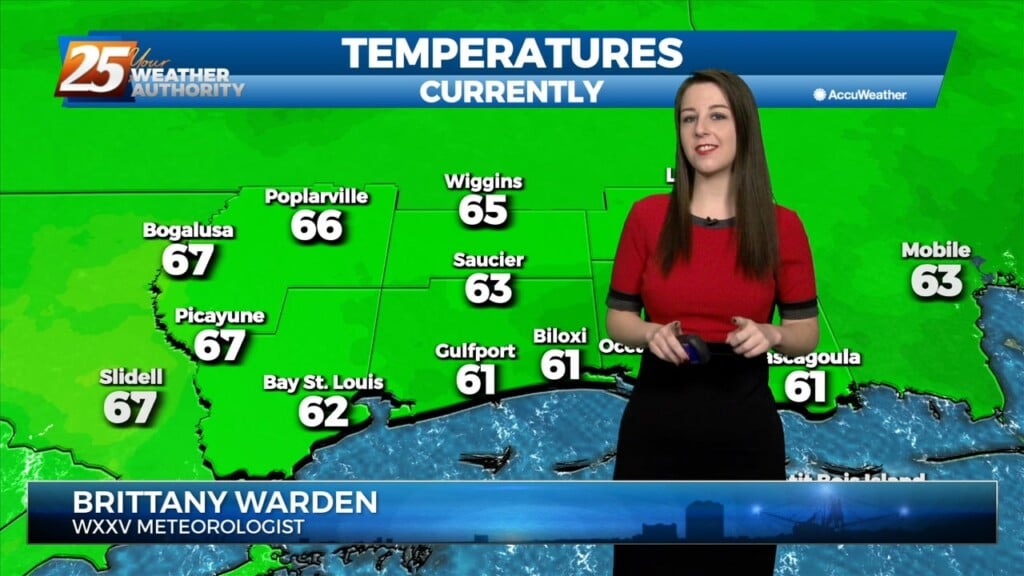
Increased cloud coverage and warmer temperatures are present across South Mississippi. A warm front traversed our area this morning. With it, moisture is on…
We start to enter a more active weather pattern starting today as an upper level disturbance moves eastward with an associated front forming at the…
The coldest air from the recent cold snap is behind us. Temperatures won’t drop too much more tonight. Clouds will be on the increase tonight as more…
High pressure continues to build over the area today and winds will gradually subside over the next 24 hours, at least over land areas. Very…
High pressure continues to build over the area today and winds will gradually subside over the next 24 hours, at least over land areas. Very dry air has moved…
Clearing ensued through the morning as drier and colder air filters into South Mississippi. We will manage low-to-mid 50s across the area as winds will continue…
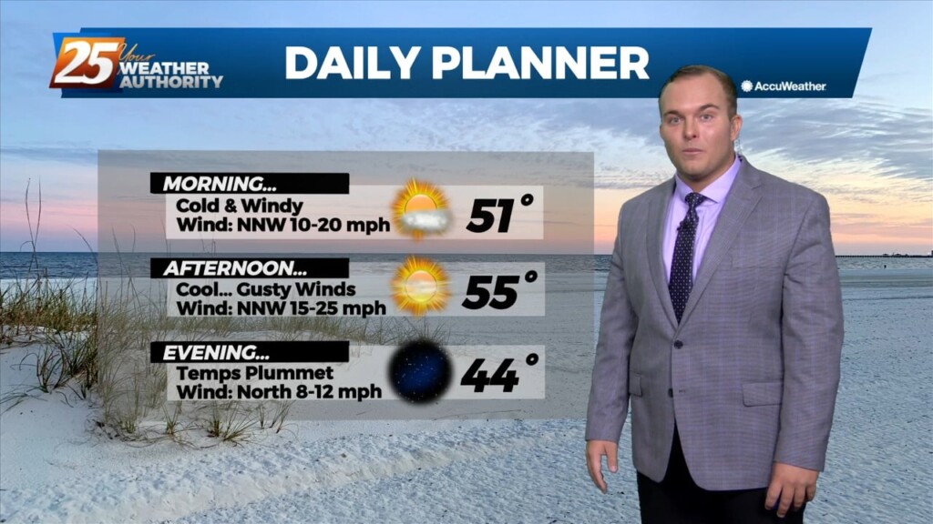
A potent cold front passed through our area yesterday which led to a cold and windy start. Winds will stay elevated today as high pressure is still well…
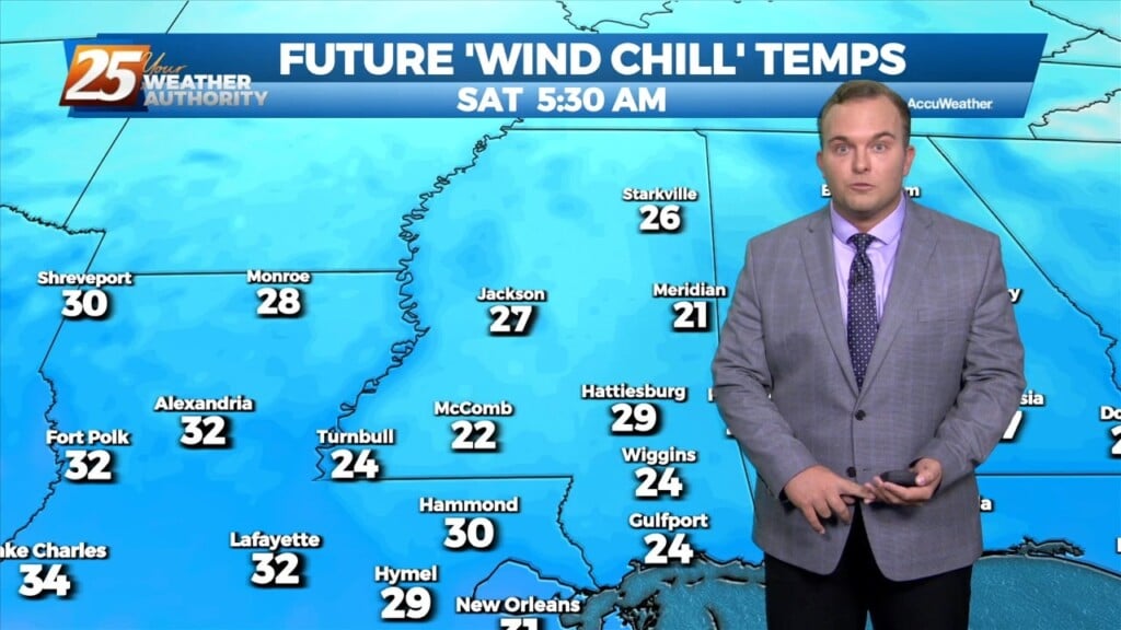
As the frontal system moves offshore, strong high pressure will dominate the upper level pattern. Strong northerly flow will help to advect cold air and dry air into the…
As the frontal system moves offshore, strong high pressure will dominate the upper level pattern. Strong northerly flow will help to advect cold air and dry air into the…
Strong thunderstorms are making their way through the area. We are under a Level 2 of 5, or Slight Risk for severity across George and Stone…
There is a Marginal (Level 1 of 5) Severity risk for the majority of our area, with portions of George and Stone County under a Slight…
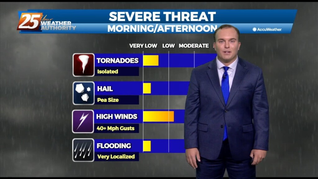
A cold front moves through Thursday and should enter the area around 9am and out of the area around 4pm. Instability and shear values are at the lower…

A BEAUTIFUL afternoon ahead with breezy conditions out of the SW. A cold front moves through Thursday and should enter the area around 9am and…
The relatively dry air over eastern gulf has basically moved to the southern gulf and back up into the western gulf. Normally this process allows this air…
High pressure has shifted eastward and winds have already returned to a southerly direction. Dewpoints have been rising steadily throughout the day especially in western areas where a surface…
High pressure has shifted eastward and winds have already returned to a southerly direction. Dewpoints have been rising steadily throughout the day especially in western areas where a surface…
Clear skies and sunshine will be the story of this afternoon. Temperatures will soar well into the 60s across our area. Tonight, a warm front will move…