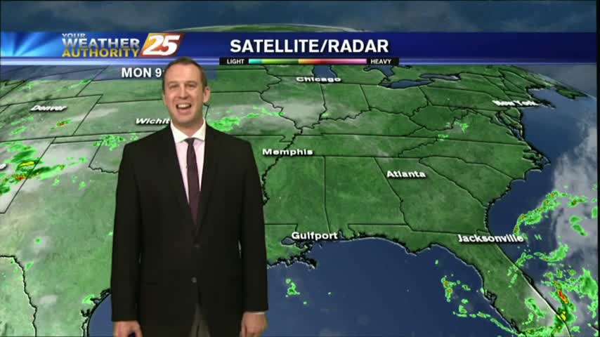
07/31 Ryan's "Clear & Cooler" Monday Night Forecast
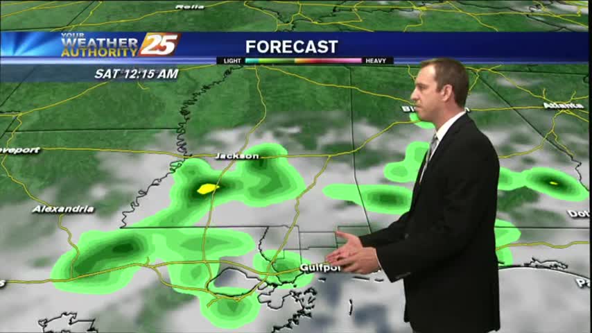
Our pleasant afternoon is turning into a cool & dry night, but temperatures will begin to rise before the rain moves back in. Watch the full forecast for details.
Our pleasant afternoon is turning into a cool & dry night, but temperatures will begin to rise before the rain moves back in. Watch the full forecast for details.
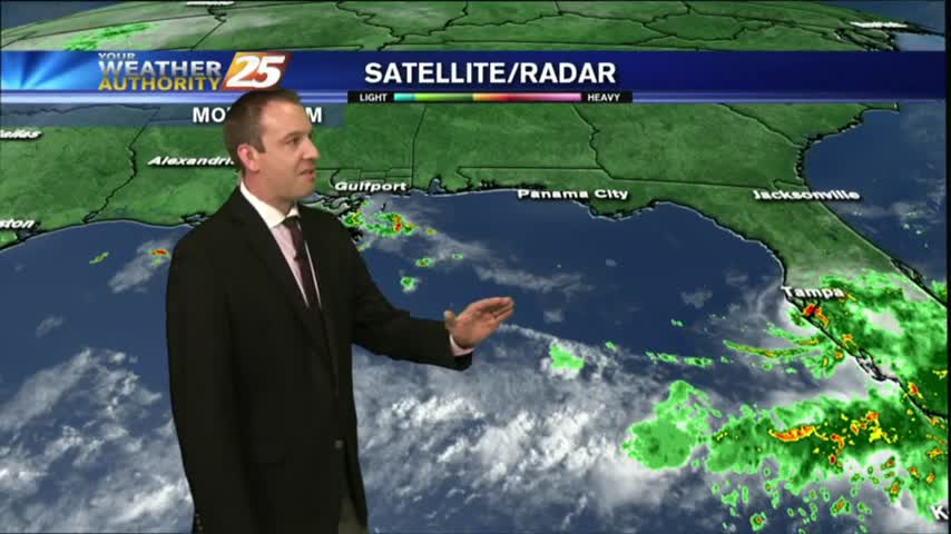
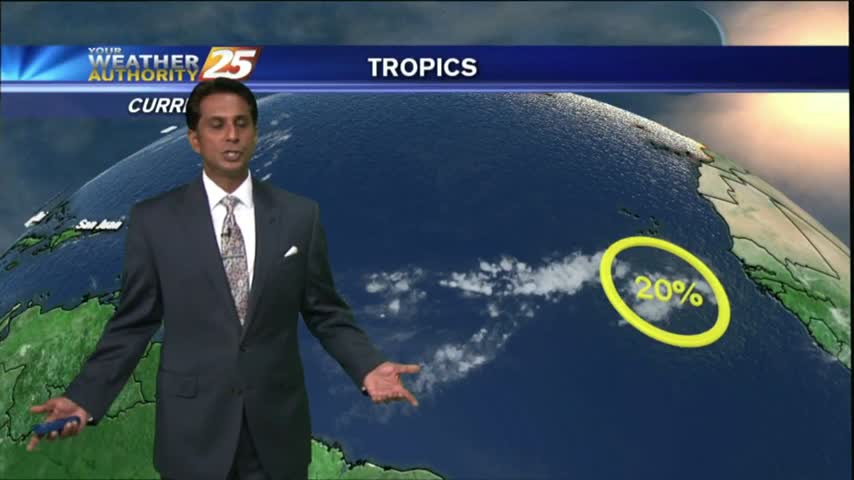
Drier and slightly cooler conditions moved into South MS, just as a developing Tropical Storm moved East! Great conditions last a little longer, but change soon. Read full forecast for details.
After a beautiful day yesterday to close-out the weekend, the drier air mass will continue to affect the region through Tuesday, but more rain is on the way.

A sunny and DRY start with a cold front overhead...
The beginning of the week will be hot and dry, but with less moisture it won't feel quite as hot as it has the past couple weeks.
While Thursday may have been the hottest, today was the most sunny! That's already starting to end though as cloud cover increases through the night. Full forecast inside.
After a warm and humid start to your Friday, its downright HOT in the viewing area and through the region...
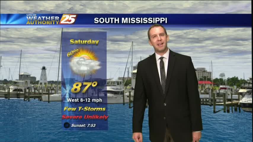
Another warm start to the day with HOT & HUMID conditions. Changes are expected through the final weekend of July with an approaching cold front...
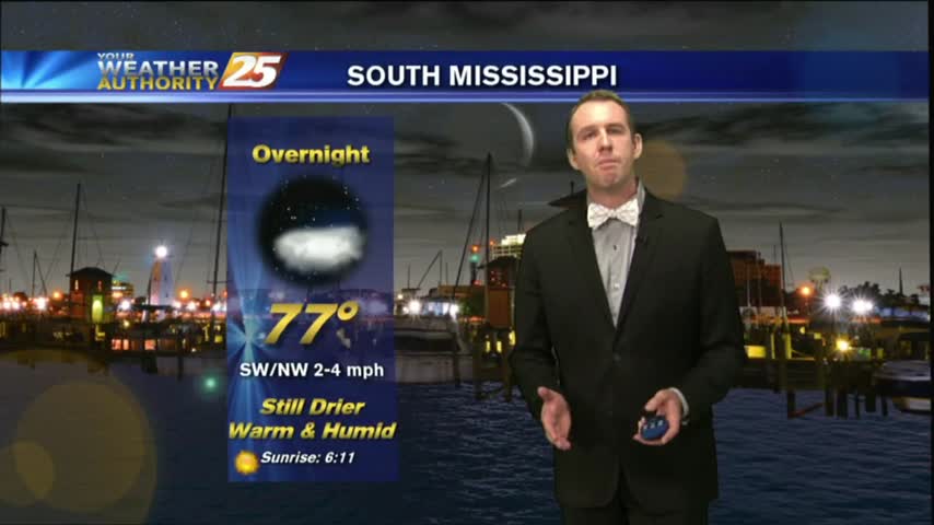
Mostly clear skies will help us cool into the mid-to-upper 70s, but we'll see very hot conditions tomorrow. Watch the full forecast for details.
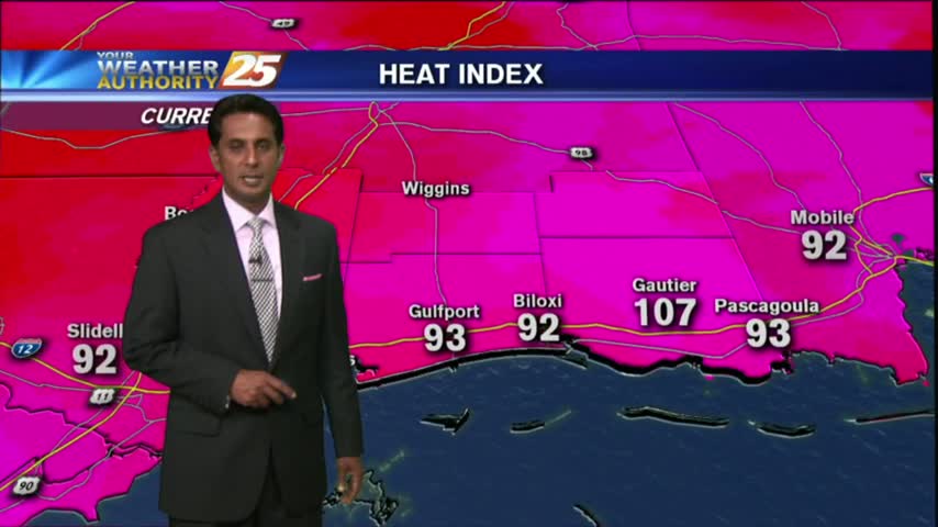
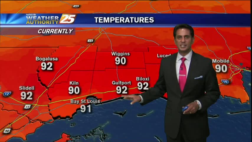
Skies continue to be clear as the mercury climbs into the low/mid 90s...but feels SO MUCH hotter with the heat index.
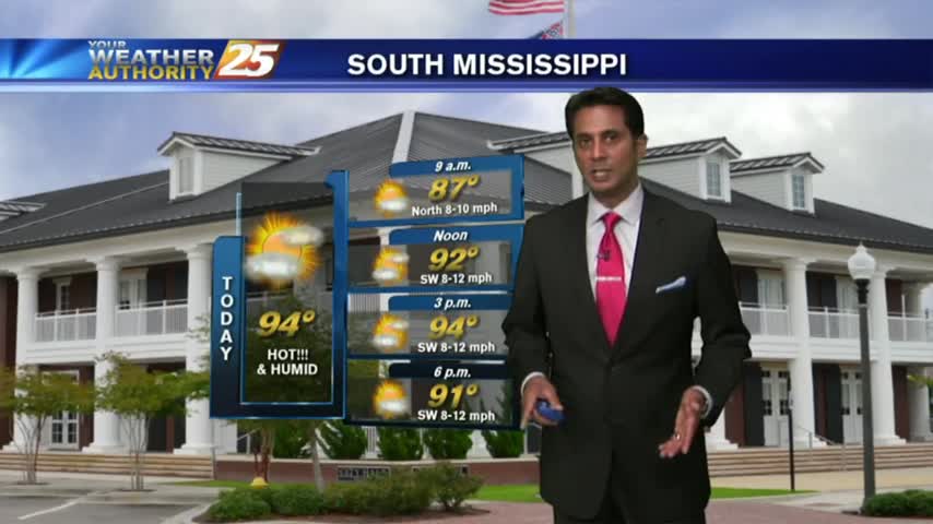
Another warm and humid start to the day, but rain-free. DANGEROUS HEAT will be in the region through Friday evening...
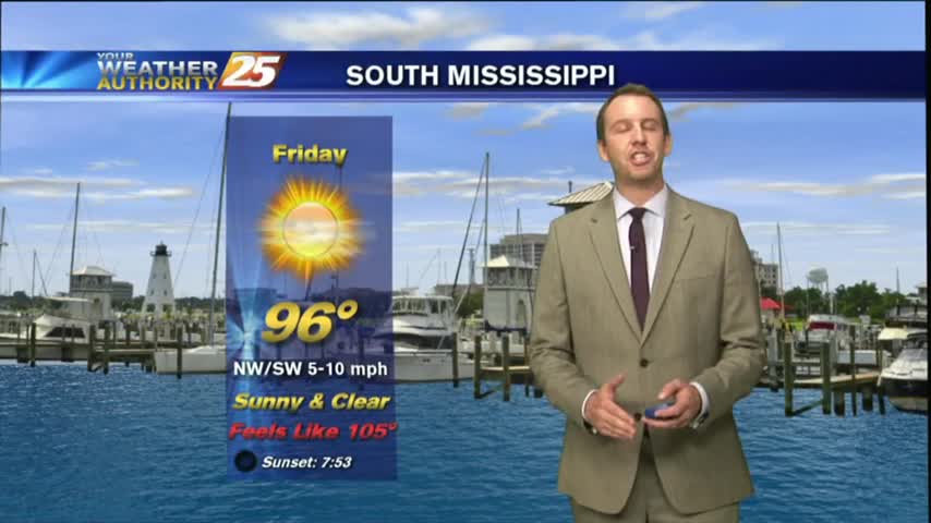
Much drier today with only a few showers popping up in the West, but the high heat indices we expected definitely showed up. Another dry and hot day ahead before rain arrives, so watch the full forecast for details.
We saw a few showers pop up this afternoon, and I'm expecting a few more tomorrow, but otherwise it will be very hot and humid. Watch the full forecast for details.
After a rain-free start to the day, HOT and HUMID conditions are along the Mississippi Gulf Coast...

After very WET conditions the past few days, a drier patter is beginning to move into the region which will dominate through the rest of the workweek...
No showers have materialized yet after this afternoon's moved on, and drier weather can be expected through the rest of the week. Please watch the full forecast for details.
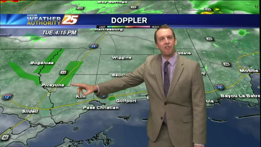
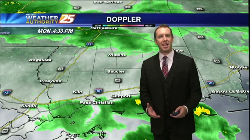
As expected, we saw a little more rain overnight with more showers this afternoon. Things will begin clearing up tonight, so expect some sunny & drier weather! Details within.
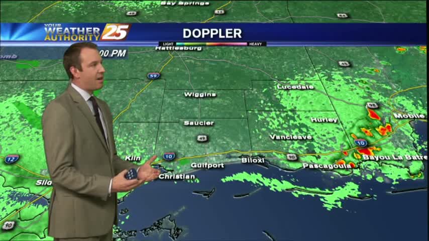
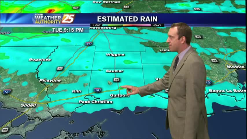
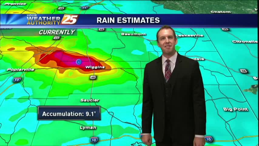
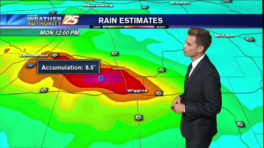
Today will bring the same scenario with the activity in the area. An additional 2-4 inches of rain is not out of the question with the strongest storms.
A DRIER start to the day but similar to yesterday, activity will develop and move across the viewing area from west to east...
Our earlier showers & thunderstorms have cleared out, but I'm expecting more overnight and tomorrow afternoon. Watch the full forecast for more.
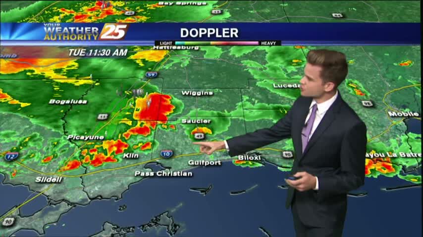
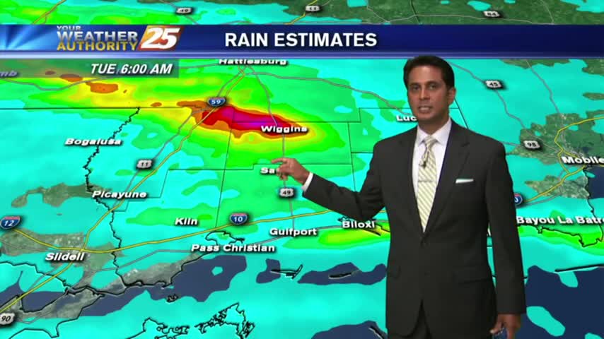
Rain was expected to begin the week, but we saw some ridiculously high rainfall totals from this afternoon's thunderstorms. Drier air moves in soon, watch the forecast for details.
a FLASH FLOOD WATCH continues until 7 pm Tuesday for much of the area.

Overnight showers/t-storms continue to affect the viewing area as we kick off the workweek...
I expected less rain today, and we ended up getting a smidgen more than expected. I expect more of the same tomorrow, but you'll have to watch the full forecast for details.